

 Connemara
Car park at the Visitor Centre (59 m) – Diamond Hill (442 m)
Mostly easy hike (T1), with some sections of moderate difficulty (T2) near the summit. The paths on the Diamond Hill Loop are excellently maintained with slabs, footbridges and bridges. However, the final ascent up the rocky north-western ridge requires sure-footedness.
From Galway, take the N59 towards Clifden. At Glendollagh Lough, turn right onto the R344 and, at the end of the road, keep left and follow the N59 to Letterfrack. After leaving the village, turn left towards the Connemara National Park Information Centre and drive up the road to the visitor car park.
From Galway Central Coach Station (Lower Newcastle), take Citylink bus 923 to Letterfrack.
53.55038000, -9.94559900
Anzeige
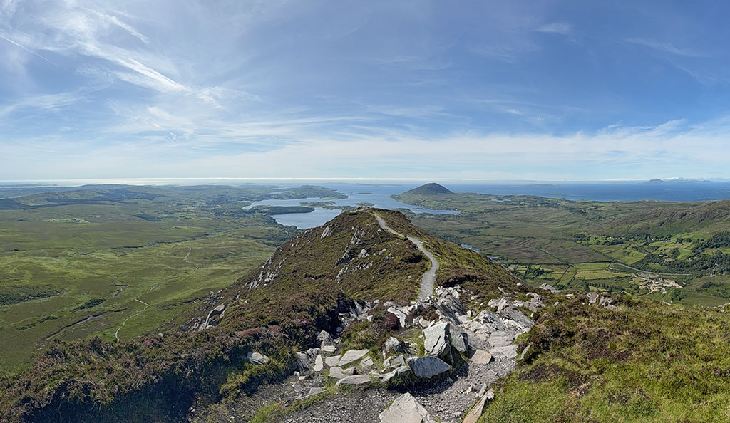
Diamond Hill in the west of Connemara is a panoramic peak in a class of its own: the view of the coastal region and the mountains of the national park is simply breathtaking on a clear day. Of course, this also has its downsides: due to its easy accessibility, the summit is a very popular destination. The paths from the Visitor Centre in Letterfrack are well-maintained and make the ascent easier even for less experienced hikers. However, you should be sure-footed, as the approach to the summit ridge is quite steep and stony. In wet conditions, the path can become uncomfortably slippery. For safety reasons, the traverse of Diamond Hill should be undertaken in a clockwise direction to ensure that no one gets in each other’s way on the narrow paths near the summit. On fine days, it is worth tackling Diamond Hill against the flow of traffic anyway, visiting either very early or later in the day.
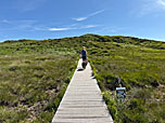
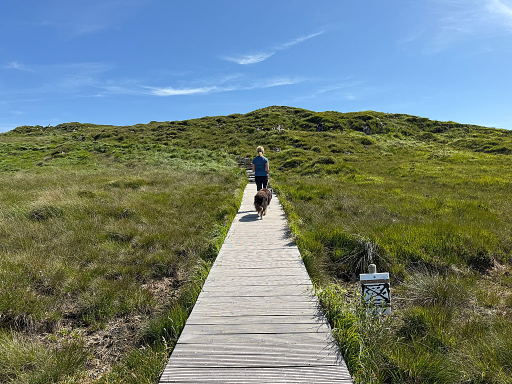
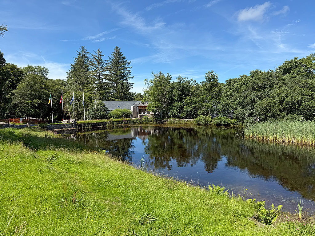 From the entrance to the National Park, we walk a few metres downhill along the footpath and turn sharply left at the first junction. Just before the pond at the visitor centre, the path forks once more. We keep to the left and reach the next junction on the bank. Here, we do not cross the bridge but turn right. After a right-hand and a left-hand bend, we leave the trees behind us and emerge into open terrain. Our path takes another left-hand bend and, with a view of the rocky ridge of Diamond Hill, we reach another junction. Now we turn right (red and blue arrow) and head south towards a grassy knoll. After the short climb to this grassy hillock, we cross a marshy plateau heading south-east via several footbridges.
 Finally, our path joins a cross-path at a prominent boulder. We now turn left and head east towards Diamond Hill. A bridge later takes us over a small stream, and we subsequently reach another junction. At this point, the ascent route now diverges from the path to be used for the descent. We therefore keep diagonally to the left and follow the paved path in a north-easterly direction. The moderately ascending path leads us up to the north-western ridge of Diamond Hill. The path now turns to the right and leads us upwards in numerous hairpin bends across the grassy flank. After a long straight stretch, we reach a faintly defined shoulder. At the grassy shoulder, our path takes a left-hand bend.
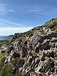
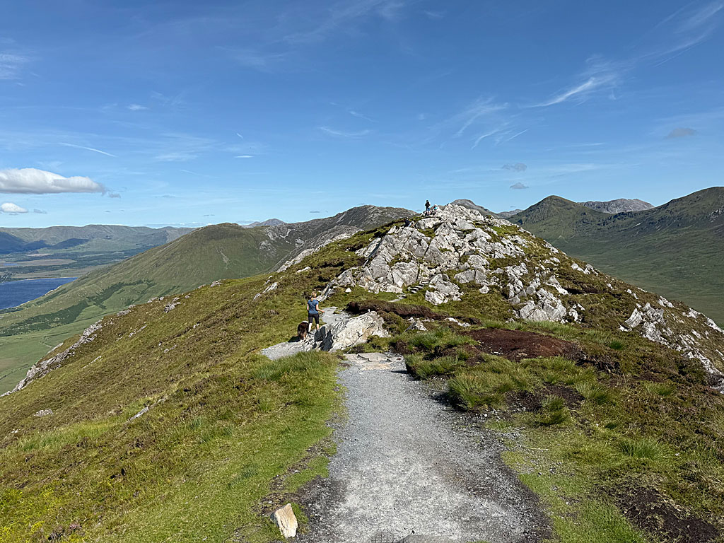 On the now flatter terrain, the stony path leads us towards the rocky summit. On the left, we can make a very short detour to a viewpoint and enjoy the wonderful view over Letterfrack to the coastal region. Back on the main path, it leads us further uphill in short switchbacks over the now rugged slope. After a left-hand bend, the path becomes significantly steeper and leads us up rocky steps to the north-west ridge. We now turn left and follow the rugged ridge upwards. The ridge is dotted with small rocky humps, which we climb over. Finally, after 1½ hours, we reach the highest point on Diamond Hill (442 m) and look out over the Connemara mountains, down to Kylemore Lough and across the hilly coastal regions far out to the Atlantic.
 We cross the top of Diamond Hill and follow the easy footpath downwards in a south-easterly direction. After a left-hand bend and a sweeping right-hand curve, our path turns north-west. We cross past the grassy southern flank of Diamond Hill. A wooden boardwalk helps us across a marshy section and shortly afterwards we rejoin our ascent route. We now head back along the outward route to the striking boulder, turn right there and follow the wooden boardwalks back to the cross-path. Finally, we would like to pay a visit to the Visitor Centre and turn right at this point. The wide path eventually leads us down to the Visitor Centre and its café. From the café, we continue to the pond and return from there to the car park.
The Hungry Hiker Cafe, Tel. +353 87 327 7155.
| Elevation | Time | Total | Destination | ||
|---|---|---|---|---|---|
| 59 m | - 442 m | + 1:30 | 1:30 | Diamond Hill | |
| 442 m | - 59 m | + 1:15 | 2:45 | Parkplatz am Visitor Centre | |