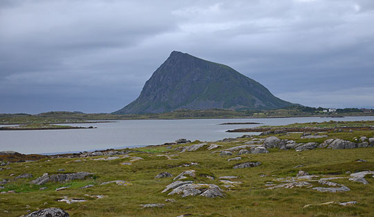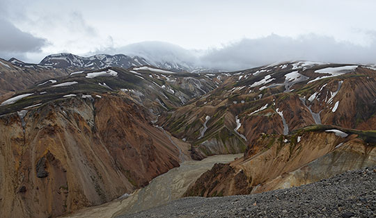
 Hardangervidda
A moderately difficult 11.2 km mountain hike requiring sure-footedness. The paths between the individual waterfalls can be very muddy and slippery when wet.
Drive from Oslo along the E18 to Drammen and turn onto the E134 in Drammen. Continue via Hokksund, Notodden and Haukeli to Røldal. Drive past Røldalsvatnet, the Røldal Ski Centre and through the Røldal Tunnel, then turn right at Trogilshol after the tunnel. Then follow Road 13 via Odda to Kinsarvik. In Kinsarvik, after the Kinso Bridge, turn right into Husedalen and drive past a settlement to the end of the road. Before the bridge crossing the Kinso, turn left and park your car at the hiking car park.
From Bergen, take bus route 930 to Odda and from Odda, continue on bus route 990 to Kinsarvik (for timetable information) or from Oslo or Bergen, take the Bergen Railway to Voss and from Voss, take bus route 990 to Kinsarvik (for timetable information).
60.36432523, 6.74462185
Anzeige
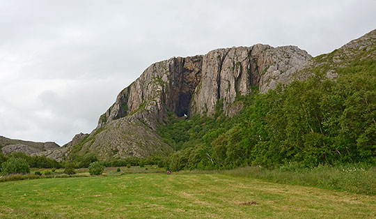
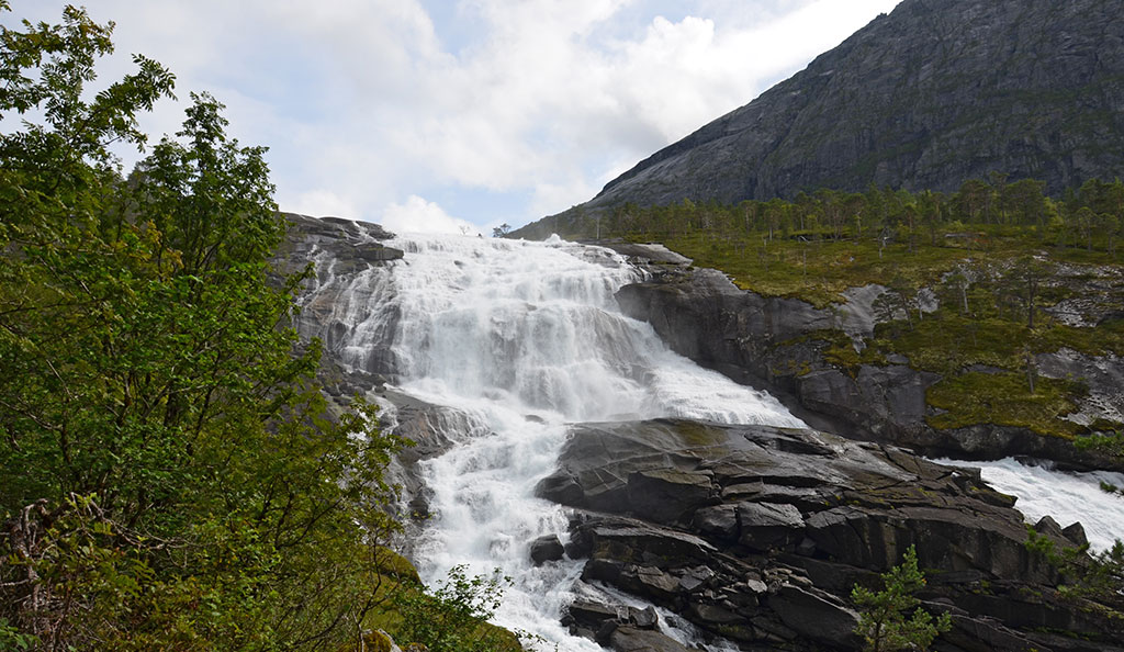
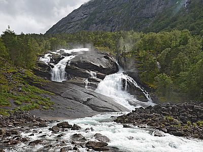
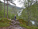
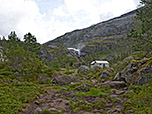
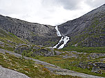
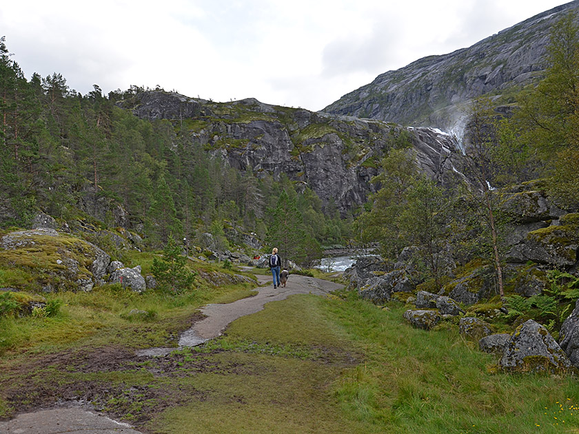
The Kinso river plunges over four mighty waterfalls from the Hardangervidda plateau down into the valley before flowing into the Hardangerfjord at Kinsarvik. In an impressive undertaking, we follow the Kinso into the Husedalen valley. After a gentle start, we come across a hydroelectric power station and the roaring Tveitafossen. From the first waterfall, we climb steeply along a water pipe up to a reservoir. There, we enter a sparse forest and continue on to Nyastølfossen and the plateau above it with its small mountain huts. At this lovely rest spot, we look out towards Nykkjesøyfossen, which seems much tamer in comparison to the 180-metre-high Nyastølfossen. Finally, a rocky path takes us up to a vast, undulating plateau. Here we find a final vantage point and enjoy the view of the last waterfall, Søtefossen, which rushes down from the Hardangervidda in two stages, plunging almost 250 metres into the depths.
 From the car park at Kinsarvik Skytebane, we head back to the road and walk across the river Vivippo, keeping to the left. After the bridge, the wide path leads us south-east and we pass the Airlift Kinsarvik helipad. The path then leads us along a rocky, steep slope into the narrowing Husedalen valley. We follow the Kinso river and reach a fork in the path after just under 25 minutes. Here we take the right-hand (lower) path and shortly afterwards find ourselves in front of the Kinso hydroelectric power station. Behind the power station, the Tveitafossen waterfall, a good 100 metres high, plunges down into the depths. We walk past the power station building on the left and climb uphill along a water pipe via a stony path marked with red T-signs.
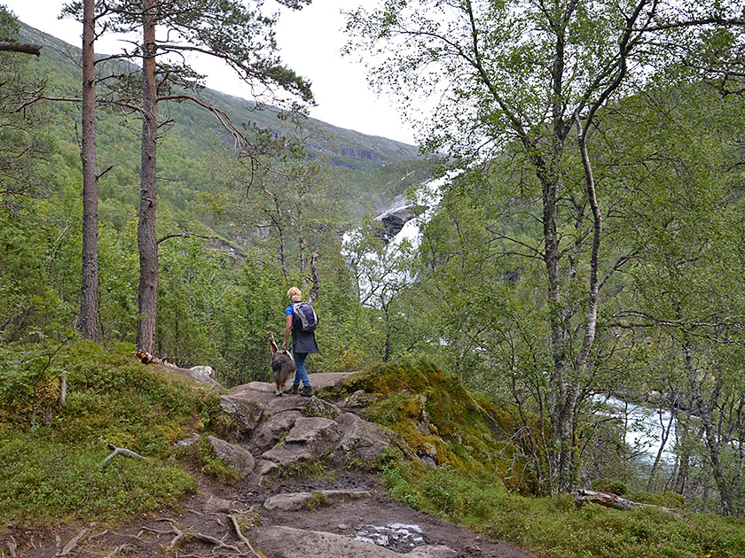 After this steeper climb, we reach a farm track and a reservoir. Shortly afterwards, the farm track turns into a path that leads us eastwards through sparse woodland without much gain in altitude. A short time later, the path becomes steeper and also significantly rockier. When wet, this section of the path turns out to be quite a muddy affair. Soon, the roaring Nyastølfossen comes into view between the trees, over which the Kinso plunges 180 metres into the depths. We continue following our bumpy path uphill and reach a flat slope. Now the path leads us to the left and upwards in switchbacks over the smooth rocks. Eventually, the path turns south-east and the terrain levels out. We lose a few metres in altitude over a wooded ridge and the trees gradually thin out.
 After a total of 2¼ hours, we reach the Nykkjesøy mountain pasture. We now head towards the small huts in the pasture area. To the right of the huts, on the banks of the Kinso – which is calm in this section – is an excellent spot to take a break. Ahead of us, we can already make out the Nykkjesøyfossen, which, at 80 metres, is the shortest of the four waterfalls in terms of height. We hike south-east towards the no less impressive waterfall and reach its base. There, the path bends to the left and we climb up a stony path in switchbacks to the final plateau. The path, marked with red T-signs, leads us up to some striking boulders. After a steeper gully, we reach the signposted junction towards Stavali (a good 3 hours from Kinsarvik Skytebane).
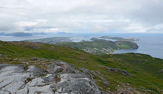
 Here, keeping to the left, you could reach the fully stocked Stavali Turisthytte (1062 m) run by the Norwegian Alpine Club (DNT). The self-catering hut on the Hardangervidda offers 62 beds. The climb from the junction to the hut takes a further 3 hours. We ignore the turn-off on the left and continue straight ahead. Ahead of us, we can already see the mighty Søtefossen. We look for a suitable spot with a good view on the vast, undulating plateau for a snack and bring our hike to the four waterfalls in Husedalen to a close.
Follow the ascent route to the reservoir above the hydroelectric power station. There, keeping to the right, we take the farm track, which is easier for the descent, and which winds down to the fork in the path north-west of the power station. From here, we walk back along the same route to the car park.
There are no places to stop for refreshments along the way.
| Elevation | Time | Total | Destination | ||
|---|---|---|---|---|---|
| 105 m | - 160 m | + 0:25 | 0:25 | Tveitafossen | |
| 160 m | - 520 m | + 1:50 | 2:15 | Nykkjesøy | |
| 520 m | - 670 m | + 0:45 | 3:00 | Hochebene am Søtefossen | |
| 670 m | - 520 m | + 0:30 | 3:30 | Nykkjesøy | |
| 520 m | - 105 m | + 1:45 | 5:15 | Kinsarvik Skytebane | |