


 Killarney
Car park at the Finoulagh River (146 m) – Devil’s Punch Bowl (670 m) – Mangerton (838 m)
Overall a moderately difficult mountain hike, leading via partly steep and mostly stony paths to the Devil’s Punch Bowl and up to Mangerton. The ground can be very muddy after the car park. Due to the steep grassy slopes, extra caution is advised in poor visibility whilst ascending Mangerton and walking around the lake.
From Killarney, take the N71 towards Kenmare to the Muckross Park Hotel. Turn left immediately after the hotel. Follow the road for 1.9 kilometres and then turn right towards Mangerton Mountain. After a further 1.9 kilometres, there is a small parking bay on the left-hand side at the starting point, in a gentle right-hand bend. A little further back, you can also park on the right-hand side of the road. Overall, parking facilities are quite limited.
Unfortunately, the starting point is difficult to reach by public transport. From Killarney railway station, it is an 8.2-kilometre walk to the car park by the Finoulagh River.
52.00696400, -9.48036300
Anzeige
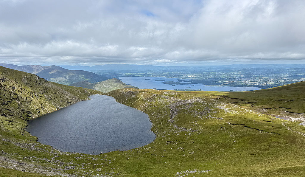
At the foot of Mangerton, within Killarney National Park, lies the legendary Devil’s Punch Bowl. According to legend, the mountain lake was formed following a dispute between the Devil and the chief of the O’Donoghue clan. In a fit of rage, the Devil tore boulders from the mountain and hurled them at the fleeing clan chief. In reality, the lake is not the Devil’s handiwork, but a product of the last Ice Age. Massive glaciers carved out the basin as they began to move down the valley. A hike to the Devil’s Punch Bowl is one of the most popular activities around Killarney. The starting point is the small car park by the Finoulagh River. We approach Mangerton from the small river across a wide plain where the Battle of Callan raged. In 1261, Anglo-Norman invaders were soundly defeated there by the Irish. This is followed by a steep climb over stony paths, which takes us up to the Devil’s Punch Bowl. From the mountain lake, it is not far to Mangerton with its expansive and marshy summit plateau. The best way is to cross Mangerton and walk around the lake. This allows you to enjoy the wonderful view down into Horses Glen. At the bottom of the valley, framed by steep, green slopes, lies the cirque lake Lough Erhogh.
 At the small car park, we take a narrow path from the stone bearing the inscription ‘Cormac’s Haggard’. This leads us across the Finoulagh River and southwards towards Mangerton.
At the start, the path climbs only moderately. In places, the terrain can be quite muddy. After the first flat section, the gradient of the path increases and the ground becomes rockier. We pass through a gate in a fence and continue uphill over a hump overgrown with ferns. To our right, Lough Leane now reveals itself in all its splendour. To the left, we catch sight of another lake, Lough Guitane. A little later, we come across a stream and cross it, keeping to the left.
At the small car park, we take a narrow path from the stone bearing the inscription ‘Cormac’s Haggard’. This leads us across the Finoulagh River and southwards towards Mangerton.
At the start, the path climbs only moderately. In places, the terrain can be quite muddy. After the first flat section, the gradient of the path increases and the ground becomes rockier. We pass through a gate in a fence and continue uphill over a hump overgrown with ferns. To our right, Lough Leane now reveals itself in all its splendour. To the left, we catch sight of another lake, Lough Guitane. A little later, we come across a stream and cross it, keeping to the left.
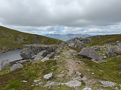
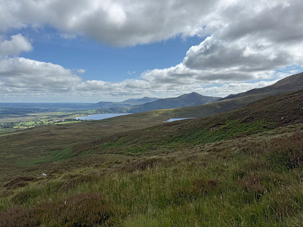 We move away from the stream for a short distance and continue uphill along the stony path, winding our way round the bends. After the steeper climb, the terrain levels out again. The vegetation also becomes noticeably sparser. Across wide meadows, we now look out towards the Macgillycuddy’s Reeks mountain range. We continue hiking uphill in a south-westerly direction and pass several large cairns. After a boulder with an iron bar, the path forks. Here, we do not take the supposedly direct route to the left, but continue straight ahead. The stony but comfortable path then leads us up to Devil’s Punch Bowl. At the northern tip of the mountain lake, we keep to the right and cross its outlet, the Owengarriff River.
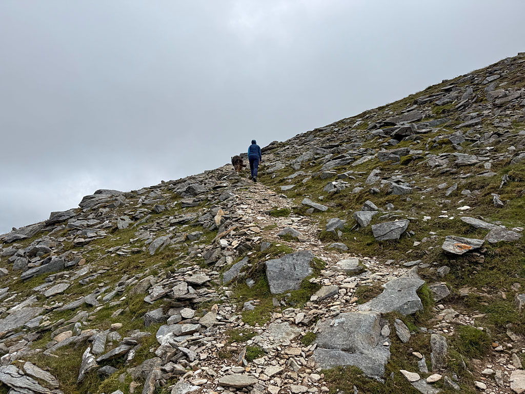 We move away from the lakeshore and cross the grassy flank of the mountain heading west. Then our path takes a left turn and we climb up the broad mountain ridge. The path branches off in front of a cairn. At this point, we turn left and thus remain on the ridge of Mangerton. The path now leads steeply upwards over ground strewn with small boulders. Eventually, the terrain levels out again and we reach the broad summit plateau of Mangerton. The path stays close to the left-hand edge of the ridge and thus near the cliff edge facing the lake. The highest point of Mangerton is on the right-hand edge of the plateau and is marked by a pole. The route to it would lead through marshy terrain. Unfortunately, it is not possible to reach the actual summit without getting your feet wet.
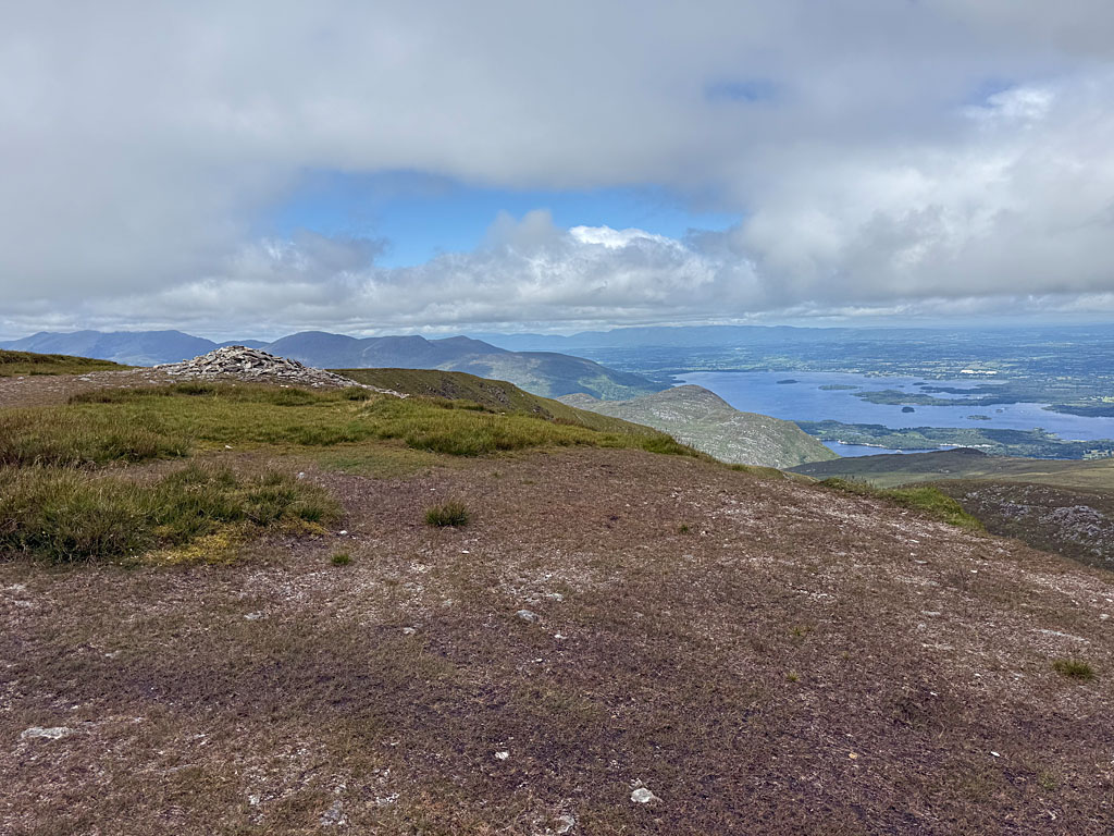 A large cairn marks our summit, which is only slightly lower. There, we maintain our general direction and walk slightly downhill towards the east. On the south-eastern side of Devil’s Punch Bowl, we turn left and descend over a grassy ridge heading north. To our right, we now look into Horses Glen, at the bottom of which lies the dark blue shimmering Lough Erhogh. With a view of the northern summit of Mangerton, we continue downhill and, at a fork in the path at its foot, keep to the left. We now pass the northern side of Devil’s Punch Bowl. The path leads us through a veritable maze of large boulders. At first, we stay a little way above the lake and eventually walk down to its outlet, where we meet our ascent route.
On the way down, we walk from Devil's Punch Bowl down to the car park by the Finoulagh River.
There are no places to stop for refreshments along the way.
| Elevation | Time | Total | Destination | ||
|---|---|---|---|---|---|
| 146 m | - 670 m | + 1:55 | 1:55 | Devil's Punch Bowl | |
| 670 m | - 838 m | + 0:35 | 2:30 | Mangerton | |
| 838 m | - 670 m | + 0:30 | 3:00 | Devil's Punch Bowl | |
| 670 m | - 146 m | + 1:30 | 4:30 | Parkplatz am Finoulagh River | |