 Cairngorms
Coire Cas (635 m) - Ptarmigan Station (1097 m) - Cairn Gorm (1245 m) - Stob Coire an t-Sneachda (1176 m) – Cairn Lochan (1215 m) – Coire Cas (635 m)
Overall, a moderately difficult mountain hike. The ascent from Coire Cas via the Windy Ridge Path and Ptarmigan Station follows a well-maintained and partly stony path. The traverse from Cairn Gorm over Stob Coire an t-Sneachda to Cairn Lochan follows small, stony paths. You frequently come close to the edge of the ridge. At Cairn Lochan, the route is pathless; here, cairns indicate the correct route. Take care in poor visibility and fog! In adverse conditions, you should avoid the described traverse. The descent from Cairn Lochan is steep at the start and then leads back to Coire Cas via a small path and later a well-maintained track. Sure-footedness and a good sense of direction are essential for the described circular route.
From Edinburgh, take the M90 to Perth and from there follow the A9 towards Inverness. Drive past Kingussie and leave the A9 south of Aviemore. After the exit, turn left towards Aviemore and, just before Aviemore, keep right at the roundabout towards Glenmore. Pass Loch Morlich and follow the road up via Glenmore to the large car park at Coire Cas.
57.13470400, -3.67130000
Anzeige
The Cairngorms are home to five of the ten highest peaks in Scotland and the whole of Great Britain. Although the eponymous Cairn Gorm itself is overshadowed by four neighbouring peaks in this mountain range, it nevertheless enjoys immense popularity. Its slopes are accessible via a funicular railway and ski lifts. So, come summer or winter, this proud Munro attracts plenty of visitors. However, anyone wishing to pay a visit to the summit of Cairn Gorm and shorten the ascent by taking the funicular will be in for a nasty surprise. Funicular passengers are not permitted to leave the plateau around the mountain station, including the restaurant. The only exception: you book a guided hike, which is not exactly a bargain. This rule is an attempt to reconcile mass tourism with nature conservation on Cairn Gorm.
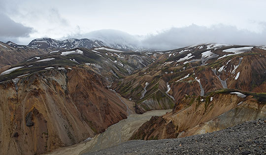
At the summit itself, therefore, the hikers are among themselves – those who have managed to conquer the 600 metres of elevation gain from Coire Cas using their own leg strength. Things become quieter once you cross Cairn Gorm and pay a visit to its two secondary peaks, Stob Coire an t-Sneachda and Cairn Lochan. The bizarre rock formations on the edge of Cairn Lochan are particularly worth seeing. Due to the steeply sloping ridge, you should only attempt this beautiful traverse when visibility is good. There is a descent route between each of the peaks, so the hike can be cut short at any time should the weather take a turn for the worse.
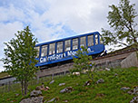
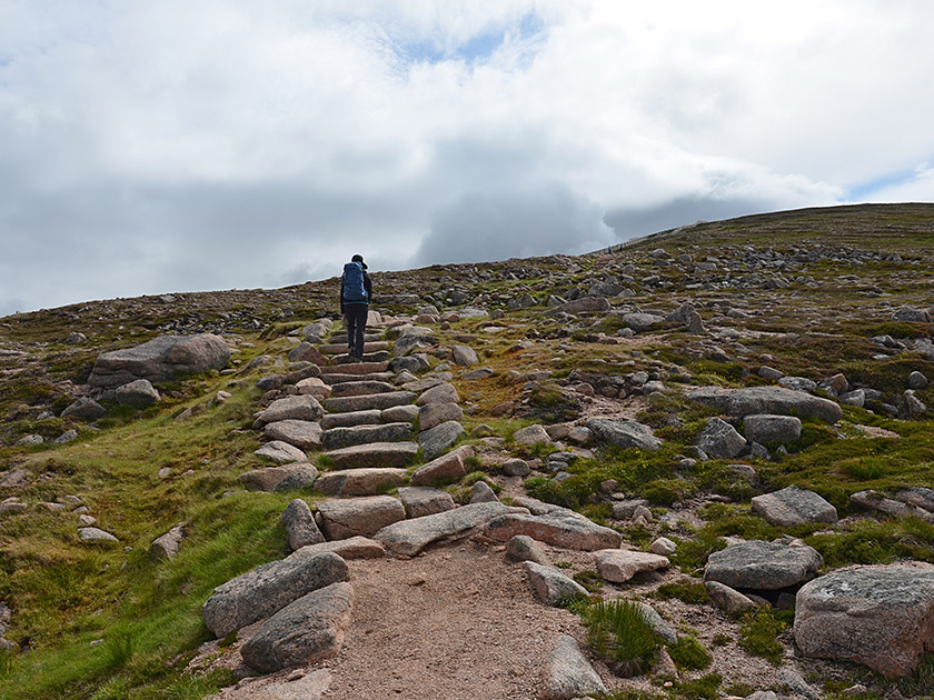 At Coire Cas (635 m), we walk towards the buildings at the south-eastern end of the car park. We pass the funicular’s valley station on our right and the Day Lodge on our left. At the end of the lodge, we come to a junction and turn left onto the Windy Ridge Path. This first takes us under the funicular line and then uphill via steps in a north-easterly direction. After a short while, the path bends to the right. Heading generally south-east, we continue to gain altitude rapidly along the steadily ascending Windy Ridge Path. The higher we climb, the better the view of Loch Morlich, which lies deep below us in the valley, framed by Glenmore Forest Park.
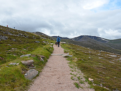
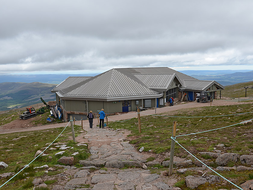 To the south-east, the forbidding summit face of Cairn Lochan is already visible; we will be visiting this as part of our traverse. The Windy Ridge Path later takes us to a wooden fence, which we will follow for a short while. We are now heading towards Cairn Gorm and the funicular’s upper station. After a walking time of just over 1¼ hours, we reach Ptarmigan Station (1097 m) with its mountain restaurant. Shortly after the restaurant, we turn slightly left and take the paved Summit Path, which will lead us southwards up to the summit plateau. 25 minutes later, we reach the expansive, stony summit area and the Cairn Gorm weather station (1,245 m, a total of 1¾ hours from Coire Cas).
 At the weather station, we turn south-west and, with a view of the two subsidiary peaks, descend over the boulder-strewn flank into the saddle between Cairn Gorm and Stob Coire an t-Sneachda. At the broad saddle, the path curves to the left and leads us towards the summit ridge of Stob Coire an t-Sneachda. Climbing up a counter-slope, we follow the ridge line, keeping a safe distance from the drop-off, up to the summit cairn (1176 m, a good 30 minutes from Cairn Gorm). At the highest point, we maintain our general direction and head south-west down to the saddle between Stob Coire an t-Sneachda and Cairn Lochan.
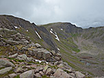
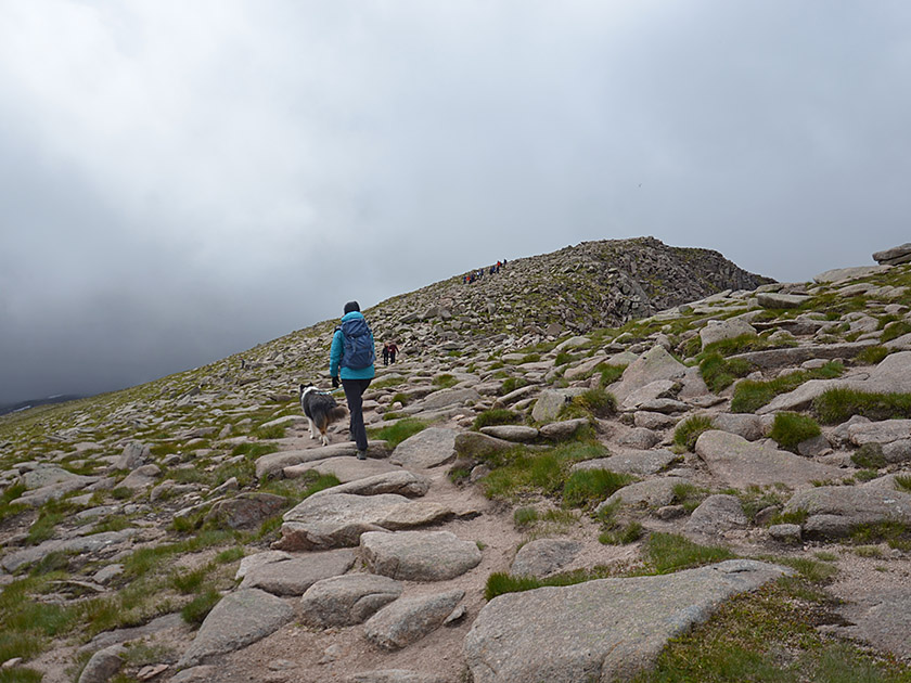
 At this saddle, we continue straight ahead and follow a meadow path up the steep, grassy flank. On the steep slope, we ignore tracks that lead off to the left. During the ascent, we keep slightly to the right, heading east. Shortly afterwards, the terrain levels out and we reach the expansive summit plateau (1,215 m, 1¼ hours from Cairn Gorm). Here, the path finally disappears among the boulders. Large cairns mark the path, which leads us eastwards across the plateau. In poor visibility, however, it is not easy to find our bearings. To the right, the terrain drops steeply down towards the north. We admire the many rocky towers that form a bizarre landscape.
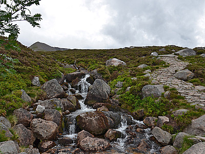
 We continue westwards across the summit plateau and come to a slope. Now we spot a path again, which curves sharply to the right and leads us down towards another plateau in a north-westerly direction. There, the path disappears once more. We keep heading in the same direction and reach a stream. We cross this, turn right and shortly afterwards come across a path again. The path leads us away from the stream to the left and crosses northwards into the flank of a grassy ridge. We then traverse the slope and, after a long traverse, meet the wide path leading down from Ben Macdhui. We follow this path north-eastwards back to the car park (635 m).
The Cairngorm Café at the starting point (Tel. +44 (0)1479 861261) serves meals, light snacks and drinks.
| Elevation | Time | Total | Destination | ||
|---|---|---|---|---|---|
| 635 m | - 1097 m | + 1:20 | 1:20 | Ptarmigan Station | |
| 1097 m | - 1245 m | + 0:25 | 1:45 | Cairn Gorm | |
| 1245 m | - 1176 m | + 0:35 | 2:20 | Stob Coire an t-Sneachda | |
| 1176 m | - 1215 m | + 0:40 | 3:00 | Cairn Lochan | |
| 1215 m | - 635 m | + 2:00 | 5:00 | Coire Cas | |