


 Bodø
Bodø 
Rønvikfjellet car park (135 m) - Øvre Vollvatnet (163 m) - Skyttedalen - Keiservarden (366 m) - Svartvatnet (173 m) - Rønvikfjellet car park (135 m)
A moderately difficult mountain hike, leading along wide paths and narrow mountain trails. In wet conditions, the paths in the upper section of the route can be slippery. A minimum level of sure-footedness is required for the circular hike described.
From the harbour and Bodø town centre, take Road No. 80 south-eastwards to a roundabout. Here, turn left onto Road No. 834 and head towards Kirkhaugen. Once you have crossed a railway line, turn right at the next opportunity onto Fjellveien. Follow this road north-eastwards through the settlement and drive uphill via two hairpin bends. After a long left-hand bend, you reach the plateau of Rønvikfjellet. Park the car on the right-hand side at the large car park.
67.30158543, 14.44508702
Anzeige
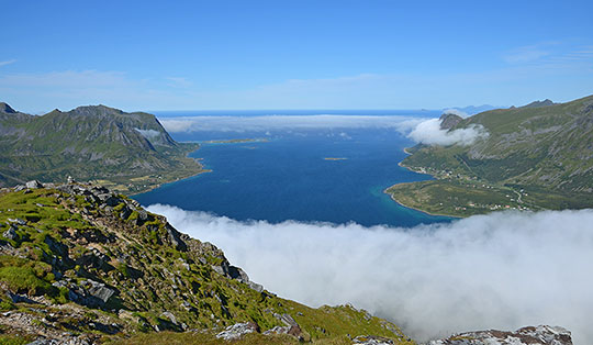
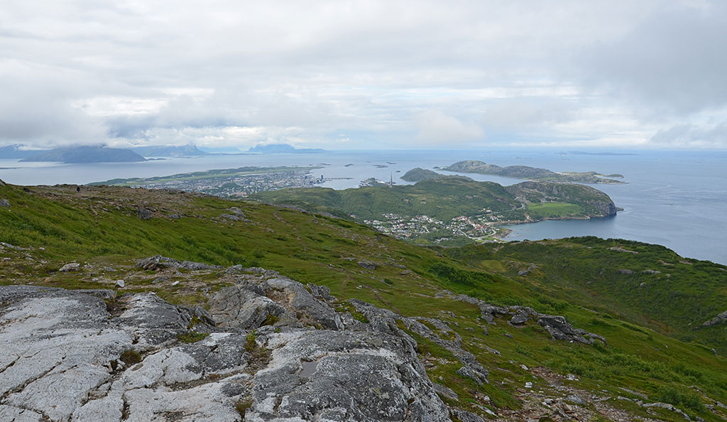
Keiservarden is a local mountain in Bodø, rising to the north-east of the town centre. It is said that in 1891, Keiservarden was climbed by the German Emperor Wilhelm II and his entourage. However, it is not certain whether the Emperor actually paid a visit to the mountain. The quickest way to reach Keiservarden is from the Rønvikfjellet car park. From the flat summit plateau, there is a wonderful panoramic view which, in good weather, stretches as far as the Lofoten Islands. We therefore begin our hike at the Rønvikfjellet car park and first walk to Øvre Vollvatnet. At the lake, we opt for a circular route and follow the path to the small wooden huts of Skyttedalen, where we continue our ascent along narrow paths to a viewpoint marked by a large cairn. From there, the route leads through a hollow and up the mountainside to the large plateau of Kaiservarden. From the summit, we choose the return route via Lake Svartvatnet.
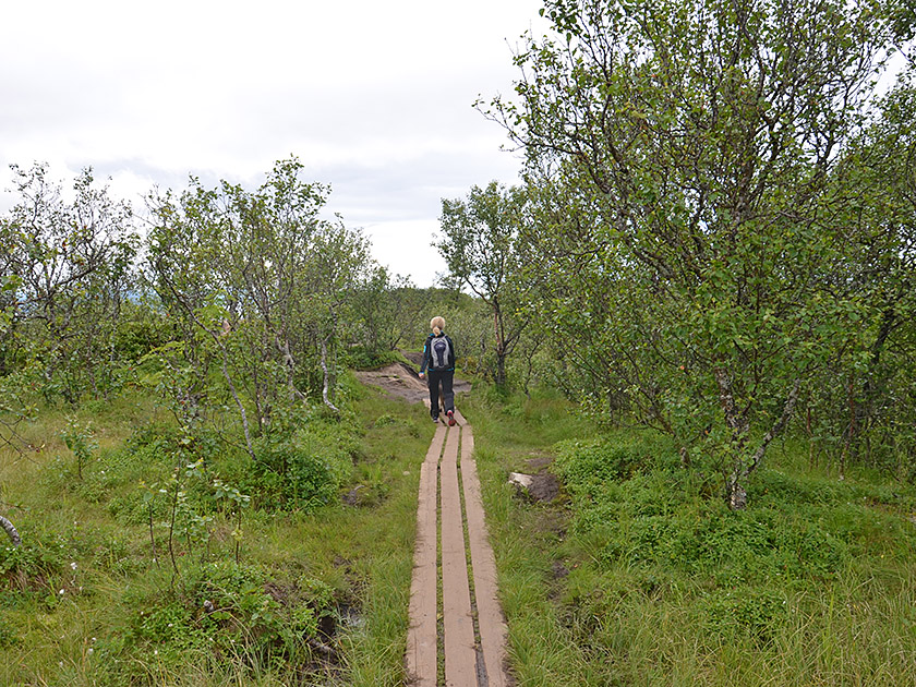
 At the hiking car park, we pass a barrier and follow the forest track in a north-easterly direction. After three minutes, we reach Lake Øvre Vollvatnet. There, we ignore the turn-off to the right and continue along the wide path, keeping to the left. We pass the north side of Øvre Vollvatnet, continue north-eastwards and shortly afterwards reach a junction. Here we ignore the direct path to Keiservarden, which leads off to the right, and follow the path across Skyttedalen towards Keiservarden. We therefore continue our ascent in a north-easterly direction and come to a few scattered wooden huts.
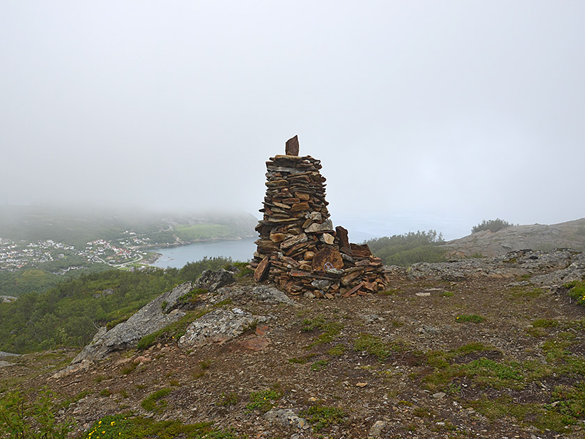 Before the entrance to one of the wooden huts, we veer diagonally to the right (signposted ‘Keiservarden’), walk past the hut in a gentle left-hand bend and continue uphill. As soon as our path takes a sharp right-hand bend, we maintain our general direction and continue climbing uphill along a small path. This leads us up to a striking rock face, which we pass on its left-hand side. Shortly afterwards, we reach a small rocky outcrop with a large cairn. From this vantage point, we have a lovely view down towards Bodø and the small islands offshore.
 After enjoying the first beautiful views, we descend from the outcrop and turn left, facing towards Bodø. We now head eastwards towards the summit flank of Keiservarden and first descend into a hollow covered with low trees. After the short descent, the path leads us steeper uphill and over partly stony paths up to the ridge of Keiservarden (15 minutes from the viewpoint). We follow this, keeping to the left, continuing upwards in a north-easterly direction (marker posts). Shortly before the highest point, the route leads over a rugged section up to the spacious summit plateau with the shelter hut and a huge cairn bearing a Kaiser Wilhelm memorial plaque.
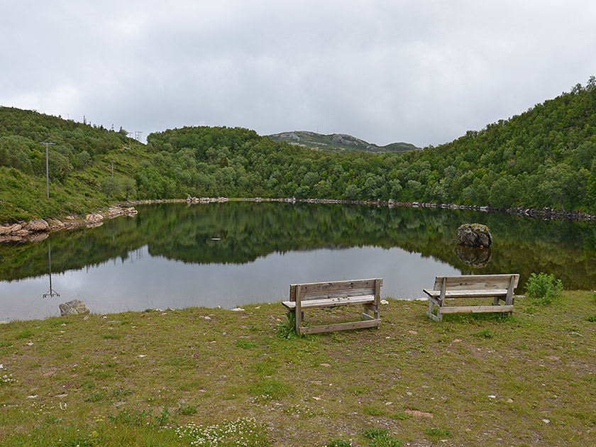
 For the descent, we choose the route via Svartvatnet. To do this, we leave the summit via the route we took on the way up and follow the ridge downhill along the marker posts, with a view of Bodø to the south-west. The stony ridge soon gives way to a small path. This takes us to a flat hillock with a small cairn. We then continue downhill and cross a marshy section via a footbridge. A few minutes later, we reach Svartvatnet and walk past its north-western shore. Shortly afterwards, we arrive at Øvre Vollvatnet, walk around its southern side and return to the ascent route, which we follow to the Rønvikfjellet car park.
There are no places to stop for refreshments along the way.
| Elevation | Time | Total | Destination | ||
|---|---|---|---|---|---|
| 135 m | - 366 m | + 1:15 | 1:15 | Keiservarden | |
| 366 m | - 135 m | + 0:50 | 2:05 | Parkplatz Rønvikfjellet | |