 Telemark
Stavsro (1170 m) – Gaustatoppen Turisthytte (1860 m) – Gaustatoppen (1883 m)
From Stavsro to the upper summit platform, this is a moderately difficult mountain hike that leads over scree-covered paths and, in one place, over short, rocky steep sections. The onward route along the summit ridge to the highest point is challenging and involves boulder climbing at difficulty level 1. Sure-footedness and a head for heights are essential for the crossing to the main summit. In total, the route covers 10.6 kilometres from Stavsro to the summit and back. The route is clearly marked with red T-markings.
From Oslo, take the E18 towards Kristiansand to Drammen, and from there follow the E134 via Mjøndalen, Notodden and Heddal to Tuddal. In Tuddal, keep right towards Rjukan (Road 651) and drive up the mountain pass to the Stavsro car park (NOK 100 parking fee, as of 2017).
59.83519228, 8.71472742
Anzeige
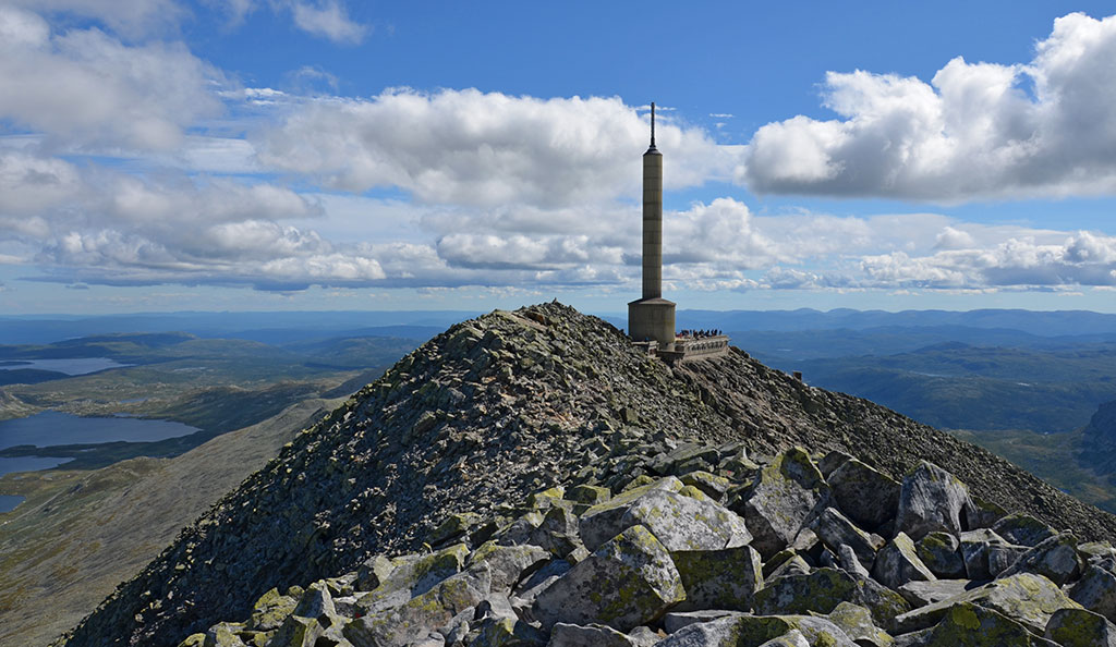
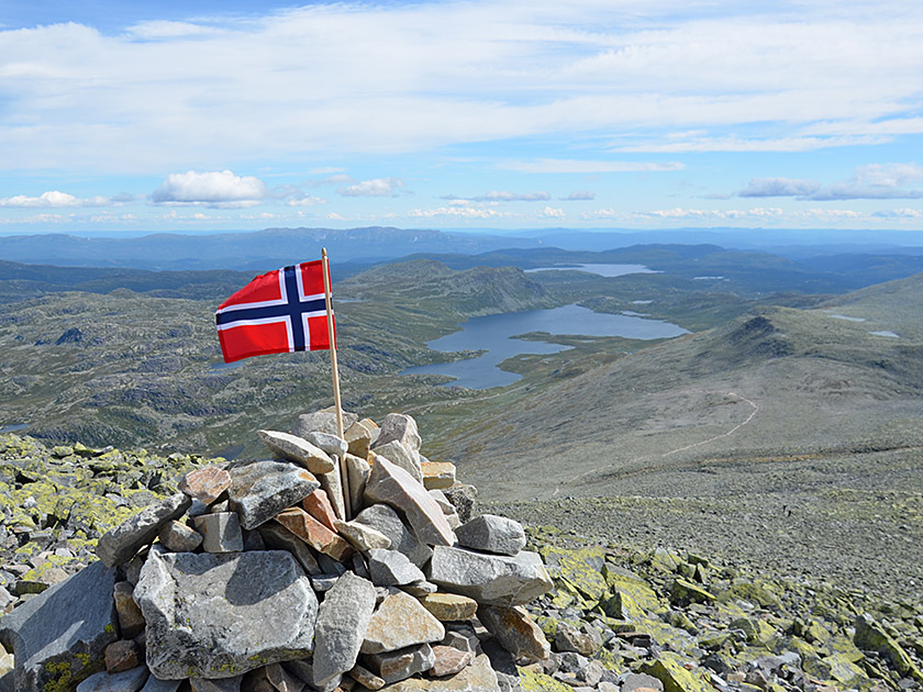
Gaustatoppen is the highest mountain in Telemark and is considered Norway’s most beautiful mountain for its views. On a clear day, from the summit of Gausta – as it is simply known in Norway – you can see a sixth of the country’s land area. During the Cold War, Gaustatoppen served a military purpose and was used as a base for radio and radar. In the 1950s, a tunnel was bored through the mountain to allow a railway to reach the summit. The railway remained a secret for many years due to its military use. It is only since 2010 that the Gaustabanen has been transporting visitors up to Gaustatoppen.
Naturally, the best way to experience Gaustatoppen is to hike up without any mechanical aids. We start at the Stavsro car park on the mountain pass road between Rjukan and Tuddal. From there, we find ourselves in scenic terrain right from the start and make our way across stony ground towards the imposing summit with its large radio tower. Below the summit lies the Gaustatoppen Turisthytte, built in 1893 by the Norwegian Alpine Club (DNT), where you can refuel with fresh waffles. The hike presents no particular difficulties up to the upper viewing platform. The crossing over the boulder-strewn summit ridge is, however, challenging and requires boulder climbing in terrain that is at times exposed.
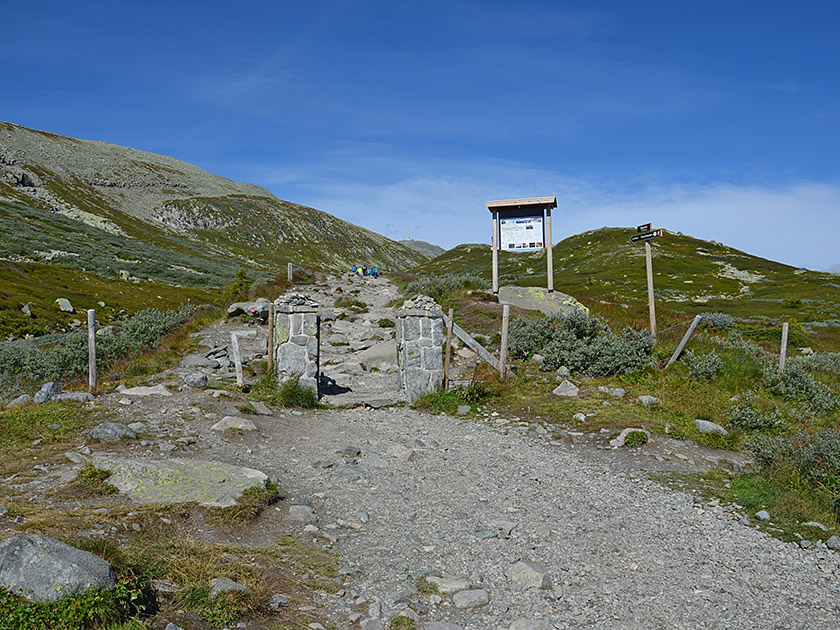 We leave the Stavsro car park, cross the mountain pass road between Rjukan and Tuddal and take the signposted hiking trail towards Gaustatoppen. We pass through a gap in a fence and hike north-westwards uphill past green meadows. Soon the wide path narrows and becomes rockier. We come across a small stream, which we follow uphill.
We head for a faintly defined saddle to the left of a green hump. Looking back, we can see our starting point and Lake Heddersvatn. After crossing the saddle, we pass a huge cairn and a small pond. We then keep to the left, cutting into the flank of Gausta, and continue hiking uphill in a north-westerly direction.
We leave the Stavsro car park, cross the mountain pass road between Rjukan and Tuddal and take the signposted hiking trail towards Gaustatoppen. We pass through a gap in a fence and hike north-westwards uphill past green meadows. Soon the wide path narrows and becomes rockier. We come across a small stream, which we follow uphill.
We head for a faintly defined saddle to the left of a green hump. Looking back, we can see our starting point and Lake Heddersvatn. After crossing the saddle, we pass a huge cairn and a small pond. We then keep to the left, cutting into the flank of Gausta, and continue hiking uphill in a north-westerly direction.
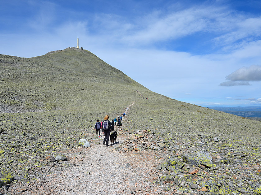 During the ascent, we cross several fields of small boulders. Later, the path turns left and leads us towards a ridge of boulders, which we climb over. After clearing this obstacle, the path continues north-westwards across rocky terrain towards the summit of Gaustatoppen. Finally, we reach a signpost and meet the ascent path leading up from the Gaustabanen valley station. We turn left and follow the red T-markings in a south-westerly direction. Over rough boulders, we now climb more steeply and keep to a stony gully on its upper left edge. Eventually, we reach another signpost and turn right there.
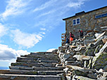
 Once again, we head north-west towards the summit structure. We climb upwards over the gravelly and bouldery terrain in numerous switchbacks. Finally, we reach the Gaustabanen mountain station. From there, a stone staircase leads us up to the Gaustatoppen Turisthytte. From the hut, we climb up steps again to the upper viewing platform at the foot of the radio mast (a good 2¾ hours from the Stavsro car park). Most visitors and mountaineers consider the platform to be the summit. Those with sure-footedness and a head for heights can pay a visit to the main summit within just under half an hour. To do so, we first pass the radio tower on its right-hand side and find ourselves on the bouldery and initially broad summit ridge of Gaustatoppen.
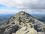
 A We follow the ridge to a rise and descend into a hollow on the other side. The narrower ridge leads us to another elevation, which we pass on the left-hand side. Then the route veers to the right and we traverse past several large boulders. We climb over a steep step and head straight along the ridge towards the highest point. Now several large, smooth boulders block our path, which we have to scramble over in a series of ups and downs. Here, the danger is not so much of falling, but of slipping on one of the smooth, sloping slabs and landing with your legs in one of the countless crevices. After the time-consuming up-and-down climb, you finally find yourself at the foot of the highest point, from where the ascent becomes easier again over a final rock step (just under 30 minutes from the upper viewing platform).
Same as ascent.
Gaustatoppen Turisthytte (1860 m), Tel. +47 35 53 25 55.
| Elevation | Time | Total | Destination | ||
|---|---|---|---|---|---|
| 1170 m | - 1860 m | + 2:45 | 2:45 | Gaustatoppen Turisthytte | |
| 1860 m | - 1883 m | + 0:30 | 3:15 | Gaustatoppen | |
| 1883 m | - 1860 m | + 0:25 | 3:40 | Gaustatoppen Turisthytte | |
| 1860 m | - 1170 m | + 2:05 | 5:45 | Stavsro | |