

 Mangfall Mountains
Osterhofen cable car valley station (792 m) – Hochkreuth (980 m) – Wendelsteiner Almen (1420 m) – Wendelsteinhaus (1724 m) – Wendelstein (1838 m)
Moderately difficult mountain hike. The tour, which is just under 14 km long (there and back), involves a climb of around 1,000 metres.
Take the Munich–Salzburg motorway to the Weyarn exit, then follow the B 307 from Weyarn via Miesbach and Schliersee towards Bayrischzell and park at the cable car valley station before Osterhofen.
From Munich Central Station, take the Bayerische Regiobahn towards Bayrischzell to the Osterhofen stop (timetable and booking).
47.68788973, 11.97974324
Anzeige
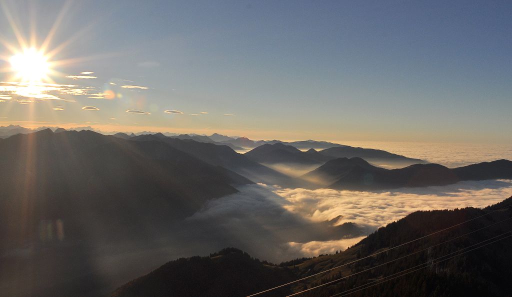
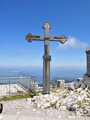
The Wendelstein is visible from afar even from Munich due to its striking shape and exposed location. However, you will rarely find yourself alone on the summit, which can be reached by rack railway, cable car and, of course, on foot. About 100 metres below the summit are the Wendelstein Chapel, the Wendelstein Cave and the Wendelstein House, which even has conference rooms equipped with every conceivable amenity. From the shared mountain station of the cable car and rack railway, a well-maintained path leads to the summit. There, a viewing platform offers beautiful views to the south, west and north. To the east, the view is restricted by an observatory belonging to the Ludwig Maximilian University and transmission masts of Bayerischer Rundfunk, the regional public broadcaster in Bavaria. The summit cross is somewhat obscured by the buildings.
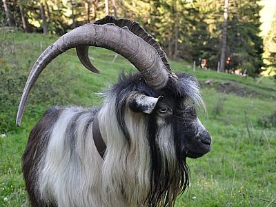
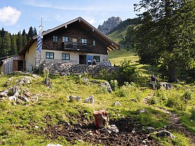
 From the cable car car park, the signposted path first takes us to Osterhofen station. Here, hikers even have access to a Kneipp facility, which we’ll be happy to use after the hike. Apart from a short detour, a tarmac path mostly leads us to Hochkreuth, where two inns invite you to stop for a while or spend a holiday. Along the way, we encounter not only cows and Highland cattle but even a llama. Behind the Siglhof café, we hike up the mountain on a wide forest track and, just under half an hour later, reach a junction signposted ‘Wendelstein’ to the left. Passing the Siglalm and a DAV self-catering hut, we reach the Wendelsteinalmen via the path about 30 minutes later. Thirsty souls can take their first break here in a cosy atmosphere.
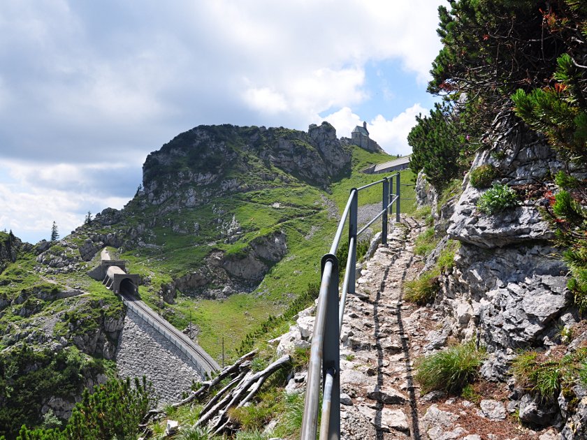
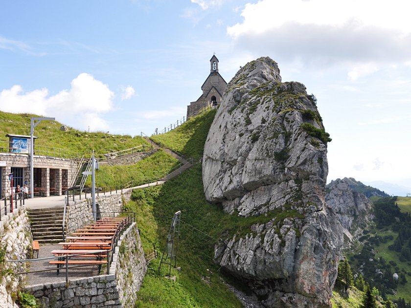 We continue our ascent behind the alpine pasture and, about a quarter of an hour later, must decide whether to continue along the König-Maximilian-Weg via the Bocksteinscharte or the Zeller Scharte. We choose the Bocksteinscharte. By now, we already have a rather lovely view of the Leitzach Valley. The Seebergkopf, the Hochmiesing and the Aiplspitz are visible. Passing beneath the cable car, we reach the viewing terrace of the Wendelsteinhaus. We visit the Wendelsteinkircherl, the highest church in Germany according to canon law, and climb the steps to the “Gachen Blick”, a viewpoint where information boards also reveal the names of the surrounding mountains. Together with the numerous visitors who have arrived by cable car or rack railway, we set off to cover the remaining few metres to the summit.
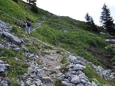
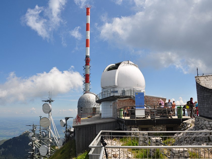 The path to the actual summit begins behind the Wendelsteinhaus and should be manageable even for those who do not usually spend time in the mountains. The path winds its way up in numerous hairpin bends, rising moderately steeply to the summit. Depending on the number of people, this section takes around 20–30 minutes. Along the way, there are also a few benches where you can rest and enjoy the view. Once at the summit, the viewing platform offers a beautiful panoramic view. From west to north-east, you can look deep into the Alpine foothills. The Inn, Simsee and Chiemsee glisten in the sun. The panorama stretches from the Kampenwand, the Berchtesgaden Alps, the Kaisergebirge with the Ellmauer Halt, the Großglockner and Großvenediger, the Karwendel, and the Zugspitze to the Benediktenwand. The transmission masts and the observatory obstruct the view to the east somewhat, but on the Panorama Trail that follows we will also be able to enjoy the view in this direction.
 The Panoramic Trail begins to the west of the summit area, circles the Wendelstein clockwise and ends below the rack railway station. Passing the ‘Wetterloch’ (weather hole), which marks the entrance to a Wendelstein cave that cannot be visited, the trail leads us to another vantage point, east of the summit. Here, too, there is a beautiful view to the east. The Watzmann can be seen in the distance. We continue our circumnavigation of the summit and can watch the rack railway winding its way up the foot of the Soinwand. You should allow a good half an hour for the high-altitude trail.
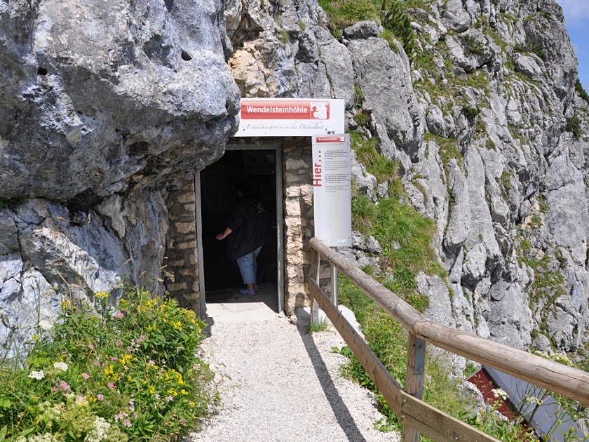 A visit to the illuminated Wendelstein Cave is also well worth it. For a one-euro entrance fee, the cave can be accessed via a steep staircase. It is a karst cave, with passages accessible to everyone extending deep into the mountain. In the rear section, the average annual temperature is 3 degrees Celsius. We visit the natural cave entrance and the rock dome. Information boards provide visitors with all sorts of interesting facts about the cave. We then set off to descend via the König-Maximilian-Weg to the Zeller Scharte and the Wendelsteinalmen. From there, we follow the ascent route back to the Kneipp facility at the station in Osterhofen and, if necessary, on to the car park at the valley station of the cable car. From the Zeller Scharte, you can also climb the Soinwand or the Lacherspitze. The views there are just as good as from the Wendelstein, but with the added bonus of a clear view to the east.
Follow the ascent route from the Wendelsteinhaus. Alternatively, you can take the cable car down to the starting point, which is easier on the knees.
| Elevation | Time | Total | Destination | ||
|---|---|---|---|---|---|
| 792 m | - 980 m | + 0:30 | 0:30 | Hochkreuth | |
| 980 m | - 1420 m | + 1:00 | 1:30 | Wendelsteinalmen | |
| 1420 m | - 1724 m | + 0:45 | 2:15 | Wendelsteinhaus | |
| 1724 m | - 1838 m | + 0:30 | 2:45 | Wendelstein | |
| 1838 m | - 1724 m | + 0:30 | 3:15 | Wendelsteinhaus über Panoramaweg | |
| 1724 m | - 1420 m | + 0:30 | 3:45 | Wendelsteinalmen | |
| 1420 m | - 792 m | + 1:00 | 4:45 | Seilbahnparkplatz Osterhofen | |


