

 Serra de Tramuntana
Lluc Monastery car park (500 m) - Coll del Telégraf (1120 m) - Puig de Massanella (1364 m) - Coll de sa Batala (678 m) – Lluc Monastery car park (500 m)
Mostly a moderate mountain hike; the summit ascent as described here is unsecured and requires climbing experience. However, the climbing section can be bypassed.
From Palma, take the Ma-13 to Inca, then continue on the Ma-2130 via Selva, following the signposts towards Lluc Monastery. Shortly after Coll de sa Batala, turn right and stay on the road until you reach Lluc Monastery. Park in the large car park south of the monastery.
39.82036681, 2.88419737
Anzeige
Mallorca has many faces and attracts a wide variety of people to this Mediterranean island. Alongside the famous nightlife in Palma, the countless beaches and secluded coves, the mountains of the Serra de Tramuntana are among the island’s highlights. The highest isolated peak that tourists can climb is Puig de Massanella, at 1,364 metres. The only higher point is the south-western peak of Puig de Major, the Penyal des Migdia (Midday Peak), at 1,401 metres. Unfortunately, however, the summit of Mallorca’s highest mountain is a restricted area. Access is reserved for the Spanish and US military.
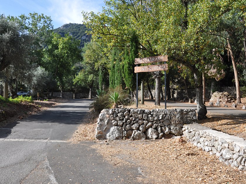 We start our hike at the south-western edge of the car park, to the right of the Sa Font Cuberta restaurant. Behind it there is also a spring where you can refill your water bottles. After climbing over a gate via a ladder, the path—partly paved with rough stones—leads us past terraces and olive trees, sometimes in the shade, sometimes in the sun, to the Ma-10 main road in just under 30 minutes, which we cross.
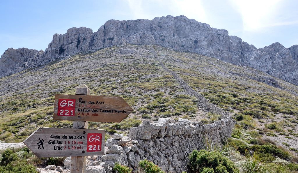
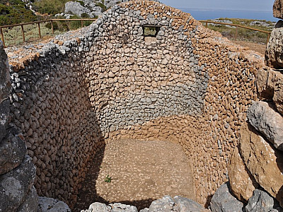
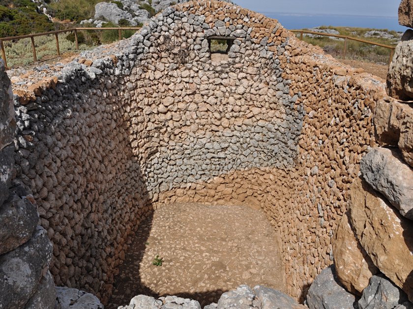 The path now becomes imperceptibly steeper until, after another half an hour, we reach a junction where we keep to the left and head uphill. The wide path, now paved once more, winds its way up the mountain in numerous hairpin bends until we reach a sort of high plateau. Here we make a short detour to a reconstructed snow house (Mallorcan: Cases de Neu), which were formerly used for storing snow and making ice. After we have thoroughly explored this historic ‘fridge’, we walk the short distance back to the GR 221 trail.
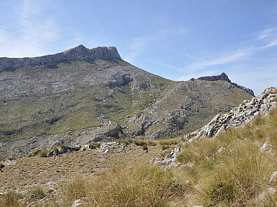
 We continue our ascent, heading east towards Sa Mola, a 1,159-metre-high secondary peak in the Massanella massif. Before reaching it, however, we turn right and walk halfway round the 1,195-metre-high Puig Galileu. Observed by numerous goats, we discover further ruined snow houses. Even from a distance, it is clear that from the saddle ahead of us (Col del Telégraf) we will have a beautiful view of the 1,447-metre-high Puig Major to the west, with its radar dome. We briefly enjoy the view from the saddle and continue our hike along the GR 221 trail for 20 minutes until we come across a stone wall. Here we have to decide whether to take the short route involving a bit of scrambling through the rocks above the wall or to continue along the hiking trail.
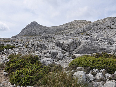
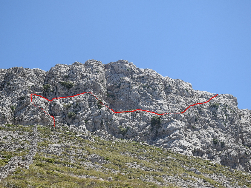 We opt for the short scramble up the west face below the summit. Those who choose the hiking trail go round the face above us and reach the summit from the south via a path that leads over several rocky steps. We follow the wall to the foot of the face. As we begin the climb to the right of the wall, we are watched sceptically by a sheep. For the most part, the terrain is straightforward, though a short section at the start is somewhat more challenging. There, we must briefly negotiate climbing sections rated Grade II on the UIAA scale. Afterwards, we keep to a ledge heading right (look out for cairns!). We encounter no further difficulties and shortly afterwards we have crossed the wall and, after a few metres, reach the summit of Puig de Massanella.
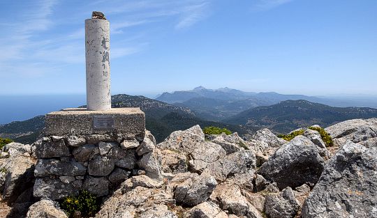
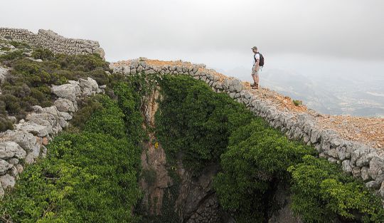
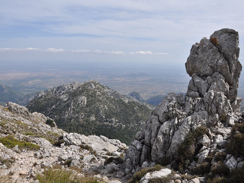
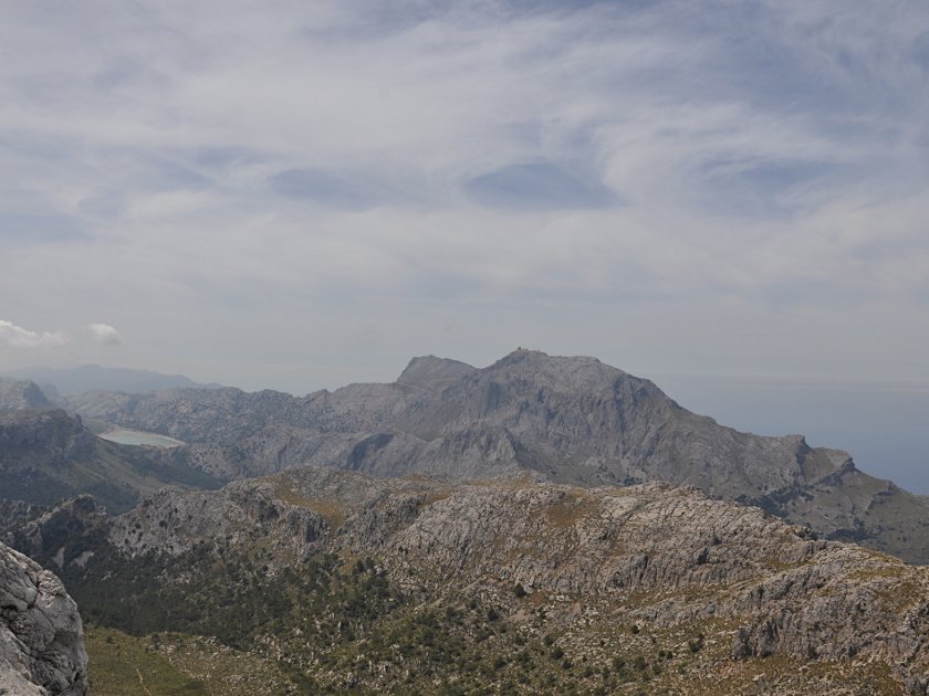 From the summit, there is a magnificent view over much of the island. To the west, the island’s highest mountain, Puig Major, towers majestically. You can also see the sea and numerous other peaks of the Serra de Tramuntana. To the east, the view stretches far into the island’s plains. Also of interest is a hole some 5 metres deep, right near the summit. For climbers, it is also worth making a detour to the southern summit, some 500 metres away, over which the hiking trail leads on the ascent and from which there is a great view of the reservoirs in the valley.
 From the summit, we head east and descend through the rocky terrain on a sporadically marked path towards the flatter foothills of the massif. Once we reach the flatter section, we pass a prominent rock and reach the edge of the forest through steep, partly poorly marked terrain. A few metres further down, the path becomes clearer and we come across a better-maintained hiking trail. We follow this downhill to a clearing, where we keep to the left.
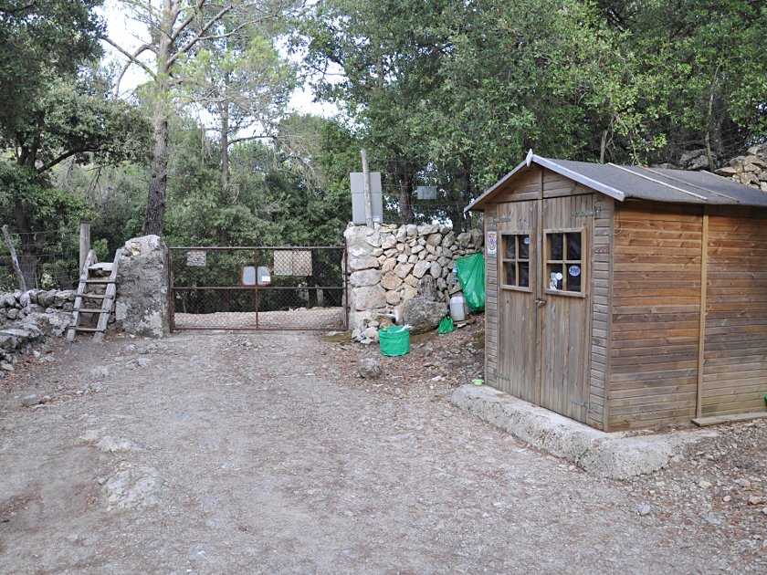 On the now wide forest road, we continue to the right, past the ‘Coma Freda’ estate. On the way to the Ma-10 main road, we pass a small hut where, if occupied, a small fee is payable, which is used to maintain the hiking trails in the area. Turning left onto the Ma-10, we head over the “Coll de sa Batala” to the junction for Lluc. There, we cross the road and walk back along the small upper road to the car park of Lluc Monastery.
No places for refreshments along the way. At the starting point is the Lluc Monastery, which offers accommodation.
| Elevation | Time | Total | Destination | ||
|---|---|---|---|---|---|
| 500 m | - 1120 m | + 2:30 | 2:30 | Col del Telégraf | |
| 1120 m | - 1364 m | + 1:00 | 3:30 | Puig de Massanella | |
| 1364 m | - 678 m | + 2:30 | 6:00 | Coll de sa Batala | |
| 678 m | - 500 m | + 0:30 | 6:30 | Parkplatz Kloster Lluc | |