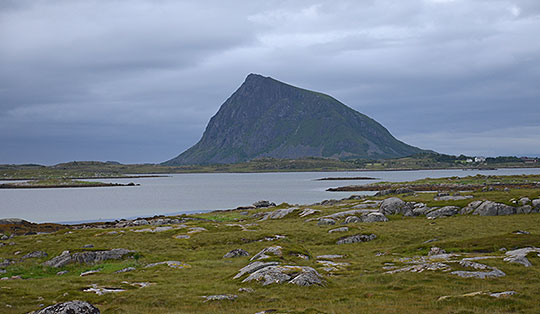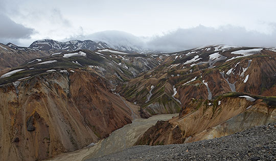


 Jotunheimen mountains
Memurubu (1008 m) - Bjørnbøltjønne (1518 m) - Bessvatnet (1373 m) - Besseggen ridge - Veslfjellet (1743 m) - Gjendesheim (994 m)
A challenging mountain hike that leads over uneven paths and, on the descent, across stony terrain and short rocky steep sections. The Besseggen Ridge requires climbing of up to grade 1 difficulty in terrain that is partly exposed. Sure-footedness, a head for heights and good physical fitness are essential for this hike.
Take the E6 from Oslo towards Trondheim, leave the E6 between Kvam and Otta and turn left onto road no. 257 towards Heidal. Follow road no. 257 past Heidal for 30 kilometres to the end, then turn left onto road no. 51. Follow Route 51 for 33 kilometres, then turn right towards Gjendesheim. As there are no long-stay parking spaces at the jetty, please park your car at the Reinsvangen car park, which is 200 metres further on, on the right-hand side. A shuttle bus runs from here to the jetty. It is approximately 1.7 kilometres on foot to Gjende (a 20 to 25-minute walk). Parking tickets and bus tickets can be booked in advance (all information at visitgjende.no). You can find all information about the boat trip and the timetable at gjende.no.
61.48665500, 8.83301900
Anzeige
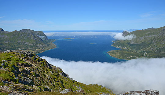
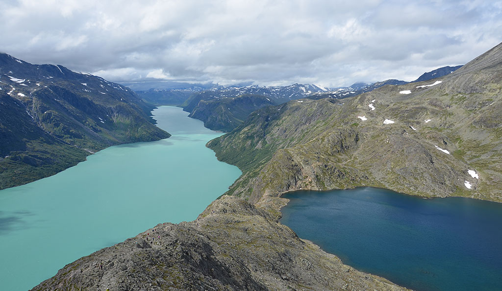
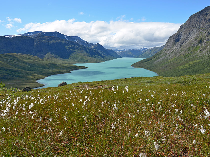
Crossing the Besseggen ridge is one of the most popular tours in the Jotunheimen mountains, alongside the ascent of Galdhøpiggen. The impressive route runs along the north side of Lake Gjende from Memurubu over a long mountain ridge to Gjendesheim. Shortly before the highest point, Veslfjellet, you pass the famous Sensengrat, over which Peer Gynt is said to have ridden on a goat in Henrik Ibsen’s famous play. This section of the ridge is actually not as sharp as its name suggests. There are only a few short narrow sections, which pose no major problems for sure-footed hikers with a head for heights. From the ridge, you then have the famous sweeping view down to the shimmering Lake Gjende and the dark-blue Lake Bessvatnet, which, viewed from a bird’s-eye perspective, seem almost to touch at a narrow point.
The Besseggen ridge is walked in both directions. There are several advantages to starting at Memurubu: you walk with the flow of traffic without much oncoming traffic and tackle the most difficult sections on the ascent. Furthermore, you usually have firm ground underfoot and save the long stretch of scree for the descent. The crumbly terrain on Veslfjellet is not much fun when ascending. Last but not least, you don’t need a return boat trip and can take your time on the hike without being tied to timetables. Ideally, the Besseggen hike begins with a boat trip from Gjendesheim to Memurubu. You should arrive at the jetty well in advance of the first departure to secure one of the coveted spots on the boat (see timetable). If you are forced to wait for the next boat, you can at least pass the time with a second breakfast at the kiosk next to the jetty.
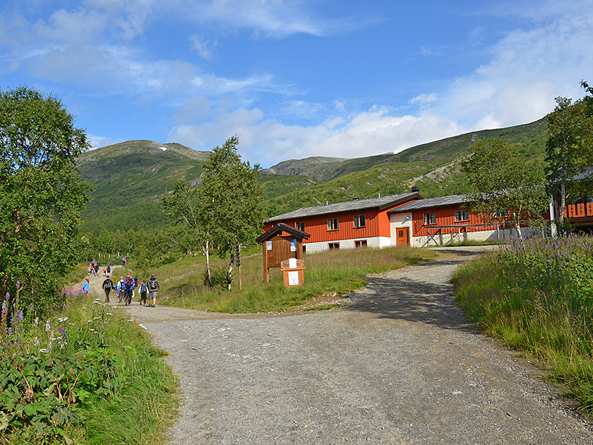 In Memurubu, we leave the boat and turn left (signpost ‘Besseggen, Memurubu’). We now walk towards the striking pyramid of Sjugurtinden and pass the Memurubu Tourist Hut. After the hut, the path curves to the right and we reach a junction. We turn left and then immediately right again at the next opportunity (signpost “Besseggen”). A now somewhat narrower path leads us northwards through sparse scrub on a moderate incline. After a short while, the gradient increases significantly and the path winds its way northwards up the steep slope. The bushes recede further and further, and we enjoy the first views down towards Memurubu and across to Gjende.
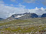
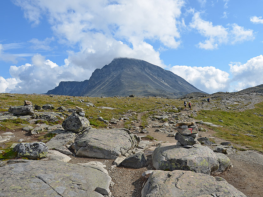 The higher we climb, the rockier the path becomes. After walking for just under an hour, the terrain gradually levels out. The now moderately steep path leads us north-eastwards up to a ridge. Once we reach the ridge, we come to the junction for Glitterheim, which we pass on the left. We now follow the ridge eastwards along the red T-markings and soon spot the striking, isolated peak of Besshøe (2,258 m) ahead of us. To our left, we look across to the glaciated Surtningssue, which, at 2,368 metres, marks the seventh-highest point in Norway. We continue eastwards across the broad ridge towards a gentle hill (1429 m).
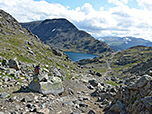
 As soon as we have crossed the crest, we see a small lake ahead of us. We now head towards the lake, lose a few metres in altitude and walk down into a hollow. In the hollow, we pass the lake on its right (southern) side. Once we have left the lake behind us, we hike up to another hill. After the ascent, we catch sight of the small lake Bjørnbøltjønne (1,518 m), which lies to our left in a hollow. To the right, the terrain drops steeply down towards Gjende. We follow the now narrower but still quite broad ridge past Bjørnbøltjønne. After the small lake, the gradient increases again and we climb over stony terrain and, towards the end, steeply up to a ridge spur of Besshøe.
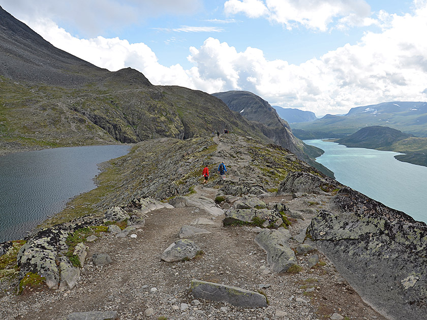
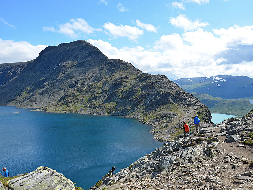 As soon as we reach the highest point of the rocky spur, we catch sight of the famous Sensen ridge ahead of us, framed on the left by the dark blue shimmering Bessvatnet and on its right by the bright blue gleaming Gjende. We now lose a few metres in altitude again and head towards the southern spur of Bessvatnet. Shortly before the lake, we reach a dip, climb up the other side in a counter-slope to a hump, and then descend steeply to the shore of Bessvatnet. We pass the dark blue waters and, after a gentle climb, reach the start of the Besseggen ridge. We follow the rocky, broad ridge slowly uphill, initially on terrain suitable only for walking.
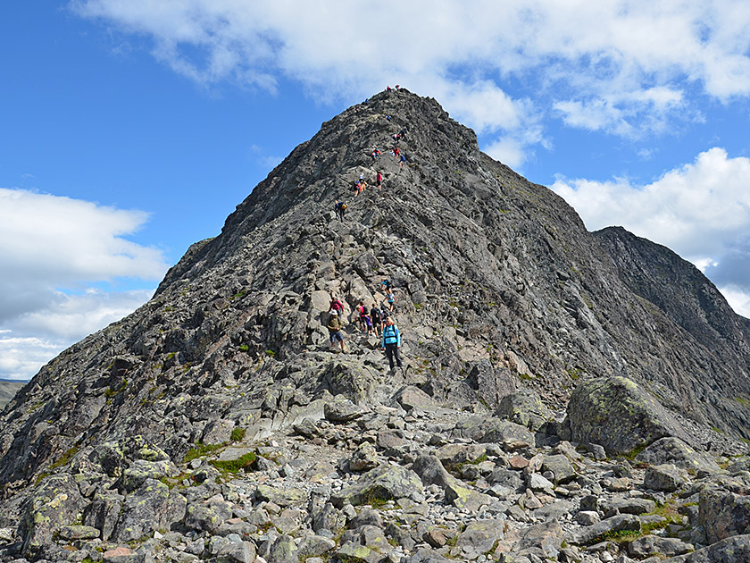 After just under a quarter of an hour, we encounter a rise in the ridge. Now the Besseggen presents us with a significantly narrower, steeper and, in places, exposed section. In the following stretch, we frequently have to use our hands and scramble upwards over solid rock. At two narrow sections, oncoming traffic may well cause minor bottlenecks. After another quarter of an hour, we leave the Sensen Ridge behind us and reach the broad, scree-covered ridge of Veslfjellet. However, we are still about 25 minutes away from the highest point. We follow the ridge, first slightly uphill and then down into a saddle. After a short, steeper climb, we reach the broad summit plateau, across which we hike at a moderate gradient to the huge summit cairn.
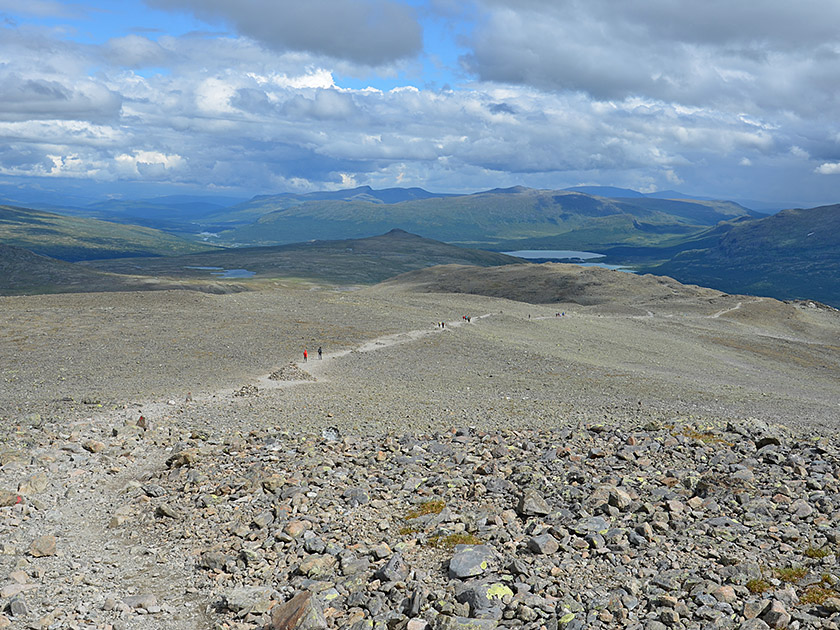 We cross the summit of Veslfjellet and continue eastwards along the stony plateau. Without losing much altitude, we descend into a hollow and then climb up a short, steep section to a hill. After the hill, we pass the signposted junction towards Bessheim, which we ignore. We keep going straight ahead and follow the signpost to Gjendesheim. Shortly afterwards, the path takes us close to a cliff edge, from where we can look down towards Gjendesheim. This is followed by another long stretch of scree across the high plateau of Veslfjellet, which allows us to lose altitude only slowly.
 Finally, the stony path turns south and leads us rapidly downhill in many hairpin bends. An iron chain helps us cross a flat, steep ledge. After the rock ledge, we hike down in many switchbacks towards a wooden fence. Standing in front of the fence, we turn left (signpost “Gjendesheim”) and walk in a right-hand curve around a grassy hill. Once we have left the hill behind us, we come to a signposted junction with several paths. We now turn right (signposted “Gjendesheim”) and follow the path southwards for just under half an hour down to our starting point in Gjendesheim.
| Elevation | Time | Total | Destination | ||
|---|---|---|---|---|---|
| 1008 m | - 1518 m | + 2:00 | 2:00 | Bjørnbøltjønne | |
| 1518 m | - 1373 m | + 1:00 | 3:00 | Bessvatnet | |
| 1373 m | - 1743 m | + 1:30 | 4:30 | Veslfjellet | |
| 1743 m | - 994 m | + 2:00 | 6:30 | Gjendesheim | |