


 Bayerisches Alpenvorland
Darching railway station (665 m) – Fentberg Chapel (780 m) – Neustadl (794 m) – Nüchternbrunn pilgrimage chapel (802 m) – Taubenberg mountain inn (824 m) – Taubenberg viewing tower (892 m) – Warngau railway station (718 m)
An easy mountain hike leading along wide forest tracks as well as small woodland and meadow paths. The woodland path between Neustadl and Nüchternbrunn can be very muddy. The total distance covered on this hike is 15 kilometres.
Take the Bayerische Regiobahn from Munich Central Station towards Schliersee/Bayrischzell to Darching (timetable and booking).
47.87076200, 11.77737700
Anzeige
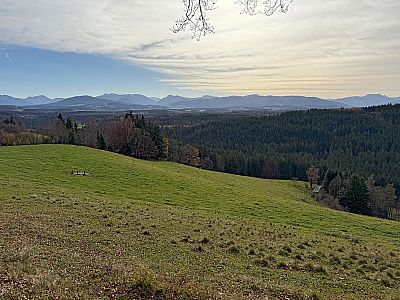
A classic hike in the Alpine foothills, where we can leave our car at home, takes us from Darching over the Fentberg and the Taubenberg to Warngau. Although we only climb 330 metres during this excursion, we cover a distance of 15 kilometres. Overall, the hike is very wooded. Nevertheless, there are beautiful views of the Mangfall Mountains to enjoy. For instance, there is a particularly lovely spot for a snack with mountain views near the Fentberg Chapel. The wooden benches a little above the Taubenberg mountain inn also invite you to take a break and enjoy the views. Further highlights of this crossing are the Nüchternbrunn pilgrimage chapel and the viewing tower on the Taubenberg. The stone structure can be visited during the mountain inn’s opening hours. There, you can obtain the key to the tower in exchange for a deposit. After descending from the Taubenberg, we still have the opportunity to stop off at the Gasthof zur Post in Warngau. From the inn, with its beer garden, it is not far to the station, where our Pre-Alpine tour ends.
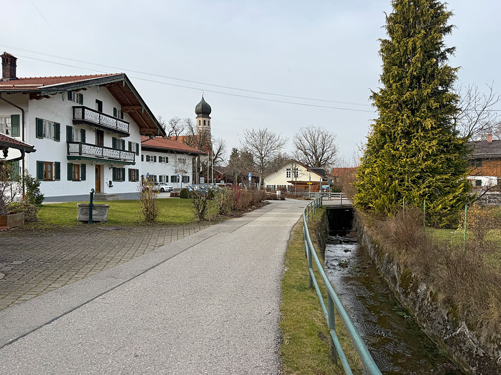
 In Darching (665 m), we leave the platform towards Bahnhofstraße and follow it to the right. We ignore the first few turnings and turn left into Raiffeisenstraße just before the Raiffeisenbank. With a view of the Wendelstein, we follow this road south-eastwards, passing a football pitch. Later, we come to a crossroads, turn right and then immediately left into Bergstraße. Now we ignore all the turnings on the right and continue straight ahead. Shortly before the end of the village, we also come across the first hiking signposts. We maintain our general direction (signpost ‘Fentberg, Taubenberg’) and leave Oberdarching. After the ‘End of Village’ sign, we pass a large crossroads and reach the edge of a wood shortly afterwards.
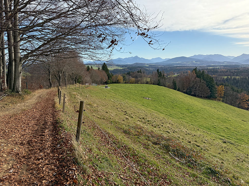 Finally, we enter the shady wood. Now we also say goodbye to the tarmac. At a stream, our forest track curves to the left and we gain our first few metres of elevation. The wide track then winds its way uphill in a south-easterly direction through the forest, which is at times dense and at times sparse. Later, after a signpost, we pass through a clearing, lose a few metres of elevation on a gentle descent and emerge from the forest. On the right-hand side, we can already make out the Fentberg Chapel at the top of a meadow slope. At the next junction, we turn right (signpost “Neustadl, Nüchternbrunn, Taubenberg”). A cart track leads us upwards in a wide right-hand bend to the Fentberg Chapel (780 m).
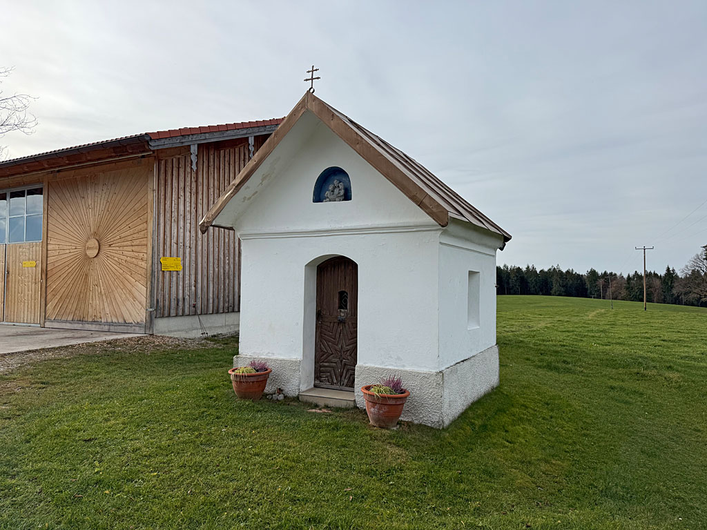 After the chapel, we pass a picnic spot with a table and a bench. From here, we look out over the Mangfall Valley towards the Wendelstein and the mountains surrounding Lake Spitzing. To the south, the Tegernsee mountains come into view. We continue to follow the cart track uphill and re-enter the mountain forest. Now the terrain gradually levels out again and we walk north-westwards along the wooded ridge. After passing a transmission mast, we reach an unmarked fork in the path at the edge of a clearing. Here we keep to the left, enter a vast pasture and head towards the hamlet of Neustadl along the ridge of the meadow. In Neustadl (794 m), we pass the farmstead on our right and walk past the Chapel of St. Mary on the left.
 After the chapel, we continue straight ahead and cross another meadow heading east. At a gap in the fence, we slip through the pasture fence and head towards a patch of woodland. Just before the edge of the woods, we come across a cart track and maintain our general direction. After a clearing, our path curves to the left. There we turn right onto the path towards Nüchternbrunn and Taubenberg. The path, which is very muddy at the start, leads us uphill on a moderate gradient shortly afterwards. The narrow forest path soon merges into a wider forest track. This takes us down to a crossroads, in the centre of which stands the Green Martersäule. At the wayside shrine, we continue straight ahead and gain the next few metres in altitude on the wide forest track.
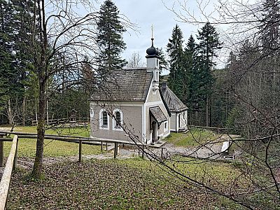
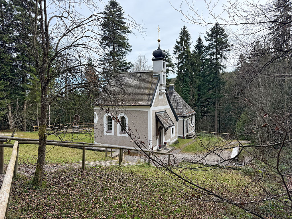 As soon as the path levels out again, we pass a signpost. Here, too, we maintain our general direction and shortly afterwards can turn diagonally left onto an unsigned path. At a fork in the path, we keep to the right and descend to the Nüchternbrunn pilgrimage chapel (802 m). Anyone who misses the turn-off will shortly afterwards come to a signposted junction; turning left there will also take them to the small forest chapel. We walk past the small church on the right and come to a stepped path (signpost ‘Taubenberg’). Down the steps we reach a path that leads us to a stream. We cross the Farnbach and follow the winding path to the next stream. Shortly afterwards we come to a fork and head diagonally to the right.
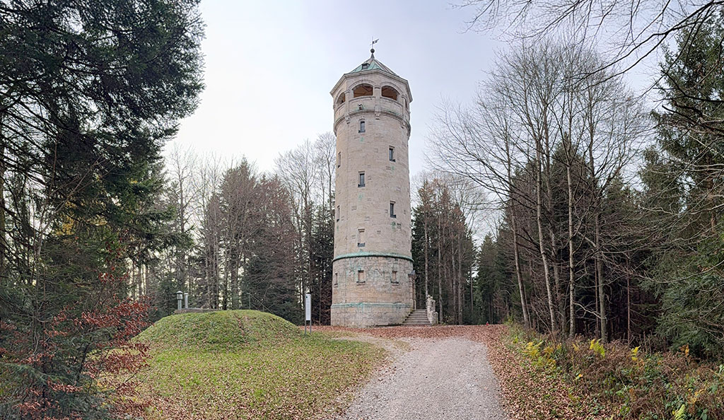
 Staying above the Farnbach valley, we cross a third stream. In a left-hand bend, our path turns into a wide forest track that leads us up to the Taubenberg mountain inn (824 m). Just before the inn, we turn right and follow the wide track uphill. After a sweeping left-hand bend, we leave the track at a wooded area, keeping to the left. We now stay at the edge of the forest and walk uphill along the narrow path. A short while later, the path rejoins the track and we reach a junction. At the multi-way junction, we head diagonally to the right and walk past the Chapel of St Benno on the left. Shortly afterwards, the gently ascending forest track takes us to the viewing tower on the Taubenberg (892 m).
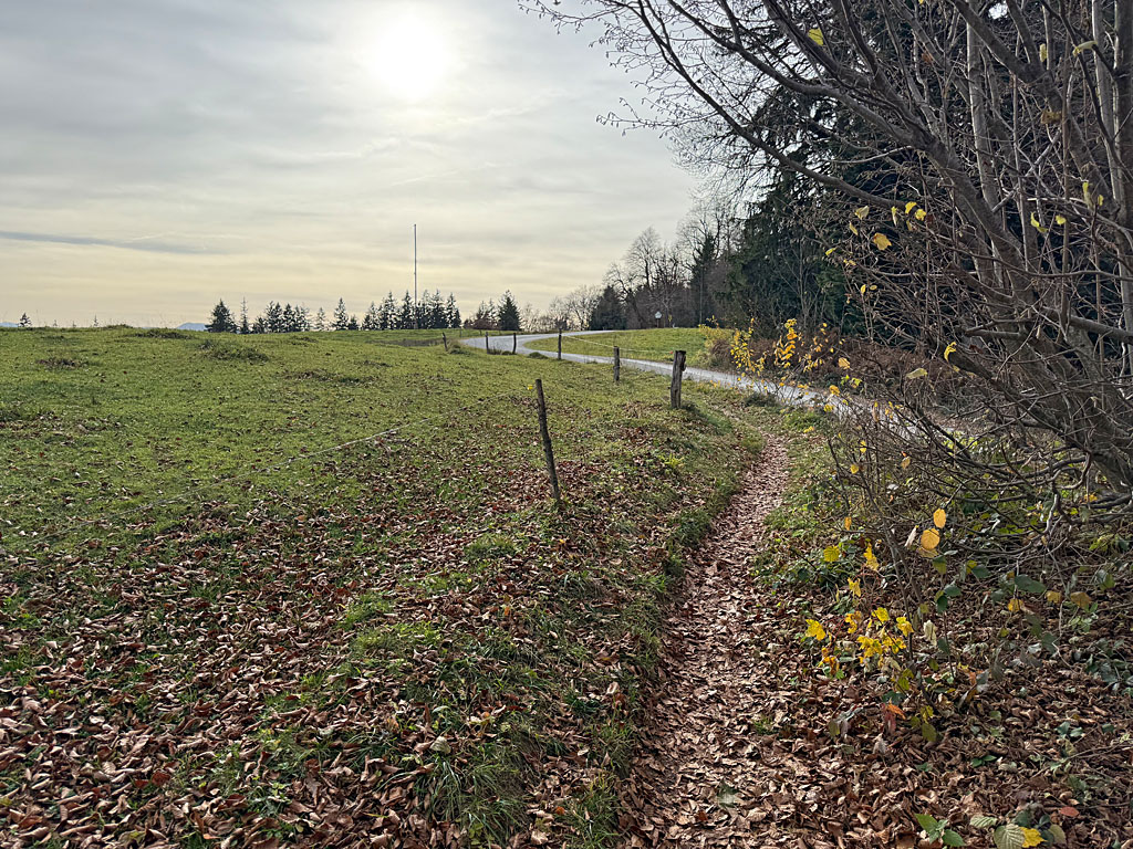
 At the stone tower, we continue straight ahead and, after five minutes, come to a signposted junction. Here we keep to the left (signposted ‘Warngau’) and follow the winding forest track downhill in a south-westerly direction. As soon as the forest thins out, we come to a crossroads and turn right into it. The tarmac road takes us down to Oberwarngau. There we reach Austraße, which we follow to the left onto Lindenstraße. We continue straight ahead and, after a left-hand bend, head towards St. Johann Baptist Church. Before the church, we keep slightly to the right and pass the Gasthof zur Post on Taubenbergstraße. After the beer garden, the road curves to the left and takes us westwards to the railway station (718 m), where our walk ends.
| Elevation | Time | Total | Destination | ||
|---|---|---|---|---|---|
| 665 m | - 780 m | + 1:15 | 1:15 | Fentbergkapelle | |
| 780 m | - 794 m | + 0:25 | 1:40 | Neustadl | |
| 794 m | - 802 m | + 0:50 | 2:30 | Nüchternbrunn | |
| 802 m | - 824 m | + 0:30 | 3:00 | Berggasthof Taubenberg | |
| 824 m | - 892 m | + 0:20 | 3:20 | Aussichtsturm am Taubenberg | |
| 892 m | - 718 m | + 1:10 | 4:30 | Bahnhof Warngau | |


