

 Dolomites
Würzjoch - Passo Delle Erbe (1987 m) - Peitlerscharte (2357 m) - Kleiner Peitler (2813 m) - Peitlerkofel/Pütia (2875 m)
Alpine hike requiring sure-footedness and a head for heights. The final few metres to the main summit of the Peitlerkofel are via an easy via ferrata. A via ferrata set is recommended for less experienced hikers!
Leave the motorway at Brixen and follow the signs for the Plose Pass. In St. Andrä, keep right and follow the signposts to the Würzjoch. At the foot of the Peitler Group, turn left towards the Würzjoch. Park in the pay-and-display car park at the Würzjoch.
From Brixen railway station, take bus route 330 to St. Peter and from there continue on bus route 339 to Würzjoch (for timetable information).
46.67506000, 11.81433500
Anzeige
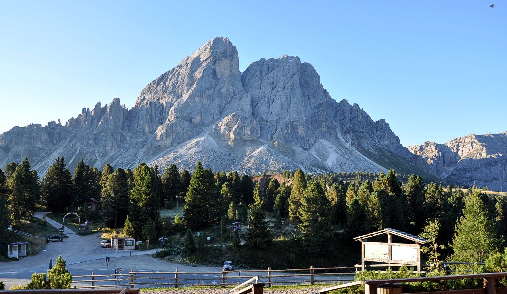
A little east of the Aferer Geisler, separated by the Peitlerscharte, lies the Peitlerkofel. This famous mountain, with its freestanding twin peaks, is best known for its unique panoramic views. Those wishing to avoid the via ferrata near the summit can make do with the “Kleiner Peitler”. But even those who choose not to climb the summit at all and simply circumnavigate the mighty mountain massif will be thoroughly satisfied thanks to the spectacular views of the South Tyrolean mountains.
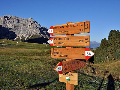
 We leave the large car park at the Würzjoch and head south-west along trail 8A. With the mighty north faces of the Peitlerkofel before us, we walk along the wide track towards the Fornela Alm. Before we reach the huts at the Alm, we keep to the right and head south-west towards the Peitlerscharte. The Aferer Geisler, including the 2,652-metre-high Tullen, become more and more impressive with every step as they are illuminated by the slowly rising sun. After keeping to the left at a junction, the road turns into a path. On the path, which continues to climb gently, we finally reach the saddle. The path from the Halslhütte now joins us from the left.
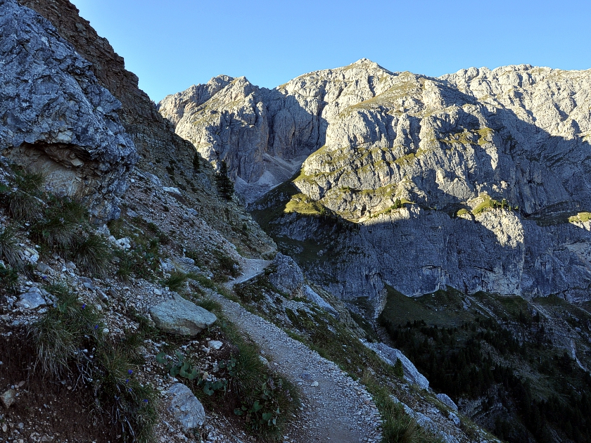
 In the shady saddle, the path now becomes significantly steeper. Although you usually don’t need to use your hands for support, your heart rate inevitably rises during the roughly 30-minute climb to the edge of the Peitlerscharte. Once at the top, we are greeted by the sun again and a fantastic view opens up of the Puez Group, which adjoins the Geisler Group to the east. We too head east at first, later more to the north, and continue our ascent via numerous switchbacks on trail 4B.
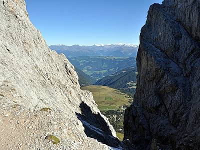
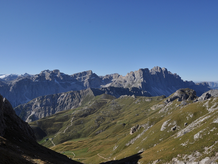 With every step, the view to the south becomes more spectacular. To the west, the Geisler range soon comes into view, featuring the Sass Rigais and the Große Furchetta. To the south, the glacier-covered Marmolada becomes increasingly visible. After a few metres of ascent, we can also make out the Piz Boe, the highest point of the Sella Group. Apart from one easily surmountable climbing section, the path is steep but not particularly exposed. Anyone who, like us, wishes to visit the ‘Kleiner Peitlerkofel’ should keep left towards the west at an altitude of around 2,740 metres. From the notch between the two peaks, you can see through a saddle all the way to the Würzjochhütte (Ütia de Börz), our starting point. We quickly reach the summit of the Kleiner Peitler via an easy hiking trail. The view is breathtaking.
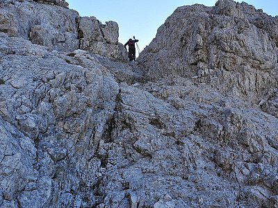
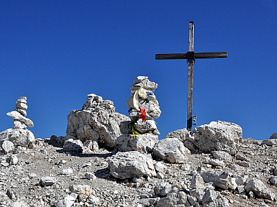
 Of course, we also want to visit the main summit. To do this, we descend back to the junction and then head a few metres east. Here, the short via ferrata to the main summit begins, heading north. Relatively easy by via ferrata standards (approx. A/B), the well-secured route extends to just below the summit. Whether or not a via ferrata set is necessary here is ultimately up to each individual to decide. A helmet may be advisable due to loose material on the route. About 20 minutes later, we stand on the main summit of the Peitlerkofel and can now also enjoy the view eastwards towards the Fanes Group with the Neuner and Zehner. Monte Cristallo and the Tofana are also clearly visible.
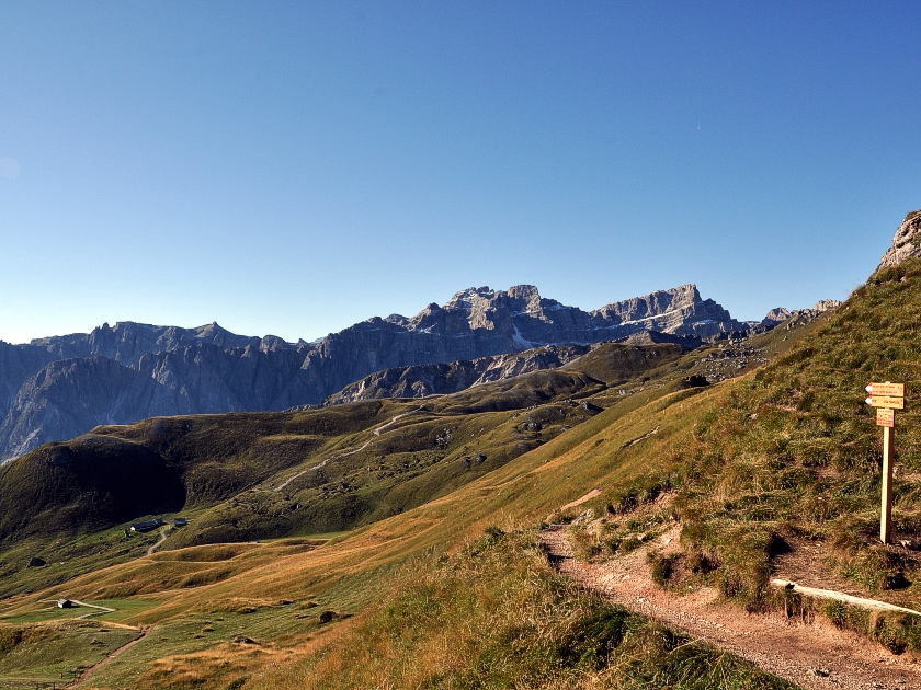
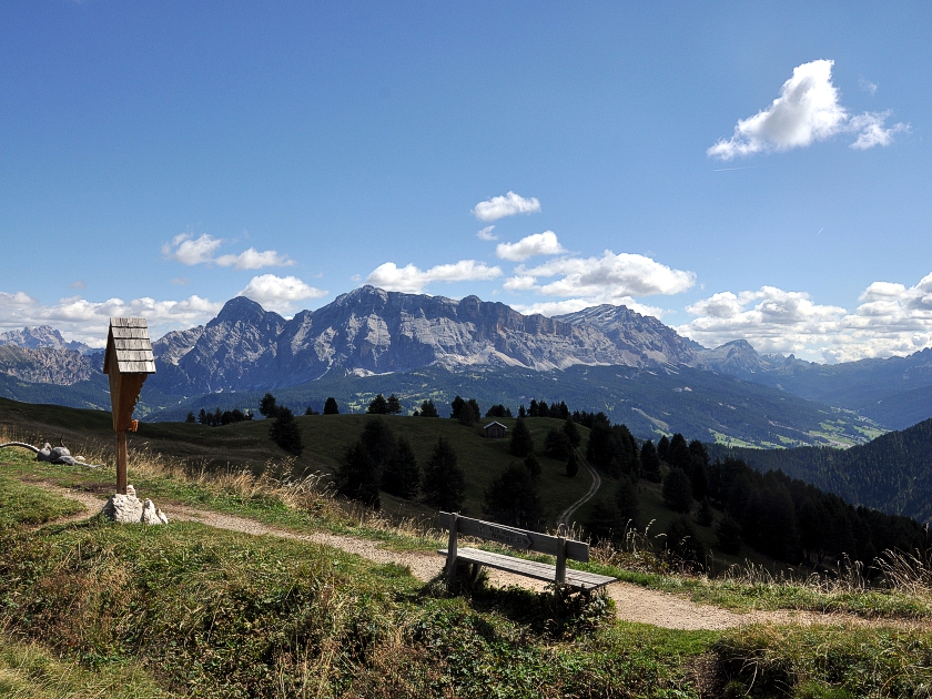 After thoroughly enjoying the panorama, we set off back along trail number 4 to the saddle, refreshed by a snack and the obligatory summit beer. Here, hikers can decide whether to take the same route back or, like us, circumnavigate the Peitlerkofel via the Gömajoch. To do this, we walk a short way downhill along the southern slopes before reaching a track, which we follow eastwards. Passing countless hay huts, we walk now uphill, now downhill past the alpine meadows. Accompanied by the magnificent view of the Dolomites to the south, time flies by. At the Gömajoch, we take another short break before descending northwards. Via the Ütia de Göma and a magical stretch of woodland beneath the northern slopes of the Peitlerkofel, we hike back to the Würzjochhütte. There, we enjoy another delicious meal before heading home.
Ütia de Börz/Würzjochhütte (2007 m), Tel. +39 (0)474/520066. Open from early May to early November and from Christmas to the end of March.
| Elevation | Time | Total | Destination | ||
|---|---|---|---|---|---|
| 1987 m | - 2357 m | + 1:30 | 1:30 | Peitlerscharte | |
| 2357 m | - 2813 m | + 1:00 | 2:30 | Kleiner Peitler | |
| 2813 m | - 2875 m | + 0:30 | 3:00 | Peitlerkofel | |
| 2875 m | - 2109 m | + 2:15 | 5:15 | Gömajoch | |
| 2109 m | - 1987 m | + 1:15 | 6:30 | Würzjoch - Passo Delle Erbe | |


