


 Ammergau Alps
Garmisch (800 m) – St. Martinshütte (1028 m) – Mittergernkopf (1834 m) – Kramerspitz (also known as Kramer, 1985 m) – Stepbergalm (1592 m) – Garmisch (800 m)
A challenging and, above all, long mountain hike that requires sure-footedness and good physical fitness. The hike, which is a good 16 km long, involves a climb of around 1,200 metres.
Take the Munich–Garmisch motorway to the end, then continue through the Oberau and Farchant tunnels towards Garmisch. After the tunnel, continue on the B 23 towards Fernpass/Reutte. In Garmisch, turn right onto Loisachstraße before the Loisach bridge. Follow Loisachstraße until it becomes a one-way street. Shortly afterwards, veer to the right and then turn left into Frühlingsstraße, which rejoins Loisachstraße. Follow this road until Maximilianstraße and turn right. After a good kilometre, turn slightly right towards Maximilianshöhe and follow the road to the car park in front of the Berggasthof Almhütte.
Trains from Munich arrive at Garmisch-Partenkirchen station every hour. The starting point at the Berggasthof Almhütte is about 3 km from the station and can be reached via the route marked in purple on the map. You can shorten the route slightly by taking one of the local buses on line 1 or 2 from the station to Marienplatz (timetable and booking).
47.49310973, 11.06292129
Anzeige
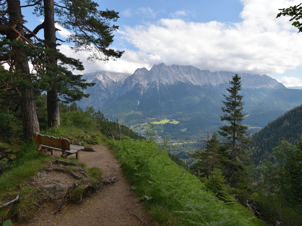
The route to the Kramerspitz is long and steep. But even if you work up a sweat here, the circular walk is well worth it for the spectacular views of the Wetterstein and Ester mountains. The St. Martinshütte and the picturesque view of Garmisch-Partenkirchen from the Felsenkanzel make the ascent all the more enjoyable. On the descent, the Stepbergalm beckons for a stop for refreshments before you return via the Gelbe Gwänd to the starting point on the Kramerplateauweg, the Gasthof Almhütte.
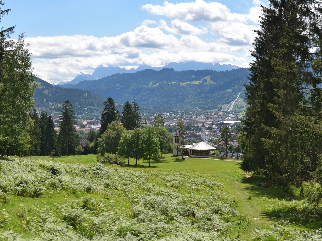 Starting from the Berggasthof Almhütte, we reach the Kramerplateauweg after just a few metres via a side path heading west. We turn right. The Plateauweg lives up to its name and we walk largely on level ground past a fish pond towards the north-east. Opposite us lies the Wetterstein range, with the Alpspitze, the Waxensteine and the Zugspitze. After about 20 minutes, we can see the War Memorial Chapel on a meadow below us and shortly afterwards we come to the junction leading left to the Martinshütte.
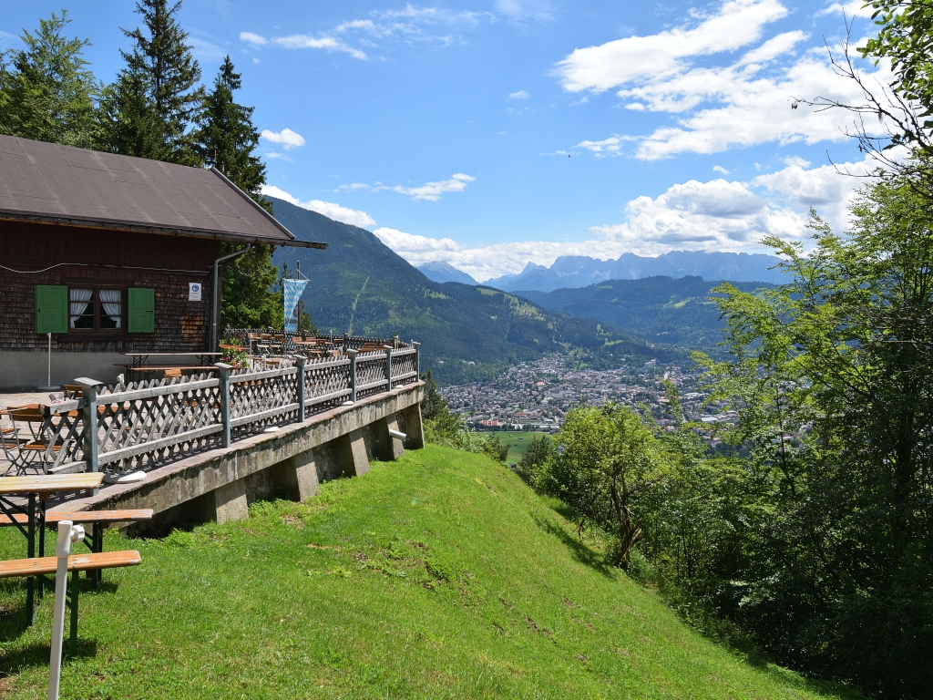 The wide path to the Martinshütte, which is used as a toboggan run in winter, leads us steeply through the forest. We ignore a turn-off to Garmisch and instead follow the signs to the Martinshütte and the Königsstand. We have to climb just under 300 metres before reaching the hut, which is situated high above Garmisch. Although most of the tour still lies ahead of us, nobody has anything against a refreshment, so we take a short break to enjoy the view from the sunny hut terrace of the Wetterstein Mountains and Garmisch-Partenkirchen.
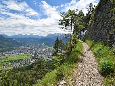
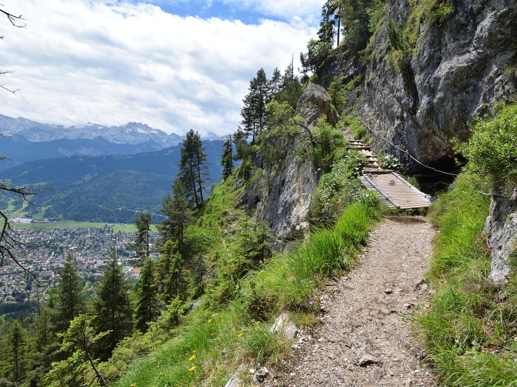 To the north of the hut, we continue our ascent. Although the path narrows, apart from the cut-offs it still has a manageable gradient, not least because it was originally laid out as a bridle path for King Maximilian to reach the Königsstand. A highlight awaits us after about half an hour. First, the path leads spectacularly past the rock before we reach the Felsenkanzel. The Felsenkanzel is a small platform jutting a few metres out over the abyss. It is certainly a suitable spot for an address to the people of Garmisch.
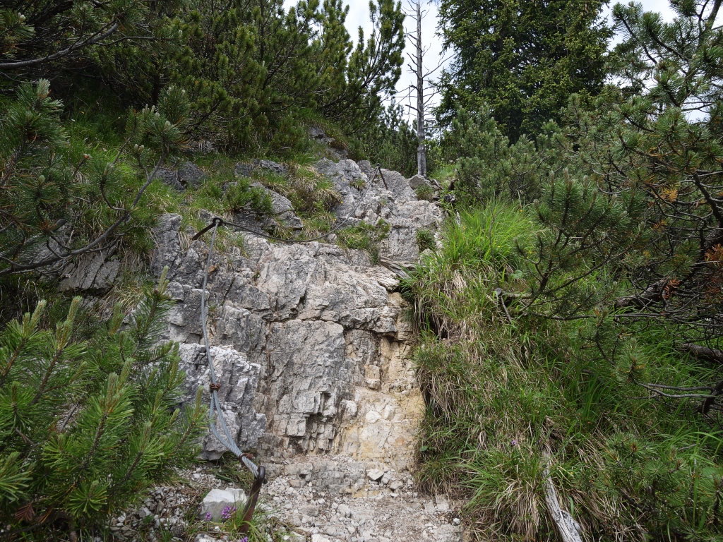 Visually, at least, one has a wonderful view of the spa town, and as for the sound, one would probably not have had many more listeners in the town park either. The ascent via the former bridle path continues in a similar fashion after the Felsenkanzel until the junction for the Königsstand. We keep left there and climb, now much more steeply, up to the ridge connecting the Katzenkopf and Kramer. The path is now considerably more challenging, with a short section secured by wire ropes.
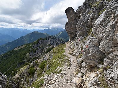
 On the ridge, we keep to the left heading west. Now less steep, though still challenging in places, the path winds through the mountain pines towards the summit. A stony, rocky section is secured by a wire rope. We view from a distance a beautifully shaped rock pinnacle, atop which a small cross stands. An optional detour is a visit to the Mittergernkopf, a peak situated in front of the Kramerspitz, which also features a cross. An unmarked side path leads left to this rather unremarkable summit.
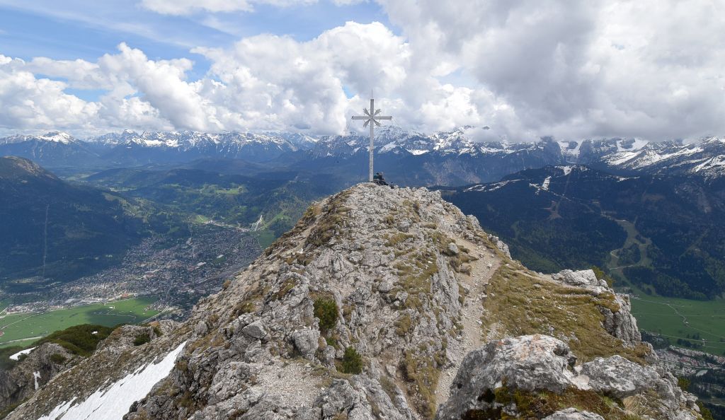
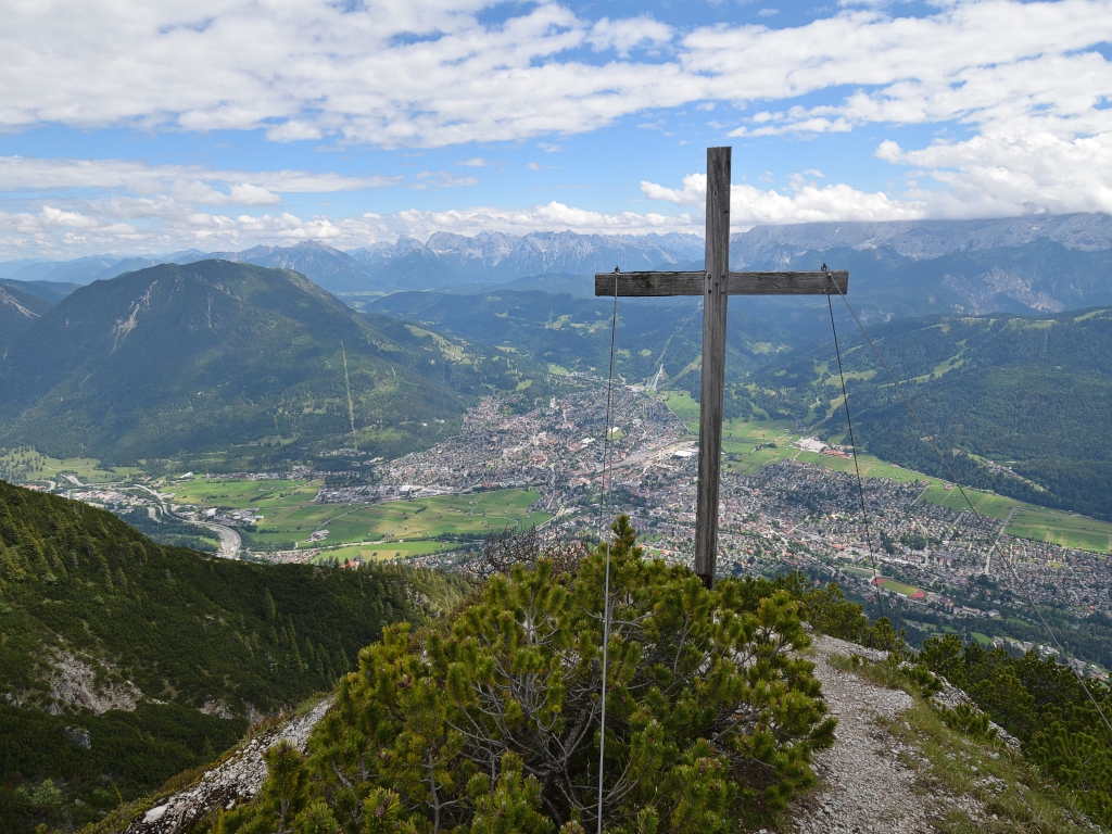
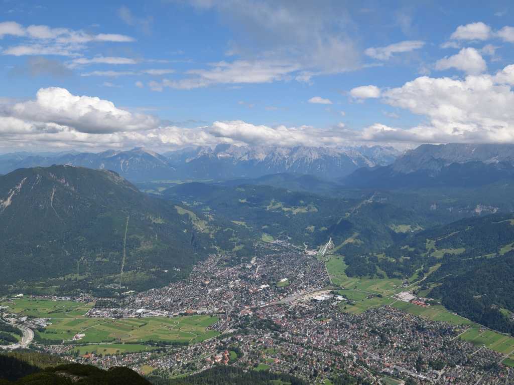 The route continuing towards the Kramerspitz then takes us to a saddle and past a much more imposing pre-summit on the north side. From the summit cross, which does not stand at the highest point of the mountain, we enjoy the magnificent view of the Ester, Karwendel and Wetterstein ranges. Well-known peaks, such as the Alpspitze, the Waxenstein and the Zugspitze, catch the eye alongside numerous other mountains. The views of the Loisach Valley, Garmisch-Partenkirchen, Grainau and the Eibsee also add to the enjoyment of the distant vistas. We have a hearty snack before continuing our traverse westwards.
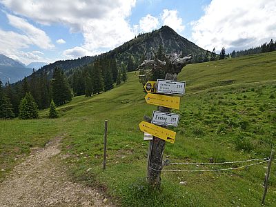
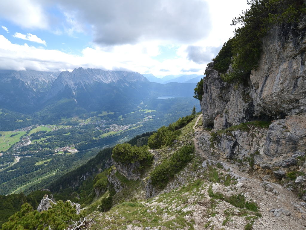 The Kramersteig now leads us on in a varied route towards the Stepbergalm. Initially quite stony, the path on the south side of the ridge becomes flatter. Only after the Predigtstuhl does a steep path lead us through the mountain pines to the Stepbergalm. To decide whether to continue our descent via the Kreuzweg or the Gelbe Gwänd, we treat ourselves to a hoppy drink at the alpine hut. Both routes are well signposted to the Kramerplateauweg, although the descent via the Gelbe Gwänd is considered somewhat more challenging.
 We ultimately decide on the Gelbe Gwänd, not least because the Kreuzweg involves a short uphill section. We continue our varied descent southwards. Here, too, there is a section secured with a wire rope. Once again, we can admire the Wetterstein Mountains in all their splendour before reaching the Kramerplateauweg. Relaxed and on largely flat ground, we follow the path eastwards to the starting point at the Berggasthof Almhütte.
If you would like to shorten the approach from Garmisch-Partenkirchen station a little, take one of the local buses on line 1 or 2 to Marienplatz before setting off on the hike.
| Elevation | Time | Total | Destination | ||
|---|---|---|---|---|---|
| 800 m | - 1040 m | + 0:50 | 0:50 | St. Martinshütte | |
| 1040 m | - 1985 m | + 2:40 | 3:30 | Kramerspitz | |
| 1985 m | - 1592 m | + 1:00 | 4:30 | Stepbergalm | |
| 1592 m | - 800 m | + 1:45 | 6:15 | Garmisch, Gasthof Almhütte | |


