 Hardangervidda
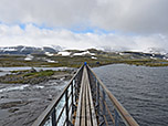
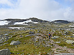
A moderately difficult mountain hike covering a total of 10.6 kilometres. The hike to Hardangerjøkulen follows stony and partly marshy paths. At one point, a mountain stream must be crossed via a rickety suspension bridge. The paths are marked with a red ‘T’. Sure-footedness is essential for this hike.
Finse is a car-free station and can only be reached via the Bergen Railway (Oslo–Bergen). To the east, coming from Oslo, Haugastøl is the last station accessible by car. The last major town on the railway line is Geilo. From Oslo, take the E18 towards Kristiansand to Sandvika and from there the E16 to Hønefoss. From Hønefoss, follow Route 7 via Gol to Geilo or on to Haugastøl. Coming from Bergen in the west, Voss station is a good place to board the Bergen Railway. Voss can be reached from Bergen via the E16. Tickets for the Bergen Railway can be booked online at vy.no.
60.60139907, 7.50519214
Anzeige
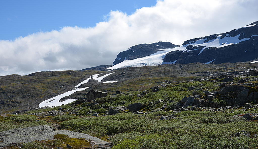
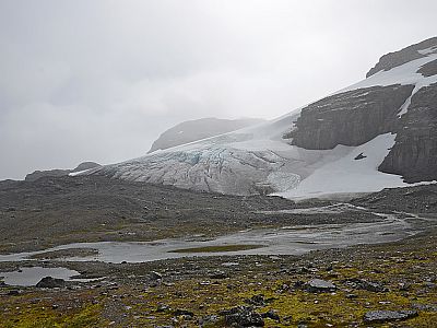
Finse is one of the car-free stations on the Bergen Railway in the Hardangervidda. The journey on the Bergen Railway, which connects Oslo with Bergen, is spectacular in its own right. The railway line makes it possible to undertake lovely day trips in the Hardangervidda. A very popular excursion starts in Finse, which is also the highest railway station on the Bergen Railway and in the whole of Northern Europe. The four-hour hike takes us first past Lake Finsevatnet and leads us across stony terrain and a rushing stream to the Hardangerjøkulen glacier. There, depending on your mood, you can walk along the glacier tongue. Back in Finse, the Finsehytte hut run by the Norwegian Alpine Club (DNT) is a great place to stop for a bite to eat. The prices for food are moderate by Norwegian standards. The hut even offers home-brewed beer from its own Finse 1223 Brewery. Here you can sample various beers from the microbrewery, including a spicy dark beer and a fruity pale ale. In Finse, a bitingly cold wind can whistle past your ears even in summer. You should definitely pack plenty of warm clothing for this trip to Hardangervidda.
 We leave the platform at Finse and come to a wide cross-path. We now turn left and follow the path along the railway tracks south-eastwards (in the direction of Oslo). The path we are on is called Rallarvegen. Rallarvegen is Norway’s most popular cycle route and follows the Bergen Railway for 82 kilometres across the Hardangervidda. After a few minutes, we pass the DNT’s Finsehytta, which is situated a few metres away from us on the shore of Lake Finsevatnet. At a snow barrier, our path veers away from the railway tracks and we come to a signposted junction.
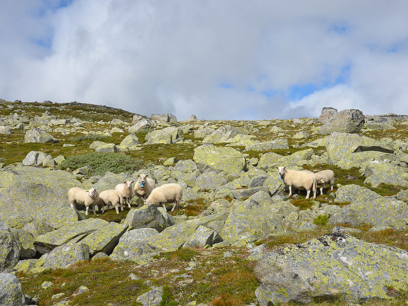
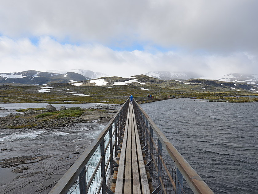 At the junction, we turn right (signposted ‘Kjeldebu, Krækkja, Blåisen’). Shortly afterwards, at the eastern end of Lake Finsevatnet, we cross a dam and a bridge. Immediately after the bridge, we come to a junction where we continue straight ahead (signposted ‘Blåisen, Jøkulen’). We pass a marshy section of the path and hike in a south-westerly direction, past some large boulders, up to a hill. We cross this and lose a few metres in altitude again. After the short descent, the path turns gently to the left (south) and we pass some small lakes.
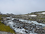
 We head for a boulder-strewn slope, keeping to the left as we cross into its flank (in summer, you may encounter an old snowfield here) and climb up to the right to a plateau. Here we turn slightly left again and walk southwards without gaining or losing much altitude. Finally, the path curves to the left and the markings lead us downhill in a south-easterly direction over stony terrain. We reach a valley floor through which a rushing mountain stream carves its way. After a left and a right bend, we reach a suspension bridge leading over the deeply cut stream.
 The bridge is very wobbly; we cross the stream with caution. On the opposite side of the stream, the path turns right and we walk south-westwards without any significant change in altitude. After a few minutes, we come to a rocky outcrop, which we negotiate in short switchbacks. The path then leads us southwards over a few rocky humps towards the glacier. From a hill, we descend into a hollow, pass a small lake and climb a final ascent to the highest point before the glacier. From here, you can now descend to the foot of the glacier and walk along it. Anyone wishing to walk on the glacier can book a guided glacier tour here.
We return to Finse via the same route.
Finsehytta (1223 m), Tel. +47 22 82 28 00.
| Elevation | Time | Total | Destination | ||
|---|---|---|---|---|---|
| 1222 m | - 1390 m | + 2:10 | 2:10 | Aussichtspunkt am Hardangerjøkulen | |
| 1390 m | - 1222 m | + 1:50 | 4:00 | Finse | |