


 Lofoten
Golf course near Hov (8 m) – Hoven (367 m)
Moderately difficult mountain hike, which starts with a short stretch over marshy terrain and then leads steeply and uncompromisingly along stony paths to the highest point. Take care in the steeply sloping summit area. Sure-footedness is essential for the ascent of Hoven.
Take the E10 from Svolvær towards Leknes. Cross the Gimsøystraumen Bridge to Gimsøya and turn right just before the Sundklakkstraumen Bridge. After 6.8 km, turn left at Saupstad and follow the road for 4 km to the car park at the golf course near Hov.
68.34011782, 14.12516638
Anzeige
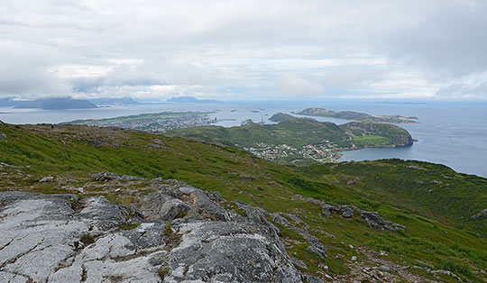
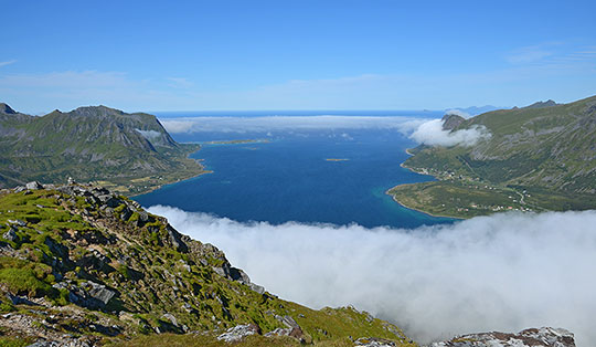
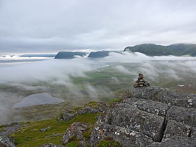
Anyone travelling through the Lofoten Islands between Svolvær and Leknes will inevitably be struck by the striking, isolated peak of Hoven. The mountain at the northern tip of Gimsøya rises just 367 metres into the sky. Nevertheless, its isolated position makes it an impressive sight. From the golf course at Hov, Hoven can be reached on foot within an hour. First, you approach the foot of the mountain through marshy terrain. The route then climbs steeply and relentlessly up its north-eastern ridge to the summit. The views during the ascent over Gimsøya towards the sea and the surrounding mountains of the Lofoten are magnificent. From the highest point, marked by a large cairn, you follow the ascent route back down to the starting point.
 At the golf course, we head to the far (western) end of the car park and turn left. Immediately after turning, we ignore the path leading off to the right. We continue straight ahead and keep right at the next fork. As soon as the wide path ends, we keep right again at a fork. The path now leads us through marshy terrain. In places, the path is paved with stone slabs to help with the very muddy sections. Passing meadows of cotton grass, we approach the foot of the Hoven. After a right-hand bend and a left-hand curve, we find ourselves on the north-eastern ridge of the mountain.
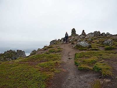
 Winding its way through rocky terrain covered in heather, our path climbs in a general south-westerly direction. Sometimes stony, but almost always steep, we quickly gain altitude along this narrow path. Later, we come to a beautiful viewpoint with flat rocks and a few cairns. There we enjoy the view across the marshy plain to the sea and the mountain landscape of the Lofoten Islands. The rest of the route is clear: staying on the ridge, we hike in a south-westerly direction up the well-defined path to Hoven. The highest point is marked by a large cairn.
The descent to the car park at the golf course follows the ascent route.
There are no places to stop for refreshments along the way.
| Elevation | Time | Total | Destination | ||
|---|---|---|---|---|---|
| 8 m | - 367 m | + 1:00 | 1:00 | Hoven | |
| 367 m | - 8 m | + 0:45 | 1:45 | Golfplatz bei Hov | |