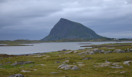
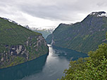
 Geirangerfjord
A moderately difficult 2.8 km mountain hike requiring sure-footedness. The ascent from Westerås Gard to Storseterfossen follows a path that is partly paved with stones. Steep sections are partly secured with a chain or rope. In wet weather, the paths can be muddy and slippery. The path leading behind Storseterfossen is also secured with a chain.
From Oslo, follow the E6 towards Trondheim via Lillehammer to Otta. In Otta, turn left onto Route 15 and drive through the Ottadalen valley via Lom and Bismo into the Breiddalen valley. At Langvatnet, turn right onto Route 63 and follow the mountain pass road past Djupvetnet and Dalsnibba towards Geiranger. Above Geiranger, after the Flydalsjuvet viewpoint, turn diagonally right onto Geirangervegen towards Westerås Gard and drive along the narrow road (steep drop to the left, take care of oncoming traffic!) to the car park just before the Westerås farmstead.
62.10078500, 7.21710600
Anzeige
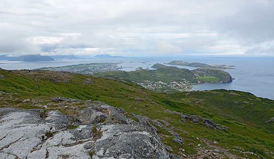
The Geirangerfjord is one of Norway’s most famous fjords. Consequently, the fjord region is very busy during the high season, which may put off the odd traveller to Norway seeking peace and quiet. In the tranquil village of Geiranger, huge cruise ships drop anchor and disgorge large numbers of visitors. Nevertheless, the Geirangerfjord is definitely worth seeing at least once. For those travelling to the fjord from the Ottadalen and Breiddalen valleys, a drive up to Dalsnibba is highly recommended. You’ll be surrounded by many visitors here too, but the fantastic view is well worth the detour. Just before Geiranger, a stop at the Flydalsjuvet viewpoint is a must, offering a magnificent view of the Geirangerfjord.
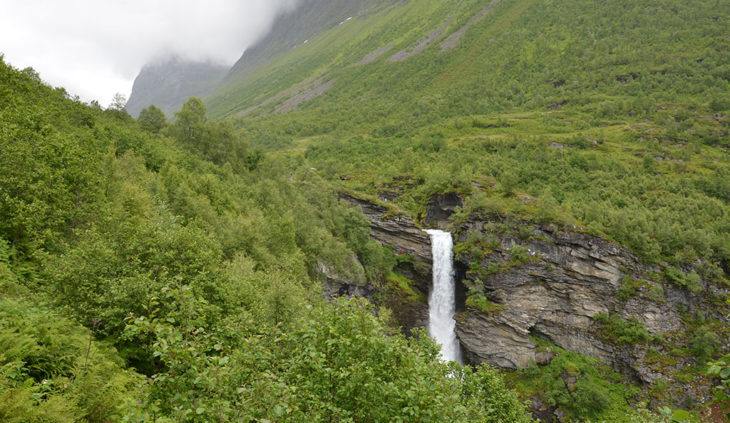
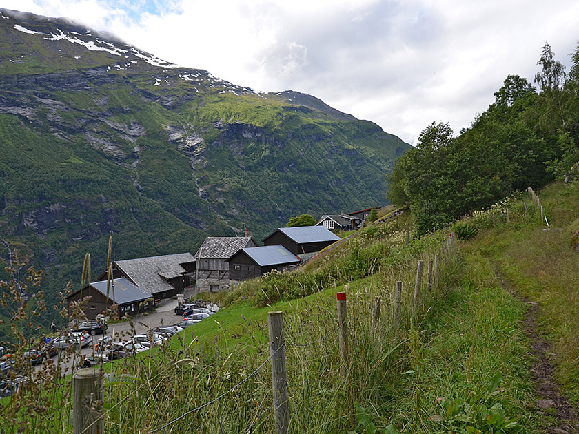
For a short hike, we recommend the walk to the Storseterfossen waterfall (also spelled Storsæterfossen). This starts at the Westerås farmstead high above the village of Geiranger and takes us up to the waterfall in a good three-quarters of an hour along flat paths. There, a secured path leads behind the waterfall, allowing us to experience a unique natural spectacle complete with a dizzying view down into the depths. If you find the tour too short, you can also start the hike directly in Geiranger at the Norsk Fjordsenter. A short distance east of the Hotell Union Geiranger, you will find the start of the path leading up to Westerås Gard (an additional 230 metres of elevation gain and 1¼ hours).
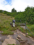
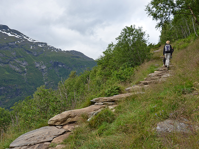 At the car park in front of Westerås Gard, we leave the farm and follow the road back a short distance towards the south-east. After a short while, we come to the signposted turn-off on the left towards Storseterfossen, Vesteråssætra and Laushornet. We therefore leave the road to the left, walk briefly along a grassy cart track and reach a pasture gate via a path with stepped slabs. There, we slip through the gate and continue climbing north-westwards along a stony path secured with a chain. Later, we come to the path leading directly up from the Westerås Restaurant, which we will use for the descent after visiting the waterfall.
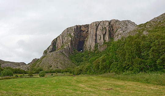
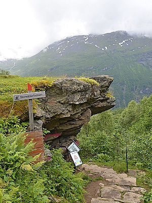
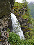
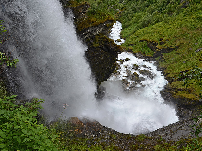 After the junction, the paved path turns north-east and allows us to gain altitude rapidly. At first, the path winds its way uphill in hairpin bends, before leading us straight north-east. Ahead of us, we can already see the Storseterfossen, whose roaring waters plunge 30 metres down a wooded slope. Eventually, we come to the signposted turn-off for the waterfall and turn right. We pass a grassy picnic spot and shortly afterwards reach the start of the path to the waterfall. A narrow, rocky path secured with a chain (wait for oncoming traffic!) leads us down into a cave located behind the roaring waterfall.
 Before the descent, we recommend taking a break at the grassy picnic spot above the waterfall. We follow the same route back down to the junction, which is situated at an altitude of 420 metres. There, we turn right and take the alternative route to the Westerås Restaurant. The paved path, secured with a rope, leads us steeply down a flight of steps in a south-westerly direction. Finally, the terrain levels out slightly and, after a few hairpin bends, we reach the Westerås farmstead. At the Westerås Restaurant, which is open daily, we can fortify ourselves with fresh waffles after the short hike. From the restaurant, we finally walk back along the track to the starting point.
Westerås Restaurant, Tel. +47 926 49 537.
| Elevation | Time | Total | Destination | ||
|---|---|---|---|---|---|
| 304 m | - 530 m | + 0:50 | 0:50 | Storseterfossen | |
| 530 m | - 304 m | + 0:40 | 1:30 | Westerås Gard | |