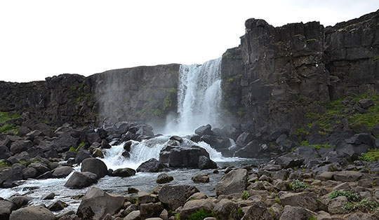


 Helgeland
Overall, a moderately difficult mountain hike. The ascent is easy and follows a stony path, well-marked with steps, to the cave entrance. The descent takes you down narrow, stony paths – which can be slippery when wet – to the coast. The rest of the return journey to the car park is straightforward. A minimum level of sure-footedness is required for the circular walk described.
Take the E6 from Trondheim towards Narvik. In Gartland (after 206 km), leave the E6 to the left and take the Rv775 to Høylandet. There, turn right and follow the Fv17 to Holm (+ 109 km). In Holm, take the ferry to Vennesund and continue to Brønnøysund (+ 50 km). Drive through the town of Brønnøysund, following the signs for Torghatten, and cross the spectacular Brønnøysund Bridge. After a further 14 km, just before the campsite, there is a car park for hikers on the right-hand side in a left-hand bend (large information board and signpost for ‘Torghatten’).
65.39536958, 12.09682737
Anzeige
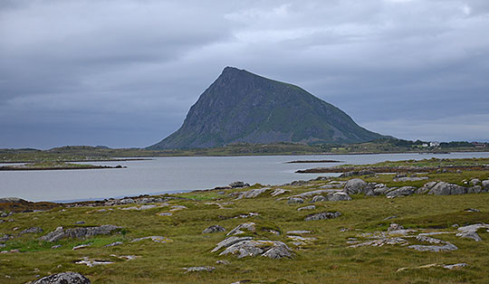
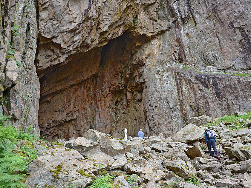
Torghatten is a famous and curious mountain in Norway. A huge hole runs right through its imposing rock formation. Through the 160-metre-long opening, which is up to 35 metres high and 20 metres wide, you can not only look through but also walk through. And so it is hardly surprising that the 258-metre-high summit of Torghatten tends to be overlooked, whilst the impressive cave attracts all the more visitors. Even the Hurtigruten ships head for Torghatten to allow passengers a view from the sea through the large hole in the legendary mountain. The climb from the car park to the cave takes just under half an hour. Most visitors take the same stony, well-maintained path back. It is, however, far more beautiful to climb through the massive hole, down to the coast and back to the car park via the coastal path. During the descent from the cave exit, this route offers a wonderful view across the archipelago to the open sea.
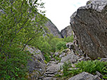
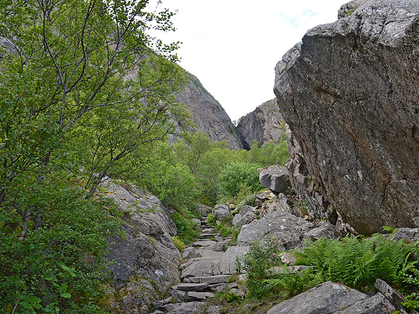 We leave the car park and take the signposted path leading northwards from the car park (signposted ‘Torghatten’). The path, which is stony right from the start, leads us past several large boulders on a moderate incline. Through sparse woodland, over steps and small boulders, we reach a striking rock with an inscription. We walk past the huge boulder on the right and climb uphill via steps. We then pass through a sparse deciduous forest and, after a few hairpin bends, reach the boulder field below the cave entrance. At the lower end of the boulder field, we come across a sign warning of falling rocks. We now hike much more steeply up steps towards the cave and finally climb over smaller boulders to reach the cave entrance. We reached the entrance to Torghatten Cave after 25 minutes.
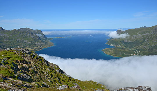
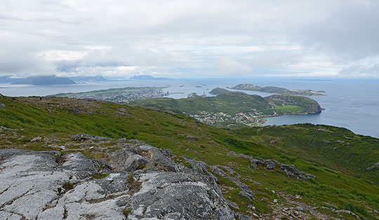
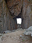
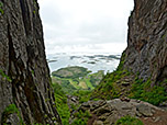
 We enjoy the beautiful view to the north-west towards the Helgeland coast. Through the immense Torghatten Cave, we look out to the other side of the mountain. There we can see the beautiful archipelago landscape, consisting of countless islands jutting out from the coast. We walk into the opening and descend a wooden staircase located on the right-hand side of the cave. With every step, the perspective changes, revealing the interior of the cave in a completely different light. Once we have left the stairs behind us, we follow the red dots through the jumble of boulders on the cave floor and reach the exit. The walk through the hole in Torghatten, also known as the ‘Stone Cathedral’, takes a good five minutes.
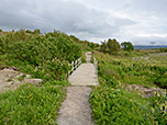
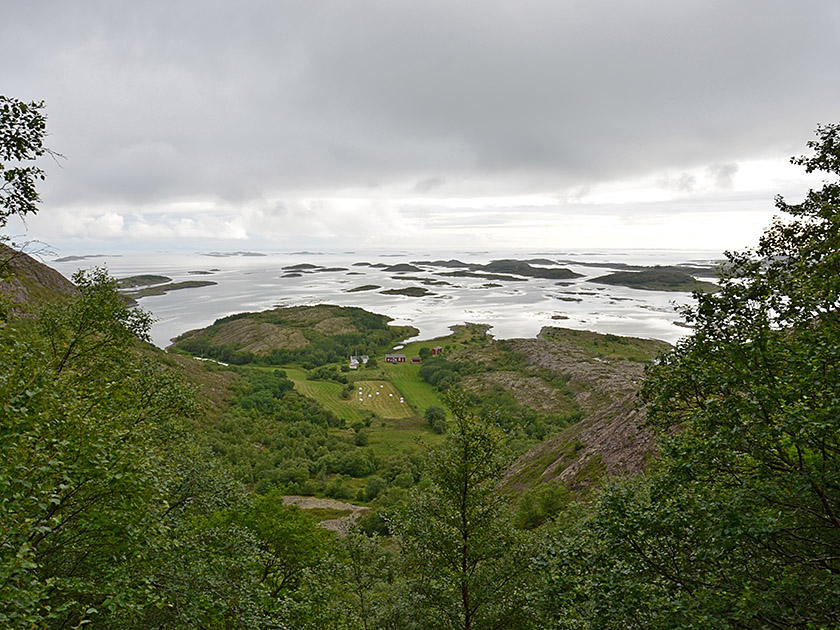 With a view of the archipelago, we leave the Torghatten cave heading south-west. We follow a stony path – slippery and unpleasant when wet – winding its way downhill. Later, we enter a sparse forest of low deciduous trees. The closer we get to the coast, the gentler the path becomes. Eventually, the path leads us down to a meadow. We keep as far to the left as possible on the grassy area and follow the edge of the forest southwards. Just before we reach the coast, we have another chance to look through the hole in Torghatten. Finally, we pass under a power line and then reach the coastal path.
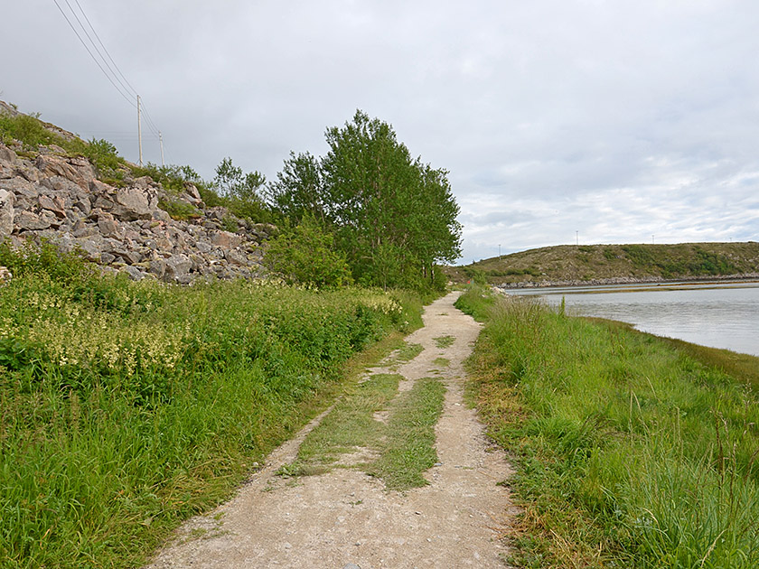 Now we keep to the left and walk along the wide path westwards. After a left-hand bend, we pass the signposted junction for the path leading up to the summit of Torghatten. Anyone who still has the time and inclination can climb to the top of Torghatten from here in 45 minutes. To return to the car park, we continue straight ahead and shortly afterwards come to a sharp right-hand bend leading to a wooden bridge. We do not follow the bend to the bridge, but instead continue straight ahead along the bend (heading north-east). After a few steps, we come to a clearly visible meadow path which crosses past the flank of Torghatten on a gentle uphill slope and finally brings us back to the car park.
There are no places to stop for refreshments along the way.
| Elevation | Time | Total | Destination | ||
|---|---|---|---|---|---|
| 15 m | - 140 m | + 0:25 | 0:25 | Torghatten (Höhle) | |
| 140 m | - 0 m | + 0:40 | 1:05 | Küstenweg | |
| 0 m | - 15 m | + 0:25 | 1:30 | Torghatten-Parkplatz | |