 Cairngorms
Glenmuick (410 m) – Lochnagar (Cac Barn Beag, 1155 m) – Loch Muick (405 m) – Glenmuick (410 m)
A technically moderate but demanding mountain hike due to the length of the route, requiring sure-footedness and good physical fitness. The ascent from Spittal of Glenmuick to Lochnagar follows wide tracks and narrow paths. In the Cuidhe Cròm area, you must climb its high plateau via a boulder-strewn slope. The summit area of Lochnagar drops vertically towards the north-east. Take care in poor visibility due to fog! On the alternative descent to Loch Muick, a short, steep slope is crossed after the waterfall.
From Edinburgh, take the M90 to Perth and continue via Guildtown, Blairgowrie, Bridge of Cally, Glenshee and Braemar to Ballater. After leaving Ballater, cross the River Dee and turn right immediately after the bridge. Shortly afterwards, before the Bridge of Muick, continue straight ahead into Glen Muick at the right-hand bend and follow the narrow road to the pay-and-display car park near Spittal of Glenmuick (parking fee £3, payable in coins at the pay-and-display machine, as of 2018).
56.95230634, -3.13615889
Anzeige
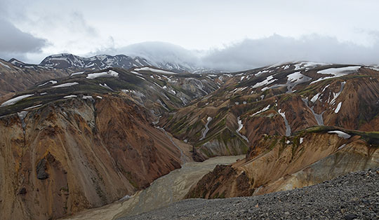
Lochnagar, with its forbidding north face, is the highest mountain in the southern Cairngorms. You should allow plenty of time for an ascent of this majestic peak. The round trip takes around 6 to 7 hours of pure walking time. If you choose the alternative descent via the beautiful Glas Allt waterfall and along the shores of Loch Muick, you’ll cover a distance of just under a half-marathon. The starting point for this extended hike is the car park at Spittal of Glenmuick. The Glenmuick Visitor Centre and the beautifully situated Loch Muick attract many visitors, particularly at weekends. You should therefore set off early to secure one of the coveted parking spaces. Overall, the area around Lochnagar has a number of attractions to offer alongside the beautiful landscape. To the north of the mountain lies Balmoral Castle, which is used by the royal family as a summer residence. A visit to the castle is well worth it, as is a detour to the Royal Lochnagar whisky distillery, which lies two kilometres from Balmoral Castle on the River Dee.
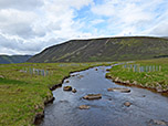
 We leave the car park at Spittal of Glenmuick and take the wide path heading south-west. This leads us across the Allt Darrarie and, after a left-hand bend, to the visitor centre. Shortly after the visitor centre, we turn right onto the signposted Lochnagar Path. The wide path leads us north-west towards the buildings of Allt Na Giubhsaich. We cross the River Muick and later come to a crossroads. We now turn left, walk a few metres to a small stone house and turn right immediately behind it (signposted ‘Lochnagar Path’). A narrow path leads us north-west towards a wooded area, which we walk through.
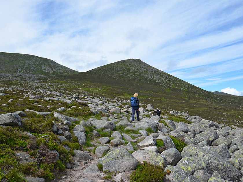 After the woods, we follow a wide, partly eroded path heading roughly eastwards, accompanied by a stream. Later, we descend to the stream and cross it. The path, which is partly stony, then leads us further uphill in a south-easterly direction. Gradually, the path turns eastwards again and finally leads us up in a long right-hand bend to the saddle at the foot of Conachcraig (1½ hours from the car park at Spittal of Glenmuick). At a large cairn, we leave the wide path to the left and follow a narrow track curving leftwards for a few metres downhill. The track turns south-west and leads us towards the prominent saddle between Cuidhe Cròm and Meikle Pap.
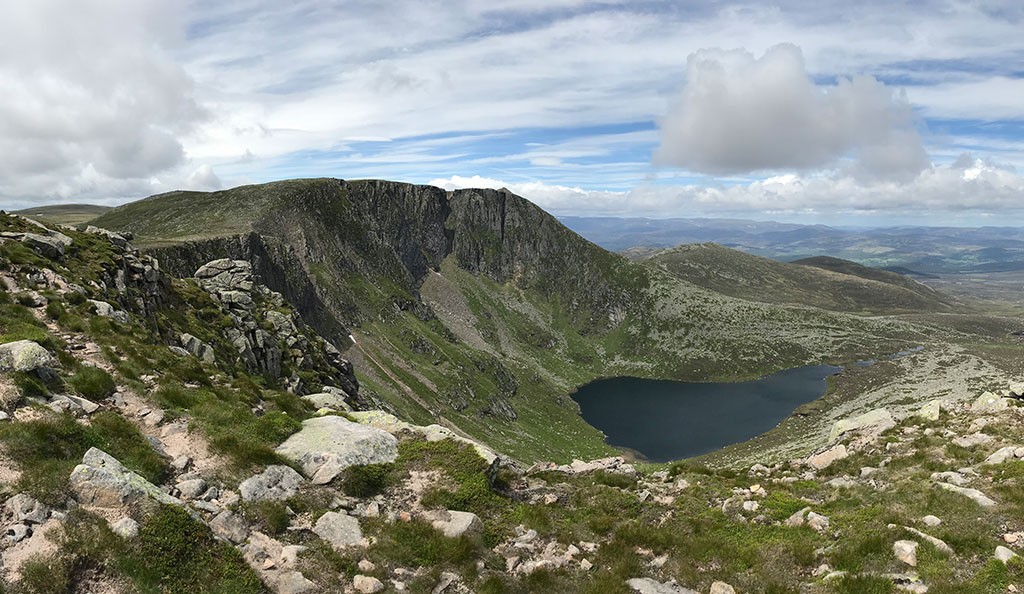
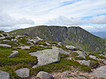
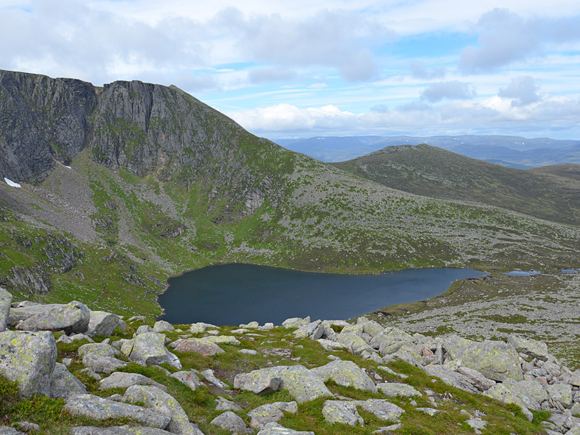 We cross a field of boulders and finally climb up to the wide saddle via a few hairpin bends. From there, we catch our first close-up view of the forbidding northern cliffs of Lochnagar and the mountain lake lying at its foot. Standing at the saddle and looking towards Lochnagar, we turn left and head south towards Cuidhe Cròm. We follow the path, built up with stone slabs, up a slope strewn with large boulders. In this rocky wasteland, we stick to the slabs arranged in a stair-like pattern, which make it easier to navigate the tangle of boulders. Eventually, we reach the high plateau of Cuidhe Cròm and hike down in a right-hand curve, generally heading east, towards the saddle between Cuidhe Cròm and Lochnagar.
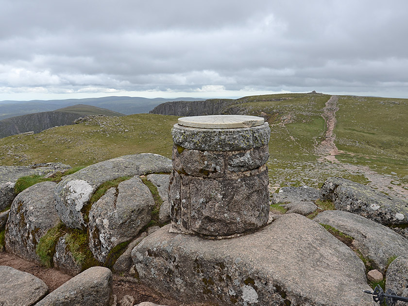 As soon as we meet the path leading up through the Glas Allt valley, the trail turns right (north-west) and leads us steeply up to the broad ridge of Lochnagar. After this short, steeper ascent, the terrain levels out again and we head towards the large cairn on the pre-summit of Cac Carn Mór. We pass the cairn on its left-hand side, walk a few metres downhill and, via the broad ridge and a short counter-ascent, reach the summit structure of Cac Barn Beag. After a short scramble over boulders, we finally climb to the highest point of the main summit of Lochnagar and enjoy the fantastic panoramic view over the Cairngorms (3½ hours from the car park at Spittal of Glenmuick).
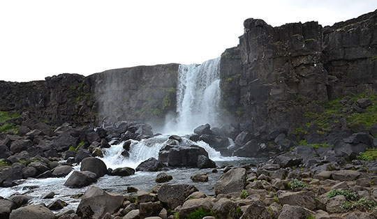
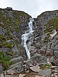
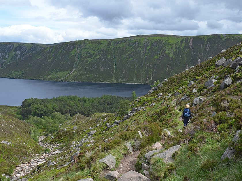 We walk along the ridge past the cairn on Cac Carn Mór back towards the saddle between Lochnagar and Cuidhe Cròm. Just before the saddle, we turn right and follow the path down through the Glas Allt valley in a south-easterly direction. Later, we cross the Glas Allt via a small wooden bridge. We then descend in a series of switchbacks to the foot of the imposing Glas Allt waterfall (1½ hours from the summit). From the waterfall, we head towards Loch Muick below us and cross a steep slope. After the traverse, the path leads us down in switchbacks to a wooded area.
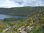
 In the woodland, we turn left at a fork in the path and reach the shore of Loch Muick. We then turn left again and follow the long, winding lakeside path in a north-easterly direction. At the northern end of the loch, we turn right at the Boat House and follow the shore to the River Muick. We cross the river and turn left after the bridge. Our path takes us up to a cross-path, which we follow to the left in a north-easterly direction. Finally, we pass the visitor centre and, 3½ hours after setting off from the summit of Lochnagar, reach the car park at Spittal of Glenmuick.
There are no places to stop for refreshments along the way.
| Elevation | Time | Total | Destination | ||
|---|---|---|---|---|---|
| 410 m | - 920 m | + 2:15 | 2:15 | Sattel am Meikle Pap | |
| 920 m | - 1155 m | + 1:15 | 3:30 | Lochnagar (Cac Barn Beag) | |
| 1155 m | - 600 m | + 1:30 | 5:00 | Wasserfall des Glas Allt | |
| 600 m | - 410 m | + 2:00 | 7:00 | Parkplatz Glenmuick | |