

 Allgäu Alps
Neunerköpfle mountain station (1,790 m) – Neunerköpfle (1,862 m) – Strindenscharte (1,855 m) – Sulzspitze (2,084 m) – Gappenfeldscharte (1,858 m) – Schochenspitze (2,068 m) – Landsberger Hütte (1,810 m) – Obere Traualpe (1,649 m) – Vilsalpsee (1,165 m)
Overall a moderately difficult mountain hike, mostly over stony paths and only briefly over wide tracks. On the ascent to the Sulzspitze, a rugged section can be bypassed on the right-hand side. Take care in the steeply sloping summit areas of the Sulzspitze and the Schochenspitze! The steep descent from the Landsberger Hütte to the Traualpsee is secured in places with wire ropes. On the route described, the descent covers a good 1,000 metres in altitude. In addition to sure-footedness, a good level of fitness is required for this hike.
Take the Ulm–Füssen motorway (A7) to the Oy-Mittelberg exit. After the exit, follow the B310 past Wertach and Unterjoch towards Oberjoch. At the roundabout at the entrance to Oberjoch, turn left towards the Tannheim Valley and drive via Schattwald and Zöblen to Tannheim. Park your car on the left-hand side of the road at the large car park or on the right-hand side at the parking spaces around the valley station of the Neunerköpfle gondola lift (parking fee €5 per day, as of 2022). Alternatively, you can reach Tannheim from Reutte via Weißenbach am Lech and the Gaicht Pass.
Take the train from Munich via Garmisch or from Kempten to Reutte in Tyrol. From Reutte station, take bus route 120 (towards Oberjoch) to the Tannheim in Tyrol roundabout stop (for timetable information). From the bus stop, it is a 2-minute walk to the Neunerköpfle gondola lift valley station.
47.49922411, 10.52503645
Anzeige
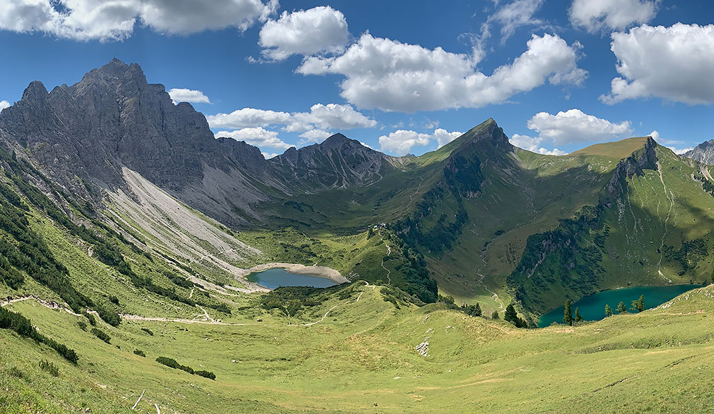
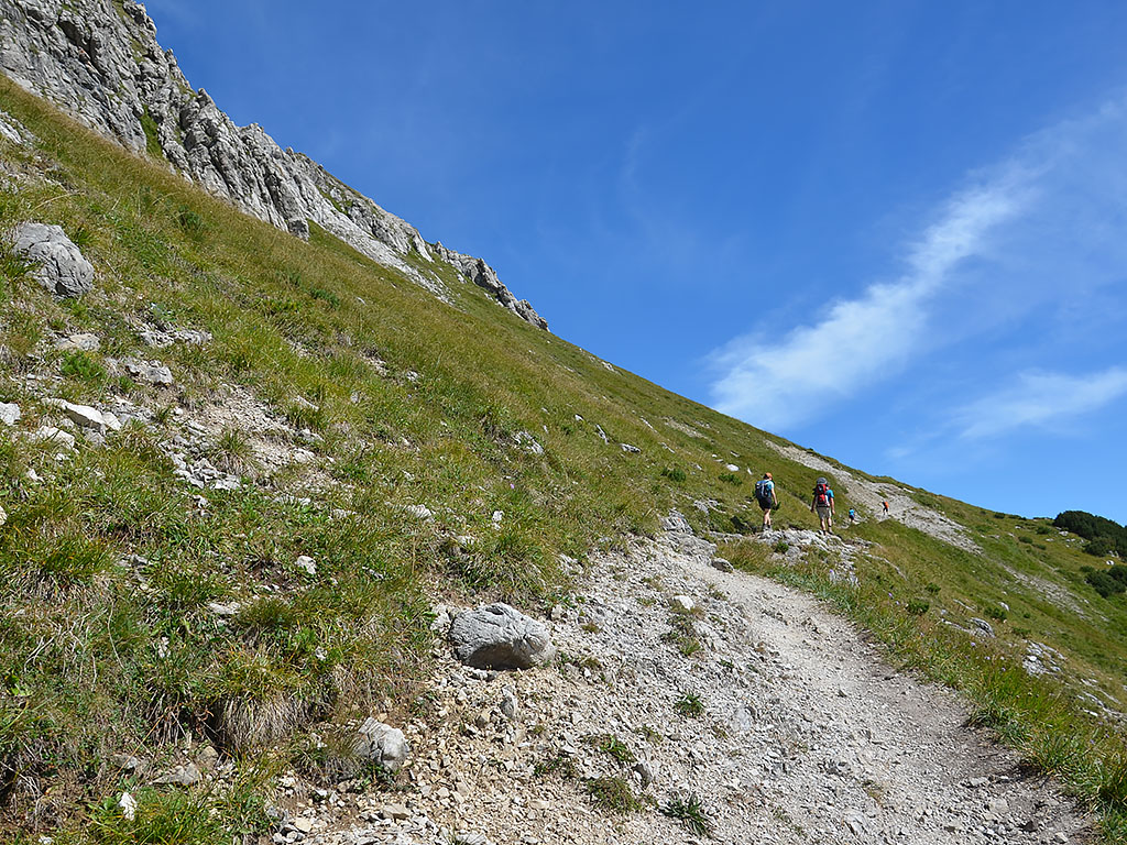
As beautiful and varied as the route from the Neunerköpfle to the Landsberger Hütte is, it is just as popular and well-frequented. On fine summer days, you are unlikely to be alone on this high-altitude trail above the Tannheim Valley. Right from the mountain station, you are greeted by the first magnificent views across Lake Halden to the Rote Flüh, the Kellenspitze and the Krinnenspitze. The artistically designed summit cross on the Neunerköpfle is quickly reached from the mountain station. This is followed by a hike above the Strindeltal valley to the Strindenscharte. Shortly after the saddle, you come to the summit path to the Sulzspitze, which can be climbed within half an hour.
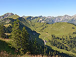
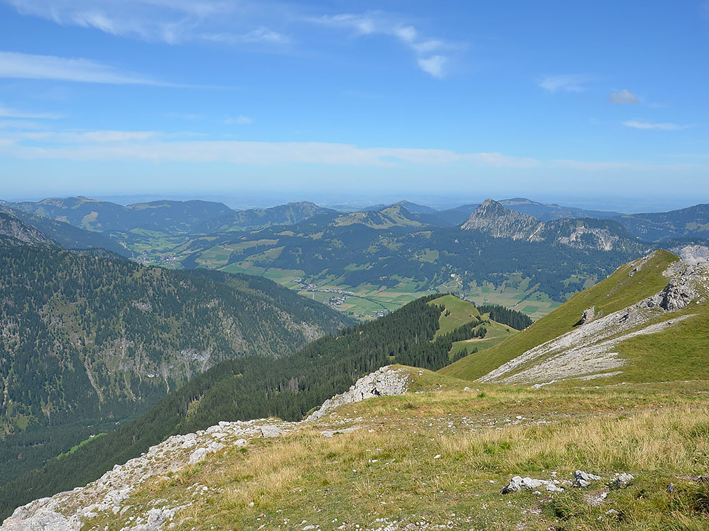
Back on the Saalfelder Höhenweg – as the section between the Strindenscharte and the Landsberger Hütte is known – you soon reach the Gappenfeldscharte. There, the Gappenfeldalpe offers the first opportunity for a refreshment stop within a few minutes. The route continues to the foot of the Schochenspitze, whose striking summit can be reached in a further 15 minutes via a steep, winding path. With the beautiful backdrop of the Lachenspitze, the Rote Spitze and the mountain lake Lache before our eyes, we hike down to the Landsberger Hütte.
If you skip the summits of the Neunerköpfle, Sulzspitze and Schochenspitze, the walking time from the mountain station to the hut is reduced from 3¾ to 2½ hours. After a hearty meal, the two-hour descent follows via the Traualpsee and the Obere Traualpe to the Vilsalpsee. From there, we take the bus or the Tannheimer Alpenexpress back to Tannheim.
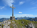
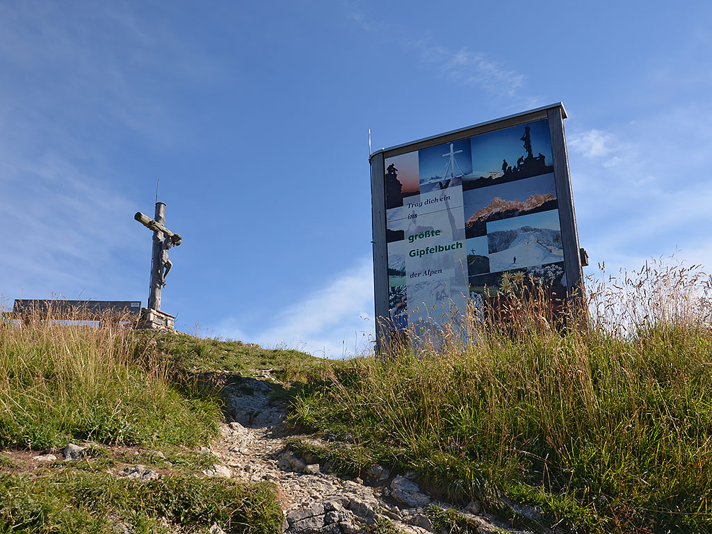 After taking the Neunerköpfle gondola lift (ascent €18, as of 2022), we leave the top station (1,790 m) and keep to the right at the first fork in the path (signposted ‘Neunerköpfle, Landsberger Hütte’). After a right-hand bend, we pass a T-bar lift and reach a signposted junction. Here we turn left and take the summit path to the Neunerköpfle. The wide path leads us uphill in hairpin bends and crosses the rocky walls of the summit structure (secured with railings). On the western side of the mountain we come to a junction, turn left and climb up to the summit cross on the Neunerköpfle (1,862 m). Just below the summit stands the largest summit logbook in the Alps, where you can leave your mark before continuing on your way. From the summit, we return to the junction and turn left (signposted “Sulzspitze, Landsberger Hütte”).
 Heading south-east, we walk down to a saddle. There, our path takes a right-hand bend and subsequently leads us past the wooded western flank of the Vogelhörnle. Eventually, the trees recede again, and we reach a broad meadow ridge in a sweeping right-hand curve. On the ridge, we ignore two junctions on the right and maintain our general direction. Heading south-west, we approach the foothills of the Lochgehrenspitze. There, our path turns south-east in a sweeping left-hand bend, and we later meet the path coming up from the Strindenalpe. At this junction, we keep slightly to the right and continue the ascent over a short stony section. At a turnstile, we slip through the pasture fence and, after a right-hand bend, we traverse past the Lochgehrenspitze in a sweeping left-hand bend.
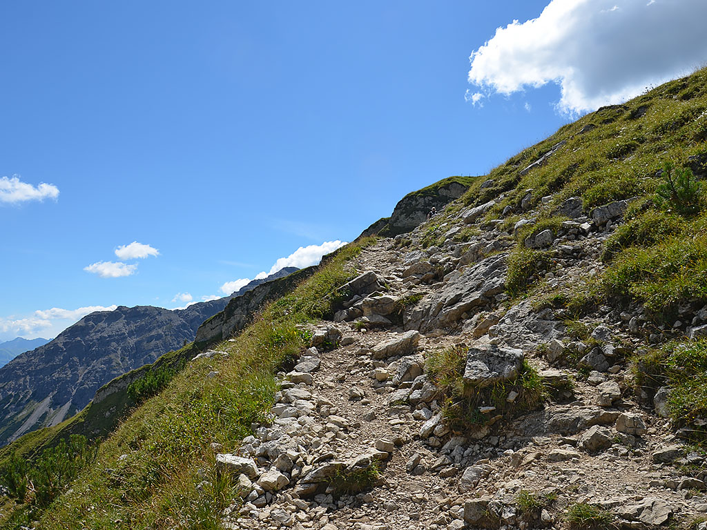
 A short climb over rocky outcrops to a corner of the terrain is followed by another left-hand bend, which now takes us towards the Strindenscharte. Finally, we cross terrain covered in mountain pine and, after the Latschengasse, reach a track which we follow on its right-hand side. Shortly afterwards, we meet the track again and cross it. We then climb up through a stony gully to the Strindenscharte (1,855 m) and meet the wide track there once more. We now turn left onto it and pass a turnstile next to a gate. We then stay on the track and, 10 minutes after the saddle, reach the junction for the Sulzspitze. To make the final ascent to the summit, we now turn sharply right here and climb up a small meadow path in a north-easterly direction towards a field of mountain pines. After the mountain pine gully, we pass below the summit rocks and reach a grassy slope in a left-hand bend.
 Continuing in a left-hand curve, we follow the meadow path to a rugged slope. Either directly over the scree (red markings) or, more easily, veering right along a path, we climb up to the summit slope and over it to the summit cross of the Sulzspitze (2084 m, just under 2 hours from the mountain station at Neunerköpfle). Back on the track, we reach the Gappenfeldscharte (1,858 m) after a few minutes. From here, it is a stone’s throw to the Gappenfeldalpe, situated 10 metres lower down and open in summer. To continue towards the Schochenspitze, we leave the track at the saddle, keeping to the left, and walk westwards along a meadow path. Shortly afterwards, our path curves to the left and leads us south-west towards the striking Schochenspitze. After a short while, the path becomes significantly rockier and steeper. During the ascent, we head for the saddle to the left (east) of the Schochenspitze.
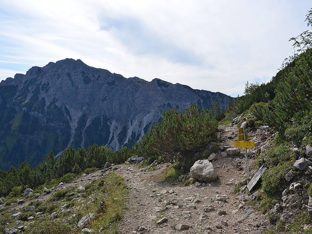
Finally, we climb up to the saddle via a rocky, stepped path secured with wire ropes. At a signpost, we turn right onto the steep summit path and hike up via numerous hairpin bends to the Schochenspitze cross (2068 m) in less than 15 minutes (just over 1 hour from the Sulzspitze). At the Schochenspitze, the dizzying view down to Lake Vilsalpsee is particularly fascinating. Back at the saddle, we turn right and follow the path downhill towards the south-west with a view of the Lachenspitze (signpost “Landsberger Hütte, Vilsalpsee”). After a left-hand bend, we reach a small rock tower with a signpost. There, our path turns right again and leads us down in short switchbacks across meadowland to terrain covered in mountain pines. There, we ignore a turn-off to the Lachenspitze on the left and continue our descent with a view of the Rote Spitze, whose striking summit rises above the Landsberger Hütte.
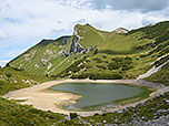
Our next stop is the Lache, the small mountain lake below the Landsberger Hütte. The stepped path leads us down through the mountain pine scrub to the valley floor, and we reach a fork in the path just before the Lache. From here, both paths lead to the Landsberger Hütte. We opt for the left-hand path, which circles the Lache on its southern side. From the southern shore, we can once again enjoy a particularly beautiful view across the mountain lake to the Schochenspitze. We therefore turn left and cross the scree slope that runs down from the north face of the Lachenspitze. As soon as we have passed the southern shore of the lake, the path turns north-west. We then cross the stream bed of the Traualpbach and hike up a short, gentle climb to the Landsberger Hut (1,810 m). We reach the spacious mountain hut 3¾ hours after setting off from the top station of the gondola lift at the Neunerköpfle. Had we not visited all three peaks, the crossing would have taken around 2½ hours.
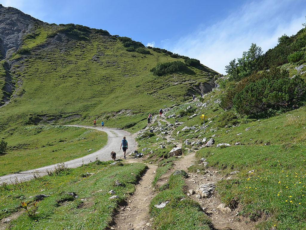
 We leave the Landsberger Hut heading north-east (signposted ‘Vilsalpsee’). At the next fork in the path, you can take either route. These converge again after a few metres and shortly afterwards we reach a signposted junction. We now turn left towards Vilsalpsee and descend along a rocky path secured with wire ropes, winding down a rock face in several hairpin bends. We quickly approach the valley floor, where the Traualpsee lies, and cross a stream. On the eastern shore of the reservoir, we continue walking to the Obere Taualpe (1,649 m), the last place to stop for refreshments before Vilsalpsee. At the snack bar, we turn left and follow a stony, steep path downwards in numerous hairpin bends, with a view of Vilsalpsee. We pass through a sparse copse and later, in a clearing, come to a prominent boulder with a signpost.
 The stony path soon leads us into a shady section of woodland. As soon as the trees thin out, we catch sight of the Untere Traualpe, situated on the shore of Lake Vilsalp. We continue down towards the valley floor in further hairpin bends. At the valley station of the material cable car, we come to a track that takes us to the Untere Traualpe. At the alpine hut, we turn right onto a cross-path and follow the wide track along the eastern shore to the bus stop at the Gasthof Vilsalpsee (1,165 m, 2 hours from the Landsberger Hütte). There we board the bus that takes us back to Tannheim (single journey €4, as of 2022, see bus timetable). Alternatively, we can also use the Tannheimer Alpenexpress for the return journey. From the roundabout in Tannheim, we walk along the Bergbahnweg for a few minutes back to the car park at the Neunerköpfle gondola lift.
| Elevation | Time | Total | Destination | ||
|---|---|---|---|---|---|
| 1790 m | - 1862 m | + 0:15 | 0:15 | Neunerköpfle | |
| 1862 m | - 1855 m | + 0:55 | 1:10 | Strindenscharte | |
| 1855 m | - 2084 m | + 0:40 | 1:50 | Sulzspitze | |
| 2084 m | - 1858 m | + 0:30 | 2:20 | Gappenfeldscharte | |
| 1858 m | - 2068 m | + 0:40 | 3:00 | Schochenspitze | |
| 2068 m | - 1810 m | + 0:45 | 3:45 | Landsberger Hütte | |
| 1810 m | - 1649 m | + 0:45 | 4:30 | Obere Traualpe | |
| 1649 m | - 1165 m | + 1:15 | 5:45 | Vilsalpsee | |


