


 Dolomiten
A circular walk of just under 3½ hours and 9.2 km in length, following wide tracks and narrow paths that require a minimum of sure-footedness.
Take the motorway from Munich via Innsbruck and the Brenner Pass to the Klausen exit. Drive a short distance towards Brixen, then turn right into the Villnößtal valley. Drive via St. Magdalena towards the Zanser Alm (signposted) and park at the hiking car park by the Zanser Alm (€6 parking fee, as of 2020).
Take the train from Munich via Innsbruck and Brenner to Brixen or Klausen. From Brixen or Klausen, take bus route 340 to St. Peter in the Villnösstal valley. From St. Peter, continue on bus route 341 to the Zanser Alm (for timetable information).
46.63487613, 11.76391896
Anzeige
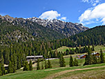
A hike against the backdrop of the imposing Dolomites: the Adolf Munkel Trail crosses the foot of the Geisler peaks and brings you close to their mighty northern cliffs. The starting and finishing point of this longer but leisurely hike, with a manageable elevation gain, is the Zanser Alm in the Villnöß Valley. On this circular route, you pass no fewer than four mountain huts serving food and drink. So, alongside the visual delights, there is plenty to satisfy your appetite too. The Adolf Munkel Trail was established in 1905 and commemorates the former chairman of the Dresden section of the German-Austrian Alpine Club.
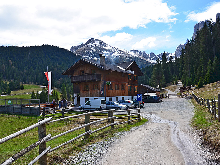 We start our circular walk at the upper car park at the Zanser Alm. There, we take the path to the Zanser Alm, which we reach shortly afterwards. We pass the alp on our left and, after passing through a gate, we come to a fork in the path. Here, we take the left (lower) path. The path first takes us over a small stream and shortly afterwards over the Tschantschenonbach. Immediately after the bridge, we turn right (signposted “Tschantschenon/Adolf-Munkel-Weg”). We now follow the wide path southwards, uphill alongside the rushing Tschantschenonbach.
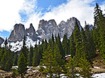
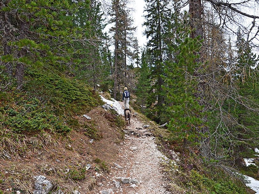
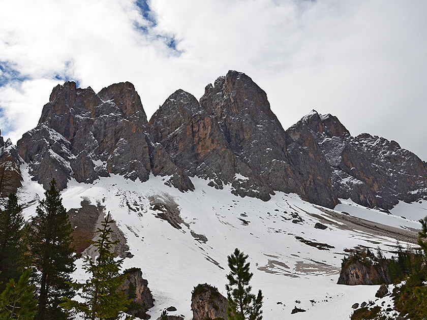 After just under ten minutes, we reach a junction. Here we keep to the right and thus continue to follow the stream. We walk along the now narrower path through sparse woodland towards the rock towers of the Geisler Group. After just under a quarter of an hour, our narrow path joins a wide forest track. We maintain our direction, continue straight ahead and, after less than two minutes, turn left onto the Adolf-Munkel-Weg at a sharp right-hand bend. We now climb a few metres uphill along a narrow path and subsequently walk through sparse woodland. On the left, the Geislerspitzen soon come into view in all their splendour.
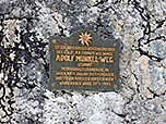
 After 15 minutes, we reach the first fork. Here we keep to the left and follow Adolf-Munkel-Weg. A few minutes later, we reach the foot of the Geislerspitzen for the first time. In the large clearing stands a huge boulder with a commemorative plaque in memory of Adolf Munkel. The path then takes us back into the sparse mountain forest via a short uphill stretch. After another 20 minutes, we reach another junction. Here we keep to the left and follow the Adolf-Munkel-Weg. Shortly afterwards, we arrive at a large clearing at the foot of the mighty rock towers.
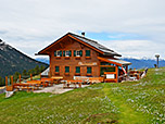
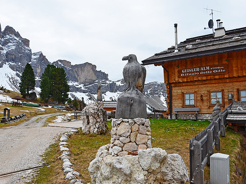
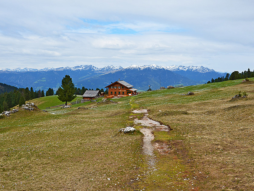 Another 20 minutes later, we pass the turn-off to the Glatschalm on our right and continue straight ahead. A quarter of an hour later, we reach a ridge, over which the path, fitted with a wooden handrail, leads us. A few minutes later, we come to a junction on the ridge. Here, we leave the Adolf-Munkel-Weg to the right (signposted “Gschnagenhardtalm/Geisleralm”) and climb up steps to a hilltop. From the highest point, we walk down across open, expansive alpine pastureland for five minutes to the beautifully situated Gschnagenhardtalm.
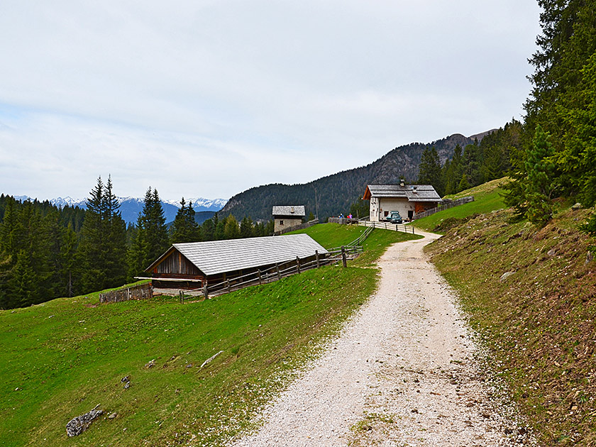
 We walk past the alpine hut and, just three minutes later, reach the Geisleralm, which is no less beautiful against the imposing backdrop of the Geisler. From the Geisleralm, we follow the wide forest track downhill and, after three minutes in the woods, come to a junction. Here we leave the forest track to the right and descend via a narrow forest path (trail no. 36 “Dusleralm/Zanser Alm”). After half an hour, the small path joins a wide track. Here we keep to the right (trail no. 36 “Dusleralm/Zans”) and follow the forest track for three minutes to the Dusleralm.
 At the Dusleralm we take one last look at the Geislerspitzen. We pass the alpine pasture, continue straight ahead and reach the mountain forest again via a meadow path. After a short descent, our path curves to the right. We then follow a longer traverse which takes us eastwards towards the Zanser Alm with only a moderate loss of altitude. A good 25 minutes after passing the Dusleralm, our path joins a wide forest track. Here we continue straight ahead and after three minutes we reach our starting point at the car park by the Zanser Alm.
| Elevation | Time | Total | Destination | ||
|---|---|---|---|---|---|
| 1680 m | - 2006 m | + 2:10 | 2:10 | Gschnagenhardtalm | |
| 2006 m | - 1680 m | + 1:20 | 3:30 | Zanser Alm | |


