

 Bayerische Voralpen
Car park at Kesselberg (850 m) – Jochberg (1565 m) – Jocheralm (1382 m) – Car park at Kesselberg (850 m)
An easy mountain hike, becoming moderately difficult near the summit, to a classic peak offering superb views between Kochelsee and Walchensee. The path leading to the highest point along the summit ridge is steep and requires a degree of sure-footedness.
Take the B11 via Kochel towards Wallgau. Shortly after the highest point of the pass road (before reaching Lake Walchen), park at the car park at Kesselberg (limited parking available, set off as early as possible).
Both Kochel and Mittenwald are easily accessible from Munich by train. The RVO bus 9608 runs between the two towns. Coming from Kochel, travel to the Kesselberg Passhöhe stop. For the return journey, or when coming from Mittenwald, you should get on or off at Urfeld, as there is no stop in this direction at the pass summit (timetable and booking).
47.62049813, 11.34899497
Anzeige
A varied mountain hike from Kesselberg to the Jochberg with a rewarding summit panorama. The steep ascent is compensated by magnificent views of the Alpine foothills and numerous lakes. The descent via the Jocheralm and along the shores of Walchensee provides a scenic and relaxed finish to the tour.
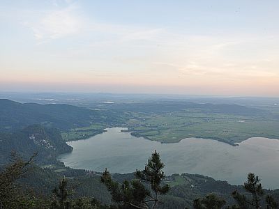
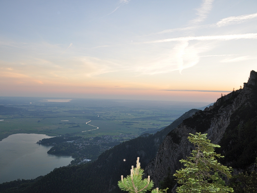 The hike up the Jochberg starts at the car park at Kesselberg. As we want to be at the top for sunrise this time, we set off in the dark. We cross the pass road and climb steeply uphill along the well-maintained path. Sections where the path allows for a breather are rather rare. After a good three-quarters of an hour, we reach a small rest area still within the forest and, beyond that, the turn-off to the Jocheralm. However, we keep to the left and continue our ascent to the Jochberg. The path repeatedly takes us close to the steeply sloping north face of the Jochberg. The view of the flat Alpine foothills far below makes us pause every now and then. Alongside the nearby Kochelsee, the Riegsee, Staffelsee and Starnberger See also glisten in the rising sun.
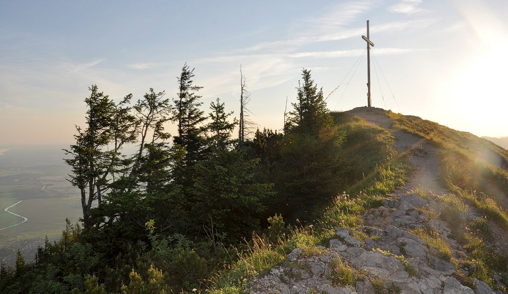
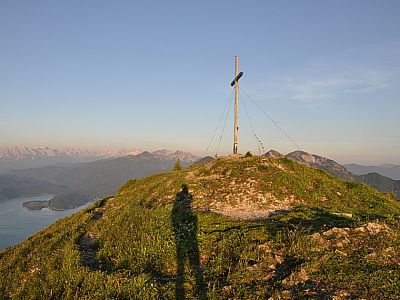
 After passing through a gate, we leave the forest and continue our ascent to the summit along a path. To the right, another path branches off, which we will use later for the descent to the Jocheralm. A good 10 minutes later, we stand at the summit cross of the Jochberg. To the north-west, deep below us, lie the picturesque Kochelsee and Kochel. In addition to the lakes already mentioned, the view now stretches as far as the Ammersee, 45 kilometres away. Further north of Kochel, we can make out Benediktbeuern.
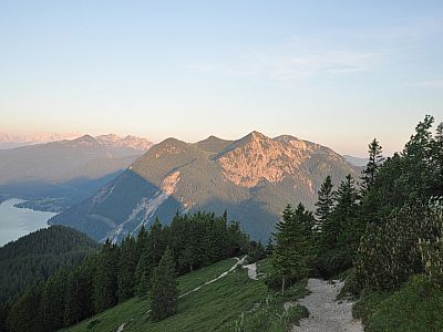
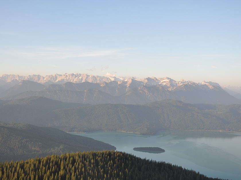 To the east, the Benediktenwand is clearly visible. Further south, the mighty peaks of the Karwendel Mountains rise up, such as the Birkkarspitze. To the south-west, the Wetterstein Mountains follow, featuring the Wettersteinspitze and the Zugspitze. The Herzogstand, which can also be climbed with the aid of a cable car, and the Heimgarten complete the 360-degree panorama to the west. We enjoy the view for a long time until the summit gradually fills up.
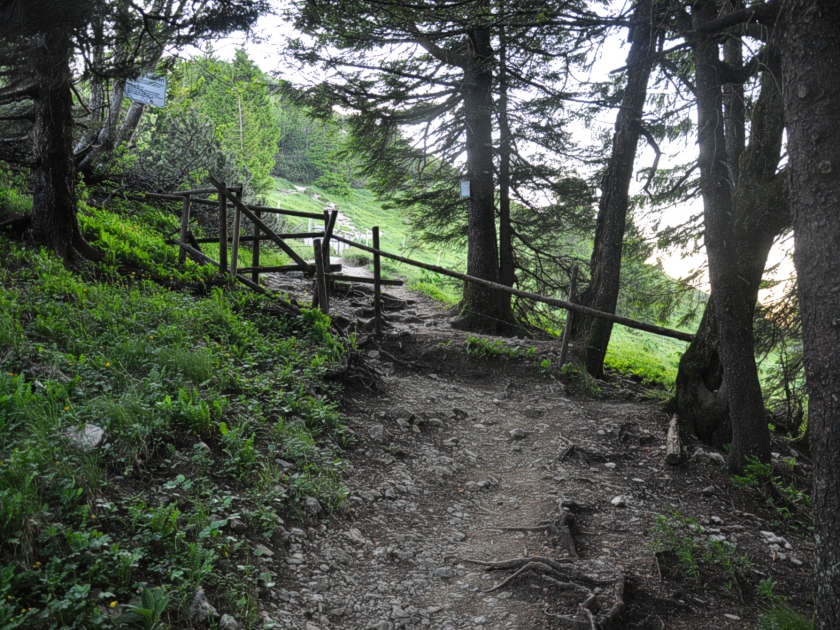
 For the descent, we walk the short distance back west to the edge of the forest, then turn left onto the path to the Jocheralm mentioned earlier. There we treat ourselves to a break and, refreshed by food and drink, continue our way along the road towards Walchensee. A little later, a path branches off to the right towards Urfeld. It becomes increasingly steep. We keep following the signposts to Urfeld and Walchensee.
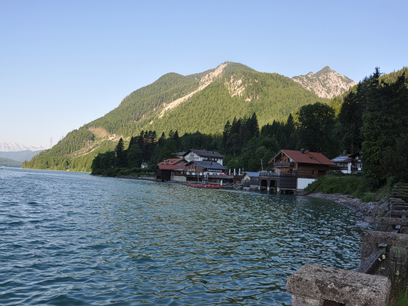 Once we reach the shore, we keep to the right and walk along the tarmac path by Walchensee. A good half an hour later, we reach the beautifully situated boathouses of Urfeld. This is where the bus drivers have reached their destination. The car park where we left our car is still a few metres higher up. Passing the Goethe monument, however, we quickly make our way up the two hairpin bends of Kesselbergstraße and reach the car.
Set off early, especially in good weather, as the limited parking spaces at Kesselberg fill up quickly and the Jochberg is a very popular summit.
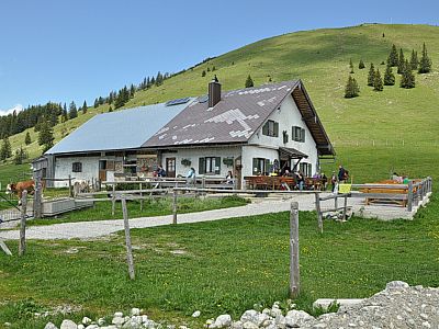
Jocheralm (1382 m). Open from late May to mid-October, Tuesday to Sunday, 10.00 am – 5.00 pm Closed on Mondays. May be closed in bad weather.
| Elevation | Time | Total | Destination | ||
|---|---|---|---|---|---|
| 850 m | - 1565 m | + 1:50 | 1:50 | Jochberg | |
| 1565 m | - 1382 m | + 0:20 | 2:10 | Jocheralm | |
| 1382 m | - 850 m | + 1:25 | 3:35 | Kesselberg | |


