


 Bayerische Voralpen
Kesselberg Pass car park (850 m) – Schlehdorfer Alm (1405 m) – Herzogstand mountain inn (1575 m) – Herzogstand (1731 m)
Overall an easy mountain hike, leading from the Kesselberg Pass summit down to the Herzogstand mountain inn along a wide track. The ascent to the summit follows numerous hairpin bends along a path that is partly rocky but well-maintained, requiring a minimum of sure-footedness.
Take the Munich–Garmisch motorway to the Murnau/Kochel exit. After the exit, turn left and drive via Großweil and Schlehdorf to Kochel am See. In Kochel, turn right onto the B 11 towards Walchensee and follow the pass road up to the Kesselberg Pass summit. Either park on the right-hand side of the road at the signposted car park just before the pass summit, or drive over the pass summit and park your car shortly afterwards on the right-hand side at the hiking car park. The latter car park, which is also used as the starting point for the Jochberg, is usually full early in the day, particularly at weekends.
Take the train from Munich Central Station or Tutzing to Kochel am See. From Kochel station, take bus route 9608 to the Kesselberg Pass summit stop (timetable and booking). Note for the return journey: There is no bus stop directly at the pass summit in the direction of Kochel. This is located in Urfeld on the shore of Lake Walchensee and can be reached on foot from the pass summit in 10 minutes.
47.62427313, 11.35210097
Anzeige
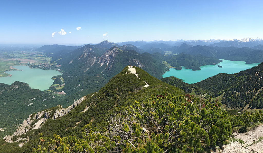
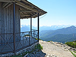
The easiest access route to the Herzogstand begins at the Kesselberg Pass near Urfeld with the bridle path. From the Kesselberg, this winds its way as a wide and moderately steep track up to the Herzogstand mountain inn. King Ludwig II had the bridle path laid out in the mid-19th century as an access route to the hunting lodge and his royal residence. Alternating between woodland and clearings, the path first leads up to the Schlehdorfer Alm, which lies in a basin on beautiful alpine pastureland at the foot of the Herzogstand. Passing through the basin, we reach the mountain inn, where we meet the many visitors who have taken the Herzogstandbahn from Walchensee to shorten the ascent. Consequently, you are rarely alone on the path to the Herzogstand, which winds its way up through the mountain pine-covered slope in numerous hairpin bends to the summit pavilion. The panoramic view from the Herzogstand is fantastic, stretching from the Kaiser Mountains to the Rofan Mountains, the Karwendel, the Stubai Alps and the Wetterstein Mountains.
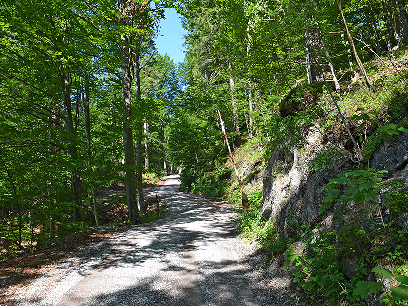 From the car park just before the pass summit at Kesselberg, we follow the footpath running parallel to the road up to the saddle. Shortly after the bus stop, we turn diagonally right onto the wide forest track towards the Herzogstandhaus and Herzogstand. Those starting the hike at the Jochberg car park should look towards the pass summit and follow the path diagonally left up the wooded slope to the forest track. We hike uphill along the wide path in a south-westerly direction and, after a gentle right-hand bend, reach a junction. Here we maintain our general direction, choosing the right-hand (upper) path and passing through a barrier. Shortly afterwards, the forest thins out and we pass under a power line in a right-hand bend and a left-hand curve.
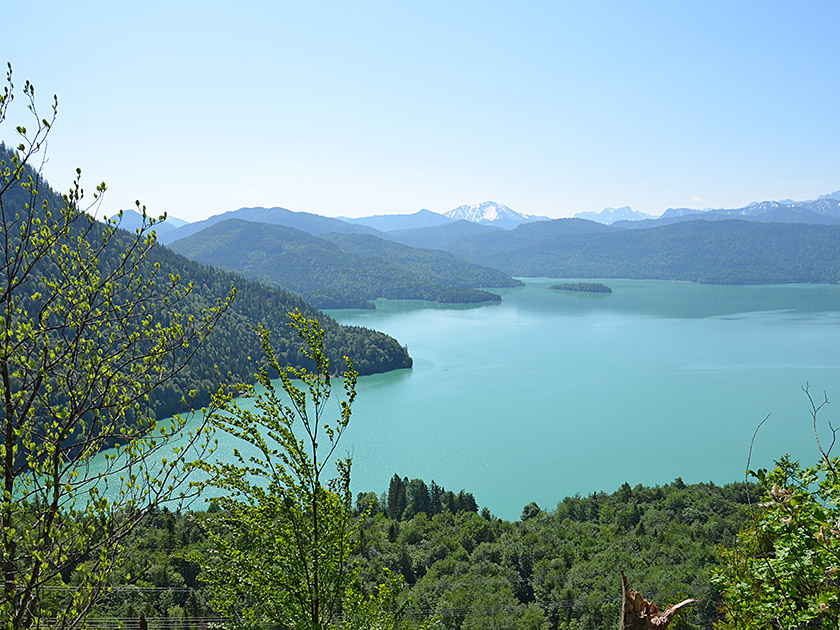 We then reach the mountain forest again and continue hiking uphill in a south-westerly direction. Shortly afterwards, an unmarked path branches off to the left, leading to a viewpoint with a bench. From here, you can enjoy a first beautiful view of Lake Walchensee. From the bench, another path leads back to the wide track, which we follow further south-west. After a right-hand bend, we come to a clearing, across which we walk slightly uphill to a junction. At this point, the Pionierweg, which leads up from Schlehdorf, meets the Reitweg. At the junction, we turn left and follow the track, alternating between woodland and clearings, heading generally southwards as it winds uphill.
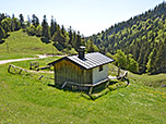
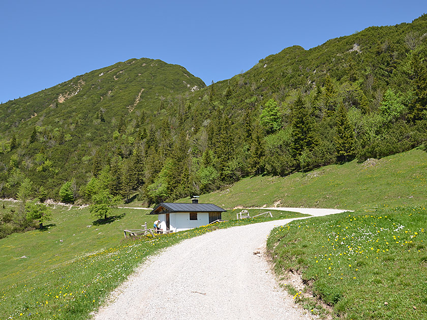 Soon we look down towards Kochelsee and far into the Alpine foothills. Finally, the path turns south-east again and leads us out of the mountain forest in a right-hand bend. We are now in the expansive basin between the Fahrenbergkopf and the Herzogstand. The bridle path leads us towards the small Schlehdorfer Alm (1,405 m) and turns there in a left-hand bend towards the west. After the bend, we walk westwards into the basin. Our path eventually makes a long, sweeping left-hand bend in the basin and leads us steeply uphill towards the south-east. After a right-hand bend, we head towards the Herzogstand mountain inn (1,575 m), which we reach after just under two hours. To continue towards the summit, we turn right in front of the mountain inn.
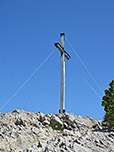
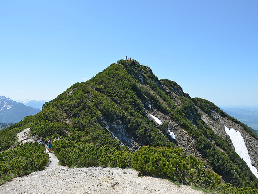 Following a moderately ascending path, we head north-west towards the Herzogstand, with its summit pavilion already visible. We cross the flank of the Martinskopf and finally reach the saddle between the Martinskopf and the Herzogstand. There, the path turns right and leads us uphill in numerous hairpin bends over the mountain pine-covered southern side of the Herzogstand. The path becomes rockier and features a few small, rugged steps in places. Through the mountain pine grove, we first reach the secondary summit, which is adorned with a large wooden cross. To continue on to the main summit, we turn left just before the secondary summit and hike eastwards up to a signpost. There, at the start of the ridge path leading over to the Heimgarten, we turn right and climb up to the summit pavilion on the Herzogstand (1,731 m) (30 minutes from the mountain inn).
Same as ascent. Alternatively, walk from the Herzogstand mountain inn in 1½ hours or take the Herzogstandbahn from the Fahrenbergkopf down to the valley station. From the Herzogstandbahn valley station (“Walchensee Herzogstandbahn stop, Kochel a. See”), take bus route 9608 to Urfeld and from there walk for 15 minutes up to the car park at the Kesselberg Pass summit.
Berggasthaus Herzogstand (1575 m), Tel. 08851 / 234. Open from 1 May to 15 November; closed on Tuesdays. Closed for the festive season from 16 November to 25 December. From 26 December until the end of April, open Friday to Sunday; open daily during the school holidays. For details of the festive closure, please see the hut’s website.
| Elevation | Time | Total | Destination | ||
|---|---|---|---|---|---|
| 850 m | - 1575 m | + 2:00 | 2:00 | Berggasthaus Herzogstand | |
| 1575 m | - 1731 m | + 0:30 | 2:30 | Herzogstand | |
| 1731 m | - 1575 m | + 0:25 | 2:55 | Berggasthaus Herzogstand | |
| 1575 m | - 850 m | + 1:35 | 4:30 | Parkplatz Kesselberg-Passhöhe | |


