


 Bayerische Voralpen
Walchensee (800 m) – Heimgarten (1790 m) – Herzogstand (1731 m) – Berggasthaus Herzogstand (1575 m) – Walchensee (800 m)
Mostly moderate difficulty, with some challenging sections on the ridge between Heimgarten and Herzogstand. Sure-footedness and a head for heights are required in some places.
Coming from Munich, take the motorway towards Garmisch, exit at the Murnau/Kochel junction and continue via Kochel on the B11 to Walchensee. Park at the valley station of the Herzogstandbahn.
Take the train from Munich Central Station or Tutzing to Kochel am See. From Kochel station, take bus route 9608 to the Walchensee Herzogstandbahn stop (timetable and booking).
47.59636780, 11.31754875
Anzeige
The Heimgarten and the Herzogstand are undoubtedly among Munich’s best-known local mountains. The ridge walk between the two peaks offers a magnificent panorama and presents hardly any insurmountable obstacles, even if sure-footedness is required in places. With the Heimgartenhütte and the Berggasthaus Herzogstand, you can be sure that the calories burned will be more than adequately replenished. The Herzogstandbahn also ensures that you rarely feel lonely on the tour.
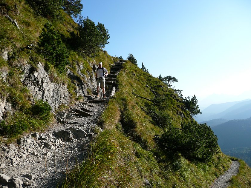
 We leave the Herzogstandbahn car park to the south and follow the signposts to Heimgarten via a footbridge. Shortly afterwards, on the wide forest track, we pass a mudflow barrier designed to contain any falling mudslides should the worst come to the worst. At a junction, we keep left as signposted and the actual ascent begins. We quickly gain height on the path. Down in the valley, the waters of Lake Walchensee glisten between the trees. Once the path has levelled out again, we have a lovely view of the ridge along which the high-altitude trail from Heimgarten to Herzogstand will later lead us. The summit cross of the Martinskopf is clearly visible, with the sun reflecting off it.
 Even before we reach a saddle, the Heimgartenhütte and the summit of the Heimgarten can also be seen. Nevertheless, we are still just under an hour away from the highest point of the tour. After the saddle, the path becomes steeper again. The trail winds its way up to the Heimgartenhütte in numerous hairpin bends. To the west, the ascent from Ohlstadt is visible. The view to the south already stretches far beyond Walchensee to the mountains shrouded in mist. Upon arriving at the Heimgartenhütte, we decide to take a short break and enjoy the view from the sunny terrace. Refreshed, we then climb the final few metres behind the hut and reach the summit of the Heimgarten a minute later.
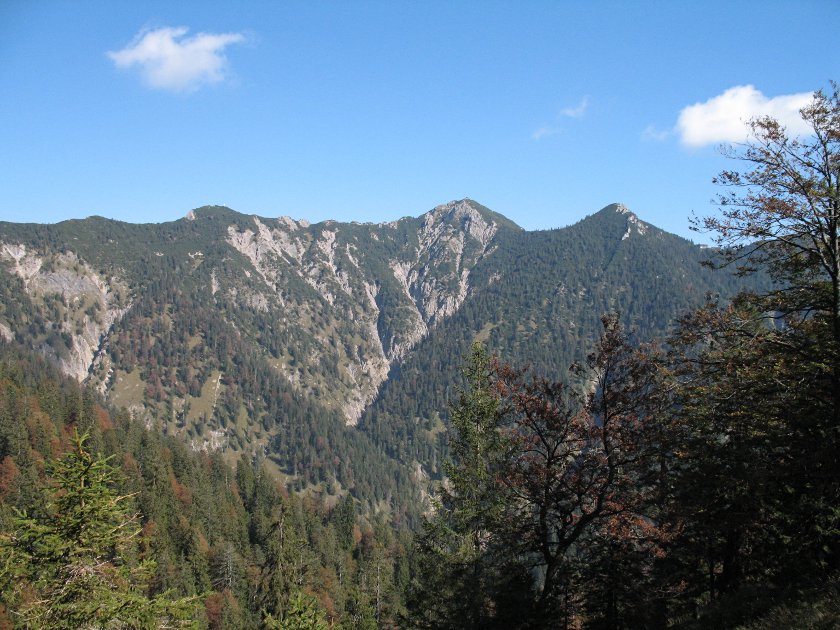
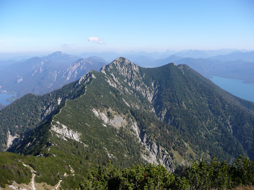 The view stretches deep into the flat Alpine foothills from north-west to north-east. The Murnauer Moos, as well as Staffelsee, Riegsee, Starnberger See and Kochelsee, lie at our feet. To the east, to the left of the Herzogstand, the Benediktenwand and the Jochberg are clearly visible; to the south-east, the Schafreuter stands out from the multitude of peaks. To the south, the Karwendel range ends at Mittenwald with the Westliche Karwendelspitze. A little further west, the massif around the Große Arnspitze is visible; further to the south-west, the Zugspitze in the Wetterstein range towers above three mountain ranges in front of it. To the west, the view extends as far as the Tannheimer Mountains. Peaks such as the Teufelstättkopf stand out strikingly on the horizon.

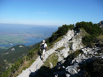
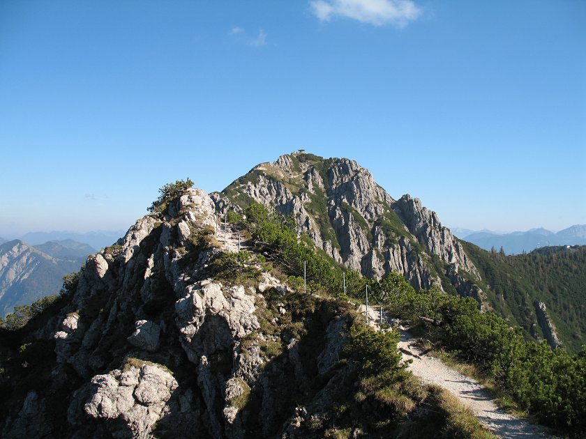 We leave the summit of the Heimgarten, the highest point of our excursion, and descend to the ridge. The high-altitude trail between Heimgarten and Herzogstand is excellently secured and never really difficult. Hiking boots are still advisable in any case, even if you’ve reached this point by cable car. About halfway along the route to the Heimgarten, we reach the Schlehdorfer Kreuz, a small secondary peak on the ridge. The ascent takes us only a few minutes and offers a welcome opportunity for a short break to take in the panorama. Continuing on the path to the Herzogstand summit pavilion, we are treated to another wonderful view down into the Alpine foothills. Passing a small cross on a rocky outcrop, we can spot Schlehdorf Monastery on the northern shore of Lake Kochel. The path now becomes a little steeper again and a quarter of an hour later we have reached the summit pavilion.

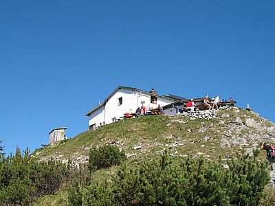
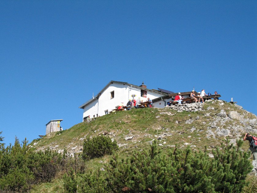
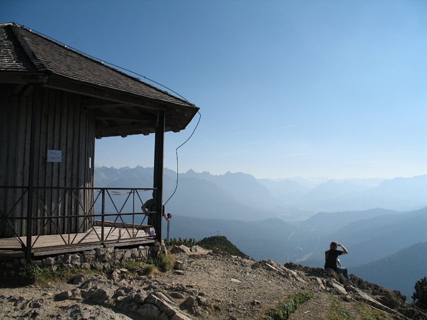 The summit of the Herzogstand offers hikers a fantastic view. The view into the Jachenau valley is now also clear. The path past the Martinskopf to the Herzogstand mountain inn is also clearly visible. On the way down, we make a brief stop at the Herzogstand cross, which lies a few metres further east, slightly below the actual summit. The path then leads us downhill in numerous hairpin bends before we reach the Herzogstand mountain inn, passing the Martinskopf on level ground.
 After the obligatory intake of calories in solid and liquid form, we continue our descent. The path leads steeply downhill, but we can still enjoy the view time and again. We pass a stream that winds its way steeply down into the valley. Ultimately, however, we are glad to see the end of the path approaching. Through a clearing in the mountain forest, we spot the valley station of the Herzogstandbahn. Shortly afterwards, exhausted but happy nonetheless, we reach the cable car car park.
Heimgartenhütte (1775 m). Open from mid-May to mid-October.
Berggasthaus Herzogstand (1575 m), Tel. 08851 / 234. Open from 1 May to 15 November; closed on Tuesdays. Closed for the festive season from 16 November to 25 December. From 26 December until the end of April, open Friday to Sunday; open daily during the school holidays. For details of the festive closure, please see the hut’s website.
| Elevation | Time | Total | Destination | ||
|---|---|---|---|---|---|
| 800 m | - 1790 m | + 2:45 | 2:45 | Heimgarten | |
| 1790 m | - 1731 m | + 1:30 | 4:15 | Herzogstand | |
| 1731 m | - 1575 m | + 0:30 | 4:45 | Berggasthaus Herzogstand | |
| 1575 m | - 800 m | + 1:15 | 6:00 | Walchensee | |


