


 Dolomiten
Pe de Börz (1862 m) – Ütia Pecol (Pecol Hut, 1951 m) – Alfreider Joch (2280 m) – Maurerberg (2332 m) – Alfreider Joch (2280 m) – Maurerberg Hut (2157 m) – Pe de Börz (1862 m)
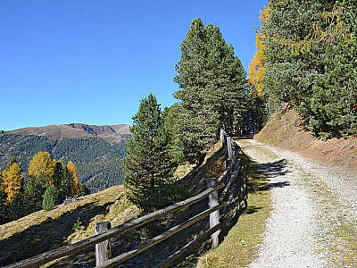
Overall an easy mountain hike. From the Pe de Börz car park, the route climbs steeply for a short while along a root-covered path; otherwise, the hike follows very gentle terrain. The walk to the Pecol Hut follows a wide cart track; the ascent to the summit is via moderate gradients on comfortable paths. The descent from the Maurerberg Hut to the car park follows a wide track.
Take the Munich–Innsbruck–Brenner motorway to the Brixen exit. After the exit, head towards Brixen. At the southern end of Brixen, turn left towards Plose and at the next roundabout keep right towards Plose/Würzjoch. Drive up via St. Andrä to the Würzjoch and, after the pass summit, park your car at the Pe de Börz car park in a left-hand bend following two sharp hairpin bends. The large car park is on the left-hand side of the road. From the Puster Valley, the route is from St. Lorenzen, west of Bruneck, via St. Martin in Thurn and Untermoi.
By train from Munich via Innsbruck and Brenner to Klausen. From Klausen, take bus route 340 to St. Magdalena in the Villnösstal valley. From St. Magdalena, continue on bus route 339 to the Würzjoch (for timetable information). From the Würzjoch, take trail no. 1 for 20 minutes to Pe de Börz.
46.68196340, 11.82335017
Anzeige
The Maurerberg is a gentle hill in the northern Dolomites. At its grassy summit, you are greeted by a magnificent panoramic view of the Zillertal Alps, the Rieserferner Group and the Dolomites. The quickest way to reach the Maurerberg is from the Pe de Börz car park, which is situated a short distance east of the Würzjoch. From Pe de Börz, the summit can be reached either via the Pecolhütte or via the Maurerberghütte. The ascent via the Pecol Hut is slightly more challenging. It follows cart tracks for only a short stretch and consists mainly of narrow paths. We’ll save the wide track to the Maurerberg Hut for the descent. Before heading back to the car park, a stop at the beautifully situated Maurerberg Hut with its stunning views is, of course, a must. From the hut’s terrace, we enjoy a wonderful view across to the Prags Dolomites, the Sennes and Kreuzkofel groups, as well as the Peitlerkofel and the Aferer Geislern.
 At Pe de Börz (1,862 m), we take the forest track heading east, which takes us over a cattle gate. Immediately after the cattle gate, we come to a signpost. Here we turn sharply left and take the path towards Ütia Pecol. This leads us uphill over a grassy slope and into a wooded area. Along the root-covered and, in this section, uneven path, we gain altitude quickly in the shady mountain forest. After a few minutes, the forest thins out and we continue hiking steeply uphill across a slope. Eventually, we reach a wooded ridge. Now we need to be careful: on the ridge, we do not follow the wide cart track to the right, but instead head slightly left, following the markings for a few metres downhill.
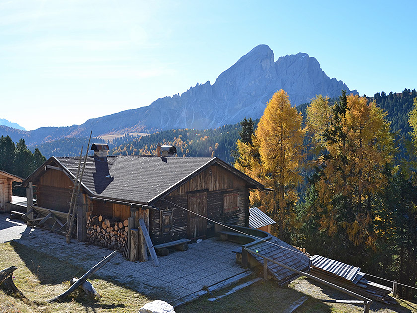 After the short descent, the path turns right and crosses a wooded slope heading north-east. Finally, our path curves to the left and leads us out of the forest. We reach open meadowland and pass a fence. Shortly after the fence, we come to a cross-path and turn left onto it (signpost “Ütia Pecol, Mauererberghütte”). The cart track leads us alternately through sparse woodland and across sun-drenched terrain, past small wooden huts, heading north-west. After a 40-minute walk, we finally reach the Pecol Hut (Ütia Pecol, 1,951 m). Immediately after the Pecol Hut, we turn diagonally right and follow the meadow path uphill towards the Maurerberg Hut (Trail No. 2).
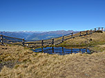
 The narrow meadow path winds its way up to a gate. After the gate, we follow the path up to a cart track, which we follow to the right for a short distance to a watering hole. There we come across a signpost and turn left onto the direct route 2B to the Maurerberg. This takes us uphill in a northerly direction and after a few minutes we come to a cross-path. We cross the cart track, thus staying on the path, and shortly afterwards return to the track. Now we turn left and follow the cart track north-westwards. We pass a small settlement of wooden huts, walk through a short stretch of sparse woodland and then come to two more wooden huts. In front of the huts, we turn right and walk up across the meadow to a red-and-white marker.
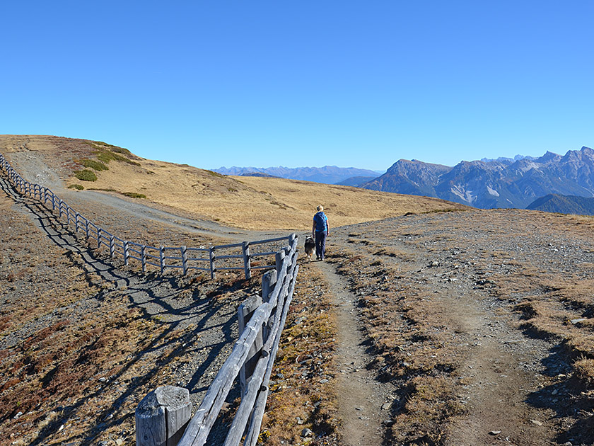 There, keeping to the left, we turn onto a meadow path which leads us uphill in a long, sweeping right-hand bend. Finally, we cross the southern flank of the Alfreider Joch in an easterly direction and reach the broad ridge of the Maurerberg. Once on the ridge, we meet the path coming up from the Maurerberghütte. We turn left and follow the gentle ridge upwards in a north-westerly direction. In doing so, we almost imperceptibly cross the barely pronounced Alfreider Joch (2280 m), a secondary summit of the Maurerberg. Shortly afterwards, we come to a fence and pass it on the right through a gap. We then follow the broad ridge, keeping to the right of the fence, with some ups and downs towards the Maurerberg. After a final short climb, we reach the huge summit cross of the Maurerberg (2332 m) after a walking time of 2 hours.
 We return via the Alfreider Joch along the same route to the junction for the Pecolhütte. We now leave this to our right, continue straight ahead and hike down in a south-easterly direction to the Maurerberghütte (2157 m). Looking towards the valley, we come across a signpost (“Pe de Börz”) to the left of the hut terrace. From there, we follow a meadow path southwards down the grassy slope. This eventually curves to the left and joins a wide track. We now stay on the track and walk down it through two bends. After a third bend, we ignore two sharp right-hand turn-offs. At the next junction, we keep to the right towards Pe de Börz and walk along the wide forest track in a south-westerly direction back to the car park (1,862 m).
Ütia Pecol (Pecolhütte) (1951 m), Tel. +39 335 7878777. Open from June to mid-October.
Maurerberghütte (2157 m), Tel. +39 0474 520059. Open from late May to mid-October.
| Elevation | Time | Total | Destination | ||
|---|---|---|---|---|---|
| 1862 m | - 1951 m | + 0:40 | 0:40 | Ütia Pecol | |
| 1951 m | - 2332 m | + 1:20 | 2:00 | Maurerberg | |
| 2332 m | - 2157 m | + 0:35 | 2:35 | Maurerberghütte | |
| 2157 m | - 1862 m | + 0:55 | 3:30 | Pe de Börz | |


