

 Tuxer Alpen
Loassattel (1675 m) – Kuhmesser (2246 m) – Kellerjochhütte (2237 m) – Kellerjoch (2344 m) – Gartalm Hochleger (1856 m) – Loassattel (1675 m)
Mostly moderate, but also challenging mountain hike in the summit area of the Kellerjoch with short sections secured by wire ropes. From the Loassattel, the ascent to the Kuhmesser follows narrow and steep paths. The route onwards to the Kellerjochhütte leads partly over stony ground. After the Kellerjochhütte, you must climb over three rocky steps secured with wire ropes. The alternative descent via Gartalm leads along narrow paths that are stony in places. Sure-footedness and a head for heights are required for the ascent of the Kellerjoch.
Take the Munich–Innsbruck motorway to the Schwaz exit. Cross the Inn bridge and turn right at the roundabout. After the Schwaz swimming pool, keep left at the roundabout towards Pillberg. Drive through Pillberg and Hochpillberg and continue towards Grafenrast. After a left-hand bend just before the Pillberg car park, turn sharply right towards Gasthof Loas. Please note! The parking meter is located on the left-hand side immediately after the turn (parking fee €4, as of 2025). Drive up the unpaved track past Gasthof Loas to the Loassattel and park your car at the hiking car park by the Gamssteinhaus.
The Loassattel cannot be reached by public transport. If travelling by train and bus, Grafenast is a good starting point. You can reach it from Schwaz via Regio-Linie 8 (Pillberg Hotel Frieden stop, for timetable information). From there, it’s a 10-minute walk to the chairlift valley station, the ascent to the Hecherhaus and just under an hour to the hut (350 metres of elevation gain). Without the chairlift, the ascent to the Kellerjoch Hut from Grafenast takes 3 hours (1,000 metres of elevation gain).
47.30001994, 11.76398439
Anzeige
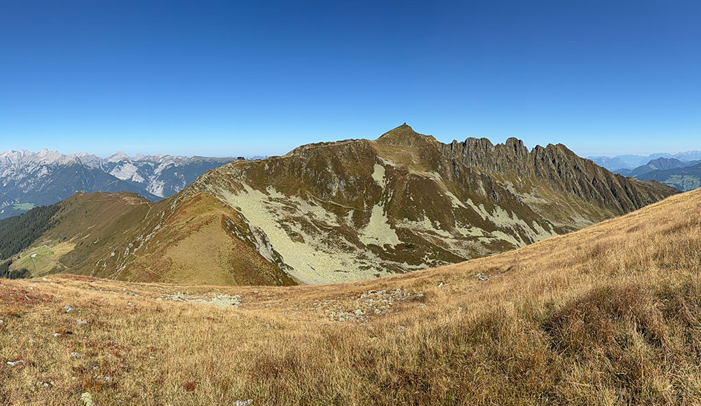
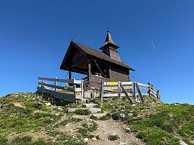
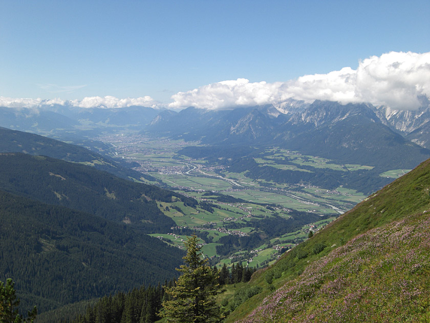
Due to its prominent position on the edge of the Inn Valley, the Kellerjoch feels like you are surrounded by a gigantic panoramic backdrop. From its small summit chapel, the view stretches from the Karwendel over the Rofan to the Zillertal and Stubai Alps. Without the use of lifts, the quickest way to reach the Kellerjoch is from the Loassattel. From the high-altitude hiking car park, the ascent via the Kellerjochhütte takes about 2½ hours. Along the way, you can even tackle a second summit via the Kuhmesser. After the Kellerjoch Hut, there are a total of three rock steps secured with wire ropes to negotiate on the way to the summit. An alternative descent route is via the Gartalm. This leads from the summit down through a beautiful cirque to the snack bar. On the eastern side of the Kuhmesser, and with a short climb back up, the route from the Gartalm eventually returns to the Loassattel.
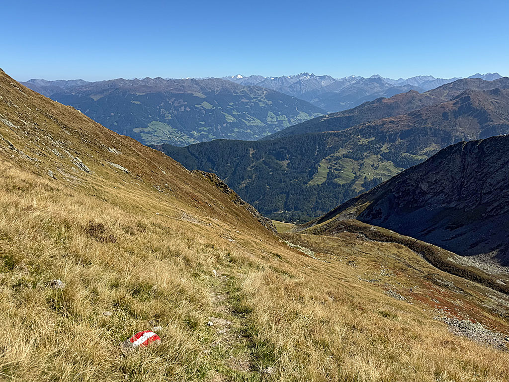
 With a view to the north-east, we slip through a turnstile at the Loassattel car park (1,675 m) near the Gamssteinhütte. We then gain our first few metres of altitude via a series of hairpin bends. After a good 5 minutes, we reach a signpost. Here we continue straight ahead (signpost “Liftstation Hecher, Kellerjochhütte”) and, following a left-hand bend, reach a wooded area. In the woods we come across another signpost. Here we turn right towards Kuhmesser and follow a root-covered path upwards in hairpin bends. After the steep switchbacks, the woods thin out and we enter an open slope. Our path then winds its way uphill across the slope, which is covered in grass and berry bushes, continuing in a north-easterly direction.
 A short while later, we come to a row of trees, but we soon leave them behind. In the sun-drenched terrain, we reach a rest area with a wooden bench. On the increasingly stony path, we approach the Kuhmesser via further steep switchbacks. At its summit ridge, we finally come across a signpost. Now there are two options: either we turn diagonally left and cross past the west side of the Kuhmesser on the stony path (signpost ‘Kellerjochhütte’). Or we walk past the signpost on the right (the Kuhmesser is not signposted at this point), climb over a few boulders and follow the steep but distinct path up to the summit cross on the Kuhmesser (2246 m).
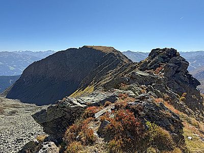
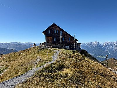
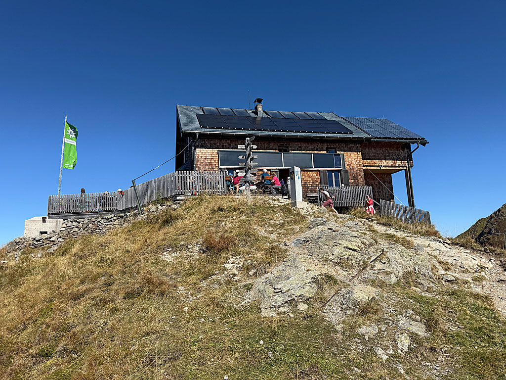 With a view of the Inn Valley, we descend from the summit cross on the Kuhmesser in a north-westerly direction via switchbacks to a meadow saddle. There we come across the path that crosses past the western flank of the Kuhmesser. Heading north, we make our way towards the next rise in the ridge and veer left before reaching it. We then traverse the western side of the ridge on a stony path. As soon as the Kellerjoch Hut comes into view above us, our path veers to the right and leads us up to a saddle. There we turn left and follow the ridge to the Kellerjoch Hut (2,237 m). From the hut, we can already make out the small chapel perched high above the Inn Valley on the summit of the Kellerjoch.
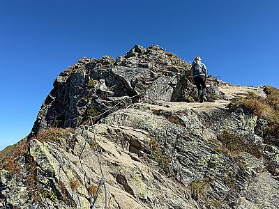
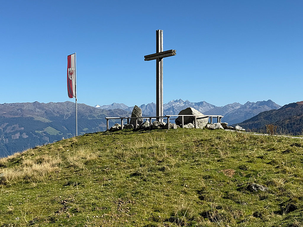
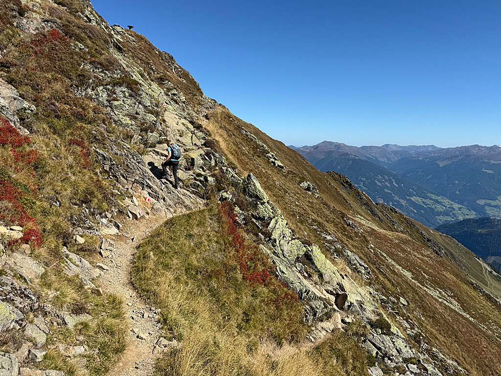 We walk past the annexe of the Alpine Club hut, keep to the right of the ridge and head towards a rugged slope. At its foot, we turn left, follow the wire rope safety line across the scree and then climb in a right-hand arc over rocky ground to a hillock. We then stay on the right-hand side of the ridge again and reach the next steep section. We negotiate the flat rock along the wire rope safety line and using the steps. Finally, we face a last ascent equipped with wire ropes. After the rocky section with good handholds, we find ourselves back on the summit ridge and come across the signposted turn-off to the Gartalm. We leave this to the right for now and hike up to the summit chapel at the Kellerjoch (2344 m).
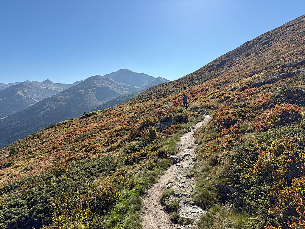
 From the chapel, we descend along the route we took on the way up to the signposted junction on the ridge. Here we turn left and follow the signs towards the Gartalm. A narrow, partly stony path leads us downhill initially in a south-westerly direction. The path later turns southwards in a wide right-hand bend. At the edge of a scree slope, we come across the path coming down from the Kellerjochhütte. We now turn left onto the traverse path and continue our descent in a south-easterly direction. The stony path winds its way through the undulating terrain and soon we can see the Gartalm below us. With our destination and the Zillertal Alps in view, we head towards the snack bar.
 One hour after setting off from the summit chapel, we stand on the terrace of the Gartalm (1,860 m). For the return journey to the Loassattel, we head towards the Gartalm pond. With a view of the pond and the large wooden cross, which stands on a grassy hill on the other side, we walk to the right around the small body of water. We then head towards the wooden cross. Just before the cross, a small path branches off the wide track towards the Loassattel. Keeping slightly to the right, we turn onto the meadow path and walk downhill towards the south. After a left-hand and a right-hand bend, we cross the eastern flank of the Kuhmesser on a stony path.
 After the traverse, the path turns slightly to the right and we tackle a slight uphill section heading south-west. As soon as we approach a patch of woodland, the terrain levels out again. Finally, we enter the shady mountain forest. On the now fairly flat path, we walk through the woodland heading west. After a bench, the mountain forest thins out and we cross a marshy section of the path via wooden planks at a watering hole. We then head towards a signpost, where we meet the ascent path. We turn left and descend along the familiar route to the car park at the Loassattel (1,675 m) (1 hour from the Gartalm).
Gartalm (1860 m), Tel. +43 (0)676/32 25 599. Open daily from 10.00 am from the beginning of June to mid-October.
Kellerjochhütte (2237 m), OeAV Schwaz, Tel. +43 (0)664/2202612. Open from late June to early October.
| Elevation | Time | Total | Destination | ||
|---|---|---|---|---|---|
| 1675 m | - 2246 m | + 1:30 | 1:30 | Kuhmesser | |
| 2246 m | - 2237 m | + 0:30 | 2:00 | Kellerjochhütte | |
| 2237 m | - 2344 m | + 0:30 | 2:30 | Kellerjoch | |
| 2344 m | - 1860 m | + 1:00 | 3:30 | Gartalm | |
| 1860 m | - 1675 m | + 1:00 | 4:30 | Loassattel | |


