

 Mangfall Mountains
Tegernsee railway station (764 m) – Neureuth (1261 m) – Gindelalmschneid (1335 m) – Kreuzbergalm (1223 m) – Sagfleckl (1178 m) – Baumgartenschneid (1448 m) – Riederstein (1207 m) – Riederstein mountain inn at Galaun (1060 m) – Tegernsee railway station (764 m)
Overall a moderately difficult mountain hike, leading along wide forest tracks as well as small meadow paths and partly uneven forest trails. Between the Kreuzbergalm and the Sagfleckl, you will cross a steep wooded slope on the western side of the Kreuzbergköpfl. Take care in this area, especially in wet conditions. Sure-footedness is essential for the circular route described.
Ideally, you should travel to this tour by the Bayerische Regiobahn. There are a few paid parking spaces at Tegernsee station. Day tickets are only available there at weekends; on weekdays, the maximum parking time is 3 hours. Alternatively, you can park at the Schießstätte hiking car park (view on Google Maps). From there, the tour begins with a descent to the Maria Schnee Chapel. After the Alpbach Bridge, leave Max-Josef-Straße, keeping to the right towards Neureuth. Passing the Neumüller Chapel, head up to Lieberhofweg and, at a junction, turn sharply right into Neureuthstraße. Follow this to the Neureuth car park and from the car park, walk briefly uphill along the tarmac road. Behind a white house, turn left into Kobelweg and continue along this to Bayernweg or Sommerweg. Take one of these two paths to Neureuth and continue as described.
From Munich Central Station, take the Bayerische Regiobahn to Tegernsee. The circular route described starts directly at the station (timetable and booking).
47.71406406, 11.75749004
Anzeige
An extended loop around Lake Tegernsee: As standalone summit destinations, the Gindelalmschneid and the Baumgartenschneid can be reached fairly quickly. Visiting both mountains turns it into an extended tour. Starting in Tegernsee, the route covers just under 16 kilometres and 900 metres of elevation gain. Along the way, this circular route offers several places to stop for refreshments: with the Berggasthof Neureuth, the Kreuzbergalm and the Berggasthof Riederstein am Galaun, there are three refreshment stops right on the route. With a little more time, you can even reach another mountain hut, the Gindelalm. In addition to the culinary highlights, this hike offers mountain lovers a wonderful view of Schliersee, Tegernsee and the Bavarian Pre-Alps. Incidentally, the circular route described here is particularly well suited to leaving your car at home.
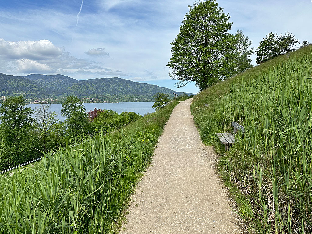 We leave the forecourt at Tegernsee railway station (764 m), turn left at the crossroads and walk uphill along Klosterwachtstraße in a north-westerly direction. After the first houses, we turn diagonally right onto Nigglweg. The tarmac footpath leads us past a wayside shrine. Before the entrance to the Hotel “Das Tegernsee”, we veer left and cross a meadow slope. As we cross, we enjoy the beautiful view of Lake Tegernsee. After the hotel’s underground car park, we keep diagonally to the right and head into the mountain forest along a wide path. After a few steps, we reach a cross-path and turn left onto it. After a few metres, we come to a fork in the path and take the right-hand (upper) path.
 Continuing north-west, we walk uphill and shortly afterwards reach a signposted junction. Here, you could turn right onto the Bayernweg and climb up to Neureuth. We opt for the Sommerweg and continue straight ahead. After a right-hand bend, we keep slightly to the right at a fork. We thus take a small forest path which subsequently leads us uphill in a series of hairpin bends. Later, we come to a cross-path and turn sharply left onto it. After a few metres, we leave the forest track by keeping to the right and continue the ascent on the small Sommerweg. The often root-covered path winds its way uphill in short serpentines. After a right-hand bend and a long straight stretch, we come to a signpost.
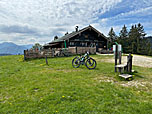
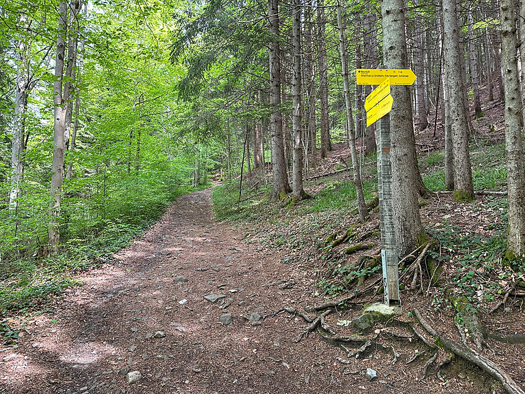
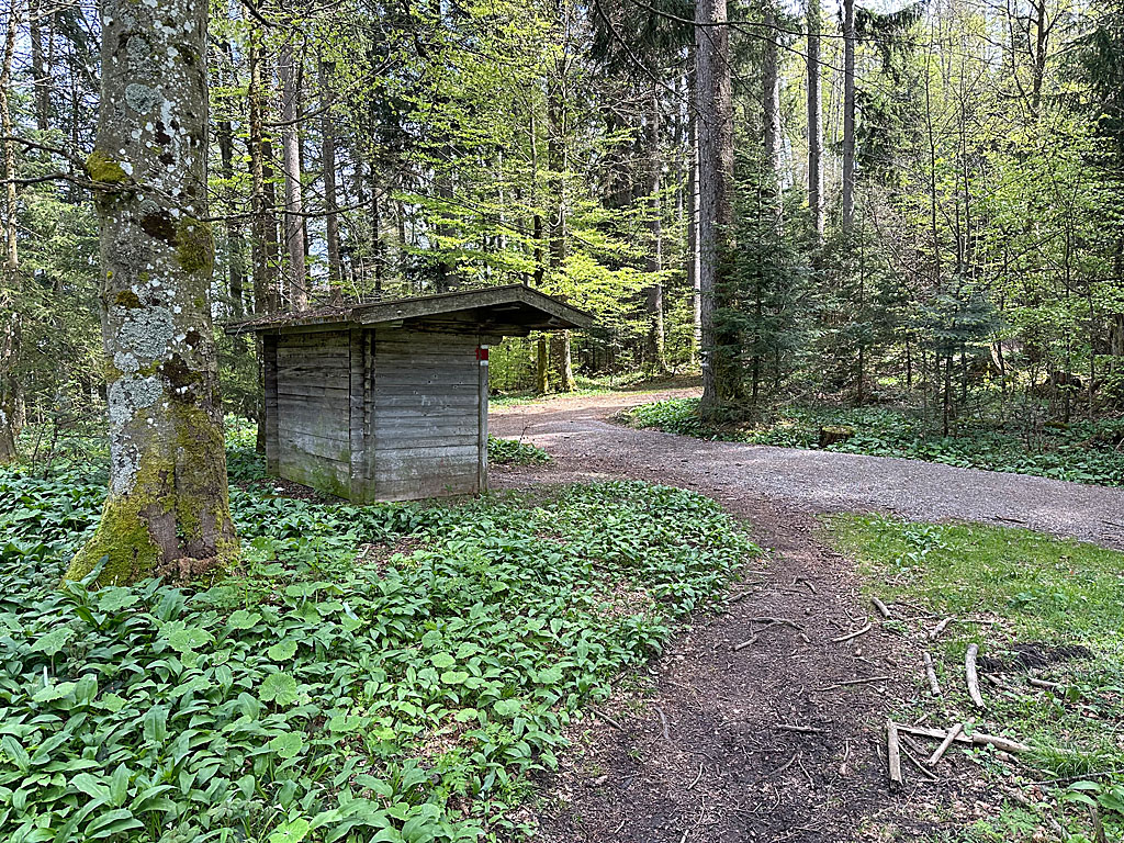
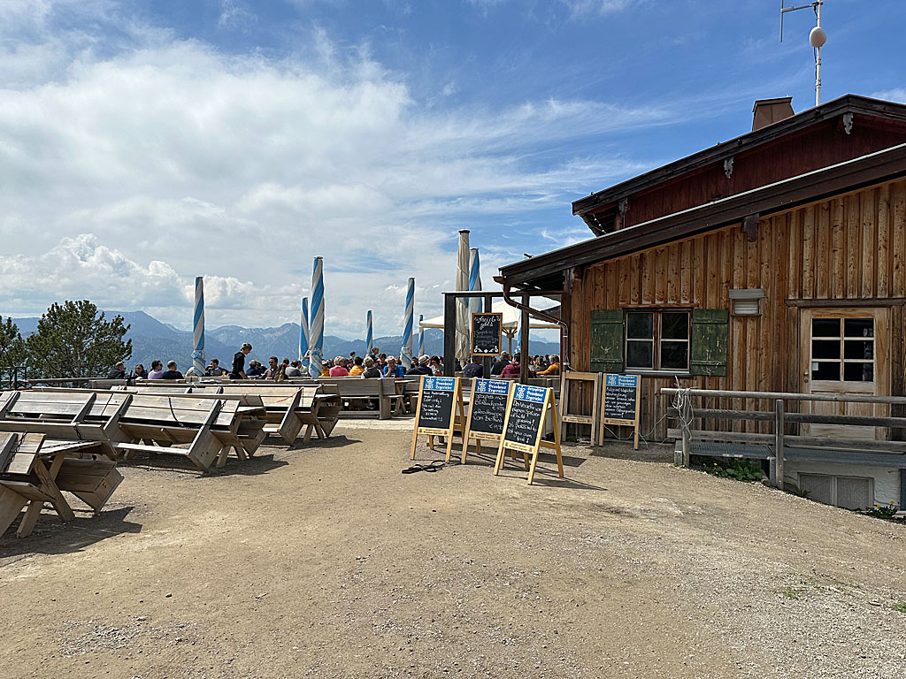 At this point, the Bayernweg joins our Sommerweg. We turn left, continue uphill and pass a shelter. After the shelter, we come to the Westerhofweg, which we join by keeping to the left. The wide forest path leads us north-eastwards on a moderate incline. At the edge of the forest, we pass through a culvert under the pasture fence and walk along the grassy ridge towards Neureuth. At a cattle grid, we ignore the turn-off to Gasse on the left and, after a total walking time of 1½ hours, reach the Neureuth Chapel and the Neureuth Mountain Inn (1,261 m). To continue directly, we walk past the inn on the left and maintain our general direction at a signpost.
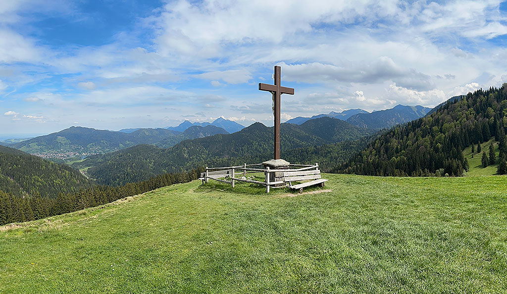
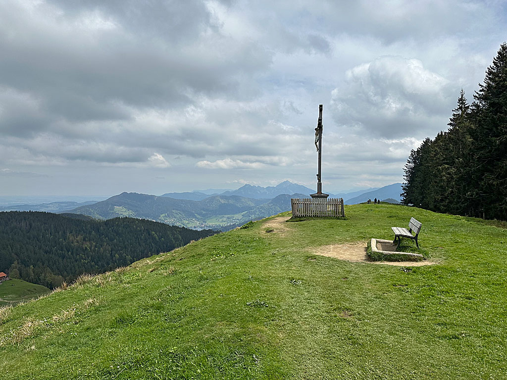 We also ignore the second turn-off to Gasse and reach a wooded area. From there, we stay on the wide path, which leads us north-eastwards through shady and occasionally open mountain woodland on a very gentle incline. As soon as we reach the edge of the forest, we cross the pasture fence and enter the extensive meadowland of the Gindelalm. Shortly after crossing, we come across a signpost. Anyone wishing to stop for refreshments at the Gindelalm should continue straight ahead here. To take the direct route to the Gindelalmschneid, we turn right. In a sweeping left-hand bend, we follow the initially steep hiking trail up to the grassy ridge of the Gindelalmschneid (1,335 m) with its huge summit cross (30 minutes from Neureuth).
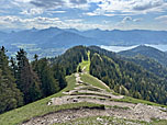
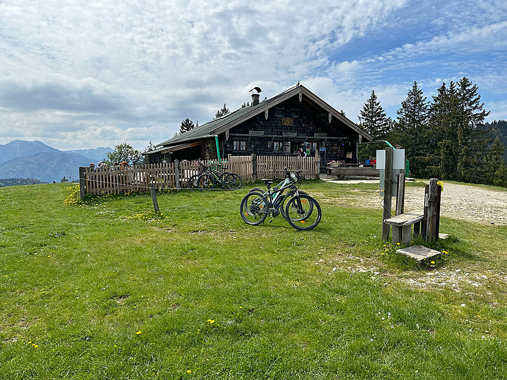 At the summit cross, we continue straight ahead, staying on the ridge. Our path curves to the right and, after a section lined with wooden planks, leads us to a crossing. After the pasture fence, a stepped path takes us down into a grassy hollow, sometimes along the edge of the forest and sometimes through the woods. There we come to a signpost and turn right towards the Kreuzbergalm. We hike up a steep counter-slope across a grassy hillside to the beautifully situated Kreuzbergalm (1,233 m) (30 minutes from the Gindelalmschneid). To the right of the alpine hut, the track begins, leading us back downhill in a left-hand bend. At the bottom, we keep to the right at the junction and head south-west towards the mountain forest.
 Just before the edge of the forest, we ignore a turn-off to the left and head into the woods. Immediately after the cattle grid, we turn left towards the Baumgartenschneid. A narrow forest path leads us to the western side of the Kreuzbergköpfl, which we subsequently cross. In places, the wooded terrain to our right is steep. So, careful walking is required on this bumpy little path. After the traverse, the path leads us on to the Sagfleckl, which forms the saddle between the Kreuzbergköpfl and the Baumgartenschneid. After a shelter, we turn right and take the summit path to the Baumgartenschneid. The narrow path leads us uphill towards the south and later winds its way round several bends.
 The higher we climb along the sometimes bumpy path, the rockier the surrounding terrain becomes. After a rocky outcrop, our path turns to the right (south-west). We then come to a fork and take the right-hand (upper) path. This leads us along a wooded ridge to a pasture fence. After crossing it, we enter the meadowland of the Baumgartenalm. To our left, we can already see the summit cross of the Baumgartenschneid. We walk up towards the buildings of the Baumgartenalm, stay a little way below the huts and head towards the summit. To the right, we look down from the ridge of the meadow towards Lake Tegernsee. A steep and stony path finally takes us up to the Baumgartenschneid (1,448 m) (1¼ hours from the Kreuzbergalm).
 With a view of Lake Tegernsee, we leave the Baumgartenschneid via its western side. We hike down to a mountain ridge via many tight hairpin bends. There, before the next ascent, we veer off to the right and cross past the Rohrkopf. We reach the ridge again and, at a tree marked with a red arrow, keep to the right once more. In several hairpin bends, the path leads us downwards along the red-and-white markings. Later, we come to a junction right by the wooded ridge. Here, we ignore the first turn-off to Tegernsee on the left and continue straight ahead. After a short descent and a left-hand bend, we come to a second turn-off at the foot of the Riederstein.
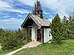
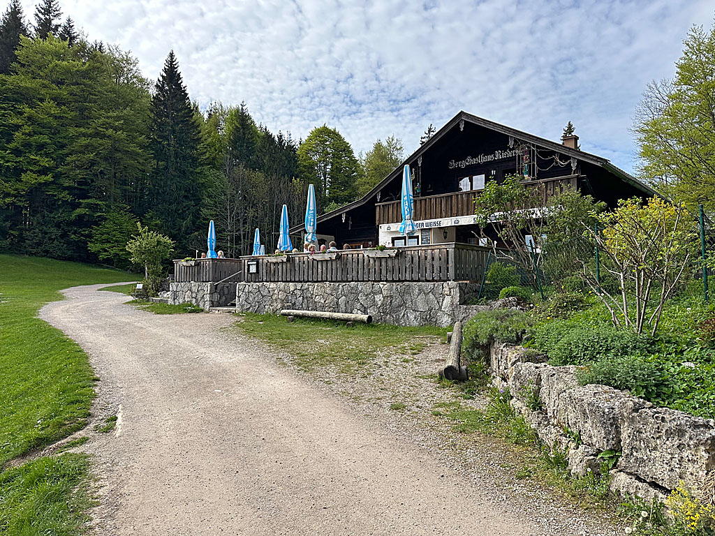 At this junction, we will continue the descent to Tegernsee in a few minutes. First, however, we wish to pay a visit to the Riederstein Chapel; we maintain our general direction and climb the numerous steps up to the little church (45 minutes from Baumgartenschneid). From the Riederstein (1,207 m), we return to the junction, turn right and walk down the countless steps of the Way of the Cross. As soon as we come to a track, we keep to the right and shortly afterwards arrive at the Riederstein mountain inn on the Galaun (1060 m). From there, we follow the wide path straight on, enter the mountain forest and reach another junction just beyond the edge of the woods.
 There, we choose the descent via the Schießstätte and head slightly to the right. After a steeper descent, we reach a junction. Here we turn slightly to the left, taking the lower of the two left-hand paths. After a short flat section, there is a moderate climb. Shortly afterwards, the path curves to the right and leads us down a steeper slope. In a left-hand bend, we cross a clearing and then reach a signposted junction.Here we leave the wide forest track, keeping to the right and taking the path. A small forest track leads us first downhill and then, without losing altitude, out of the valley above the Alpbach stream.
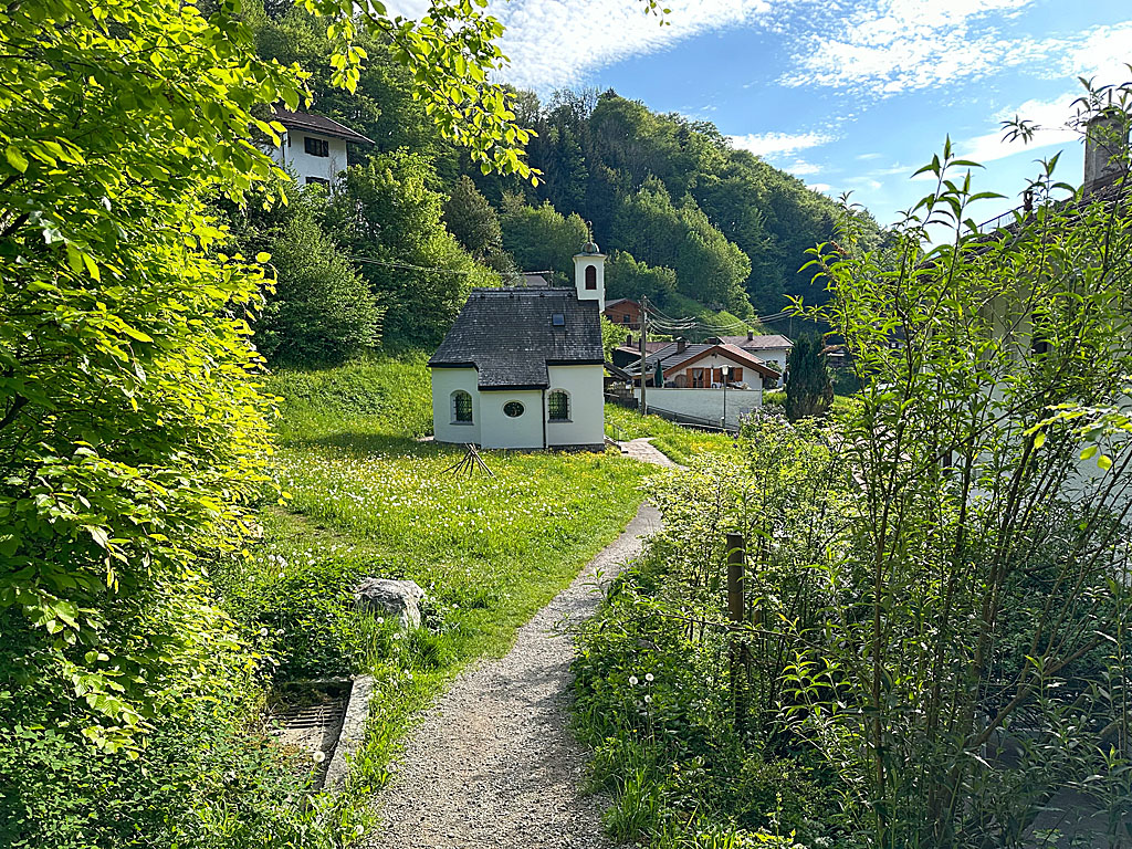 After two wooden bridges, our path joins a wider track, which we follow steeply downhill again. We ignore the turn-off to the Alpbach car park and continue straight ahead. In front of the Schießstätte inn, we come to Schützenstraße, which we cross. A stepped path then leads us down to the Maria Schnee chapel. After the little church, we turn slightly left onto Max-Josef-Straße, which takes us over the Alpbach. We now stay on Max-Josef-Straße, which eventually brings us to Bahnhofstraße. We turn right and walk back to Tegernsee railway station (764 m, 1½ hours from the Riederstein).
| Elevation | Time | Total | Destination | ||
|---|---|---|---|---|---|
| 764 m | - 1261 m | + 1:30 | 1:30 | Neureuth | |
| 1261 m | - 1335 m | + 0:30 | 2:00 | Gindelalmschneid | |
| 1335 m | - 1223 m | + 0:30 | 2:30 | Kreuzbergalm | |
| 1223 m | - 1448 m | + 1:15 | 3:45 | Baumgartenschneid | |
| 1448 m | - 1207 m | + 0:45 | 4:30 | Riederstein | |
| 1207 m | - 1060 m | + 0:15 | 4:45 | Berggasthaus Riederstein am Galaun | |
| 1060 m | - 764 m | + 1:15 | 6:00 | Bahnhof Tegernsee | |


