


 Tux Alps
Patscherkofel cable car valley station (1015 m) – Lanser Alm (1718 m) – Patscherkofel mountain hut (1964 m) – Zirbenweg – Boscheben (2030 m) – Patscherkofel (2246 m) – Patscherkofel mountain hut (1964 m) – Lanser Alm (1718 m) – Patscherkofel cable car valley station (1015 m)
Overall, a moderately difficult mountain hike. The approach to the Lanser Alm is easy and follows mainly wide forest tracks, with a short stretch on a tarmac road before Heiligwasser. Only just before the Lanser Alm does the wide track give way to a narrow forest path, which eventually leads up to the Patscherkofel mountain hut. The onward route via the Zirbenweg to Boscheben is also straightforward. The ascent to the summit from Boscheben via the north-east ridge leads through partly rocky and scree-covered terrain and requires a minimum of sure-footedness. The descent from the summit via the wide standard route to the Patscherkofelbahn mountain station is easy.
Motorway Munich – Innsbruck, Innsbruck Mitte exit. After the exit, continue straight ahead at the roundabout towards Igls and via Vill and Igls to Römerstraße. Turn left and then park your car on the right-hand side at the large car park for the Patscherkofelbahn (€6 parking fee, as of 2024). If you take the Patscherkofelbahn, the parking fee is included in the ticket price.
Take the train to Innsbruck. From Innsbruck, bus line J runs every 10 to 15 minutes towards the Igls Patscherkofel Talstation stop (Römerstraße). From the main station, you will usually need to change buses once. Click here for timetable information.
47.22179422, 11.42456889
Anzeige
Thanks to its prominent position between the Inn Valley and the Wipp Valley, the Patscherkofel is considered one of the most beautiful panoramic mountains around Innsbruck. From the Patscherkofelbahn mountain station, it takes an hour to reach the summit. Those wishing to hike up the Patscherkofel without using the cable car must expect it to take considerably longer and require significantly more effort. It takes around 2¾ hours just to walk from the valley station to the mountain station. You will reach the Lanser Alm after 2 hours. At the rustic snack bar, you can fortify yourself for the rest of the journey in a spot with stunning views. From the Lanser Alm, it is about a 45-minute walk to the mountain station. There, for the summit climb of just under an hour via the wide standard route, there is a very attractive alternative. This leads first along the varied Zirbenweg to the Almgasthaus Boscheben. From Boscheben, the route finally ascends via a beautiful mountain path to the expansive summit. Compared to the standard route, an additional walking time of 30 minutes should be expected here. Back at the mountain station, you can finally decide whether to tackle the descent via the Lanser Alm or take the Patscherkofelbahn down to the valley station to spare your knees.
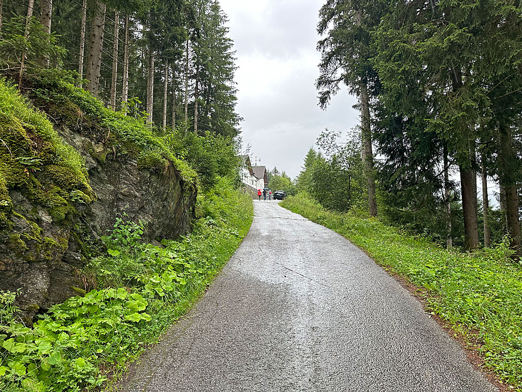 We begin our hike on the Heiligwasserweg, which leads uphill in a southerly direction between the valley station and car park P1 (signposted ‘Lanser Alm’). We pass two small chapels, enter a wooded area and come to a crossroads. Here we turn left and follow the tarmac road uphill. We pass the Eisbergbründl and, after the watering hole, reach the Teehüttn. Immediately after the small hut, we keep slightly to the right at the junction and head back into the mountain forest. After a right-hand bend, we head towards Heiligwasser and take a sharp left just before the Alpengasthaus. We have now left the tarmac behind us and follow a forest track uphill in a north-easterly direction.
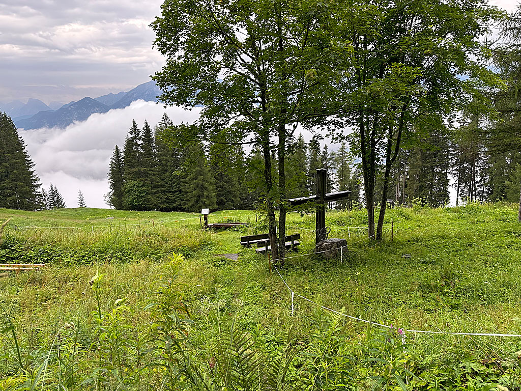 After a gentle right-hand bend, the path forks and we follow the bend to the right. Later, we pass under the cable car line and come to another fork. Here too, we stay on the wide forest track and turn left. We then pass under the cable car line once more and reach a clearing. There we come to a fork with a signpost. We continue straight ahead, staying on the forest track. This takes us past the foot of the Igler Alm. After the meadow, we re-enter the mountain forest and, after a right-hand bend, reach the upper end of the Igler Alm. Here we come to a lovely viewpoint with benches, a drinking trough and a large cross.
 Immediately after the rest area, the path forks and we take the left (upper) route. Shortly after the edge of the forest, our forest track turns left and takes us eastwards to another fork. At this point, we turn left onto a narrower forest track, which leads us uphill in hairpin bends. The forest track eventually narrows into a path that leads us to the Ramsbach stream. After the small wooden bridge, we reach the Lanser Alm (1,718 m, 2 hours from the valley station) via a stony forest path. To continue, we head right, keeping the Lanser in view, pass an unusual watering trough and, at a left-hand bend, turn right onto the forest path leading to the Patscherkofel mountain hut. We then skirt a meadow along a wooden fence.
 After the fenced-in meadow, our path takes a left-hand bend and we head into the forest. In the mountain forest, the narrow path leads us uphill in a south-easterly direction via numerous hairpin bends. Later, we cross the Ramsbach again and, after a traverse heading south-west, reach a crossing at the pasture fence. Once past this, the forest gradually thins out and we reach an open meadow slope. There, we head slightly to the right and follow a slope up to the Patscherkofel mountain hut (1,964 m, 45 minutes from the Lanser Alm).
If you now wish to take the shortest route to the summit, continue straight on from the refuge and turn left onto the summit path before the valley station (just under 1 hour from the refuge to the summit).
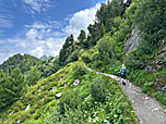
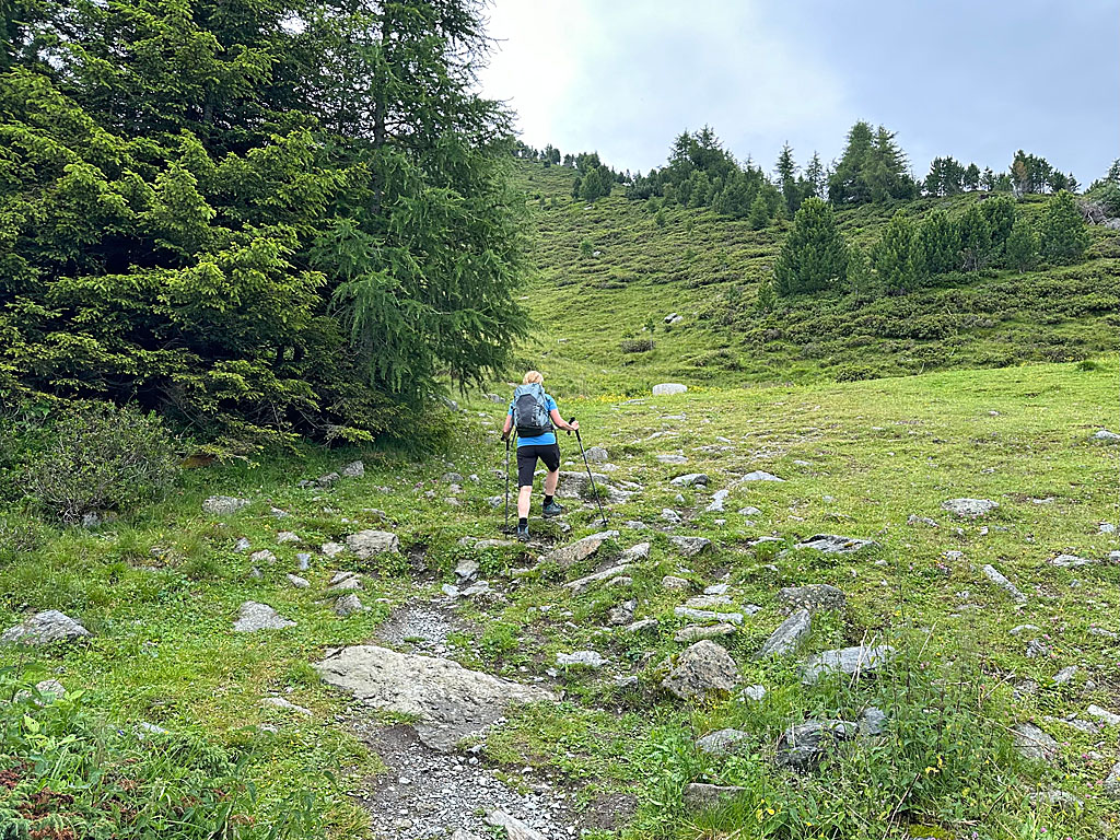
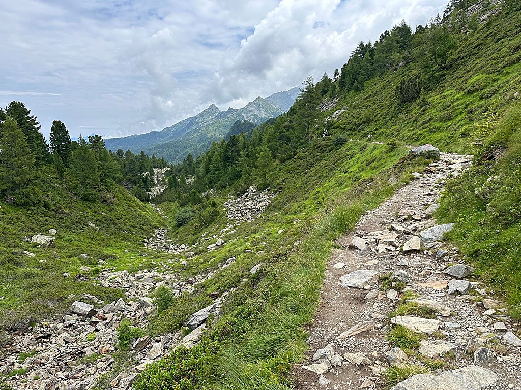 For the more interesting route via Boscheben, turn left immediately at the refuge and take the Zirbenweg. We pass a small gate and then the wooden gate of the Zirbenweg. This is followed by an ascent along a stony path, accompanied by wonderful views of the Inn Valley. Later, the terrain levels out and we come across a signpost in front of a small hut. There, we keep to the right towards the Glungezer Hut and Boscheben. Above a valley gorge filled with boulders, we head south-east towards a slope strewn with boulders. After the rocks, the winding path takes us to a small Swiss stone pine forest. After the old Swiss stone pines, the path turns left and then leads us eastwards.
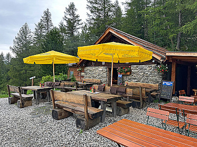
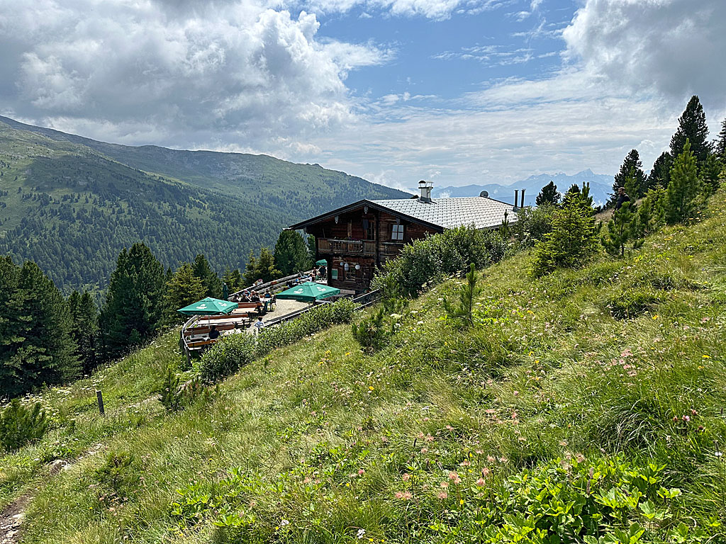 After a gentle left-hand bend, we pass a narrow section equipped with a rope handrail. The terrain then opens out and we reach a saddle with a wooden cross. There, we turn sharply right and catch sight of the Boscheben Alpine Inn (2030 m), which is just a few steps away (45 minutes from the Patscherkofel refuge). To take the direct route to the summit, we take the path that leads up the ridge to the right of the alpine hut (signposted “Jochleitensteig”). We head south-west towards a hillock adorned with a cross. After a right-hand bend, we climb over a rocky step at its foot and ascend via switchbacks. We then traverse past the north face of the Patscherkofel and head straight for the transmission tower.
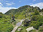
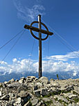
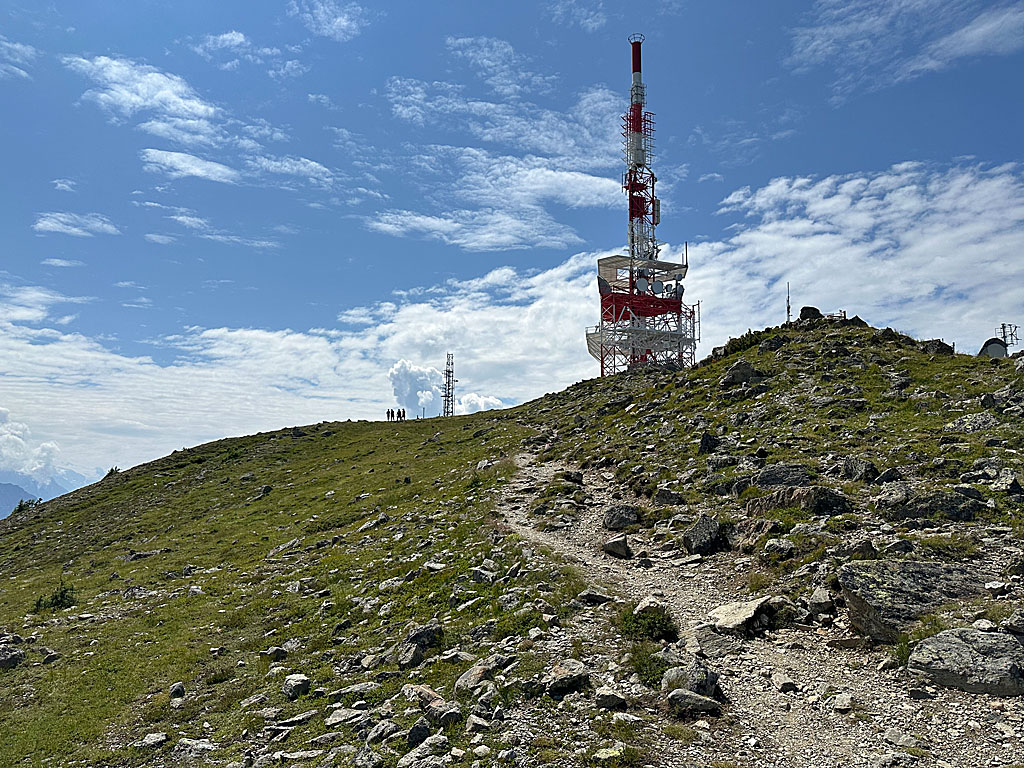 Shortly afterwards, we reach a saddle. Here we leave the Jochleitensteig and head diagonally to the right towards the Gipfelstube and the summit of the Patscherkofel. The path forks shortly afterwards. The right-hand path leads up to the ridge, the left-hand one to a stony ramp. Both paths rejoin after the ramp and we head towards the summit slope. We ascend in switchbacks to the spacious summit plateau and veer left before the transmission tower. We pass a lovely viewpoint with a bench and then head towards the Gipfelstube. Just before the Gipfelstube, we turn right and walk across the wide summit plateau to the huge wooden cross on the Patscherkofel (2,246 m) (45 minutes from Boscheben).
From the summit cross, we head back to the summit hut and pass it on the left. From there, we stay on the wide track, which leads us downhill in numerous hairpin bends. The descent is made all the more enjoyable by wonderful views of the Wipptal valley, the Stubai Alps with the Serles, and the Tux Alps. After just under 40 minutes, we reach the valley station. From here, we can take the Patscherkofelbahn down into the valley (downhill fare €19.50, as of 2024) or hike down to the valley station in around 2 hours via the familiar route over the Lanser Alm.
| Elevation | Time | Total | Destination | ||
|---|---|---|---|---|---|
| 1010 m | - 1718 m | + 2:00 | 2:00 | Lanser Alm | |
| 1718 m | - 1964 m | + 0:45 | 2:45 | Schutzhaus Patscherkofel | |
| 1964 m | - 2030 m | + 0:45 | 3:30 | Boscheben | |
| 2030 m | - 2246 m | + 0:45 | 4:15 | Patscherkofel | |
| 2246 m | - 1964 m | + 0:45 | 5:00 | Bergstation Patscherkofelbahn | |
| 1964 m | - 1718 m | + 0:30 | 5:30 | Lanser Alm | |
| 1718 m | - 1010 m | + 1:30 | 7:00 | Talstation Patscherkofelbahn | |


