


 Dolomites
Seiser Alm Cable Car Mountain Station (1850 m) - Saltnerhütte (1830 m) - Tourist Trail - Schlernhaus (2457 m) - Schlern (2563 m) – Schlernhaus (2457 m) – Tierser Alpl (2440 m) – Rosszahnscharte (2499 m) – Goldknopf – Alpenhotel Panorama (2000 m) – Seiser Alm Cable Car Mountain Station (1850 m)
A hike of just over 16 km, covering an elevation gain of approximately 640 metres. The circular route follows mostly good paths, with a section in the north on a mountain track that presents no significant difficulties.
Leave the A22 Brenner motorway at the Val Gardena-Klausen-Gröden exit and continue on the SS242d and SS242 via Ortisei and Santa Cristina in Val Gardena to the Sella Pass. There is ample parking available directly at the Sella Pass Hut.
From Waidbruck-Lajen station, take bus 350 to Wolkenstein. From the Plan stop there, continue on line 471 towards Canazei to the Sella Joch Canazei di Fassa stop (for timetable information).
46.50920391, 11.75625086
Anzeige
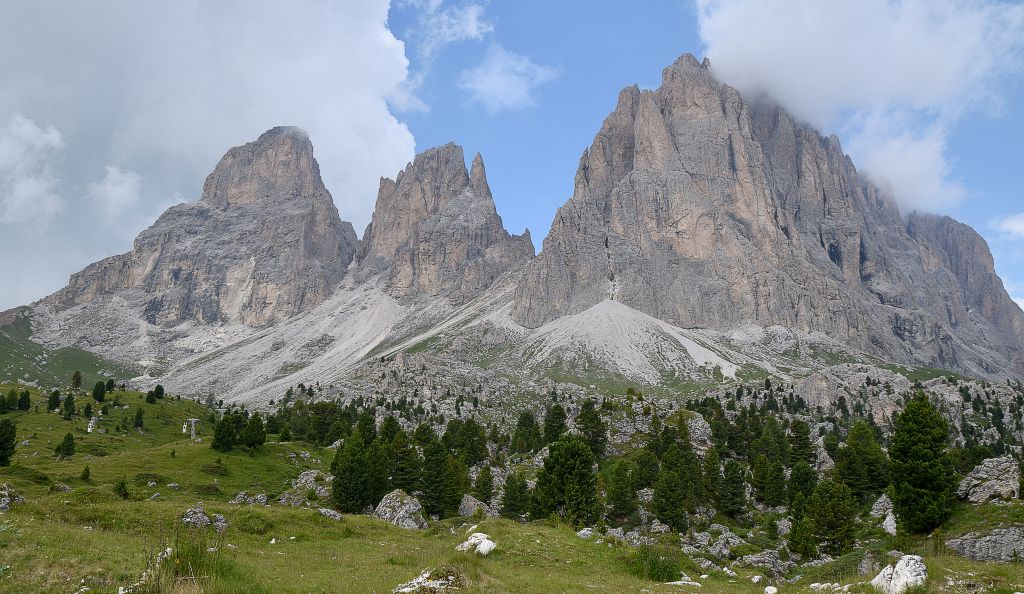
The Langkofel Group is renowned for its mighty, steeply rising rock faces. Most of the peaks, which are around 3,000 metres high, remain out of reach for hikers. Only the Plattkofel is an exception here. It can be reached via a hike from the south or via the Oskar Schuster via ferrata from the north. The infrastructure around the mighty massif is far better. The massif can be circumnavigated on well-maintained hiking trails. Numerous places to stop for refreshments enhance the tour, which also offers magnificent views of the Sella Group, the Marmolada, the Rosengarten Group and the Seiser Alm Plateau (Alpe di Siusi).
 From the car park, we start our tour on trail 526 heading north. The Comici Hut is already signposted as a 40-minute walk away. To our left, the peaks of the Langkofel Group tower above us, out of our reach. We traverse the rocky landscape with gentle ups and downs. To the south-east, the Marmolada glacier glistens in the sun; to the east, we enjoy the view of the vertical walls of the Sella Group. Behind Piz Sella, which lies ahead of us, we can now also make out the Geisler range with Sass Rigais to the north. We are not the first to arrive at the Emilio Comici Hut today. Numerous guests have already made themselves comfortable on the meadows in front of the hut. The hut warden has provided mats on which you can sit comfortably and enjoy the sun and the magnificent view of the Sella Group.
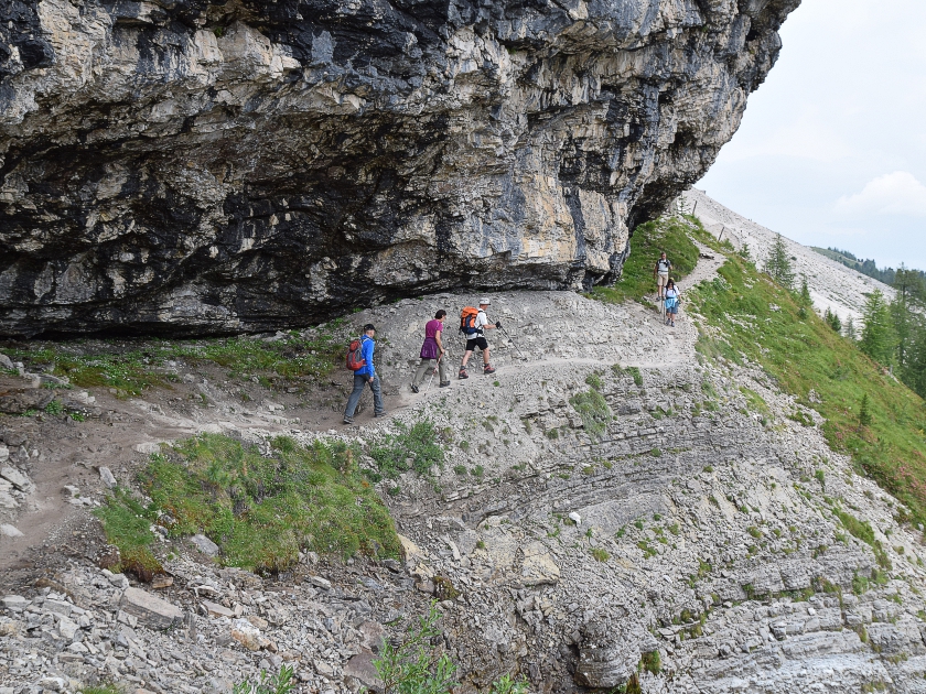 Behind the refuge, we now continue our tour westwards. We follow the signposts to the Langkofel Hut and, when in doubt, always keep to the left (trail 526A). The path, which shortly afterwards passes directly beneath the rocks, now becomes a little more challenging, but never really difficult. To the right in the valley, the houses of Sankt Christina can be seen. The elevation changes have been minimal so far. It is only at a patch of remaining snow that we have to climb a few metres again. The path now leads us through scree fields until we finally reach a junction. We keep to the left again and walk along the western side of the Langkofel towards the Langkofel Saddle.
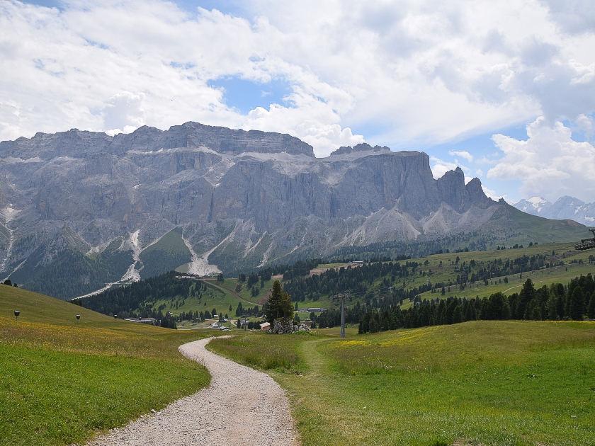
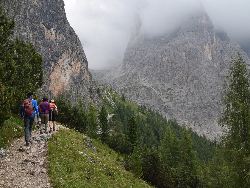 Many hikers crossing the mountain range via the Rifugio Toni Demetz hut and the Langkofel Saddle join our path here. The Langkofel Hut, situated a little way above us in the saddle, is also a popular destination. From there, the Oskar Schuster Trail leads up to the Plattkofel, which, at 2,969 metres, marks the southern side of the massif. We continue our hike westwards along Trail 527 towards the Murmeltier Hut and the Plattkofel Hut. The vast scree fields are increasingly interspersed with green vegetation. At a pass – by now we are walking through lush alpine meadows – we are greeted by two Haflinger horses. Beyond them, the view opens up to the Seiser Alm and the picturesque Rosengarten Group. Twenty minutes later, we reach the rustic Murmeltierhütte, where we stop for a short rest.
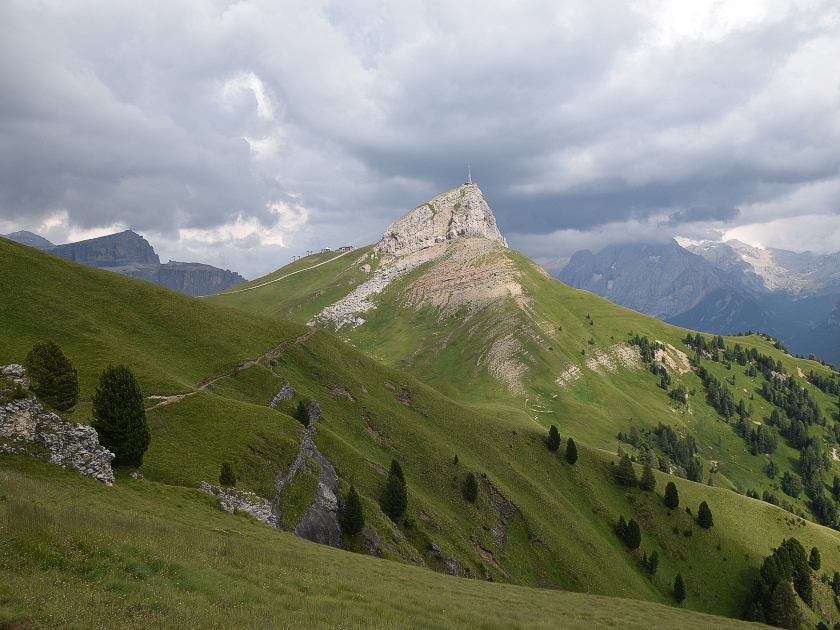
 Refreshed, we climb another 50 metres or so to the Sentiero Giro del Sassolungo, the hiking trail that circles the Sassolungo group. Gaining only a little more altitude, we continue on to the Plattkofel Hut, which is significantly larger than the Murmeltier Hut. Around 50 people can stay overnight here. From here begins the easiest route up the Plattkofel. Via ferrata climbers who have reached the summit via the Oskar Schuster via ferrata use this route for the descent. We, however, continue our tour along the flat hiking trail. A little further east, we pass the Plattkofel Alm, which lies slightly below the path. We walk on easily at a steady altitude towards the Rifugio Sandro Pertini. Time and again, we enjoy the view southwards towards the Rosengarten and Marmolada groups.
 The highlight of this section is undoubtedly the white Marmolada glacier, glistening in the sun to the right behind Col Rodella. The path, named after King Frederick Augustus, leads us first gently, then a little more steeply, towards the Friedrich-August-Hütte, also named after the Saxon king. Passing a huge wooden cow, we continue on to a small saddle. With the Sella Group and Piz Boe in view, we then head back to the starting point at the Sella Pass Hut.
| Elevation | Time | Total | Destination | ||
|---|---|---|---|---|---|
| 2175 m | - 2154 m | + 0:40 | 0:40 | Emilio-Comici-Hütte | |
| 2154 m | - 2132 m | + 2:15 | 2:55 | Murmeltierhütte | |
| 2132 m | - 2249 m | + 0:25 | 3:20 | Plattkofelhütte | |
| 2249 m | - 2300 m | + 0:50 | 4:10 | Rifugio Sandro Pertini | |
| 2300 m | - 2298 m | + 0:40 | 4:50 | Friedrich August Hütte | |
| 2298 m | - 2175 m | + 0:30 | 5:20 | Parkplatz Sellajochhaus | |


