

 Serra de Tramuntana
Lluc Monastery car park (500 m) – Es Camell (520 m) – Puig Tomir (1103 m) – Mirador de Foment de Son Amer (670 m) – Refugi Son Amer (540 m) - Lluc Monastery car park (500 m)
The circular route described here covers a good 18 kilometres and involves an elevation gain of around 850 metres. The ascent features a short, relatively easy climbing section secured by a wire rope. The route can be significantly shortened by descending via the ascent route. The descent via the eastern flank described here is partly pathless and requires a good sense of direction. Here, a step must be negotiated via easy climbing at grade I on the UIAA scale. Take plenty of water with you; the only place to stop for refreshments is at the end of the route, at the Refugi Son Amer!
From Palma de Mallorca, take the MA-13 to Inca. Then continue on the MA-2130 via Selva towards Lluc Monastery. Turn right at Coll de sa Batala and continue to the monastery complex.
39.82017738, 2.88458579
Anzeige
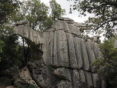
Starting from the large car park south of the monastery complex, we walk back along the MA2140 for about 250 metres and then turn left onto a tarmac road closed to public traffic. After just a few metres, we turn right and follow the gravel path for a further 200 metres eastwards. Finally, we reach a junction heading north. Although Puig Tomir is signposted straight ahead to the east, we turn left, as we also wish to visit the Stone Camel and the Cave of the Dead. The path now climbs gently and leads us through the unique karst landscape. After just a few minutes, we spot the ‘Es Camell’ turn-off to the right and shortly afterwards we stand before the rock formation. Shaped by wind and weather, it does indeed bear a striking resemblance to a camel.
 After parking the car at the Font de Pi spring, we start our tour heading north. Initially, the route continues uphill along a wide, rutted forest track. We head briefly west and, a few metres later, turn sharply right towards the north. In the partial shade of the trees, we continue our ascent northwards. About 10 minutes after the turn-off, a tower becomes visible on the left, from which the forests are monitored to detect any forest fires at an early stage. A little later, we reach the saddle with the watchtower and now keep to the left, heading west.
 After admiring this natural monument, we walk back along the path to the main track, which we can follow further north. At the next signpost, we turn right towards the east and continue along the gravel path marked ‘4 – Sa Cometa des Morts’ to the Cave of the Dead.
This is located about 300 metres further on, on the left-hand side of the path, with the entrance facing the path. Just a few metres past the entrance, it is pitch black, so, lacking a torch, we decide against further exploration of the former burial site. Back in daylight, we continue walking north-east until we finally reach the MA-10. Behind us to the south-west, we can already see the beautiful Puig Massanella, which we visited a few days ago.
After admiring this natural monument, we walk back along the path to the main track, which we can follow further north. At the next signpost, we turn right towards the east and continue along the gravel path marked ‘4 – Sa Cometa des Morts’ to the Cave of the Dead.
This is located about 300 metres further on, on the left-hand side of the path, with the entrance facing the path. Just a few metres past the entrance, it is pitch black, so, lacking a torch, we decide against further exploration of the former burial site. Back in daylight, we continue walking north-east until we finally reach the MA-10. Behind us to the south-west, we can already see the beautiful Puig Massanella, which we visited a few days ago.
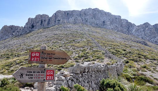
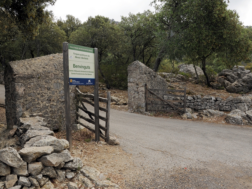 Now we have to walk about a hundred metres to the right along the MA-10 towards the south-east before turning left towards Menut i Binifaldó. Puig Tomir is signposted here on route number 2. Passing a former lime kiln, we soon reach the finca. We stay on the track and leave the houses to our right. We now ascend in a wide arc, past the Binifaldo Environmental Education Centre, to the ‘Coll des Pedregaret’. At the end of the track are a few buildings. To the south of these, next to a gate, we spot the path where we can now begin the actual ascent to Puig Tomir.
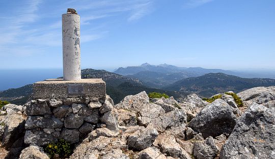
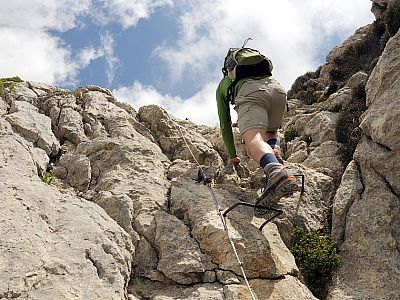
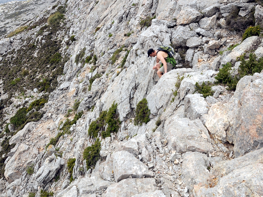
 Significantly steeper than the route so far, the path now leads us up the western flank of Puig Tomir. Below the rocks, we head towards a gully where we quickly gain altitude. At the end, a short climbing section awaits us, made easier by handrails and wire rope, which we manage without any trouble. Beyond this, the terrain flattens out again. Small cairns now line the path as we head north-east towards the summit. Soon a simple concrete pillar comes into view, and shortly afterwards we reach the highest point of Puig Tomir.
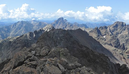
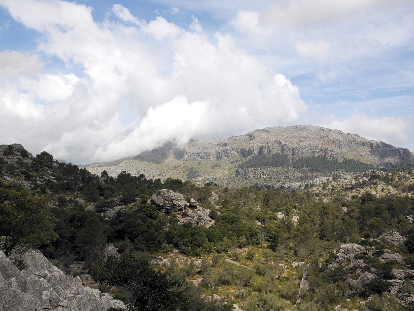
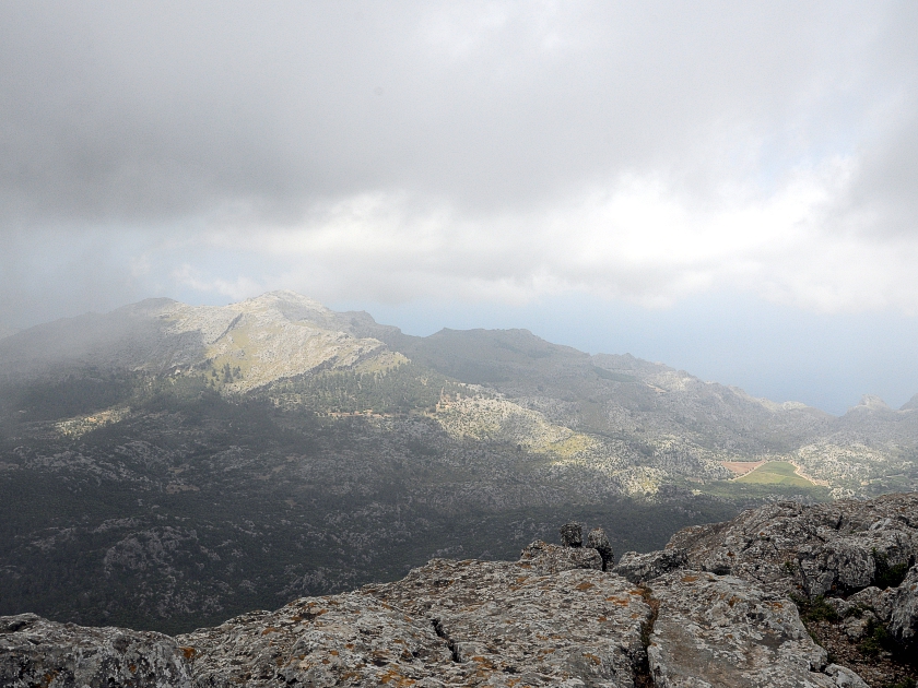 The clouds hang stubbornly just above us. Nevertheless, we can occasionally catch a lovely view of Puig Massanella to our south-west. To the right behind it lies Puig Major, the highest peak in Mallorca, though its summit is off-limits due to its military use. Further west is Puig Roig. Unfortunately, the view of Cap Formentera to the north-east remains hidden from us today. Talaia d'Alcúdia, to the east, is also hidden in the haze.
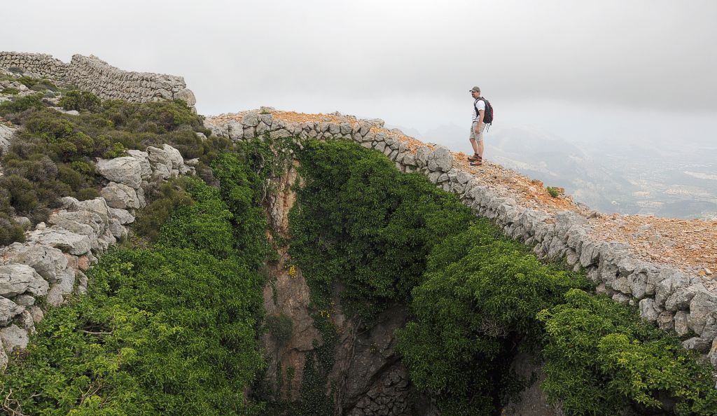
 The shortest route back follows the ascent path. However, we opt for the longer route to the east. To do this, we first pay a visit to the snow houses, which were already visible from the summit. The pits, which are still clearly visible, were used before the invention of the fridge to obtain cooling ice well into the warm season. Behind the huts, we continue our descent towards the east, largely without a defined path. At a ridge, we head right and, thanks in part to two rather inconspicuous cairns, are able to climb down without difficulty. Without further difficulty, we now head straight for the saddle ahead of us. At the highest point there is a crossing where we can easily climb over the fence separating us from a track.
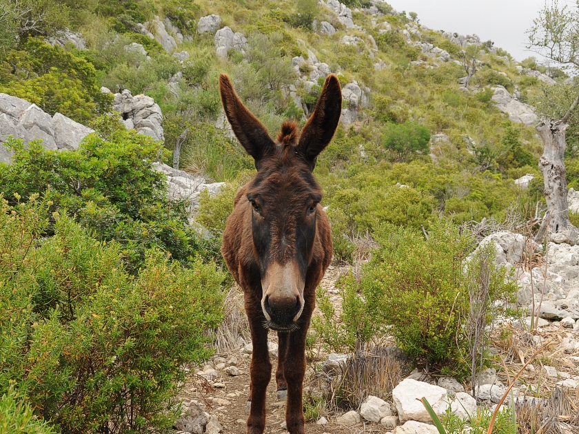 We now descend gently southwards along the track. At a gate, we climb over the fence again and keep to the right in the wide saddle of the ‘Coll de l'Arena’. We ignore the track branching off to the left and continue our way along an overgrown path towards the south-west. Two further crossings follow before we encounter some donkeys in the picturesque little valley, which accompany us for a while. After just under 2 kilometres, much to the animals’ disappointment, we come across another fence, at the crossing of which we have to part ways with our companions.
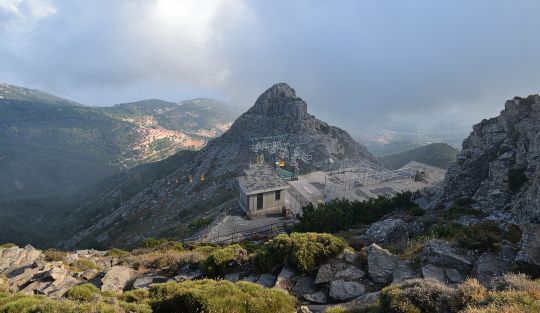
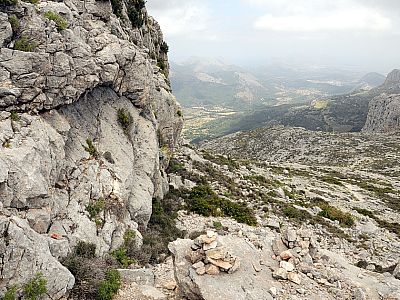
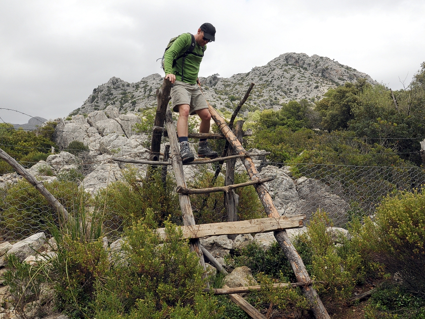 Just under 200 metres later, we keep to the right, heading west. We cross another fence via a rather precarious ladder before the path begins to climb gently again. We ignore a turn-off to the right and, after 2 kilometres, reach the well-maintained long-distance hiking trail GR221. A signpost pointing south tells us that we still have about an hour’s walk to the monastery. On the way, we make a short detour to the “Mirador” viewpoint, which offers another wonderful view of the karst landscape and the monastery complex. Parched with thirst, we then continue on to Lluc Monastery, but not without first stopping for a long break at the Refugio Son Amer.
No places for refreshments along the way. At the starting point you will find the Lluc Monastery, which offers accommodation, as well as the Refugi Son Amer.
| Elevation | Time | Total | Destination | ||
|---|---|---|---|---|---|
| 500 m | - 520 m | + 0:30 | 0:30 | Es Camell | |
| 520 m | - 1103 m | + 3:00 | 3:30 | Puig Tomir | |
| 1103 m | - 670 m | + 3:15 | 6:45 | Mirador de Foment de Son Amer | |
| 670 m | - 540 m | + 0:30 | 7:15 | Refugi Son Amer | |
| 540 m | - 500 m | + 0:30 | 7:45 | Kloster Lluc | |