


 Serra de Tramuntana
Raco de Ses Barreres car park (5 m) - Ermita de la Victòria (140 m) - Penya Roja, also known as Penya del Migdia (360 m) - Talaia D'Alcudia (444 m) - Platja des Coll Baix (0 m) – Raco de Ses Barreres car park (5 m)
The route, just over 16 km long, follows mostly well-maintained footpaths. Sure-footedness is required at Penya Roja, as well as on the final stretch to Platja des Coll Baix. Take care when swimming due to offshore currents, known as rip currents!
Drive from Palma de Mallorca along the MA-13 past Inca to Alcúdia. Before the old town, turn right onto Avinguda Príncep d'Espanya. At the end of the road, turn right and then immediately left onto Carrer de Xara. At the port of Mal Pas-Bon Aire, keep right and leave the village heading north-east. Shortly after the village, just past a stone bridge by the sea, there is a small car park on the right. Park there.
39.87094170, 3.15433949
Anzeige
On the Victòria peninsula, north of the historic town of Alcúdia, nature-loving hikers have plenty to discover. Passing the former hermitage Ermita de La Victoria, on the route described here we make a detour to the old defences at Penya Roja (Red Rock) before climbing Talaia D'Alcudia, the highest point on the peninsula. Swimmers will find what they’re looking for at the hard-to-reach cove of Platja des Coll Baix. Via the ‘Coll de Ses Fontanelles’ pass, we hike through secluded steppe landscapes in the south of the peninsula back to the starting point.
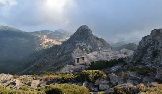
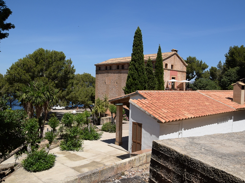 We set off from the car park along a path heading north-east and, a few metres later, come across a small road that leads us slightly uphill to the ‘Campament de la Victoria’ campsite. The site isn’t particularly large and we cross it quickly. After passing through a gate, we stay on the gravel road for a few more minutes until the former hermitage ‘Ermita de la Victòria’ is signposted on the left. On the western flank of Talaia d'Alcúdia, we continue north-east through the unique Mediterranean landscape. Thirty minutes later, we reach the hermitage. To the left of the car park is a viewpoint, which we visit. From there, you can enjoy a lovely view of Pollença Bay. Cap de Formentor, the northernmost point of the island, is also visible.
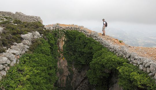
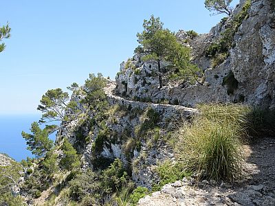
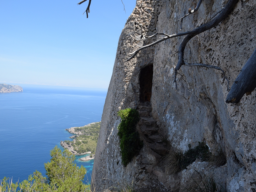 To the east of the hermitage, we continue on our way. A wide gravel road leads us through the forest about 120 metres higher up, before a small path branches off to the left after a right-hand bend. The sign for Puig Rotja – as Penya Roja, alongside Penya del Migdia, is also known – is rather inconspicuous there. On the path, we hike through the greenery of the picturesque landscape, heading first north-east and later north. The cliffs to the left drop ever more steeply down towards the sea. We finally reach a rocky ledge that ends at a narrow passage. Here, we have to suck in our stomachs to get to the east side of Penya Roja.
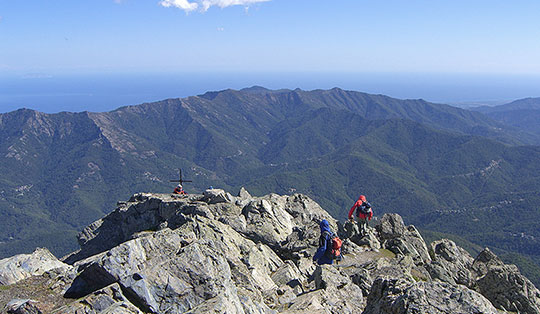
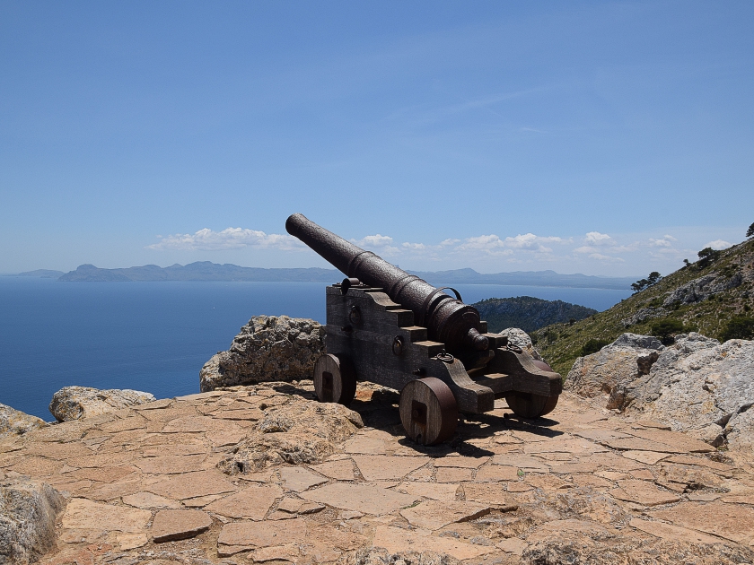 A section that is easy in itself but secured by a chain due to its exposure leads us a few metres eastwards on the other side. There we find several quite old and dilapidated bunker complexes. The actual summit lies a little further south. The ascent requires a bit of sure-footedness again, but does not take long. At the top of Penya Roja, an old cannon awaits us, underlining the strategic importance of the vantage point. To the north, the flat part of the cape, still used for military purposes, can be seen. Secluded bays with crystal-clear turquoise water are a delight to the eye. To the west lies the Bay of Pollença, with parts of the Serra de Tramuntana behind it. To the south, our next destination, the Talaia d'Alcúdia, is already visible. On the opposite side of the Bay of Alcúdia, we can make out the rocks of Cap de Ferrutz to the south-east.
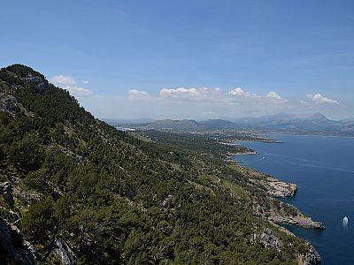
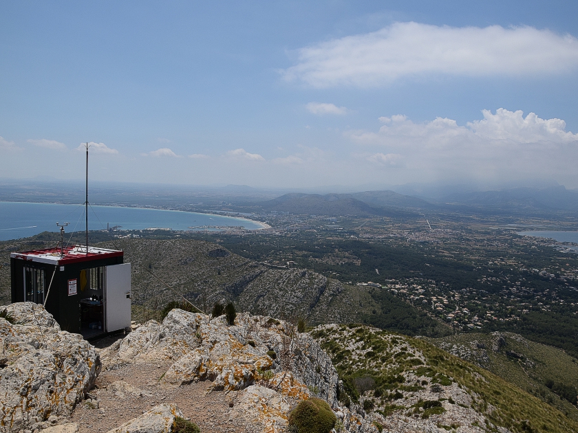 For the ascent to our main summit, we hike back along the path to the junction. There, we keep to the left. After a short climb, the terrain flattens out again in a wide saddle before we gain significant altitude on a laboriously constructed path winding through several hairpin bends. A short distance beyond the edge of the steep escarpment, the summit of Talaia D'Alcudia is signposted via a 5-minute detour to the south. We climb quickly and shortly afterwards stand on the highest point of the Victoria Peninsula. In addition to the two bays, the town of Alcúdia is now also visible to the south. We can make out the viewpoint we visited first to the north, and a little further to the left, Cap de Formentor.
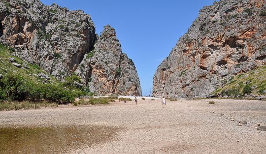
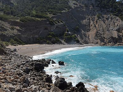
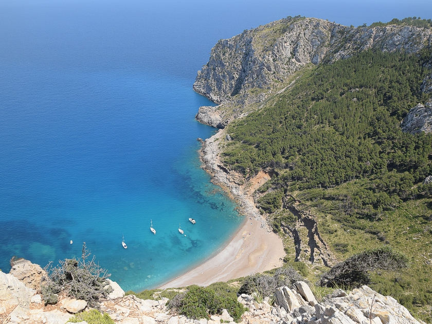 The descent initially follows the detour back. We then turn right and walk downhill to the east across the sparsely vegetated slopes. After just under half an hour, the view of Platja des Coll Baix bay opens up below us. A picture-postcard view. However, we are still a good 300 metres in altitude away from the beautiful bay. The path now leads steeply down to the “Collet des Coll Baix” saddle. Once there, we keep to the left and walk downhill, initially quite comfortably, towards the east. Ten minutes later, the path becomes steep and leads us via switchbacks to the rocky coast. Just above the water’s edge, sure-footedness is once again required on the path heading west towards the beach. Halfway there, we are confronted by a large billy goat. Its massive horns certainly make an impression on us. Thankfully, it merely eyes us briefly before strolling peacefully on. Shortly afterwards, we reach the beach and, minutes later, plunge into the refreshing waters.
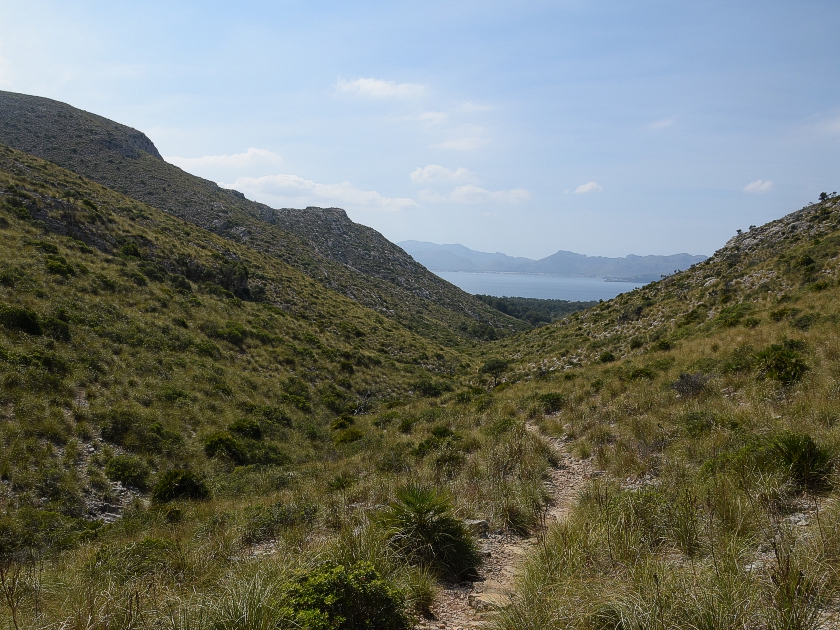 After a long break, we first climb back up to the saddle, but then keep going straight on. On a forest track, we pass several car parks and, after about 800 metres, come to a junction. There, the “Campament de la Victoria” campsite is signposted on a path to the right. We hike westwards here, across a dry riverbed and later through a steppe-like landscape. After crossing the flat pass “Coll de na Benet”, we glance once more to the right, towards the north, at the Talaia d’Alcúdia. A little later, the first houses of Bonaire appear on the left. The now wide path leads us to the campsite, from where we walk back to the car park.
Mirador de la Victoria (150 m), Tel. +34 971547173.
| Elevation | Time | Total | Destination | ||
|---|---|---|---|---|---|
| 5 m | - 140 m | + 0:30 | 0:30 | Ermita de la Victòria | |
| 140 m | - 360 m | + 0:30 | 1:00 | Penya Roja, auch Penya del Migdia | |
| 360 m | - 444 m | + 1:30 | 2:30 | Talaia D'Alcudia | |
| 444 m | - 0 m | + 1:30 | 4:00 | Platja des Coll Baix | |
| 0 m | - 5 m | + 1:45 | 5:45 | Parkplatz Raco de Ses Barreres | |