

 Snowdonia
Llanberis (114 m) – Penceunant Tea Rooms (173 m) – Llanberis Path – Halfway House (541 m) – Bwich Glas (966 m) – Snowdon (1085 m)
An easy mountain hike which, due to its length, requires a good level of fitness. The Llanberis Path is a well-maintained, partly paved trail that presents no technical difficulties. Shortly after the Halfway House and past Clogwyn Station, the paths are steep in places. Take care in the summit area if icy.
From Cardiff, take the A470 via Merthyr Tydfil, Glasbury and Llanidloes to Dolgellau and on to Trawsfynydd. Shortly after Llyn Trawsfynydd, continue straight on via the A487 and follow this road via Porthmadog and Penygroes to Caernarfon. In Caernarfon, turn right onto the A4086 and drive via Pont-rug and Llanrug to Llanberis. Pass Llyn Padarn on your right and, after crossing the Afon Arddu, park your car on the left-hand side of the road at the large pay-and-display car park (“Parking for Snowdon”) (parking fee £8, as of 2019, payable by coins or credit card).
Take the train to Bangor (Gwynedd) (for timetable information) and from Bangor station continue on bus routes 85 or 86 to Llanberis (for timetables).
53.11679299, -4.11900938
Anzeige
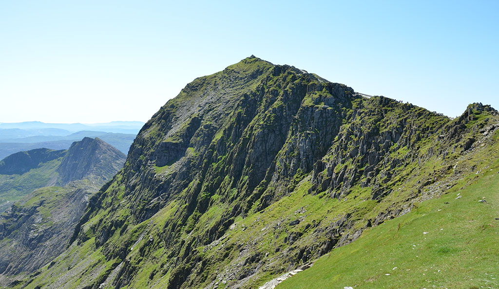
At 1,085 metres, Snowdon is the highest mountain in Wales. Of the many routes leading up to Snowdon (Welsh: ‘Yr Wyddfa’), the Llanberis Path is the easiest. The well-maintained path roughly follows the route of the Snowdon Mountain Railway, which tirelessly transports visitors from Llanberis to the summit of Wales’s highest peak. The Snowdon Mountain Railway began operating at the end of the 19th century and is the only rack railway in Great Britain. Anyone setting off from Llanberis towards the summit without technical aids can expect an easy, but by no means short, hike. To reach the highest point, you’ll need to climb just under 1,000 metres in altitude and cover 15 kilometres there and back. There is no shade at all on the ascent route, so you can work up quite a sweat on warm summer days. Halfway up, the Halfway House offers a place to stop for refreshments, where you can buy drinks and light snacks. At the Bwich Glas saddle between Garnedd Ugain and Snowdon, the equally popular Pyg Track, which leads up from the east via Pen-y-Pass, joins the Llanberis Path. From here, it is just a few steps to the summit of Snowdon, where you’ll find the Summit Station and the Visitor Centre with its café. At the highest point in Wales, in fine weather, you can enjoy a fantastic panoramic view stretching across the mountains of Snowdonia and the neighbouring coastal region as far as Ireland.
 We leave the car park in Llanberis (114 m), cross the road and turn left on the opposite side of the road. We then follow the footpath running parallel to the road towards the south-east. At the first opportunity, we turn right into Victoria Terrace. We now continue straight ahead and, after passing the last houses, reach the end of the road. Here there is also an information board for the Llanberis Path. We walk into a sparse woodland and gain the first few metres of elevation via the tarmac road. After a few bends, we reach the Penceunant Tea Rooms (173 m, 20 minutes from Llanberis). At the café, we leave the small woodland behind us and continue uphill along the tarmac road, following a stone wall in a southerly direction.
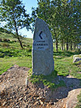
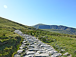
 After a left-hand and a right-hand bend, we reach the start of the Llanberis Path. A large stone with an inscription marks the entrance to the footpath. We therefore turn left, pass through a gate and take the stony path towards Snowdon. This leads us eastwards at the start and, after two bends, turns south-east. The Llanberis Path is only moderately steep from this point onwards. To our right, we look out over the valley through which the Afon Arddu stream winds its way. The rack railway also gains its first few metres of altitude in this valley. Later, we pass through a pasture gate and reach an underpass via the paved path. We now pass under the rack railway tracks and continue our ascent. After a walking time of just under 1¾ hours, we arrive at the Halfway House (541 m).
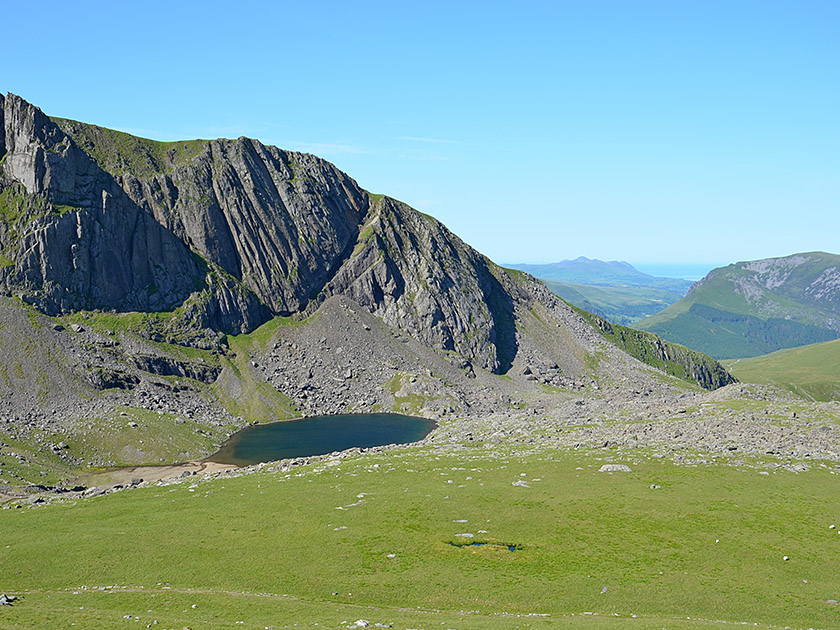 From the Halfway House, the path leads us further south-east. To our right, we look out over the striking rock faces of Clogwyn Du’r Arddu and can make out the Irish Sea in the distance. The path makes a gentle left-hand bend and a sweeping right-hand curve, bringing us to a paved, steep section that takes us rapidly uphill. To our right below us, we look out over the mountain lake Llyn Du'r Arddu, which lies in a hollow at the foot of the steep cliffs of Clogwyn Du'r Arddu. The steep climb takes us up to Clogwyn Station, where we cross under the tracks once more. After the underpass, the path turns right (southeast) and continues to lead us steeply uphill. After an initial steeper ascent, our path makes a long right-hand bend and the terrain gradually levels out again.
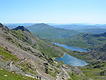
 We now walk towards the south-west on a moderate incline, enjoying the view across Llyn Cwellyn and over the coast to the Irish Sea. Below us, we can make out the route of the Ranger Path, which leads from Llyn Cwellyn up to Snowdon. After a gentle left-hand bend, we reach Bwich Glas (966 m), the saddle between Garnedd Ugain (1065 m) and the summit of Snowdon. There, both the Ranger Path and the Pyg Track join our ascent route. At the saddle, the view opens up for the first time down to Llyn Llydaw and Pen-y-Pass, at the highest point of which the Pyg Track begins. We maintain our general direction and head towards the summit ridge of Snowdon. A paved path leads us upwards in a left-hand bend, parallel to the tracks, towards the summit station.
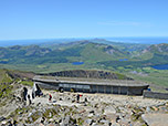
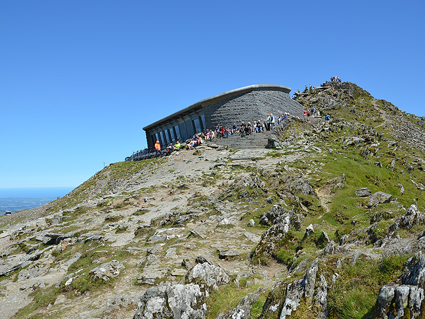 Shortly before the summit station, we turn diagonally left and reach a plateau. From the rocky plateau, we finally climb the summit rocks to our left via a stone staircase. After a walk of 3½ hours, we stand at the highest point of Snowdon (1,085 m) and of the whole of Wales. A metal plaque at the summit informs us of the names of the countless other peaks visible in the vicinity of Snowdonia National Park and on the horizon. On a clear day, we can look westwards far across the Irish Sea to the Irish mainland. Before the descent to Llanberis, you’ve earned a refreshment and a bite to eat at the café at the summit station. In good weather, it’s quite pleasant to sit by the wall of the Visitor Centre, reasonably sheltered from the wind and with a magnificent panoramic view.
Same as ascent.
| Elevation | Time | Total | Destination | ||
|---|---|---|---|---|---|
| 114 m | - 173 m | + 0:20 | 0:20 | Penceunant Tea Rooms | |
| 173 m | - 541 m | + 1:20 | 1:40 | Halfway House | |
| 541 m | - 1085 m | + 1:50 | 3:30 | Snowdon | |
| 1085 m | - 541 m | + 1:30 | 5:00 | Halfway House | |
| 541 m | - 114 m | + 1:15 | 6:15 | Llanberis | |


