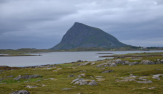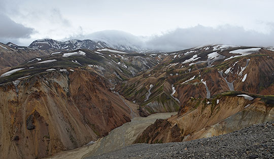
 Jotunheimen mountains
Spiterstulen (1104 m) – Svellnose (2272 m) – Keilhaus topp (2355 m) – Galdhøpiggen (2469 m)
A challenging mountain hike leading over uneven paths and extensive scree and boulder fields. During the ascent to Svellnose and at the transition from Svellnose to Keilhaus topp, there are short sections of boulder climbing at a maximum difficulty level of 1. In summer, old snowfields are often encountered, which can further increase the difficulty. Good physical fitness, sure-footedness and a head for heights are essential for the ascent.
Take the E6 from Oslo towards Trondheim to Otta, turn left there and follow road no. 15 past Vagavatnet to Lom. At the roundabout in Lom, keep slightly to the left and turn onto Road No. 55, following it for 23 kilometres. In Røisheim, turn left onto Visdalsvegen, which shortly afterwards becomes an unpaved toll road that is bumpy in places. Follow the track for 17 kilometres up to Spiterstulen. Park your car here in the large car park below the hostel. The toll of 80 NOK (as of 2014) is to be paid at the reception at Spiterstulen.
From Otta railway station, take the bus to Lom and from Lom continue by bus to Spiterstulen (see timetable information).
61.62558801, 8.40382495
Anzeige
Galdhøpiggen is the highest mountain in Norway and in the whole of Scandinavia. Galdhøpiggen has only held this title for a few years. Until the 1980s, the neighbouring Glittertinden was considered the highest peak in Scandinavia. Its glaciated summit has since melted to such an extent that it is now surpassed in height by Galdhøpiggen. And as with all the highest and, moreover, relatively easily accessible mountains, you are rarely alone on Galdhøpiggen. If you want to enjoy a bit of peace and quiet, you should set off early from the car park at Spiterstulen, when most mountaineers are still tucking into the breakfast buffet at the comfortable hostel. Around midday, it can even get quite crowded at the summit. That is when the first rope teams from the guided tours from Juvasshytta via the Styggebrean Glacier arrive. The ascent from Spiterstulen described here is entirely glacier-free. In summer, however, you may encounter some patches of old snow on this route as well.
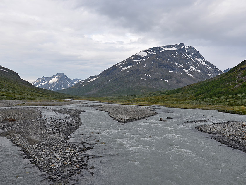 From the car park, we follow the River Visa further south to a wooden bridge. Here we cross the river and turn right after the bridge (signpost “Galdhøpiggen”). We now follow the path, which leads slightly diagonally away from the water, across the campsite. At the end of the campsite we come across the first marker (a red “T”). The path now leads us towards a steep slope. After the campsite, our path winds its way briskly uphill through sparse scrub. After just a few minutes, we leave the bushes behind and from now on we are moving through open terrain with excellent views. The path offers no respite at the start and leads steeply and in many switchbacks up the slope in a north-westerly direction.
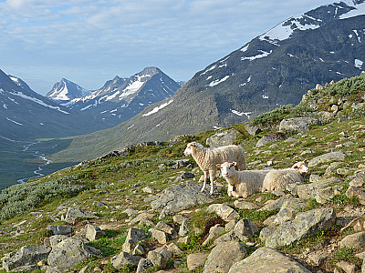
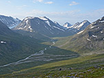
 The higher we climb, the more beautiful and expansive the view to the south becomes. Across the valley through which the Visa glacial river winds its way, we look out towards the mighty Hellstugutinden and the striking pyramid of the Urdadalstinden. After a good half-hour’s walk, our path curves to the left and now leads us more gently uphill in a south-westerly direction towards a grassy ridge. Here the path turns right again (north-west) and leads us uphill over rockier terrain. We pass a few small streams and soon after cross our first scree slope. The path now becomes increasingly obscured amongst scree and boulders. However, the route is marked with a few cairns and consistently with red ‘T’ markings.
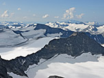
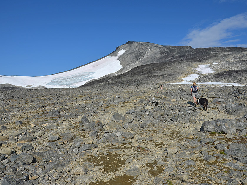 We now cross extensive scree slopes and continue climbing north-westwards until we reach the high plateau below Svellnose. We now walk on level ground towards the peak of Svellnose, eventually turning slightly to the right and climbing over scree towards the ridge line east (right) of Svellnose. Once on the ridge, a magnificent view opens up down to the Styggebrean Glacier. We now turn left and follow the ridge westwards, heading towards the summit of Svellnose. After some minor boulder scrambling, the ridge leads into a scree slope, which we climb in numerous switchbacks. After a walking time of 3½ hours, we have reached the highest point of Svellnose. To the south, we look down towards the Svellnosbrean glacier.
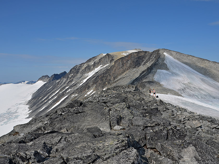 Ahead of us, we can now also see the summit of Galdhøpiggen, which is hidden behind Keilhaus topp. We follow the boulder-strewn ridge of the Svellnose steeply down into the saddle between the Svellnose and Keilhaus topp. Just before the saddle, there are some minor scrambling sections on the rock to negotiate. Especially when there is old snow, the transition from the rock to the saddle is somewhat unpleasant. Across the scree-covered saddle, we hike towards the summit structure of the Keilhaus topp. Staying on the summit ridge, we first climb over flat rock and finally over boulders, with some easy scrambling. 30 minutes after setting off from Svellnose, we have reached the spacious summit of Keilhaus topp. Those who wish can keep to the left to reach the highest point and the summit cairn.
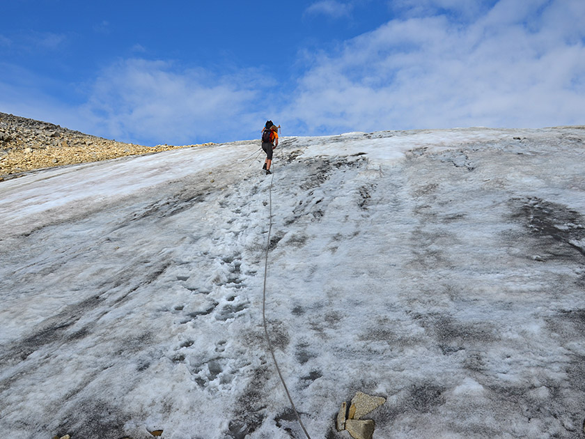 Now we can also see the final and actual destination of our mountain tour ahead of us: Galdhøpiggen with its small summit hut. We cross the summit of Keilhaus Topp and hike down the broad ridge into the saddle between Keilhaus Topp and Galdhøpiggen. Ahead of us, we can now see a glacier tongue. We head towards the lower end of the snowfield. There are now two options for overcoming this icy obstacle: thin red marker poles lead to a rope stretched across the glacier. Here, the glacier can be crossed at a section free of crevasses. The lower part of the glacier is quite steep, and crossing the snowfield on bare ice without crampons is not recommended.
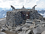
 The second, ice-free option: keep left as you pass the foot of the glacier, then at its end climb steeply up to the right over scree, thus bypassing the treacherous ice. On the descent, you should bypass the glacier anyway and avoid crossing the snowfield. Now only a few minutes separate us from the summit: we climb up the broad scree slope to Volehytta, which is already within reach. As soon as we reach Volehytta, we walk past the small hut on the right and climb over boulders to the highest point of Galdhøpiggen, the Jotunheimen mountains and the whole of Norway. Now the magnificent view to the west over the Storjuvbrean Glacier opens up. We enjoy the fantastic panorama stretching from the Jotunheimen mountains to the Rondane range.
Same as ascent.
The Volehytta hut at the summit of Galdhøpiggen is staffed in fine weather. Otherwise, provisions are available for purchase in the small hut, and there are blankets and sleeping places for an emergency bivouac.
Spiterstulen (1104 m), Tel. Tel. +47 61 21 94 00. Geöffnet von ca. 01. März bis 01. Mai und von ca. 20. Mai bis 15. Oktober.
| Elevation | Time | Total | Destination | ||
|---|---|---|---|---|---|
| 1104 m | - 2070 m | + 2:45 | 2:45 | Grat der Svellnose | |
| 2070 m | - 2272 m | + 0:45 | 3:30 | Svellnose | |
| 2272 m | - 2355 m | + 0:30 | 4:00 | Keilhaus topp | |
| 2355 m | - 2469 m | + 0:30 | 4:30 | Galdhøpiggen | |
| 2469 m | - 2272 m | + 0:45 | 5:15 | Svellnose | |
| 2272 m | - 1104 m | + 2:45 | 8:00 | Spiterstulen | |