
 Lofoten
Golf course near Hov (8 m) – Hoven (367 m)
Moderately difficult to challenging hike, following a clearly marked coastal path. The path leads over several rocky sections; crossing a steep slope is made easier by an iron chain. You will also need to scramble over a field of large boulders and climb down a ladder some 10 metres high. The ladder can be bypassed via a steep, rugged path secured by a chain (beware of falling rocks). Shortly before Nusfjord, you encounter marshy terrain. On this straightforward route, which takes between 2½ and 3 hours to walk, you cover 5.5 km and, due to the many ups and downs, climb 260 metres in altitude. Sure-footedness and a head for heights are essential for this hike.
Take the E10 from Leknes towards Å. On the island of Flakstadøy, after the village of Ramberg, you will come to a right-hand bend. Immediately after the bend, turn left towards Nesland and follow the road – which soon turns into a track – for just under 10 km to Auster Nesland. At the entrance to the village, there are parking spaces on the left-hand side in a meadow (signposted). There are also smaller parking bays just before Auster Nesland, directly by the road.
68.00434909, 13.28958493
Anzeige
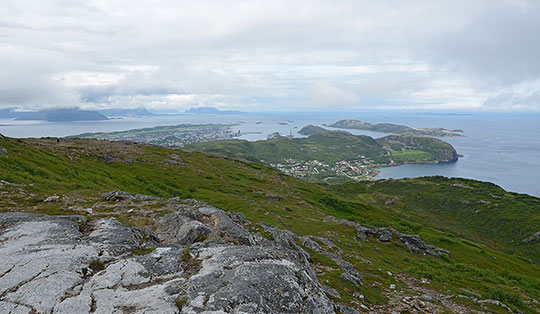
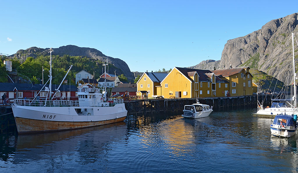
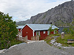
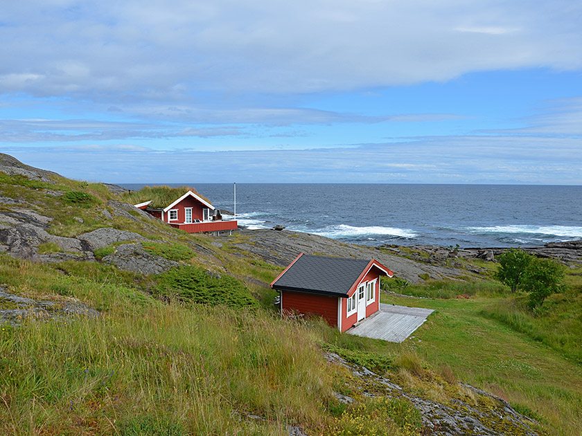
A visit to the fishing village of Nusfjord is one of the highlights of a trip to Lofoten. The small village, with its colourful wooden huts, lies on a fjord in the south of the island of Flakstadøy and is framed by high, rocky peaks. During the summer season, numerous visitors flock to the pretty museum village. But it is not only Nusfjord itself, but also the neighbouring coastal region that has its own special charm. To get to know the region thoroughly, you should tackle the classic hike from Auster Nesland to Nusfjord. On this varied coastal walk, you pass rugged mountains and beautiful bays across often rocky terrain. Before heading back to Nesland via the same route after the nearly three-hour hike from Nusfjord, you can enjoy a hearty meal in the café or restaurant. A visit to the corner shop in Nusfjord, whose stock takes you back to the 1950s, is also an absolute must.
 From the car park, we follow the track further north-east through the fishing village of Auster Nesland. At the last houses, the wide path takes a slight right-hand bend and leads us between the buildings. After the last huts, we keep diagonally to the left and take a clear path (signposted ‘Fiskersti’), which leads us north-eastwards up to an information board.
We pass the board, which provides information about the trail and the fishing industry, and walk across some flat rocks. We then reach the first cove and our path takes us slightly downhill in a left-hand bend heading north-west.
From the car park, we follow the track further north-east through the fishing village of Auster Nesland. At the last houses, the wide path takes a slight right-hand bend and leads us between the buildings. After the last huts, we keep diagonally to the left and take a clear path (signposted ‘Fiskersti’), which leads us north-eastwards up to an information board.
We pass the board, which provides information about the trail and the fishing industry, and walk across some flat rocks. We then reach the first cove and our path takes us slightly downhill in a left-hand bend heading north-west.
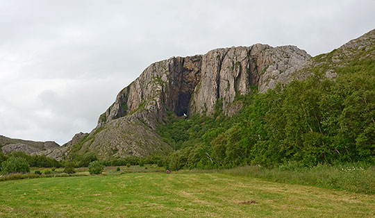
 After a right-hand bend, we continue along the shore in a north-easterly direction. We pass a beautiful viewpoint with a large cairn and, shortly afterwards, a navigation mark. The path leads us down towards the sea and, a little later, takes us uphill in a counter-slope over flat rocks and scree. We now pass through Vedvika Bay via a sparse woodland of low deciduous trees and cross a small stream via a wooden bridge. A short while later, we reach a steep, stony slope, which we cross. The path is secured here by an iron chain. After crossing, we continue through the sparse woodland.
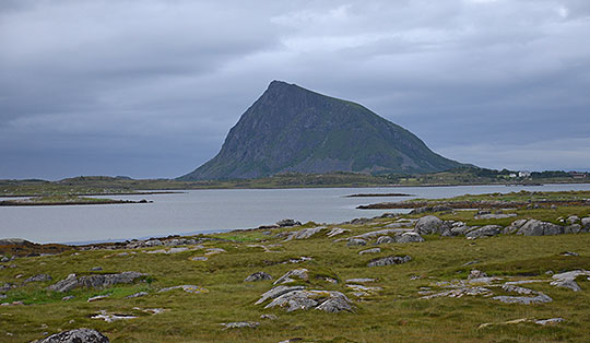
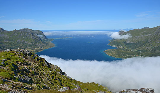
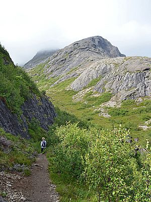
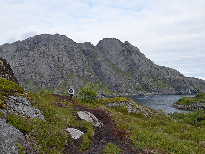
 The path eventually leads us to a vast field of huge boulders. We climb over a few boulders along the left edge of the boulder field and reach a flat boulder with a wooden marker post. We now cross briefly to the right, then turn left and scramble uphill over flat rock (red ‘T’ markings). After this steep slope, we have left the boulder field behind us. On level ground, we follow the path northwards up to a faintly defined saddle. During the ascent, we look to the right across the small offshore island of Ternholmen towards Lyrvika Bay, which is dominated in the background by a rugged mountain range.
 We now reach the crux of the hike: from the hilltop, a ladder some 10 metres high leads down into the depths. However, the ladder can also be bypassed: a short distance before the ladder, a rugged path secured by an iron chain leads down to the valley floor through a gully on the right-hand side. Anyone taking this route should be particularly wary of falling rocks on the crumbly path. At the valley floor, the two paths meet again. We then cross a stream and continue on level ground across marshy terrain, passing through some unpleasant, muddy sections. After a few minutes, we leave the marshy area and climb up a gentle incline to a grassy plateau.
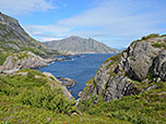
 We can now already see the fjord ahead of us, which will be our destination. We walk in a gentle up-and-down pattern in a north-easterly direction, passing a boulder on the left, and reach a rocky ledge, which we descend partly over flat rock. We now come to a wide path and the first huts of Nusfjord. We turn left onto the track and walk initially in a north-westerly direction, passing a few more buildings. Finally, our path curves to the right, leads us slightly downhill and, at last, into the centre of the museum village, where we will treat ourselves to some well-deserved refreshments in the café or restaurant before heading back.
We return to Auster Nesland via the same route in 2½ to 3 hours.
No places for refreshments along the way. There are places to stop for refreshments in Nusfjord (more information).