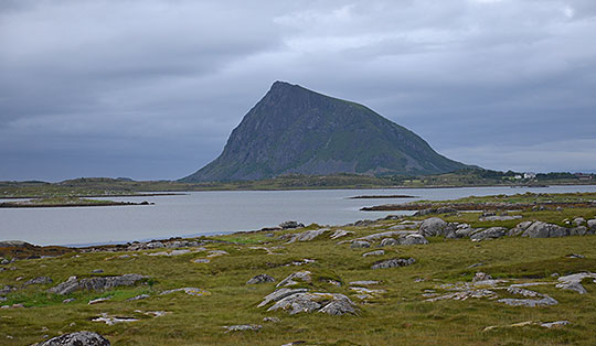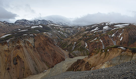
 Rondane-Gebirge
Bjørgebu (890 m) - Sukkertoppen (1213 m) - Tjønnsæterfjellet (1411 m)
Moderately difficult mountain hike following small paths. The route from Sukkertoppen to Tjønnsæterfjellet is not signposted and the final ascent to the summit of Tjønnsæterfjellet is pathless. A good sense of direction is therefore required for the ascent.
Take the E6 from Oslo towards Trondheim; leave the E6 between Vinstra and Otta in Kvam (signposted ‘Bjørgebu’). Take Road 419 northwards towards Bjørgebu. Immediately after the campsite, a toll road branches off to the right. There are a few parking spaces before the barrier. Park your car here.
61.74718319, 9.73223314
Anzeige
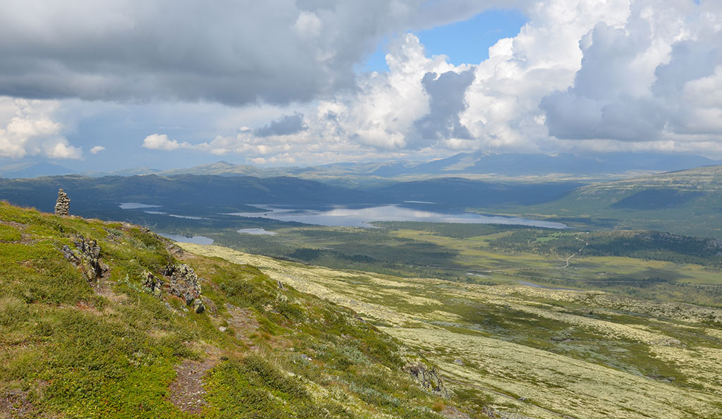
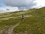
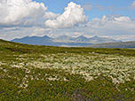
If you’re looking for an easily accessible mountain with great views in the southern Rondane mountains, Sukkertoppen is the perfect choice. It can be reached from Bjørgebu in a short hike of around 1¼ hours. From the summit, you have a magnificent view over Lake Furusjøen and towards the high mountains in Rondane National Park. If the climb to Sukkertoppen was too short for you, you can continue hiking to Tjønnsæterfjellet. On this scenic high-altitude walk, you pass a small lake covered in cotton grass and the rugged summit of Geitryggen. Finally, the route follows an unmarked but easy path over the ridge of Tjønnsæterfjellet up to the large summit area with its cairn made of stacked slabs.
 From the car park in front of the barrier, we head back to Road 419 and turn left. We walk along the tarmac road past the campsite and, immediately after the campsite, turn left onto a forest track (signposted ‘Sukkertoppen, Villmarksleir’). We follow the forest track uphill at a moderate gradient and come to a few holiday cottages. We walk past the small houses on the left and reach a sparse woodland at the upper edge of the settlement. There we come to a fork in the path and follow the forest track, keeping to the right (signpost “Sukkertoppen”). Shortly afterwards, we reach another fork in the path below two further holiday homes.
 We now leave the forest track, keeping to the left (signpost “Sukkertoppen”), and walk along a path through low trees, climbing somewhat more steeply. After the wooded area, we reach a faintly defined ridge and follow it uphill in a south-easterly direction.
We can now enjoy the first views of the surrounding Rondane mountains and down to Lake Furusjøen. Ahead of us, we can already make out the small peak of Sukkertoppen, which we are now heading straight for. We cross a small stream and walk across the wide plateau, continuing south-eastwards towards Sukkertoppen.
We now leave the forest track, keeping to the left (signpost “Sukkertoppen”), and walk along a path through low trees, climbing somewhat more steeply. After the wooded area, we reach a faintly defined ridge and follow it uphill in a south-easterly direction.
We can now enjoy the first views of the surrounding Rondane mountains and down to Lake Furusjøen. Ahead of us, we can already make out the small peak of Sukkertoppen, which we are now heading straight for. We cross a small stream and walk across the wide plateau, continuing south-eastwards towards Sukkertoppen.
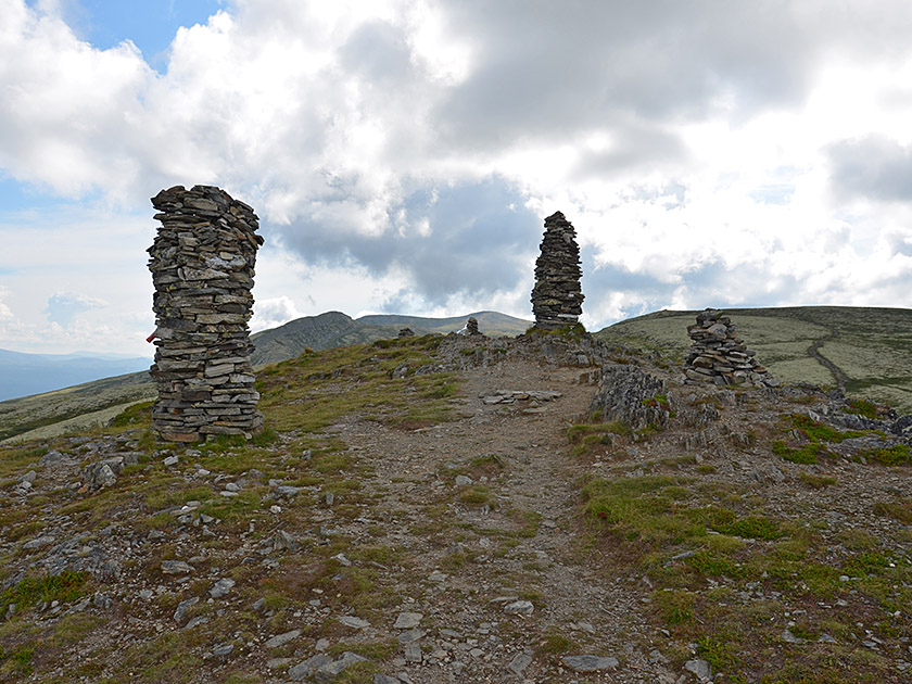 Finally, we reach a small saddle north-west of the summit, briefly traverse into the summit flank and then climb the steep path up to the many cairns on Sukkertoppen. At the summit, we enjoy the beautiful view over Furusjøen and towards the high peaks of the Rondane Mountains. Further to the south-east, we now catch our first glimpse of Tjønnsæterfjellet, which we will visit as part of a lovely high-altitude hike. To do this, we cross the summit of Sukkertoppen and descend to a signpost. We look towards the south-east and do not take the path that keeps to the right and leads up to the summit of Middagshaugen.
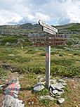
 We keep to the left and go round Middagshaugen on its left (eastern) side. After a few minutes, the path forks. We now take the right (upper) path and ignore the left-hand path, which would lead us down into a hollow. We continue past Middagshaugen and reach a faint saddle with a signpost at its south-eastern foothills. At this junction, we continue straight ahead (signpost ‘Rundkoll’). We follow the path, which climbs moderately, further south-east and cross past Geitryggen, whose rocky summit rises to our left.
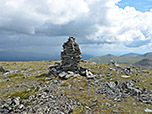
 Finally, we reach a saddle at the southern ridge of Geitryggen. We continue straight ahead along the path, heading directly towards Tjønnsæterfjellet. At the foot of Tjønnsæterfjellet, we reach a rocky ridge spur. Here, the marked path takes a sharp right-hand bend. At this bend, we leave the path, continue straight ahead and keep slightly to the left of the rocks. We now follow the ridge line uphill, keeping to the left of the rocky outcrop. After a short while, the terrain opens up and, following the tracks across the broad, gentle ridge, we reach the spacious summit area of Tjønnsæterfjellet with its large cairn.
Same as the ascent. On the way back to Sukkertoppen, you can, if you feel like it, cross over Middagshaugen (1264 m). You do not need to climb back up to the summit of Sukkertoppen, but can instead traverse past it on its left-hand side as you descend.
There are no places to stop for refreshments along the way.
| Elevation | Time | Total | Destination | ||
|---|---|---|---|---|---|
| 890 m | - 1213 m | + 1:15 | 1:15 | Sukkertoppen | |
| 1213 m | - 1411 m | + 1:15 | 2:30 | Tjønnsæterfjellet | |
| 1411 m | - 1213 m | + 1:00 | 3:30 | Sukkertoppen | |
| 1213 m | - 890 m | + 1:00 | 4:30 | Bjørgebu | |