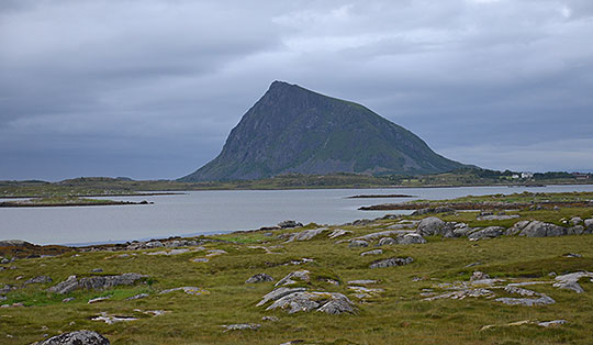
 Rogaland
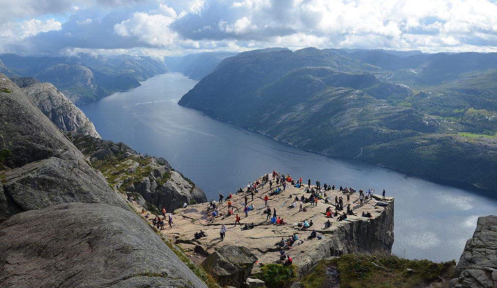
Moderately difficult mountain hike covering a total of 8.2 kilometres. The hike follows well-maintained stony paths that require a minimum of sure-footedness. The stones are sometimes wet and slippery. The final few metres to Preikestolen are covered close to the edge overlooking the Lysefjord. Here, and at Preikestolen itself, a head for heights is essential. Due to the high number of visitors, setting off very early is strongly recommended.
From Stavanger, take the ferry to Tau. The ferry runs every 40 minutes during the day (see timetable). In Tau, follow Ryfylkevegen from the harbour to the roundabout and turn right there. Take Road 13 to Jørpeland and drive through the village. South of Jørpeland, the signposted Road 529 to Preikestolen branches off to the left from Road 13. Follow this road to the large pay-and-display car park at the end of the road. The parking fee of 275 NOK (as of 2025) is paid upon leaving the car park (card payment).
From the harbour in Tau (Stavanger–Tau ferry), there is a bus service to Preikestolen between April and September (further information).
58.99236753, 6.13762940
Anzeige
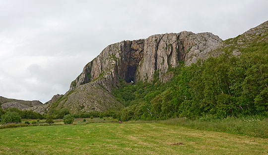
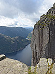
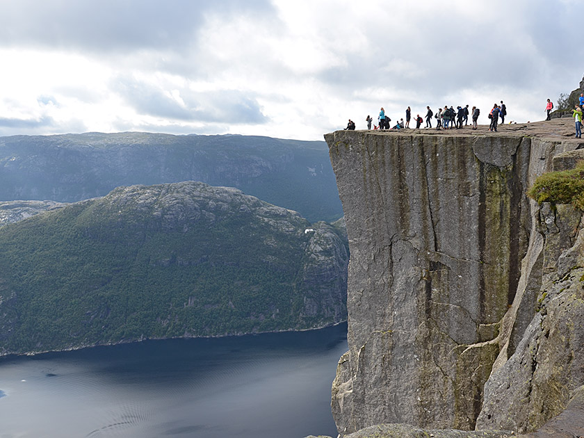
For anyone travelling in south-west Norway, a visit to Preikestolen is almost a must. The famous Pulpit Rock hangs a good 600 metres above the Lysefjord and offers visitors a wonderful view, including a dizzying drop below. However, the spectacular scenery also means that you won’t experience solitude at Preikestolen. Around 200,000 hikers visit the 25-by-25-metre Pulpit Rock every year. This means that Preikestolen attracts even more visitors than the famous Trolltunga cliff. If you want to avoid finding yourself in the middle of a mass exodus, you should set off from the car park very early during the peak season. Later in the morning, you’ll be surprised by the crowds you can encounter in Norway’s mountains. At the narrowest points in the upper section of the hike, minor bottlenecks can certainly occur. Yet despite the high number of visitors, Preikestolen is an absolutely worthwhile destination that every Norway enthusiast should have visited at least once.
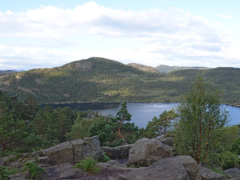 We leave the car park at Preikestolen fjellstue heading east, pass under the access road, turn left after the underpass and follow a wide forest path uphill. After a hairpin bend, the path leads us upwards on a moderate incline in a south-easterly direction. The trees frequently give a view of Lake Revsvatnet below us. After a good quarter of an hour, we reach a small high plateau. We keep slightly to the left, leave the plateau via a path paved with stone slabs and continue south-eastwards through sparse woodland. We cross a small stream via a small wooden bridge.
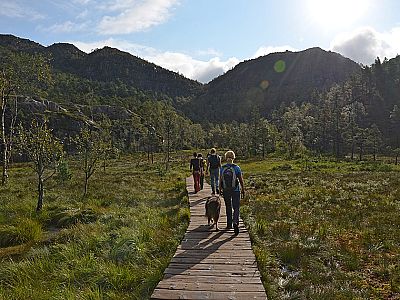
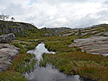
 The stony path leads us to smooth rock, which we climb over via steps. Afterwards, the stone-paved path leads us further uphill and we reach a marshy meadow. We cross this via a wooden boardwalk and reach another stone path. A short descent follows, leading us to a signpost. Here we ignore the turn-off to Moslifjell on the left and continue straight ahead. After the descent, we reach another wooden boardwalk. We cross marshy terrain and later walk along a stony path past a rock face. A final wooden footbridge follows, which eventually leads us to a stone staircase.
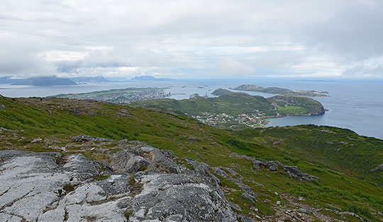
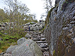
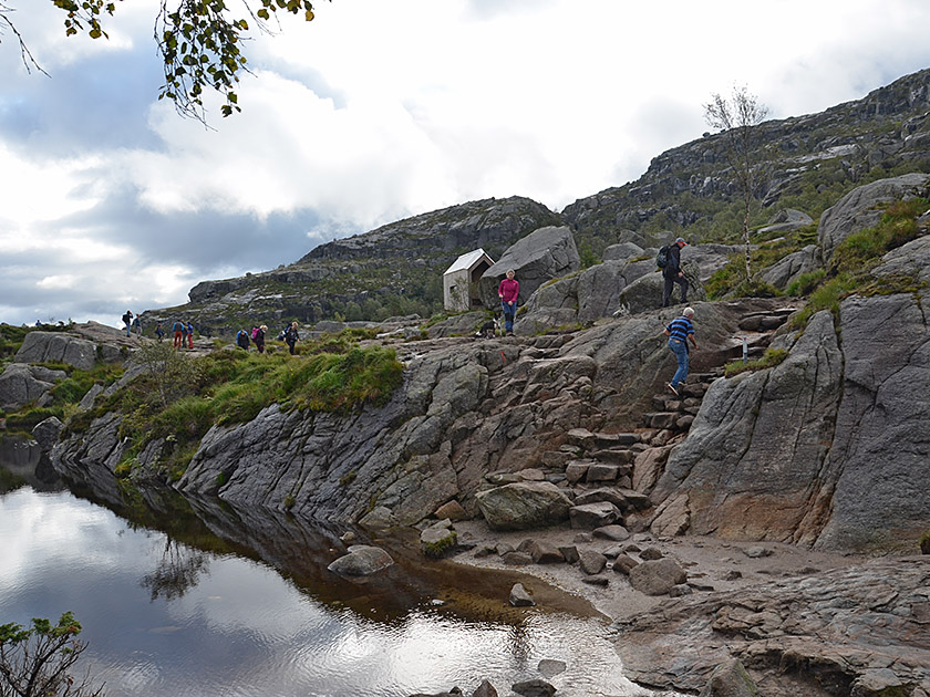 We climb countless steps, first through sparse woodland and later uphill at the foot of an imposing rock face. After the steps, the terrain finally levels out again and we reach a ridge with a fork. Here we can see a branch of the Lysefjord for the first time. We turn diagonally right and follow the signs towards Preikestolen. After a traverse, we come to a short stone staircase. A short descent follows, leading us down to a lake. We pass the mountain lake along its eastern shore, then descend briefly over a smooth rock step and arrive at another lake, whose shore we leave via a stone staircase.
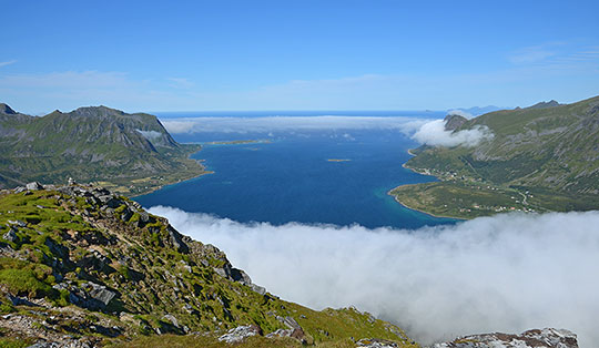
 We walk eastwards over smooth, flat ground and pass another body of water. Eventually, we come to a traverse that leads us close to a rock face. A narrow section has been made safer with a handrail and a wooden bridge. After this secured passage, we continue our hike across open terrain with flat ground. The path curves gently to the right towards the south and becomes significantly narrower. Close to the cliff edge, we follow the now narrower path up to Preikestolen, which we reach after a good two hours. If you stand at Preikestolen and look back towards the rock face, you will see some red markings on the stepped rock on your right. Following these markings, you can climb a short distance up towards Neverdalsfjell and enjoy a magnificent view over Preikestolen and the Lysefjord from above.
Same as ascent.
No places for refreshments along the way. At the starting point is the Preikestolen fjellstue (280 m), a mountain hut run by the Norwegian Alpine Club (DNT) (Tel. +47 51 74 20 74, open all year round).
| Elevation | Time | Total | Destination | ||
|---|---|---|---|---|---|
| 280 m | - 604 m | + 2:10 | 2:10 | Preikestolen | |
| 604 m | - 280 m | + 1:50 | 4:00 | Preikestolen fjellstue | |