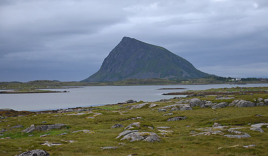

 Agder
Agder 
Up to the tunnel entrance, it is an easy, flat walk that follows the wooden log flume all the way. The two suspension bridges sway slightly when crossed, so you must have a head for heights. You have to crouch down to pass through the low tunnel. This can be uncomfortable for those with knee or back problems. Furthermore, it is pitch black inside the rock tunnel. A powerful head torch should be carried. People with claustrophobia would be better off avoiding this section of the tunnel.
From Kristiansand, take the Setedalsveien (towards Evje) to Mobsy, then turn right towards Vennesla. Drive through Vennesla and, at Grovane, turn left onto Steinsfossvegen. Pass under the railway tracks and keep left at the fork. After a level crossing, head diagonally right and follow the road over a bridge. After a left-hand bend, there are car parks by the power station. The first car park is reserved for power station staff. A little further down, there is a car park for walkers on the left. If you follow the road a little further, there are additional parking spaces on the right.
From Kristiansand, take bus route 30 to the Grovane bedehus (Vennesla) stop (for timetable information). From the bus stop, it is a 15-minute walk along Steinsfossvegen to the start of the Tømmerrenna.
58.30040214, 7.96947598
Anzeige
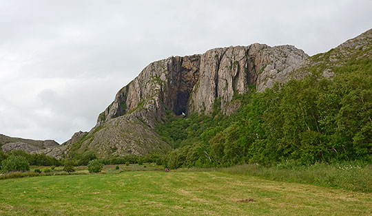
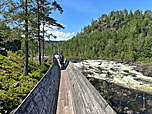
It’s not every day you get to experience a tour like this: where tree trunks were once floated down a lumber slide out of the valley, the Tømmerrenna now offers an impressive hiking route. The route follows this former lumber slide directly from Grovane, crossing rickety suspension bridges and passing through a pitch-black rock tunnel to the Beiehølen reservoir. The 4-kilometre-long lumber slide is the only one of its kind in the whole of Norway. Not far from the flume run the tracks of the Setesdalsbanen railway, which has been converted into a heritage railway. With a bit of luck, you might spot the puffing steam locomotive during your walk. The walk along the flat lumber slide is not difficult, but does require a certain amount of consideration when meeting oncoming traffic. If you lean to one side, oncoming walkers can easily slip past you. The two suspension bridges are certainly a bit of a wobbly affair. You should therefore have a head for heights for the walk along the Tømmerrenna. The key section, however, is the rock tunnel. For one thing, it is really dark in there. A smartphone torch is often not enough to illuminate the darkness. It is better to have a good head torch in your bag. Anyone with knee or back problems will also find the tunnel a bit of a struggle, as the low ceiling means you have to crouch to get through. The rock tunnel is also not recommended for those with claustrophobia. But whether you go through the tunnel or not, the Tømmerrenna, with its two suspension bridges, is an unforgettable experience.
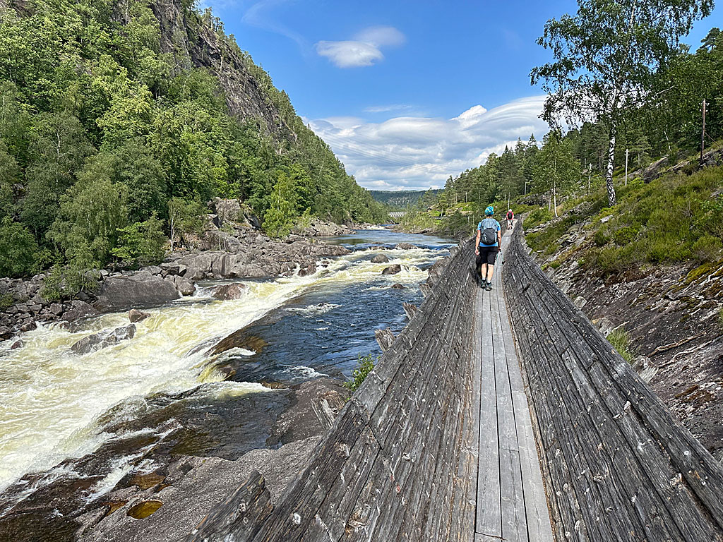 From the car park, we follow the road back towards Grovane, cross the Otra and, immediately after the bridge, come across the Tømmerrenna information board on the left. We therefore leave the road to the left and take the footpath, which leads us down to the Flößerrinne, accompanied by a view of the Steinsfossen waterfall. We enter the lumber slide and follow the Otra north-westwards. A short while later, we pass under the Setesdalsbanen railway tracks. Shortly after the underpass, we come to the first of the two suspension bridges and cross the river on the wobbly deck. After the thrill and the magnificent view down into the valley, we pass through a sparse stretch of woodland. There we come across a possible exit from the lumber slide.
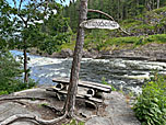
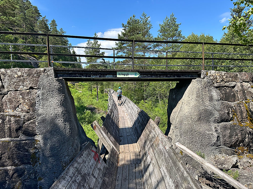 We continue to follow the Tømmerrenna and soon pass under a footbridge. Just before the bridge, there is another opportunity to leave the lumber slide. After the underpass, we reach the second suspension bridge, which takes us back to the right bank of the Otra. Immediately after this wobbly crossing, we come across a turn-off towards Grovane, leading off to the right. A few metres further on, the next exit is on the left. This leads to the Vrengebenken rest area, which is equipped with two benches and a wooden table. On the banks of the Otra, this lovely spot invites you to take a short break. Back on the wooden walkway, we come to the entrance to the rock tunnel. Now it’s time to switch on our headlamps and duck our heads.
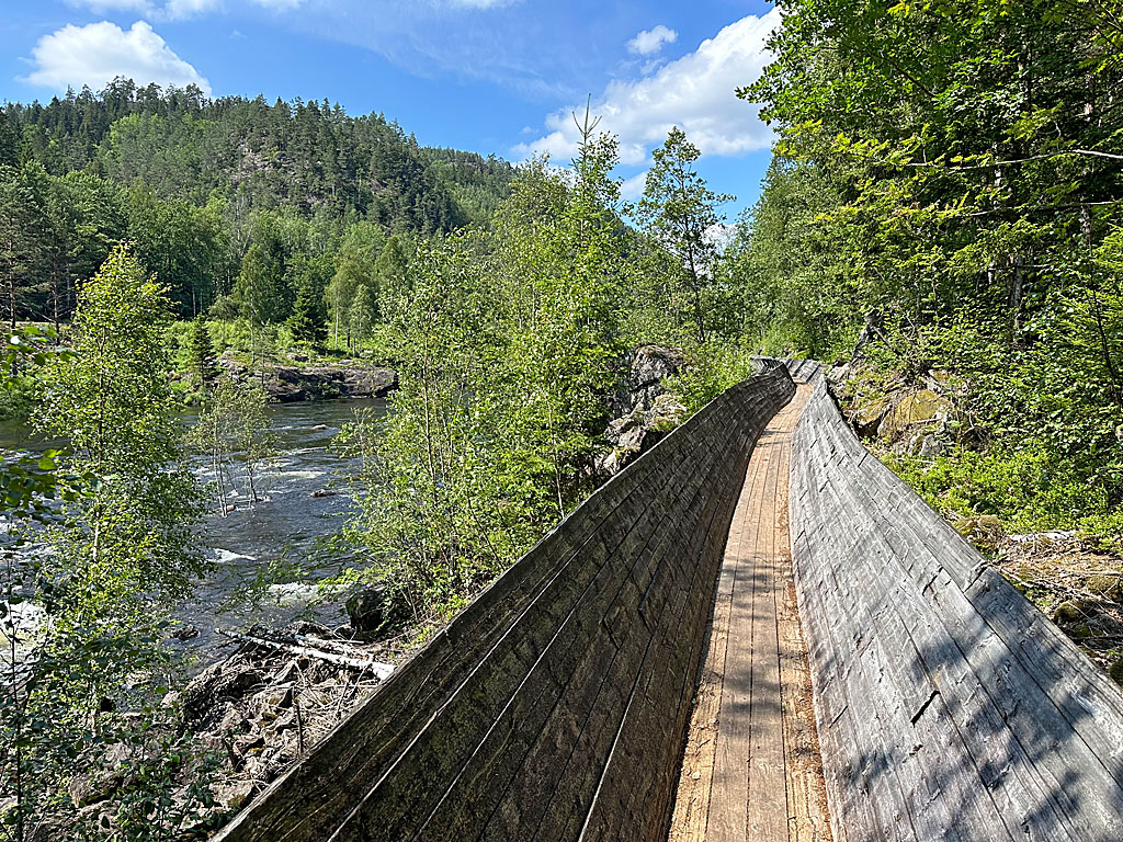 For the first few metres, we make our way into the cold and pitch-black tunnel in a crouched position. The tunnel is particularly low in the first section. We take particular care not to bump our heads and feel our way forward in the darkness. Soon we spot a light at the end of the tunnel and approach the exit step by step. Back in daylight, we follow the Otra along the flat lumber slide further north-west. A good 15 minutes’ walk still separate us from our destination, the dam at the Beiehølen reservoir. Finally, we pass the Løyning railway station building, which is situated on the opposite bank. Then we reach the dam, which also marks the end of the Tømmerrenna. We climb a flight of steps up to the Beiehølen reservoir, which marks the end point of our short hike.
We return to Grovane via the same route.
There are no places to stop for refreshments along the way.