


 Mangfallgebirge
Neuhaus, Dürnbachstraße car park (850 m) – Bodenschneidhaus (1365 m) – Bodenschneid (1669 m)
Overall, a moderately difficult mountain hike. The route to the Bodenschneidhaus is an easy walk, mainly along wide tracks and briefly along a narrow forest path. From the basin south of the Bodenschneidhaus, a path – particularly stony in the lower section – leads to the summit via short, rocky steep sections. At the start of the climb, there is a short traverse secured by a rope; on the summit ridge, a short gully must be climbed. The path is unpleasant when wet. Sure-footedness is essential for the ascent to Bodenschneid.
Take the Munich–Salzburg motorway to the Weyarn exit. After the exit, head towards Weyarn and drive via Weyarn, Miesbach, Hausham and Schliersee to Neuhaus. After the level crossing, take the second right towards Josefstal and immediately turn right again into Dürnbachstraße. There is a car park for hikers at the end of Dürnbachstraße.
From Munich Central Station, take the Bayerische Regiobahn towards Bayrischzell to the Fischhausen-Neuhaus stop (timetable and booking). Walk from the station along Waldschmidtstraße to Dürnbachstraße and follow this to the hiking car park (just under a 20-minute walk to the starting point, 1.2 kilometres in total).
47.70017345, 11.86669350
Anzeige
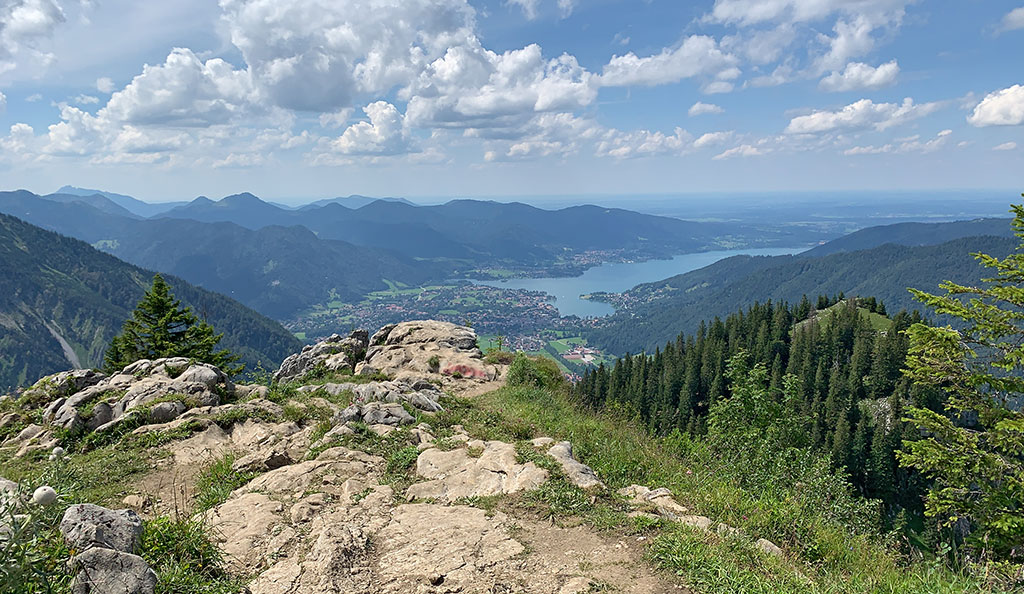
The Bodenschneid between Lake Tegernsee and Lake Spitzingsee can be approached from several directions. The ascent from Neuhaus via the Dürnbach Valley and the Bodenschneidhaus is very popular. This route is also particularly suitable for those travelling by public transport. From Fischhausen-Neuhaus station, you can reach the hiking car park on Dürnbachstraße within a manageable 20 minutes. From the car park, the route takes you up forest tracks and small woodland paths to the meadows of the Raineralm and on to the Bodenschneidhaus. The tracks end at the Alpine Club hut, and we walk into the beautiful cirque at the foot of Bodenschneid and Rinnerspitz. From here, a rocky and entertaining path – which requires sure-footedness in places – leads us up to the summit with its large cross. At the highest point, we are greeted by a beautiful view down to Lake Tegernsee and a magnificent vista over the Mangfall Mountains and the Karwendel.
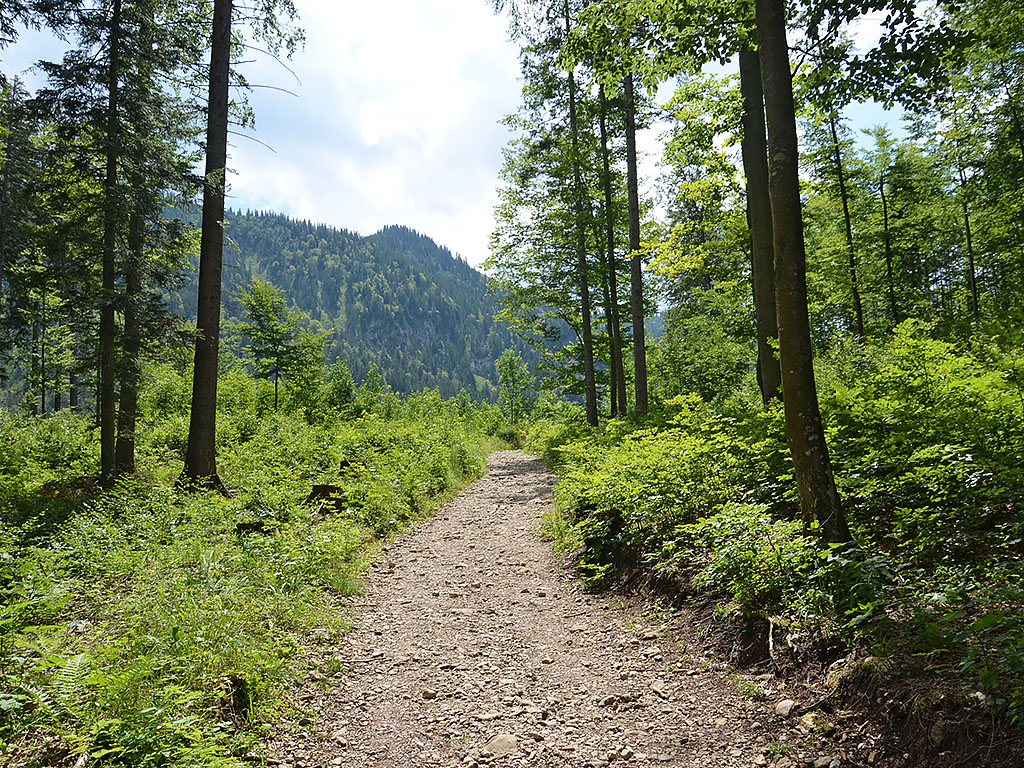 We leave the hiking car park at the end of Dürnbachstraße and take the forest track that leads us uphill in a south-westerly direction through the Dürnbach Valley (signposted ‘Bodenschneid, Bodenschneidhaus’). The wide track takes us to the Dürnbach Chapel and shortly afterwards to a junction, which we pass on the right. We therefore stay on the winding forest track, which eventually brings us to a junction. There we continue straight ahead and walk along a now narrower path through sparse mountain woodland towards the south-west. We reach another crossroads, continue straight ahead here too, and enter a shady section of woodland. There, our forest path takes a right-hand bend and, in a sweeping right-hand curve, we walk uphill towards a track. We turn left onto the wide track and follow it uphill in a southerly direction.
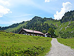
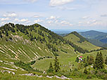
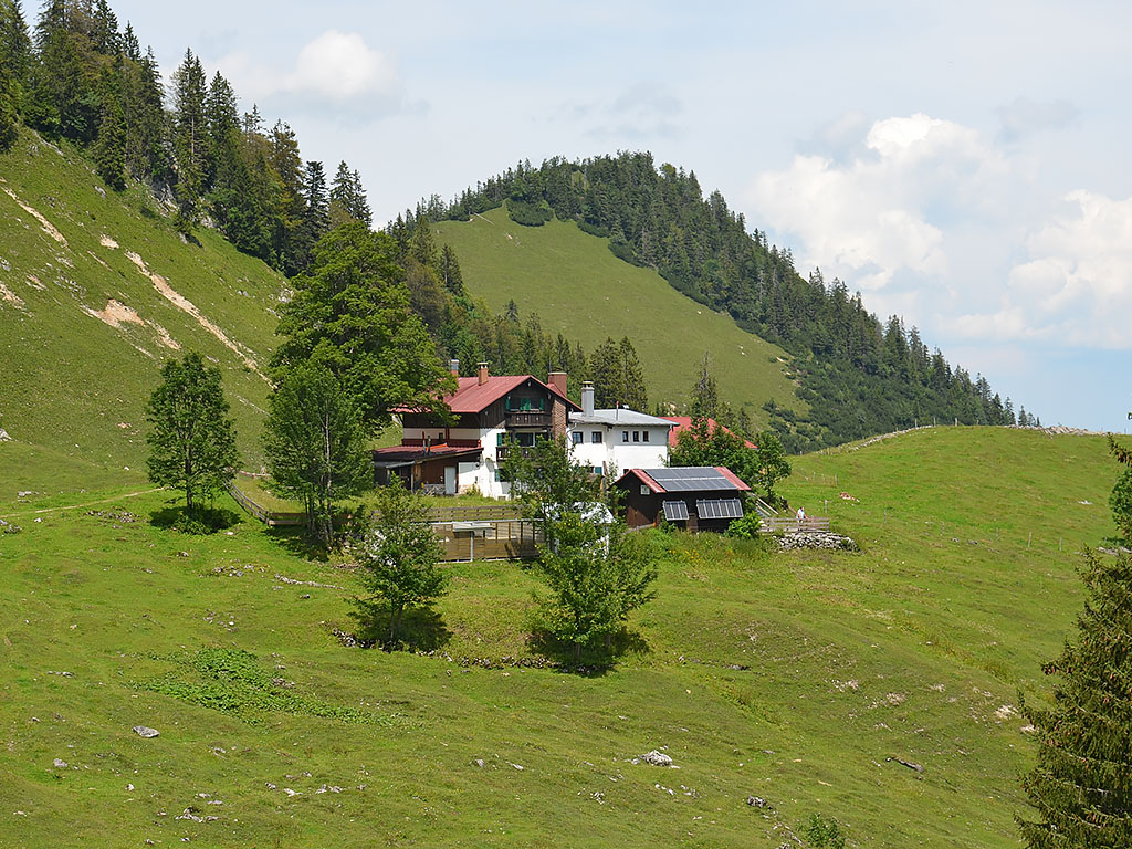 After a short climb, the wide meadowland of the Raineralm opens up before us. The Bodenschneid rises up ahead of us; to our right, the alpine pasture is framed by the Rainerkopf and the Wasserspitz. We pass the Raineralm building on our left and stay on the wide track. This leads us uphill at a moderate gradient and, after a short stretch of woodland, we catch sight of the Rettenbeckalm and the Bodenschneidhaus ahead of us. After a walking time of 1½ hours, we finally reach the Alpine Club hut. To continue on to the Bodenschneid, we walk past the Bodenschneidhaus on the right and leave the terrace heading south-west. With a view of the Rinnerspitz, we soon reach a signpost and continue straight ahead there (“Bodenschneid”). The path leads us further into the cirque, where it makes a sweeping left-hand bend.
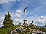
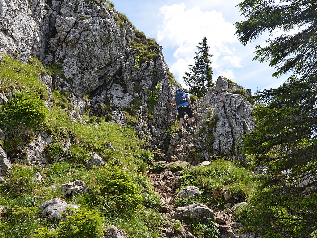 After the long bend, we come to a junction and, keeping to the right, take the signposted path to the Bodenschneid. Shortly after the start, this turns right and leads us across a rocky slope via a traverse secured by wire rope. We follow the stony path upwards through a series of hairpin bends and climb over short rocky steps. As soon as we leave the sparse woodland behind us, we reach a plateau. Now we can see the rocky summit structure of the Bodenschneid above us. We hike towards the summit wall through further hairpin bends and traverse to its western side at the foot of the wall. There we climb up a short rocky gully and thus reach the saddle between the Bodenschneid and the Rinnerspitz. At the saddle, we turn left (east) and climb up the scree slope to the huge summit cross (1 hour from the Bodenschneidhaus).

The descent follows the ascent route.
Bodenschneidhaus (1365 m), DAV Sektion Bodenschneid, Tel. +49 (0)8026/4692. Open daily all year round from 9 am to 10 pm. For current opening hours and any planned closures, please check the hut’s website.
| Elevation | Time | Total | Destination | ||
|---|---|---|---|---|---|
| 850 m | - 1365 m | + 1:30 | 1:30 | Bodenschneidhaus | |
| 1365 m | - 1669 m | + 1:00 | 2:30 | Bodenschneid | |
| 1669 m | - 1365 m | + 0:45 | 3:15 | Bodenschneidhaus | |
| 1365 m | - 850 m | + 1:15 | 4:30 | Neuhaus | |


