


 Bregenzerwald
Au (822 m) – Alpengasthof Edelweiß (1495 m) – Kanisfluh (2044 m)
The route to the Alpengasthof Edelweiß is an easy mountain hike on comfortable paths. The onward route to the highest point of the Kanisfluh is mostly easy. Sure-footedness is advisable on two short, steeper sections of the path.
Take the Munich–Lindau–Bregenz motorway and continue to the Dornbirn Nord exit. Then follow the road towards the Bregenzerwald. Drive via Alberschwende, Egg and Mellau to Au. Shortly after entering the village, turn right towards Damüls. Park at the bridge over the Argenbach, just past the ‘End of Au’ sign. There are parking spaces at the roadside before and after the bridge. Alternatively, you can park your car directly by the church in Au and start the hike there (signposted, approx. 15 minutes’ additional ascent time).
Take the train from Lindau to Dornbirn. From Dornbirn, continue on bus route 40 towards Achrain-Egg-Bezau-Warth to the Au stop in Vlbg Jaghausen (for timetable information). Hike from Au via Argenstein to Ahornenvorsäß and continue as described (15 minutes longer ascent time).
47.31825060, 9.96182621
Anzeige
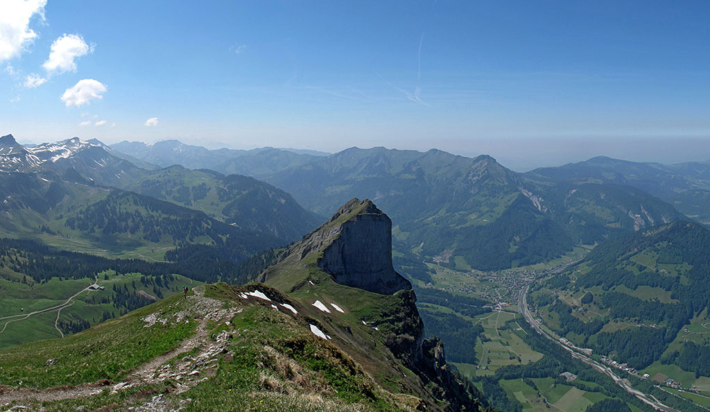
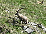
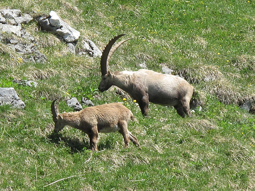
The Kanisfluh is an elongated mountain range in Vorarlberg and also the landmark of the Bregenzerwald. An ascent of this legendary mountain, whose northern flank drops steeply, is tackled via the lovely southern side. Without the aid of lifts, the quickest way to reach Holenke, the highest point of the Kanisfluh, is from Au. The hike can be significantly shortened by driving up to the Alpengasthof Edelweiß. Even with the help of the Mellauer Bergbahn, the ascent becomes little more than a short trip. However, it is highly recommended to climb the Kanisfluh from the valley and take in the alpine landscape. In the summit region, there is a very high chance of encountering ibex.
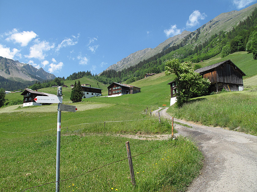 The hiking trail to Kanisfluh begins on the right-hand side of the road after the bridge (signposted). We follow the forest track for a short while and turn left after a few metres. At a fork, we take the left-hand path, leaving a farmstead on our right. We follow the wide forest track into the sparse woodland. A stream runs alongside us on the left. After a hairpin bend, the path leads us out of the forest and then climbs in a series of switchbacks to the first buildings of the Ahornenvorsäß. Here we meet the path that leads up from the centre of Auer.
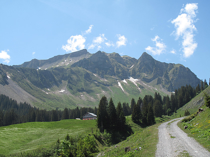 We turn left at the junction and walk through the sprawling Ahornenvorsäß alpine settlement. At the end of the settlement, we reach a small chapel. After the chapel, the path becomes significantly steeper and narrower, though it remains very comfortable. The path leads us into a shady section of woodland. After the woodland, we come to the Alpe Feuerstein. As soon as we have passed the Alpe, the path becomes significantly flatter. We now continue at a leisurely pace until we reach the Alpengasthof Edelweiß, which soon comes into view.
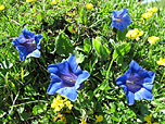
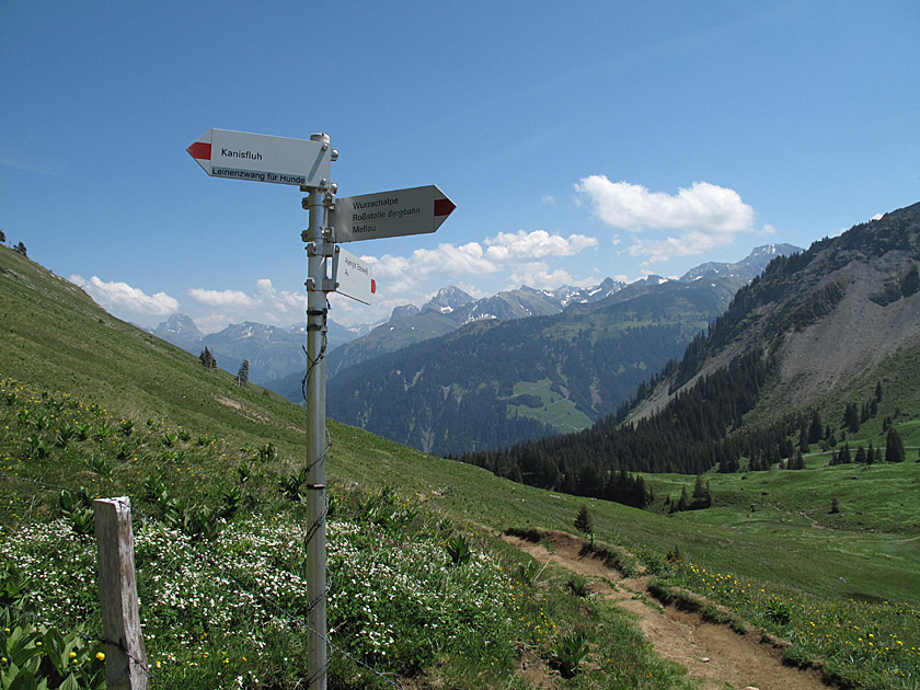 At the inn, the meadow path branches off to the right towards Kanisfluh (signposted). We pass a bench and walk along the path past colourful flowering meadows into a hollow, crossing a small stream. After the hollow, we climb gently up a meadow slope until we reach a fence. From here, keep your eyes peeled, as there’s a good chance of spotting ibex. Dogs must now be kept on a lead.
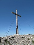
 First, we come to a small rocky step by a tree. A rope is attached to the left of the tree, which makes the climb easier. After the step, the path leads us up the grassy flank in numerous switchbacks. Just below the Hählesattel, the path becomes steeper and, thanks to the rugged terrain, more uneven. Upon reaching the Hählesattel, we look to the left towards the Stoß, a dizzying rock tower with smooth, polished vertical walls. We turn right and hike along the ridge up to the Holenke, the highest point of the Kanisfluh.
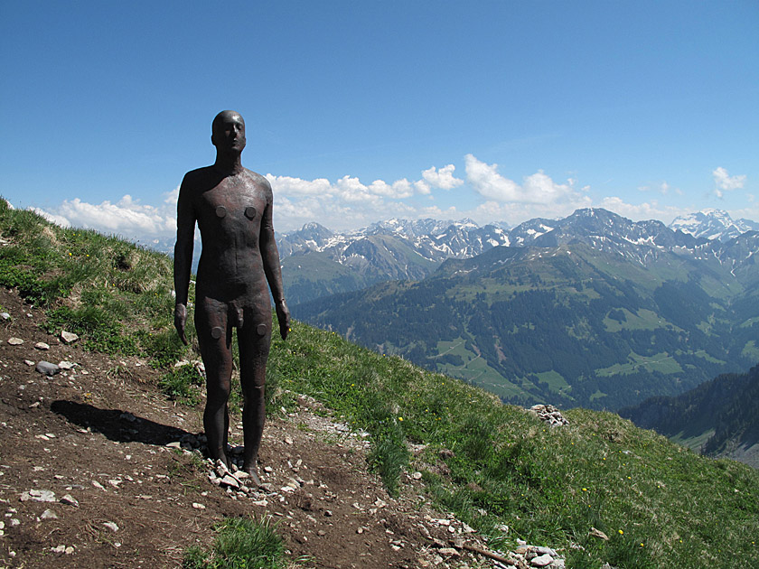 Just below the summit stands a life-sized Iron Man. One hundred of these statues were erected by the British sculptor Antony Gormley in collaboration with the Kunsthaus Bregenz in Vorarlberg at an altitude of 2,039 metres. From the summit cross, we enjoy a wonderful view over the Allgäu Alps, including the Hoher Ifen and the Großer Widderstein, over the Lechquellengebirge and into the Montafon towards Sulzfluh, the Drei Türme and the Schesaplana.
Same as ascent. If you follow the path at the Hählesattel to the right, you will reach a narrow ledge offering an incredible view down into the valley. The ledge should only be accessed by those with absolutely no fear of heights! In wet conditions, crossing the narrow ridge is not recommended due to the risk of falling.
Alpengasthof Edelweiß (1495 m), Tel. +43 (0)664-4324840. Open from 1 May to 26 October.
| Elevation | Time | Total | Destination | ||
|---|---|---|---|---|---|
| 822 m | - 1495 m | + 1:40 | 1:40 | Alpengasthof Edelweiß | |
| 1495 m | - 2044 m | + 1:20 | 3:00 | Kanisfluh | |
| 2044 m | - 1495 m | + 1:05 | 4:05 | Alpengasthof Edelweiß | |
| 1495 m | - 822 m | + 1:25 | 5:30 | Au | |


