


 Tannheim Mountains
Grän (1138 m) – Bad Kissinger Hut (1788 m) – Aggenstein (1985 m)
Overall, a challenging mountain hike. Up to the summit structure, it is a moderately difficult mountain hike on stony paths. At the summit, there is a short, easy scramble secured with wire ropes over bare scree. Sure-footedness is essential here.
From Garmisch via Leermos or from Innsbruck via the Fern Pass to Reutte. From Reutte, continue to Weißenbach and turn right here into the Tannheimer Valley. After Haller and Haldensee, turn right towards Grän; shortly after the ‘End of Village’ sign, park on the right-hand side at the Bad Kissinger Hütte car park. Alternatively: Drive from Pfronten towards the Tannheim Valley and park at the hiking car park on the left-hand side just before Grän.
From Reutte railway station, take bus route 120 to Grän (for timetable information).
47.51507781, 10.55609107
Anzeige
From the Tannheim Valley, you can reach the Aggenstein, a peak on the border between Tyrol and Bavaria, on a varied and interesting hike. The ascent leads through sparse woods with flowering meadows and babbling brooks to the exposed Bad Kissinger Hütte. After a charming stretch of the route and a short final climb, you finally reach the summit with its magnificent views. At the weekend, thanks to these attractions, you’re unlikely to be alone on this popular route. After successfully reaching the summit, you should definitely pay a visit to the Bad Kissinger Hut. On the hut’s terrace, you can enjoy the view over the Tannheim Valley once more whilst tucking into an apple strudel.
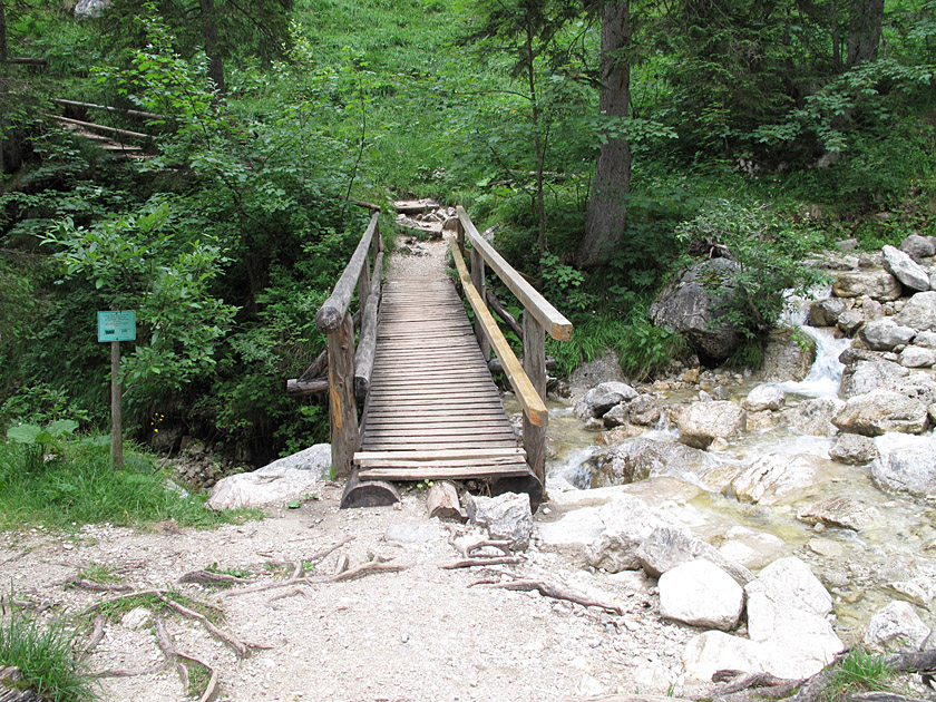 At the car park, we follow the wide track towards the Bad Kissinger Hut, which leads directly to the Aggenstein. At a small settlement, we turn right, then a few minutes later turn left again onto a dirt track (the path is very well signposted). We walk past a radio mast and now slowly begin to gain altitude. After crossing a forest track, we enter a sparse woodland. We now follow a narrow path through the woods, which is initially not very steep. We cross two rushing streams via small wooden bridges.
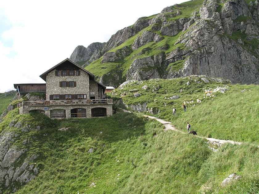 Gradually, the woodland becomes a little denser and the path winds its way up the wooded slope, becoming noticeably steeper. Gradually, the forest thins out again, revealing beautiful views of the Tannheimer Valley. After a good hour and a half, we reach a saddle between Aggenstein and the Brentenjoch to the east. From here, we can now look towards Bavaria and Lake Forggensee below us. At the saddle, we turn left and climb up to the Bad Kissinger Hut in just under ten minutes.
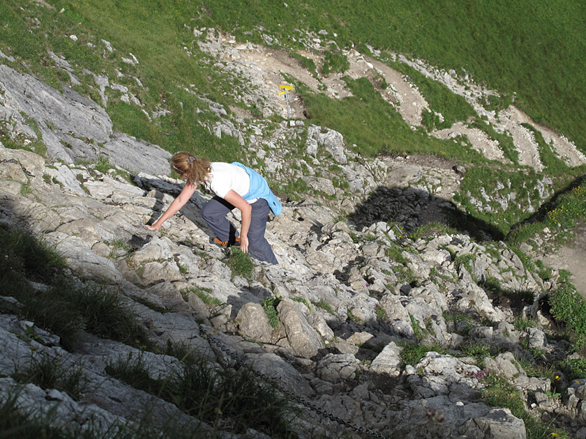
 From the hut, the summit cross of the Aggenstein already seems within reach. We walk past the hut and cross a grassy slope. Now the path zigzags up to the ridge to the right of the summit. Keeping to the left, we now climb up a gully over rocky outcrops using wire ropes. It’s not really climbing, more like a steep walk where your hands provide the necessary stability. However, the rocks are quite slippery and worn, so the climb requires concentration.
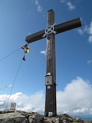
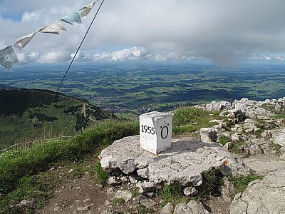
 After this scrappy final stretch, we reach the large summit cross and a boundary stone. At the highest point, we enjoy the view of the Ammergau, Tannheim, Lech Valley and Allgäu mountains, as well as the views down to Füssen and into the Tannheim Valley. Looking westwards, we gaze past the Nagelfluh range into Switzerland and can make out the Appenzell Alps, including the Säntis, in the distance.
Same as ascent.
Bad Kissinger Hütte (1788 m), DAV Sektion Bad Kissingen, Tel. +43 (0)676/3731166. Open from early May to late October.
| Elevation | Time | Total | Destination | ||
|---|---|---|---|---|---|
| 1138 m | - 1788 m | + 1:45 | 1:45 | Bad Kissinger Hütte | |
| 1788 m | - 1985 m | + 0:30 | 2:15 | Aggenstein | |
| 1985 m | - 1788 m | + 0:25 | 2:40 | Bad Kissinger Hütte | |
| 1788 m | - 1138 m | + 1:20 | 4:00 | Grän | |


