


 Mangfall Mountains
Bad Wiessee, Sonnenbichl (865 m) - Aueralm (1266 m) - Fockenstein (1564 m) - Neuhüttenalm (1328 m) - Aueralm (1266 m) – Wachselmoosalm (1180 m) – Bad Wiessee, Sonnenbichl (865 m)
Overall a moderately difficult mountain hike, leading along forest tracks to the Aueralm. The ascent to the summit follows a bumpy and partly stony path. On the descent, the traverse involves a rocky steep section and a short, rugged gully. Sure-footedness is essential for the ascent of the Fockenstein.
Munich-Salzburg motorway, Holzkirchen exit. Follow the B 318 towards Tegernsee and, at the traffic lights in Gmund, keep right towards Bad Wiessee. In Bad Wiessee, immediately after the Edeka, turn right into Söllbachtalstraße. Keep right at both junctions and drive up to the Sonnenbichl hiking car park (€10.50 parking fee for a day ticket, as of 2025).
Take the Bayerische Regiobahn from Munich Central Station to Gmund. From Gmund, take the bus (circular route towards Tegernsee) to the Lindenplatz stop in Bad Wiessee (timetable and booking). From the bus stop, it is a 30-minute walk (1.6 km and an additional 125 metres of elevation gain) to Sonnenbichl. To do this, coming from Gmund by bus, first follow the B 318 in the direction of travel and then turn right into Prinzenruhweg. At a crossroads, keep left and immediately after the Zeiselbach bridge, turn right onto a footpath. Follow this to the edge of the forest and follow the Zeiselbach stream up a forest track to the Sonnenbichl hiking car park.
47.70444100, 11.71350700
Anzeige
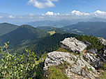
Anyone setting off from Sonnenbichl in Bad Wiessee through the Zeiselbach Valley towards Aueralm and Fockenstein begins their tour with a long warm-up. For the first 45 minutes, we follow the stream along a flat path into the valley. It is only at the Winterstube that the character of the path changes: The gradient increases, and the wide track now climbs steeply up through the valley. At the Aueralm, the view of the Fockenstein opens up for the first time. From here, the direct ascent to the summit takes about an hour. A steep and bumpy path leads us through shady mountain forest and later across rocky meadow terrain up to the small summit cross.
To enjoy a short circular walk, we cross the summit and descend on the south-western side of the mountain. Passing the Neuhüttenalmen, the path leads back to the Aueralm. We now continue via the Wachselmoosalm. After a short climb, we leave the alpine pasture area and hike over a sparsely wooded ridge to the Zwergelberg. After a traverse, the mountain forest suddenly gives way and a magnificent view down to Lake Tegernsee opens up before us. Finally, we descend along the edge of the ski slope and return through a wooded area to the hiking car park at Sonnenbichl.
The direct ascent route via the eastern ridge from the Aueralm to the Fockenstein must not be used during the winter season from 15 December to 30 April (forest and wildlife conservation area)! During this period, the ascent must be via the Neuhüttenalm and the south-western side of the mountain (an additional 15 minutes).
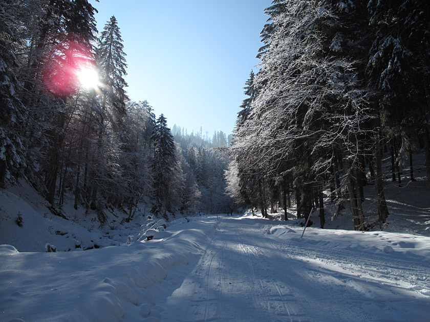 At the car park at Sonnenbichl (865 m), we cross the Zeiselbach stream, keep diagonally left after the bridge and thus take the wide forest track towards the Aueralm. After just under 10 minutes, we ignore a wooden bridge on the left that crosses the stream. We continue straight ahead and come to a signposted junction. Here too, we maintain our general direction. About 20 minutes later, we reach the Zeiselbach-Winterstube. The path now climbs slightly more steeply and after 10 minutes we reach a barrier. Beyond the barrier, the track becomes significantly steeper and we quickly gain altitude. We pass a wooden shelter and switch to the right-hand side of the stream there.
 We continue hiking uphill through the narrow valley, pass another shelter and later come to a fork. We now turn left and follow the much flatter path to a cross-path. We now turn right, leaving the mountain forest behind us for the time being, and after a right-hand and a left-hand bend reach the Aueralm (1,266 m). From the Aueralm, we follow the wide track over a ridge of meadows towards the Fockenstein. After a small chapel, we turn right onto the direct ascent to the Fockenstein. We pass through a gap in the pasture fence and follow the root-covered path steeply upwards in short hairpin bends through the shady mountain forest.
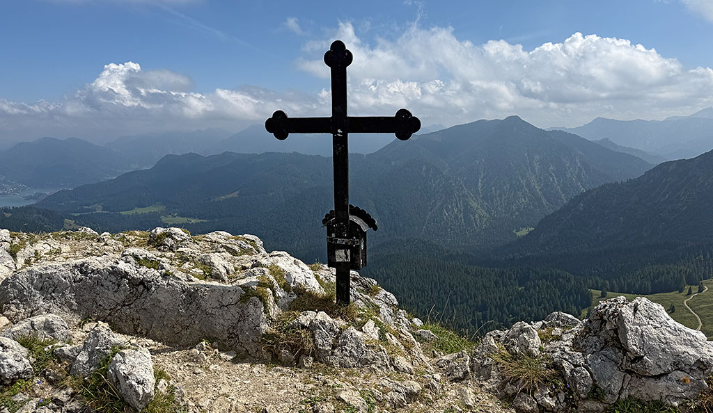
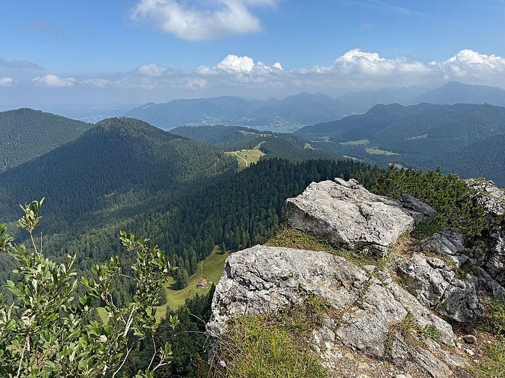 Later, we slip through a turnstile and walk south-westwards over a ridge of meadows. After a short stretch of woodland and a rugged ascent, we reach another turnstile. There, we enter the mountain forest and veer left to avoid a rocky outcrop. We lose a few metres in altitude and cross past the wooded ridge ascent. Then, keeping to the right, we return to the ridge and climb up to a shoulder after a right-hand bend. Here we turn left and traverse past a rock face. After the rocks, we follow the stony path in short switchbacks up to a grassy hollow. Through this we reach the summit meadow and climb, keeping to the left, up to the wrought-iron cross on the Fockenstein (1,564 m).
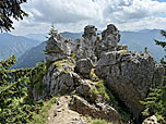
 For the descent via the Neuhüttenalmen, we cross the summit in a south-westerly direction. Over the ridge, we reach a rugged slope that leads us to a striking rock tower. To the right of the rock formations, we descend over a narrow step and through a gully. A traverse takes us to a rocky hillock. There, we head right and follow the edge of the forest north-westwards. After a wide left-hand bend and a gentle right-hand curve, we reach a signposted junction heading south-west. Here, we turn sharply left and walk downhill in a south-easterly direction.
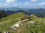
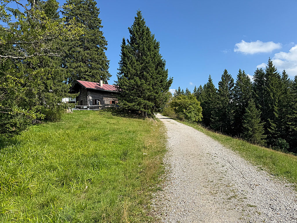 After a right-hand and a left-hand bend, we head towards the Neuhütteneck. Just before the grassy hillock, we turn left at a signpost. We then walk down to the Neuhüttenalm (1,328 m), continue straight on at the junction there, and return to the Aueralm (1,266 m) via a short uphill stretch. We pass the Aueralm and, after the left-hand bend, continue straight on at the junction. We also ignore the next junction, which leads down to the Söllbach Valley on the right. We maintain our general direction and enter the meadowland of the Wachselmoosalm through a gate. On a slight uphill stretch, the wide alpine path leads us past the Waxlmooshütte.
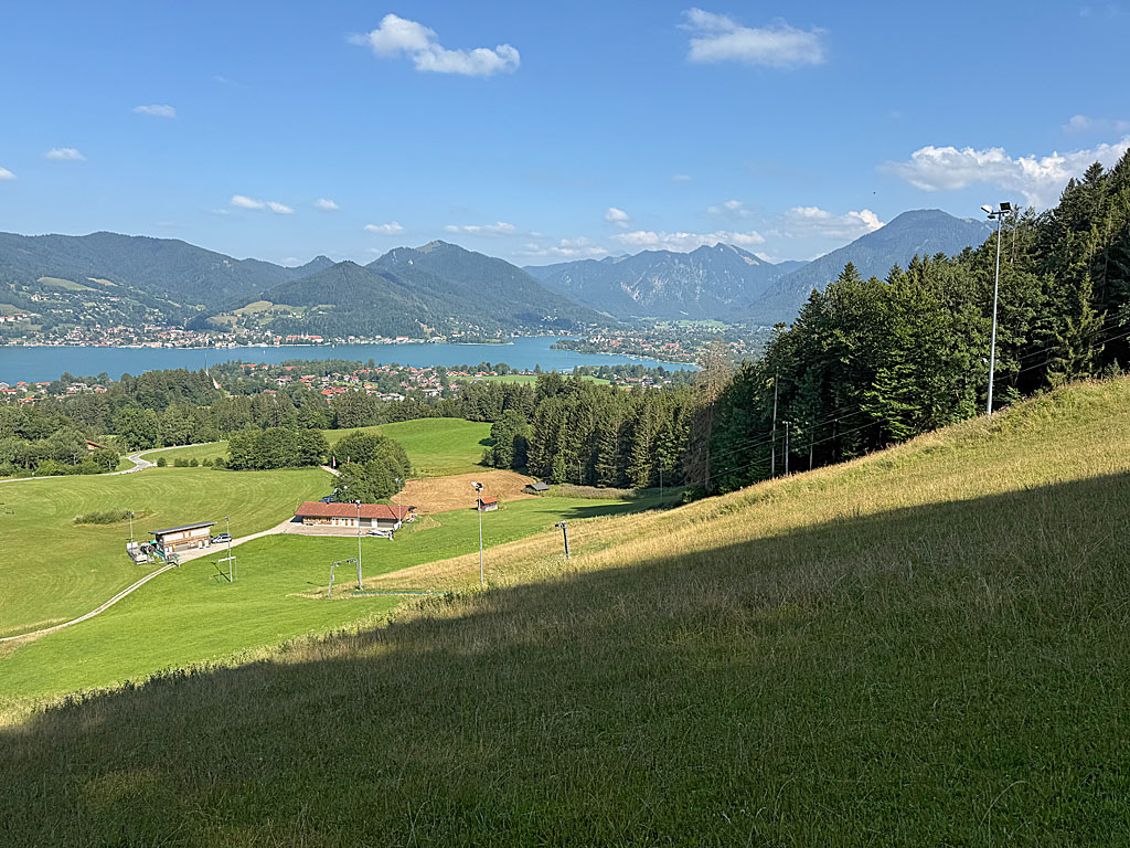 After a left-hand bend, the terrain levels out and we reach the Wachselmoosalm (1,185 m). We now walk past the alpine hut on the left, cross the pasture and negotiate a crossing at the edge of the forest. We hike north-eastwards along a wide, gently sloping ridge. In a right-hand bend, we cross past the wooded Zwergelberg and reach the upper end of the ski slope. Staying at the edge of the forest, we follow the slope downhill and, after a left-hand bend, descend steeply to the lift huts. We then head back into the mountain forest and, after a right-hand hairpin and a gentle left-hand bend, reach a junction. We now turn left and return to the Sonnenbichl hiking car park.
| Elevation | Time | Total | Destination | ||
|---|---|---|---|---|---|
| 865 m | - 1266 m | + 1:30 | 1:30 | Aueralm | |
| 1266 m | - 1564 m | + 1:00 | 2:30 | Fockenstein | |
| 1564 m | - 1328 m | + 0:35 | 3:05 | Neuhüttenalm | |
| 1328 m | - 1266 m | + 0:25 | 3:30 | Aueralm | |
| 1266 m | - 865 m | + 1:15 | 4:45 | Sonnenbichl | |


