


 Hochschwab Mountains
Gasthof Bodenbauer (884 m) - G'hacktbrunn (1785 m) - Fleischer-Biwak (2153 m) - Hochschwab (2277 m) - Schiestlhaus (2153 m) - Fleischer-Biwak (2153 m) - G'hacktbrunn (1785 m) - Gasthof Bodenbauer (884 m)
A challenging mountain hike featuring a gentle via ferrata (A) that requires sure-footedness. The rather long ascent also demands a good level of fitness. There are no places to stop for refreshments along the way. The Schiestlhaus is only reached after crossing the Hochschwab summit. In the G'hackte, old snowfields can persist well into late spring.
In the G'hackte, where there is a risk of rockfall, wearing a helmet is advisable.
Take the Munich–Salzburg motorway; at Salzburg, continue on the A1 towards Vienna/Linz to the Voralpenkreuz junction. At the Voralpenkreuz, head towards Graz (toll: €4.50, as of 2011) to the St. Michael motorway junction. At the St. Michael motorway junction, continue towards Vienna/Leoben until the Kapfenberg exit, then follow the signs to Kapfenberg and, once in the town, follow the signs towards Mariazell/Hochschwab. After leaving Kapfenberg, drive to Thörl. In Thörl, turn left towards St. Ilgen and drive via St. Ilgen to the end of the road. Park your car at the large hiking car park by the Gasthof Bodenbauer.
47.57984072, 15.11403322
Anzeige
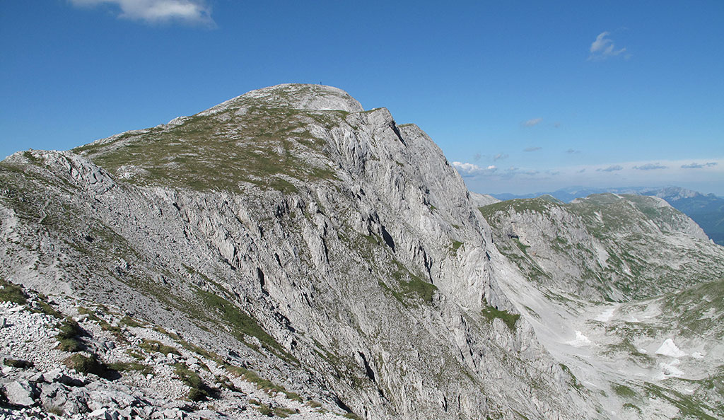
No matter which direction you approach the Hochschwab from, the routes to the summit are all long and involve a significant climb. The route from Gasthof Bodenbauer through the G'hackte is the classic and perhaps most exciting ascent of the Hochschwab. After a walk through the beautiful Trawiestal valley to the G'hacktbrunn, a treat awaits in the form of a pleasant scramble along an easy via ferrata. The final ascent across the panoramic high plateau to the Hochschwab summit ultimately rewards you for the efforts of the long approach. There are no places to stop for refreshments on the route described, but the Schiestlhaus can be reached from the Hochschwab summit in just under half an hour via a worthwhile detour.
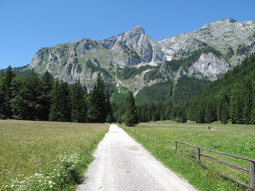 From the hiking car park at Gasthof Bodenbauer, we walk along a wide forest track towards the rocky faces of the Hochschwab. After just under five minutes, we reach a junction. Here we keep to the right and take the path towards G'hacktbrunn. We then walk through a shady forest. At another unmarked junction, we keep diagonally to the right and follow the red and white markings. A little later, we come to another signposted junction. Here we turn left towards G'hacktbrunn/G'hacktes.
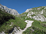
 We cross a stream and continue along the wide path. After the forest, the forest track joins a meadow path. After a few steps, the meadow path forks. Here, turn left and walk towards the rock faces. Once we reach the rock faces, the path leads us to the right and we follow it through initially sparse and later dense woodland, past the rocky faces into the Trawiestal valley. After a clearing and another stretch of woodland, we finally reach open terrain. The grassy ground gives way to gravel and we walk into a basin covered in mountain pine.
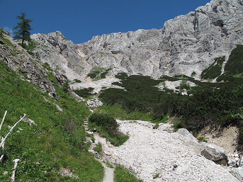
 INow we climb a mountain pine slope on the left-hand side of the basin via countless switchbacks. We gain altitude quickly and soon have a beautiful view over the Trawiestal valley and its adjacent rock formations. Two steeper sections of the path are secured with a chain. Once we have passed a small spring known as the Vogelbad, we are just 20 minutes away from the G'hacktbrunn and the Vogauer memorial cross. At the G'hacktbrunn there is a small spring and a final opportunity to top up your water supplies before the summit.
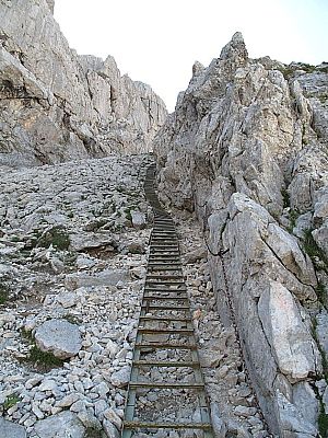
 At the Vogauer memorial cross, the paths now diverge. To the right, the route would now lead over the Trawiessattel to the Schiestlhaus. We, however, turn left and take the direct route over the G'hackte to the Hochschwab summit. After a good 10 minutes’ walk, we reach the start of the via ferrata. After a short steep section secured by wire rope, we come to an endless staircase with countless steps, which leads us up via a ramp on the left-hand side of a rock face. Eventually, the staircase gives way to rugged terrain and a chain guides us further up along the edge of the rock face. Eventually, we reach a steep ledge with handholds that help us cross the rock barrier to the right.
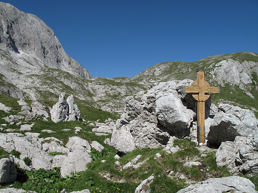
 Now, for the first time, we look over to the Hochschwab summit on our right, with its rugged and steeply sloping walls. Following an iron railing, we climb swiftly up a rugged ridge and leave the via ferrata behind us half an hour after setting off. On the walking terrain, we first follow a path keeping to the right and then follow marker posts up to the crest of a rugged hill. From there, we descend into a hollow, pass a small metal cross and climb back up on the other side. Crossing a plateau, we finally reach the Fleischer bivouac hut.
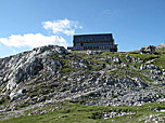
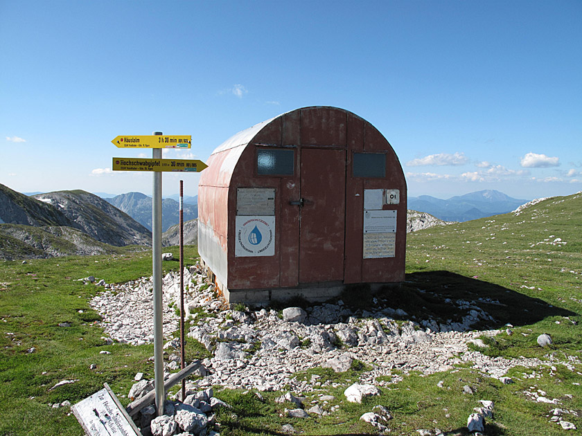
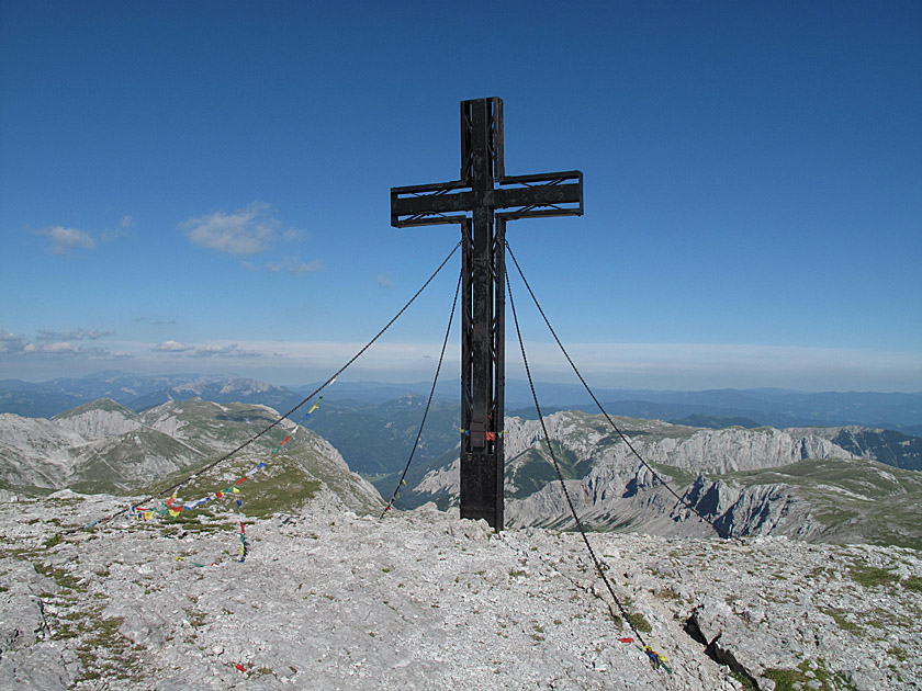 From the bivouac, it is now a further 30-minute walk to the summit of the Hochschwab. We pass the bivouac shelter and walk along a gently sloping hillside, following the marker posts towards the summit structure. After a good 10 minutes, we reach a fork below the summit. Keeping to the left, one could bypass the summit structure directly and continue on to the Schiestlhaus. Of course, we don’t want to miss out on the joy of reaching the summit, so we head straight up the broad ridge and, in just under 15 minutes, reach the Hochschwab summit with its large metal cross.
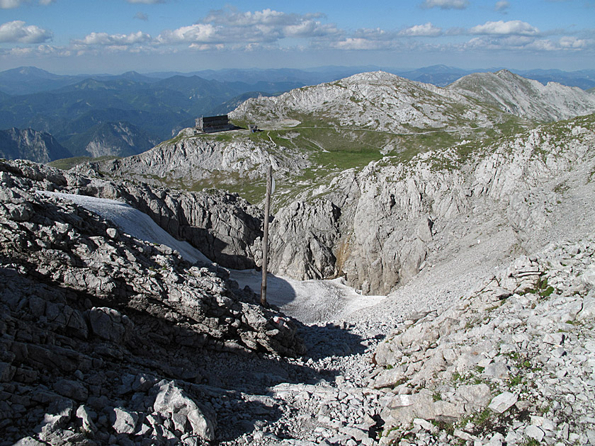 Follow the ascent route. If you wish to stop for refreshments or stay overnight at the Schiestlhaus, cross the summit and follow the marker poles down the rugged flank to the Schiestlhaus in just under half an hour. The return route to the Fleischer Bivouac leads from the Schiestlhaus on a slight uphill section to the right, past the summit structure of the Hochschwab (yellow signpost ‘Häuslalm’). In snowy or icy conditions, the path can become very treacherous and the direct crossing of the summit should be chosen as the return route. From the Fleischer Bivouac, descend through the G'hackte into the Trawiestal valley and walk back from there to the Bodenbauer Inn. If you have the time and inclination, you can hike back to the starting point from the bivouac via the Häuslalm. This significantly longer descent takes a further 4 to 5 hours’ walking time from the bivouac.
Schiestlhaus (2153 m), Österreichischer Touristenklub, Tel. +43 (0)699 108 121 99. Open from mid-May to 26 October.
| Elevation | Time | Total | Destination | ||
|---|---|---|---|---|---|
| 884 m | - 1785 m | + 2:30 | 2:30 | G'hacktbrunn | |
| 1785 m | - 2153 m | + 1:00 | 3:30 | Fleischer-Biwak | |
| 2153 m | - 2277 m | + 0:30 | 4:00 | Hochschwab | |
| 2277 m | - 2153 m | + 0:25 | 4:25 | Schiestlhaus | |
| 2153 m | - 2153 m | + 0:35 | 5:00 | Fleischer-Biwak | |
| 2153 m | - 1785 m | + 0:45 | 5:45 | G'hacktbrunn | |
| 1785 m | - 884 m | + 2:00 | 7:45 | Gasthof Bodenbauer | |


