

 Dolomites
Col Pradat cable car valley station (1720 m) - Rifugio Col Pradat (2020 m) - Sassongher (2665 m) - Edelweisshütte (Mountain Hut, 1850 m) - Col Pradat cable car valley station (1720 m)
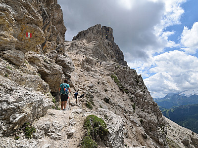
The tour to the Sassongher is an alpine hike with challenging sections. In particular, the ascent from the Forcella Sassongher saddle to the summit is exposed in a few places and secured by a wire rope (via ferrata difficulty B). A via ferrata set helps less confident walkers to negotiate this short section without too much difficulty.
Leave the Brenner motorway (Innsbruck–Bolzano) at the Klausen exit and continue via Waidbruck and St. Ulrich to the Grödner Joch. Follow the road towards Corvara for 7 kilometres. In Corvara, turn left after the bridge over the ski slope and follow the road to the car park at the valley station of the Col Pradat cable car.
Take the train to St. Lorenzen; from St. Lorenzen station, take bus route 460 towards Kolfuschg to the Kolfuschg (Corvara) stop, Str. Col Pradat (for timetable information).
46.55789137, 11.85435534
Anzeige
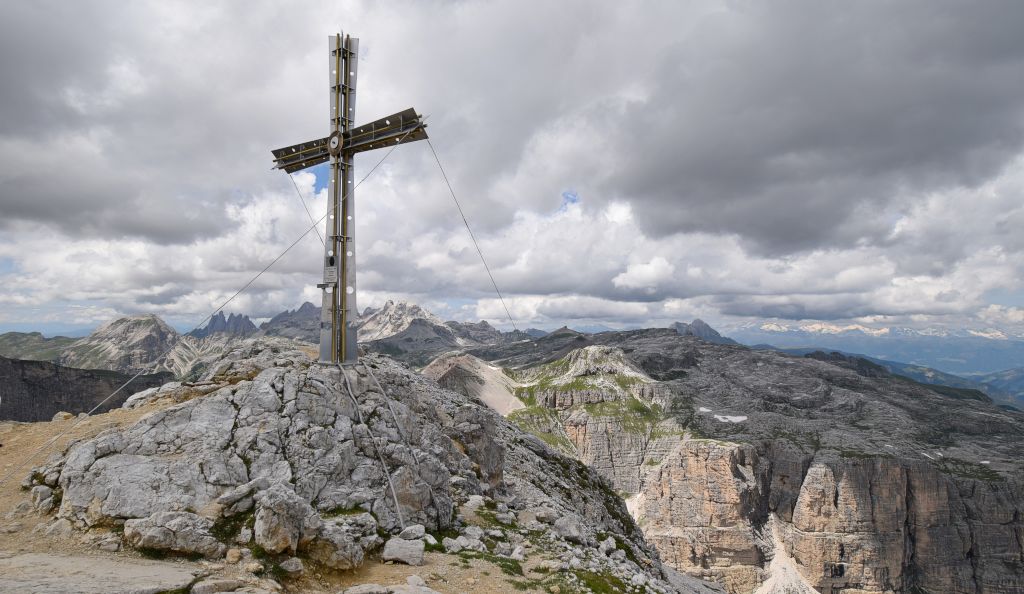
The Sassongher is the local mountain of the Ladin municipality of Corvara and a panoramic peak par excellence. Admittedly, you do have to put in a bit of effort before you can enjoy the view from the elegant summit cross of the Sella Group to the south, the Fanes and Tofana to the east, and the Puez Group to the west and north. For those with reasonably sure-footedness, the few via ferrata sections will pose little difficulty. Nevertheless, caution is advised on a short section after the Forcella Sassongher saddle, before the path continues easily to the summit. We made use of the Col Pradat cable car for the first few metres of ascent. Not that this saves much time, but it significantly boosted the motivation of our youngest hikers.
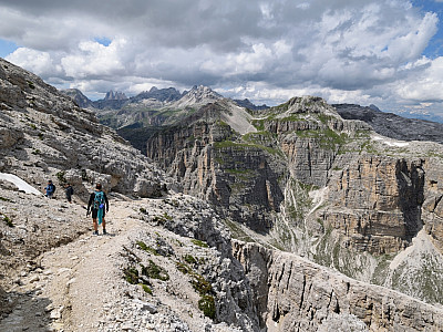
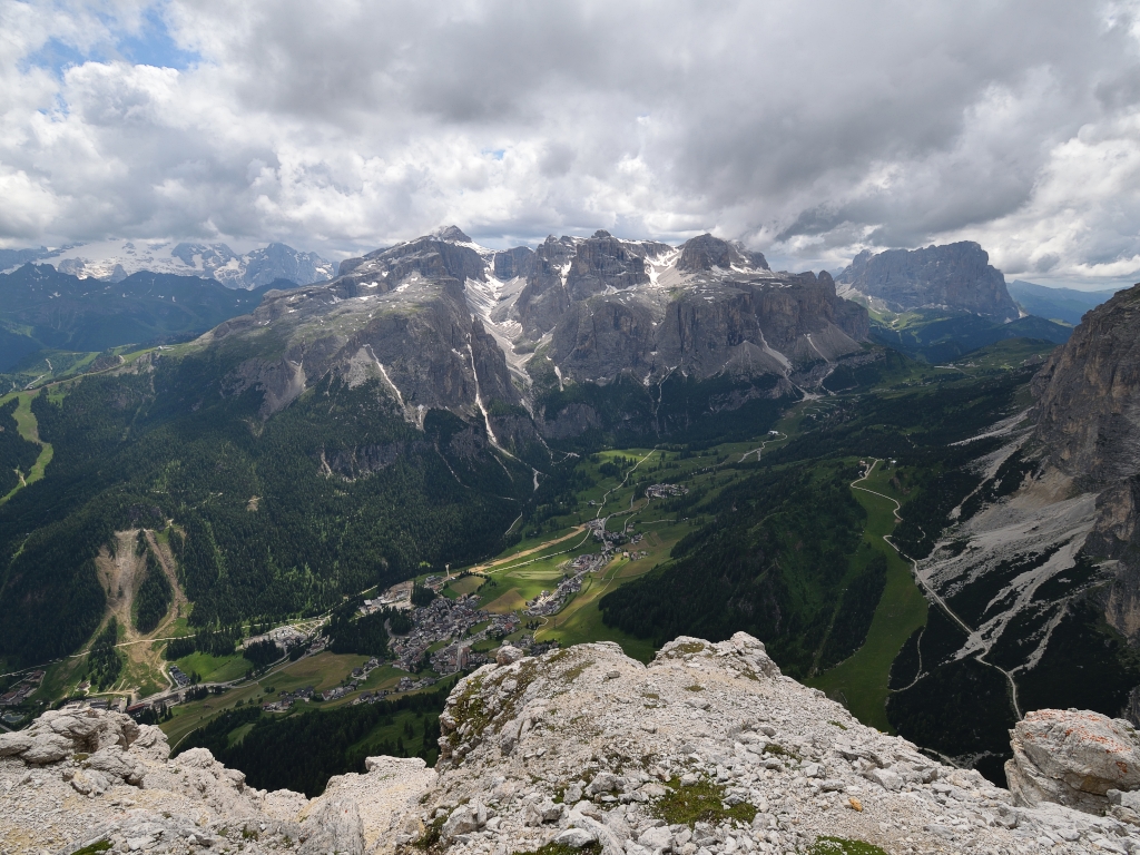
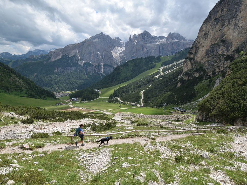
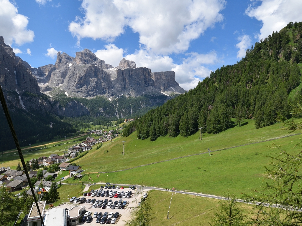 We walk directly from the car park to the nearby valley station of the Col Pradat cable car and are thus able to cover the first 300 metres of elevation gain effortlessly shortly afterwards. Those choosing to walk up will need about an hour for the ascent, as indicated in the walking time table. Typically, however, one then chooses the route to the north-west, directly past the Edelweiss Hut towards Forcella de Ciampei, and thus the route we will later take for the descent. Once at Col Pradat, we are already enjoying the view of the Sella Group with Piz Boe, as well as Cima Pisciadù, to whose summit the Pisciadù via ferrata of the same name leads. Hidden to the left behind the group, the Marmolada, the highest peak in the Dolomites, is shrouded in clouds.
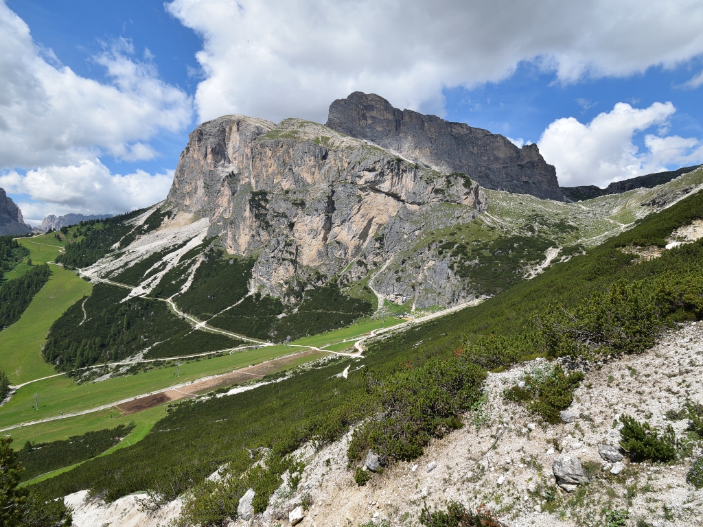 Starting with a few metres downhill and then a gentle ascent, we begin our tour past the south-western slopes of the Sassongher, heading north-east towards the Forcella de Ciampei saddle. In the hollow, the significantly narrower Path 4A branches off to the right. Our summit, the Sassongher, is already signposted here with a 2-hour walking time. To our left, we look out over the impressive south faces of the Sass da Ciampac, to whose summit a lovely hike leads from the Grödner Joch. After just under a quarter of an hour, the path from the Edelweiss Hut joins us from the left, which we will use later for the descent. We keep to the right and continue climbing towards Forcella de Ciampei and the Puez Hut.
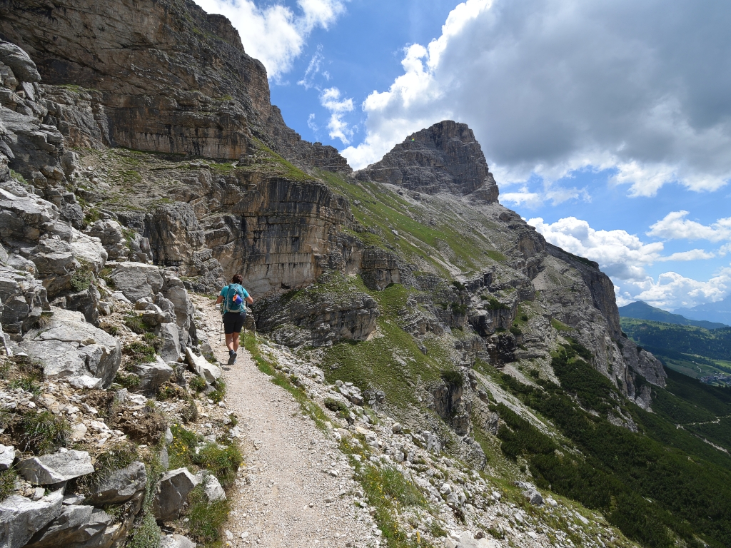 Now on a slightly steeper section, we pass a small chapel which, set against the rocks of Sass da Ciampac, makes for a real picture-postcard scene. 50 metres further up, we turn right and now head eastwards directly towards the summit of Sassongher. Even though the terrain now drops steeply to the right, the path is easy to navigate. However, to enjoy the breathtaking view of the Sella Group, you should definitely stop to avoid tripping. After just under 45 minutes, the path becomes steeper and leads us to the saddle before the actual summit.
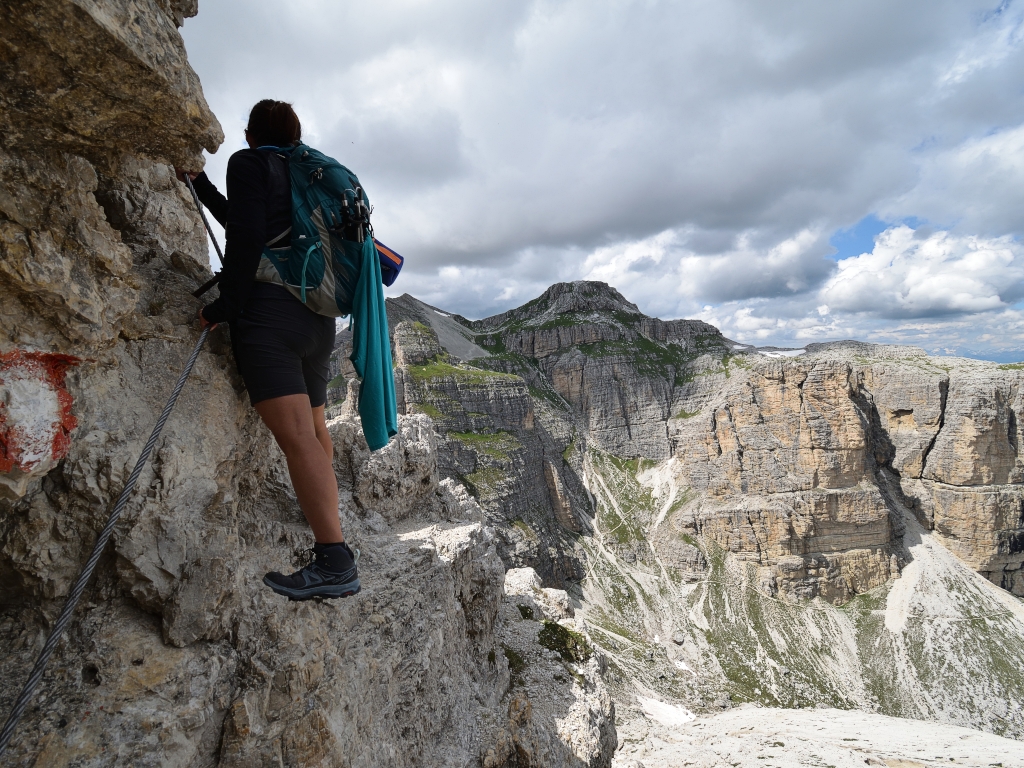 To our left, we look out over the Val de Juel. We continue to follow Trail 7 and ascend towards the south-east through scree-covered terrain. Soon we encounter sections secured by wire ropes, and at least one spot is slightly exposed. As the difficulty is limited to a maximum of grade B, we make good progress and soon leave the most challenging part of our hike behind us. The path onwards to the summit is straightforward throughout. After two hairpin bends, we reach the flat summit ridge on scree and enjoy the sweeping views in the heart of South Tyrol.
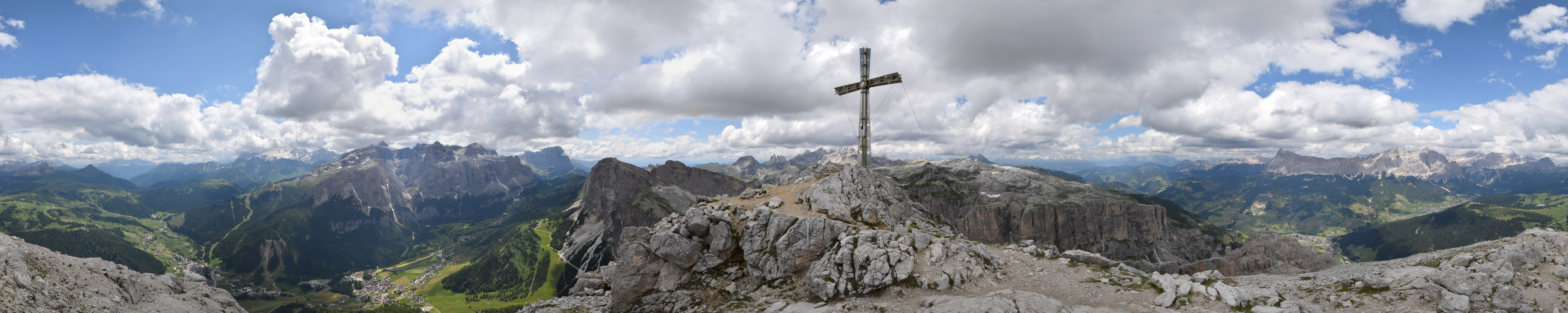
 The spectacular mountain world of the Dolomites has long since captivated us. To the east, the Fanes Group with La Varella is a sight to behold. To the left of it, the Tofana is hidden in the clouds behind the Lagazuoi. The south and south-east are dominated by the Sella Group with Piz Boe and the Langkofel Group, which we have already had the pleasure of discovering on the beautiful but challenging Oskar Schuster Trail. The west and north are dominated by the Geisler and Puez Groups. Here, the Geisler Peaks, with Sass Rigais, are particularly striking.
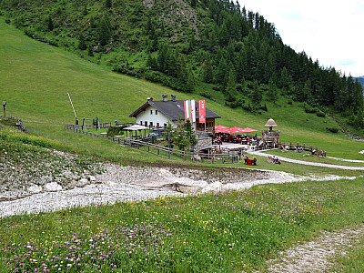
 For the descent, we initially follow the ascent route again. Just past the small chapel, instead of heading back to the cable car’s summit station, we continue along the main path 4 to the valley station. Passing the Edelweisshütte Mountain Hut by the ski lift – which tempts us with a snack – we eventually reach the car park at the Col Pradat cable car valley station safely.
Rifugio Col Pradat (2020 m), Tel. +39 0471 830 140.
Edelweißhütte (1850 m), Tel. +39 0471 836 024, +39 0471 830 332.
| Elevation | Time | Total | Destination | ||
|---|---|---|---|---|---|
| 1720 m | - 2020 m | + 1:00 | 1:00 | Rifugio Col Pradat | |
| 2020 m | - 2665 m | + 2:00 | 3:00 | Sassongher | |
| 2665 m | - 1850 m | + 1:45 | 4:45 | Edelweißhütte | |
| 1850 m | - 1720 m | + 0:15 | 5:00 | Parkplatz Seilbahn | |


