
 Réunion
Car park at Cilaos/Le Bloc bus stop (1385 m) – Refuge de la Caverne Dufour (2478 m) – Piton des Neiges (3069 m)
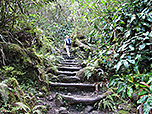
A challenging mountain hike to the highest peak of the French overseas department of La Réunion. The ascent to the hut follows a path built with countless steps. The route to the summit continues along a stony but well-marked path, which is easy to find even in the dark with a head torch.
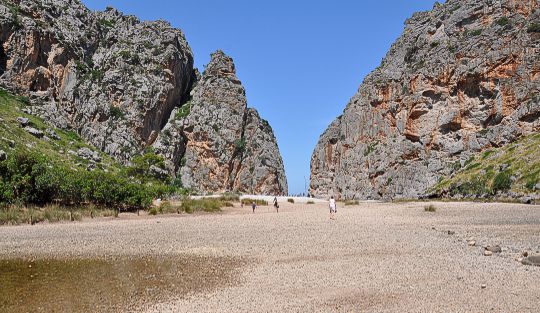
From Saint Denis, take the N1 expressway to Saint Louis and leave the motorway there. Passing through Saint Louis and La Rivière, follow the signs towards Cilaos and drive along the 30 km-long mountain pass road with countless bends to Cilaos. Drive through Cilaos and follow the signs towards Ilet á Cordes. Finally, take the N242 to reach the La Bloc bus stop. There is a car park for hikers there (signposted “Piton des Neiges”).
-21.12332320, 55.48325049
Anzeige
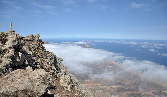
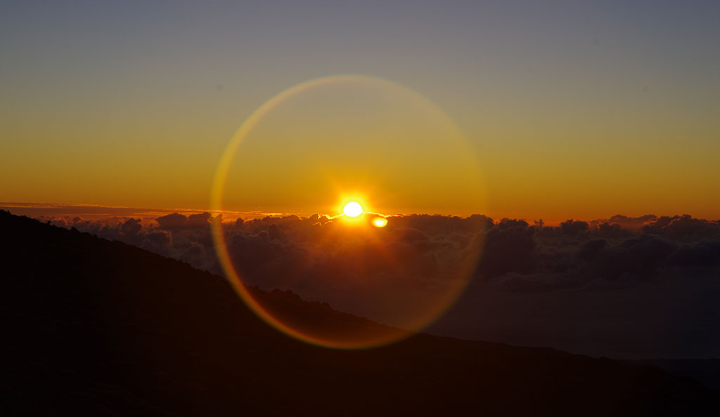
The Piton des Neiges is the highest mountain on the island of Réunion. The extinct volcano also marks the highest point in the Indian Ocean. An ascent is ideally undertaken as part of a two-day tour. As the summit of Piton des Neiges can become shrouded in clouds as early as mid-morning, after spending the night at the Refuge de la Caverne Dufour, it is best to set off towards the summit before sunrise. The trek through the cold darkness is ultimately rewarded with a magnificent display of colours. The rising sun bathes the volcanic rock in an intense red. From the highest point, you can see almost the entire island, which shows itself from its best side in the twilight of the breaking day.
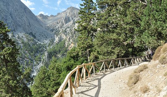
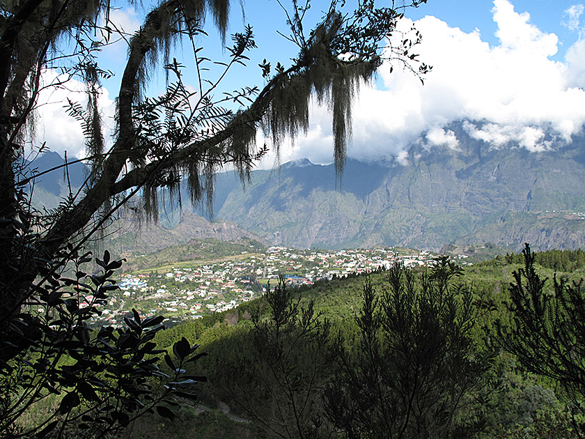 The well-signposted path up to the Refuge de la Caverne Dufour begins to the left of a large information board. We follow the markings and enter the mountain forest. Via the path, which has been built up with countless steps, we quickly gain altitude along numerous switchbacks. Soon, the mountain forest gives way to a view southwards and towards the rooftops of Cilaos. During the ascent, we are accompanied by tufts of beard lichen, which hang from the trees like tinsel and seem to thrive on these damp mountain slopes.
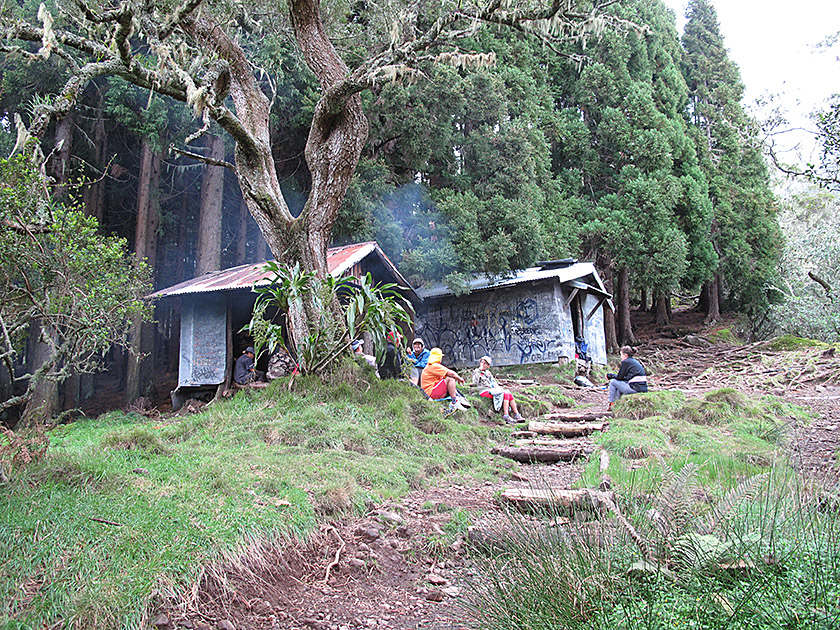 After an hour’s walk, we pass a small concrete platform, which proves to be an ideal resting spot. The path then continues steadily upwards via countless switchbacks and steps. After another half-hour’s walk, we reach a small hut following a short flat section. To the right of the hut is a water hose and a drinking trough. Drinking water can be drawn from the hose. After another short, flatter stretch, the path resumes its usual gradient and continues upwards, now somewhat more rugged over stones and steps.
 The lush, sprawling beard lichen becomes more numerous with every metre of altitude.
About 1¼ hours after passing the small hut with the water point, the tall trees recede more and more and the vegetation is now dominated by low shrubs. The gradient of the path increases once more and leads us up many steps to a saddle. From the saddle, we now look across to the Refuge de la Caverne Dufour, our first destination. We walk a few metres downhill and reach the hut in just under ten minutes.
The lush, sprawling beard lichen becomes more numerous with every metre of altitude.
About 1¼ hours after passing the small hut with the water point, the tall trees recede more and more and the vegetation is now dominated by low shrubs. The gradient of the path increases once more and leads us up many steps to a saddle. From the saddle, we now look across to the Refuge de la Caverne Dufour, our first destination. We walk a few metres downhill and reach the hut in just under ten minutes.
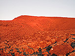
 Ascent to the Piton des Neiges: Above the hut, the signposted path to the Piton des Neiges begins. Heading north-west, we now climb up a stony and rugged path. The path is clearly marked with white markings and easy to follow in the dark by the light of a head torch. Over rock and boulder, the ascent is fairly steady and consistently heads north-west. At an altitude of approx. 2,840 metres, the path turns north (basically to the right). Maintaining the same altitude, we negotiate a traverse before the path turns north-west (left) again.
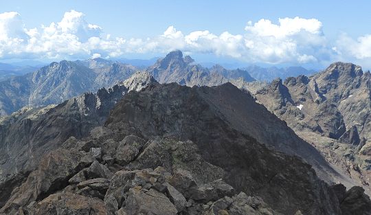
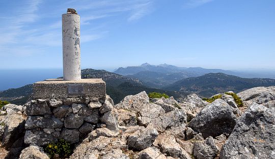
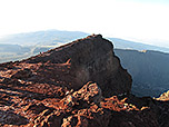
 We now walk down a gentle slope into a hollow. After crossing a gully, we climb over a ridge towards the secondary summit of Piton des Neiges, on which there is a metal box and two antennas. The main summit is to our left. Still below the secondary summit, we turn left and head for the ridge connecting the main and secondary summits. Once on the ridge, we follow it up a moderate slope to the spacious summit plateau with a cairn. From the main summit, it takes just a few minutes to walk further south and, after a short climb, reach a secondary summit with fine views.
Same as ascent.
Refuge de la Caverne Dufour (2478 m), Tel. 0262 51 15 26.
| Elevation | Time | Total | Destination | ||
|---|---|---|---|---|---|
| 1385 m | - 2478 m | + 3:00 | 3:00 | Refuge de la Caverne Dufour | |
| 2478 m | - 3069 m | + 1:45 | 4:45 | Piton des Neiges | |
| 3069 m | - 2478 m | + 1:30 | 6:15 | Refuge de la Caverne Dufour | |
| 2478 m | - 1385 m | + 2:15 | 8:30 | Parkplatz | |