


 Dolomites
Seiser Alm Cable Car Mountain Station (1850 m) - Saltnerhütte (1830 m) - Tourist Trail - Schlernhaus (2457 m) - Schlern (2563 m) – Schlernhaus (2457 m) – Tierser Alpl (2440 m) – Rosszahnscharte (2499 m) – Goldknopf – Alpenhotel Panorama (2000 m) – Seiser Alm Cable Car Mountain Station (1850 m)
Overall a moderately difficult mountain hike, leading along wide alpine paths and over small rocky steps and meadow trails. The stony paths on the Tourist Trail, during the transition from the Schlernhaus to the Tierser Alpl and on the descent from the Rosszahnscharte require sure-footedness.
Take the Innsbruck–Brenner–Bolzano motorway to the Klausen exit. From the exit, take the SS242 road via Klausen to Waidbruck, then turn left at the Seiser Alm junction (signposted). Immediately after, turn right at the roundabout towards Seiser Alm and follow the road via Kastelruth to Seis am Schlern. Drive through Seis and turn left at the southern edge of the village towards the Seiser Alm cable car. Park your car in the large car park at the valley station. Then take the Seiser Alm cable car (circular cable car) up to Compatsch (return ticket 19 euros, as of 2021). Driving up to Compatsch is not possible between 9:00 and 17:00. During this time, the road is closed to traffic. The parking fee in Compatsch is 18 euros (as of 2021).
Take the train to Bolzano and from Bolzano station take bus route 170 to Telfen (Kastelruth). From Telfen, continue on bus route 179-S to Compatsch Seiser Alm (for timetable information).
46.54054689, 11.56368971
Anzeige
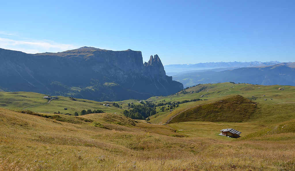
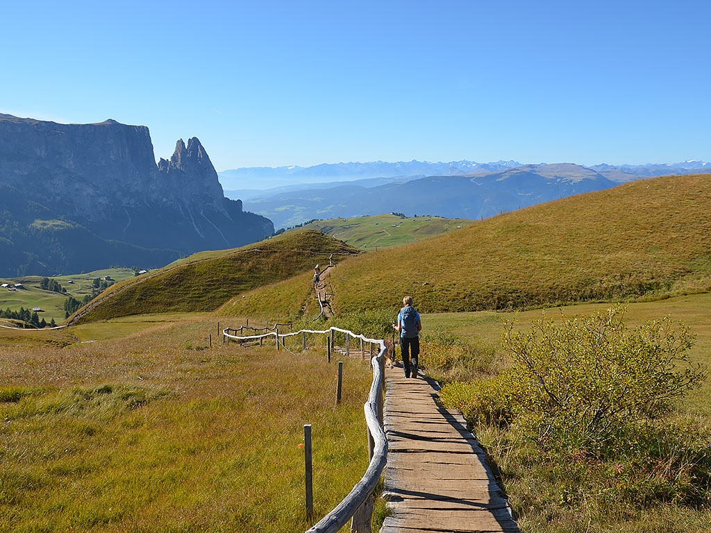
The quickest ascent to the Schlern, South Tyrol’s landmark, is from the Seiser Alm Plateau (Alpe di Siusi). From the top station of the Seiser Alm cable car in Compatsch, it takes a good 3¼ hours’ walk to the Schlernhaus, which sits enthroned on the vast high plateau against an impressive backdrop of the Dolomites. From the Alpine Club hut, it is then a further 20 minutes to the Petz, which, at 2,563 metres, marks the highest point on the Schlern. However, even this ascent is not exactly short, as the route covers a good 9 kilometres one way. The hike begins in Compatsch with a leisurely warm-up across the vast meadows of the Seiser Alm. At the Saltnerhütte, we take the so-called Touristensteig, which winds its way up to the Schlernhaus in numerous hairpin bends.
For those who do not wish to retrace their steps, a circular route via the Tierser Alpl and the Rosszahnscharte is recommended. The route from the Schlernhaus to the Tierser Alpl offers stunning scenery and takes you into the heart of a magnificent rocky landscape between the Rosengarten and the Schlern Group. From the Tierser Alpl, it is just a stone’s throw to the Rosszahnscharte, where a steep and stony descent awaits us. After countless hairpin bends, we hike back to Compatsch across undulating meadowland. With an overnight stay at the Schlernhaus or on the Tierser Alpl, this generous loop becomes an enjoyable two-day tour.
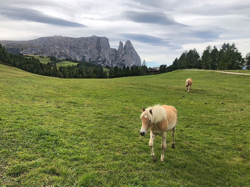 At the Seiser Alm cable car (1850 m), we leave the mountain station platform, keeping to the right via a flight of steps. At the bottom, we come to a footpath and follow it to the left to a crossroads. We then turn right and walk southwards through Compatsch to a crossroads. At the road, we keep to the left and turn right again immediately at the large signpost (signpost ‘Plattkofelhütte, Schlernhaus’). We follow the tarmac road southwards and, after a right-hand bend and a left-hand bend, come to a signposted junction. There we turn sharply right (signposted “Schlernhaus”), pass two houses and walk uphill along a wide path in a south-westerly direction. The winding path leads us to the extensive meadows of the Seiser Alm. Ahead of us, the walls of the Schlern come into view, with the prominent rocky peaks of the Santnerspitze and the Euringerspitze in the foreground.
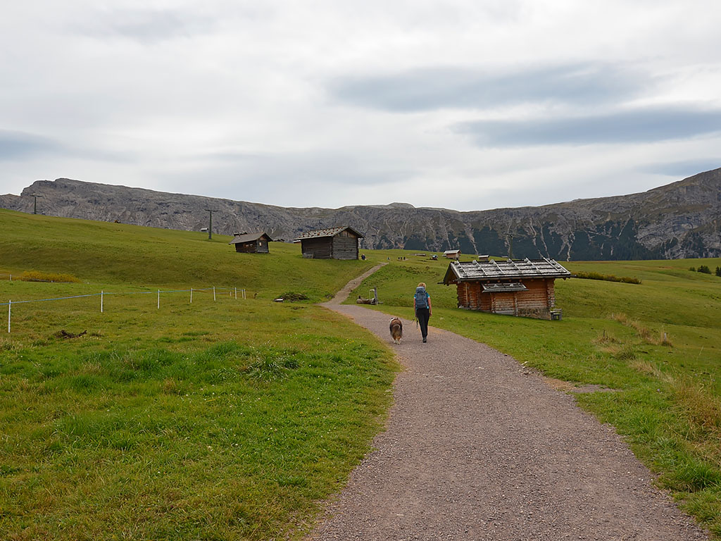 The wide path, which continues to climb gently, takes us past countless small huts. Later, we come to a junction at a rest area with a wooden table and a bench. At the junction, we continue straight ahead (signposted ‘Saltnerhütte, Schlernhaus’) and first follow a meadow path and, shortly afterwards, a paved path down to a cross-path. We turn left (signposted ‘Saltnerhütte’) and walk along the track in a south-easterly direction, continuing downhill. In a sharp right-hand bend, we cross the Prosslinerbach stream and arrive at the Gstatsch-Schwaige mountain hut (1,835 m). Shortly afterwards, we reach the Saltnerhütte (1,830 m), the last stop before the Schlernhaus. This is also where the wide track ends. To join the Touristensteig, which will take us to the Schlernhaus, we walk past the terrace on the left and through a gate. We then cross the Schwarzgriessbach.
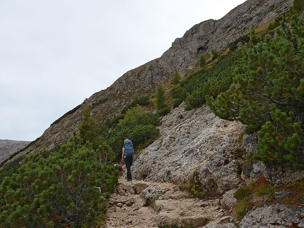 After the bridge, we turn right and take the left (upper) path at the junction. This leads us to a small wood, where we come across a wooden staircase. A short while later, we leave the sparse woodland and reach another junction in open terrain, which we pass on the right. We pass through another patch of woodland and a stream bed and head towards a mountain pine slope. As soon as we reach the mountain pine belt, the path becomes rockier. We climb briskly uphill over steps and through hairpin bends amidst the undergrowth.
We pass a scree slope and, via further hairpin bends and steps, reach a wooden staircase. Shortly after the staircase, we come to a rugged, steep step. There, the path turns north-west and leads us steadily uphill along a long straight stretch. After a few short hairpin bends and a long left-hand curve, we reach the Schlern plateau via a path that is paved towards the end and fitted with a wooden handrail.
After the bridge, we turn right and take the left (upper) path at the junction. This leads us to a small wood, where we come across a wooden staircase. A short while later, we leave the sparse woodland and reach another junction in open terrain, which we pass on the right. We pass through another patch of woodland and a stream bed and head towards a mountain pine slope. As soon as we reach the mountain pine belt, the path becomes rockier. We climb briskly uphill over steps and through hairpin bends amidst the undergrowth.
We pass a scree slope and, via further hairpin bends and steps, reach a wooden staircase. Shortly after the staircase, we come to a rugged, steep step. There, the path turns north-west and leads us steadily uphill along a long straight stretch. After a few short hairpin bends and a long left-hand curve, we reach the Schlern plateau via a path that is paved towards the end and fitted with a wooden handrail.
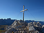
 This is also where the Gamssteig, which comes up from the Schlernbödelehütte, joins our path. We keep to the left and begin the final push towards the Schlernhaus. We hike across the plateau in a south-westerly direction and now look out towards the Rosengarten and the Latemar. Soon afterwards, we come to another junction. We make a mental note of this turn-off to the Tierser Alpl for later and turn right for now. After a short climb, we catch sight of the Schlernhaus ahead of us. We cross a field of loose scree and, after a walking time of just over 3¼ hours, reach the historic stone building. From the Schlernhaus (2,457 m), it is another 20 minutes’ walk to the summit cross of the Petz. On the hut terrace there is a signpost indicating the start of the summit path. We hike north-westwards along the stony path, which soon turns right (north-east) and heads uphill. Across gentle terrain, we reach the rocky summit structure and climb over a steep ledge. Shortly afterwards, we reach the metal cross on the Petz (2,563 m), which marks the highest point on the Schlern.
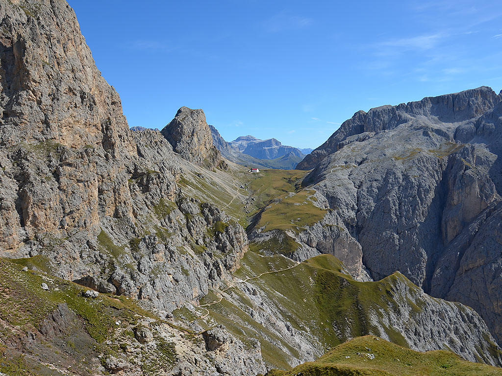
 We return via the same route to the Schlernhaus and from there to the junction towards Tierser Alpl. At the junction, we can already see the mountain range featuring the Rosszähne, the Rosszahnscharte and the Roterdspitze. We therefore keep to the right at the junction and walk down into a hollow in a south-easterly direction. From the hollow, we hike uphill along stony paths with a moderate gradient, crossing the eastern slopes of the Kranzer. After a rugged slope and a massive cairn, we reach a faintly defined saddle. From here, we follow the course of the broad mountain ridge further uphill in a south-easterly direction. On our right, we soon look out over the Schlerngraben, through which the Prügelweg leads up to the Schlernhaus. Shortly afterwards, the terrain becomes steeper and rockier once more and we come to a signposted junction. Here, we ignore the turn-off to the Maximilian via ferrata on the left and continue straight on to a wooden fence.
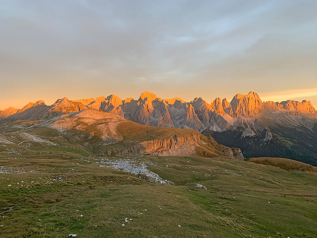
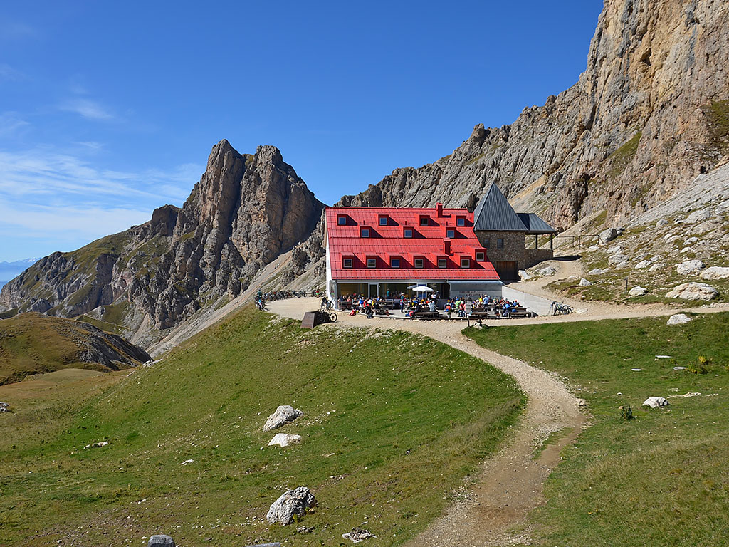
 We pass through a gap in the fence and are treated to a truly eye-opening view. Before us rises the rocky and forbidding chain of the Rosengarten. To our left, we can see the Tierser Alpl, which sits enthroned on the pass of the same name with its striking red roof. The path leads us swiftly downwards in several hairpin bends to a wooden staircase. After the steps comes a short traverse secured by wire rope, followed by a steep descent through a gully. The terrain then levels out and we cross over to the Gugglochegg (2,375 m), from where we can look down into the gorge through which the ascent via the Bärenloch leads up to the Tierser Alpl.
Shortly afterwards, that ascent route joins our path. We continue towards the Tierser Alpl and hike up the moderately ascending path to the private refuge (2 hours from the Schlernhaus). The view from the Tierser Alpl back towards the striking Roterdspitze (2,655 m), the highest peak in the entire Schlern Group, is particularly beautiful.
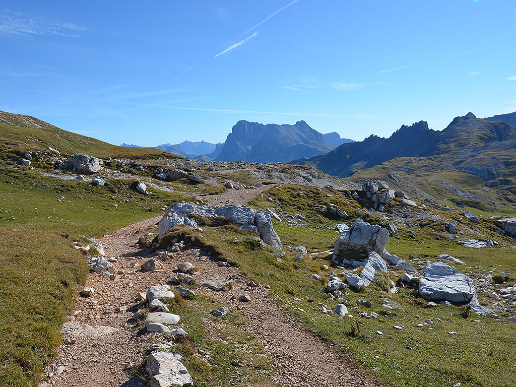
 Shortly after the Tierser Alpl hut, we take the signposted Trail No. 2 to the Rosszahnscharte on the left-hand side. The path leads us gently uphill towards the north-east. To the right, we now look towards the Langkofel and the Plattkofel, as well as the glaciated Marmolada. After 10 minutes, we reach the pass and from there descend rapidly over scree-covered terrain in countless hairpin bends. As soon as we leave the steep terrain, the path forks and we keep to the right (no signposts). Shortly afterwards, we cross a stream and walk northwards through gentle, undulating meadowland. Accompanied by views across the Seiser Alm towards the Schlern and its rocky peaks in the foreground, we skirt the gentle western flank of the Goldknopf.
 After passing through a gap in the pasture fence, we continue straight on at a fork. We then stay on path no. 2 until it joins a cross-path. We now turn diagonally left and walk north-west along a path lined with many planks. Eventually, the path widens and, after a short climb, we reach the Alpenhotel Panorama (2000 m). There we come to a crossroads, where we turn right. With views of the Langkofel and the Plattkofel, we walk down the road to a junction. At the junction, we keep to the left and follow the road in a north-easterly direction back to the ascent path, which eventually takes us to Compatsch and the Seiser Alm cable car (2 ¼ hours from the Tierser Alpl).
| Elevation | Time | Total | Destination | ||
|---|---|---|---|---|---|
| 1850 m | - 1830 m | + 1:20 | 1:20 | Saltnerhütte | |
| 1830 m | - 2457 m | + 2:00 | 3:20 | Schlernhaus | |
| 2457 m | - 2563 m | + 0:20 | 3:40 | Schlern (Petz) | |
| 2563 m | - 2457 m | + 0:15 | 3:55 | Schlernhaus | |
| 2457 m | - 2440 m | + 2:00 | 5:55 | Tierser Alpl | |
| 2440 m | - 2499 m | + 0:10 | 6:05 | Rosszahnscharte | |
| 2499 m | - 2000 m | + 1:35 | 7:40 | Alpenhotel Panorama | |
| 2000 m | - 1850 m | + 0:30 | 8:10 | Compatsch, Seiser Alm-Bahn | |


