

 Brecon Beacons
Pont ar Daf (440 m) - Pen y Fan (886 m) - Corn Du (873 m) - Storey Arms (443 m) - Pont ar Daf (440 m)
A mountain hike that follows wide, well-maintained paths. Overall, the terrain is gentle throughout the ascent and descent. Take care at the cliffs of Pen y Fan and Corn Du.
From Cardiff, take the A470 to Merthyr Tydfil and continue along this road towards Brecon. 9 kilometres past Llwyn, turn right towards the signposted Pont ar Daf car park and park your car there. It is advisable to set off early, particularly at the weekend, as the car park fills up quickly.
Take the train from Cardiff to Merthyr Tydfil (see timetable). From Merthyr Tydfil Bus Station, take bus routes T4 or T14 (towards Brecon) to the Glyn Tarell, Storey Arms stop (see bus timetables). If arriving by public transport, walk the route clockwise or follow the A470 to the Pont ar Daf car park, or use the described descent route for both the ascent and descent.
51.86812466, -3.47177625
Anzeige
Pen y Fan, in south-east Wales, is the highest peak in the Brecon Beacons at 886 metres. From the road linking Merthyr Tydfil in the south with Brecon in the north, Pen y Fan can be climbed in an easy hike that doesn’t take too long. Thanks to its easy accessibility, the mountain is a very popular destination. In good weather, you will rarely find solitude on Pen y Fan. The starting point for this short excursion is the Pont ar Daf car park. From there, a well-maintained, wide footpath leads us up to the foot of Corn Du, which lies in front of Pen y Fan. After crossing the summit slope, we climb up to the plateau of Pen y Fan and enjoy the magnificent view, which on a clear day stretches as far as Snowdonia. We then climb the neighbouring Corn Du and, from its summit, take the alternative descent route, which ends a short distance north of Pont ar Daf at the car park by Storey Arms. From there, we walk back along the road to the starting point.
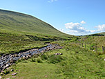
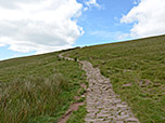
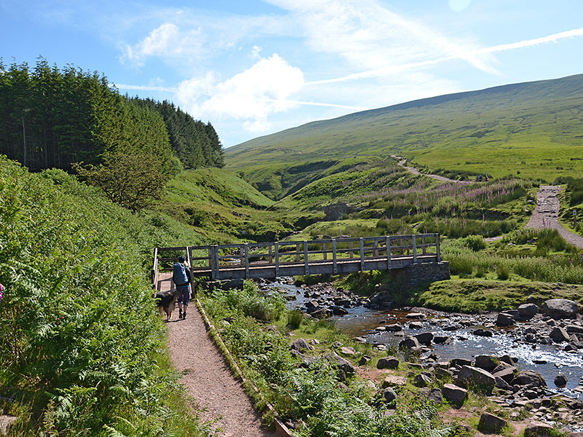 At the south-eastern end of the Pont ar Daf car park (440 m), we take the path that leads past a wooden hut on the left to a gate and a large hiking map. We pass through the gate and immediately cross the Blaen Taf Fawr river. After the bridge, the path turns left and leads us north-eastwards uphill at a moderate gradient. Soon, Corn Du comes into view ahead of us, its broad summit plateau appearing as if cut off. The well-maintained, wide and gently ascending path then leads us towards the striking mountain. Along the way, we pass small streams and can spot a few Welsh ponies on the extensive meadows and gentle mountain slopes. After walking for about an hour, we reach the saddle south of Corn Du.
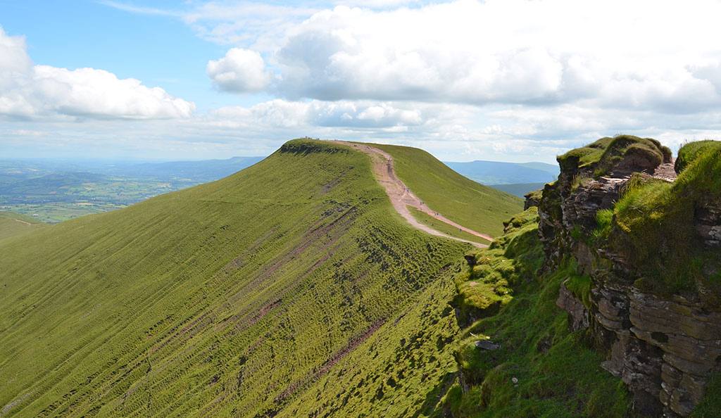
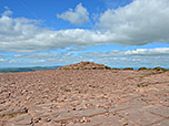
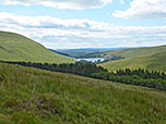
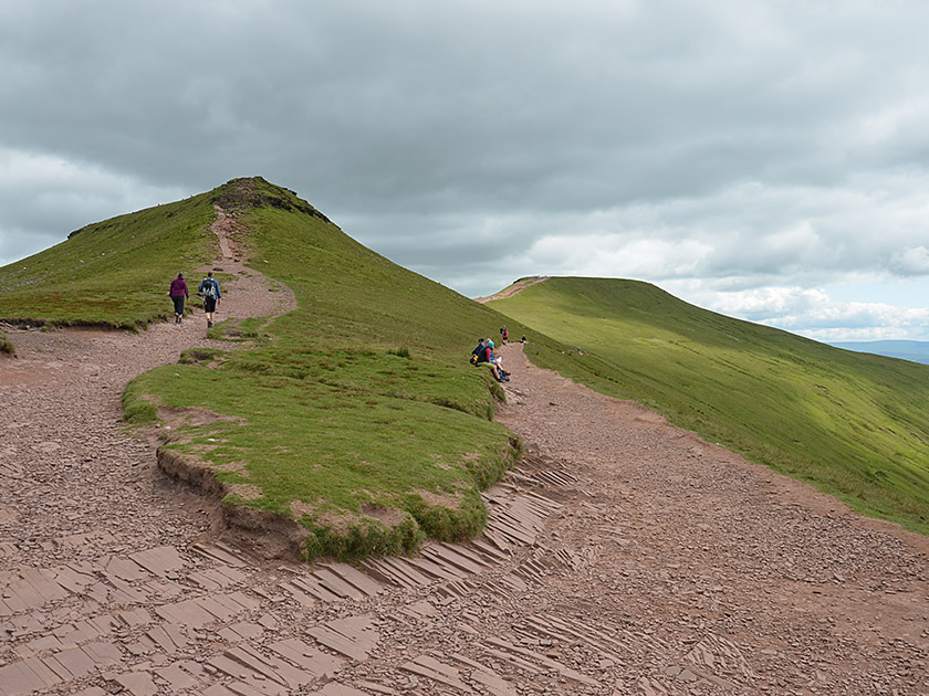 Now the view to the east opens up, and we look across to the grassy summit of Cribyn. To the south-east, we look out over the valley through which the Taf Fechan winds its way, towards the Pontsticill Reservoir. We plan to visit Corn Du on the way back, so at the fork in the path at the saddle we take the right-hand (lower) path. We cross the eastern flank of Corn Du along this path and finally reach the saddle between Corn Du and Pen y Fan. After a short, steeper climb, we follow the broad ridge up to the spacious summit plateau of Pen y Fan (886 m, 1¼ hours from Pont ar Daf). The supposed cairn on Pen y Fan is actually a burial chamber dating from the Bronze Age. From the summit, we now look out over the market town of Brecon and the wide plain to the north of the Brecon Beacons.
 We leave Pen y Fan via the route we took on the way up and keep to the right at the saddle between Pen y Fan and Corn Du. A short, steep climb takes us up to the expansive summit plateau of Corn Du (873 m) (15 minutes from Pen y Fan). The cairn on this summit is also a burial chamber from times long past. From the steeply sloping summit, we look down towards the mountain lake Llyn Cwm Llwch. For the alternative descent to Storey Arms, we head towards the lake and take the path leading down from the plateau in a westerly direction. After a hairpin bend, the path turns north-west and leads us down a ridge with a view of Llyn Cwm Llwch. There, the path forks and we take the left-hand, well-maintained track. This leads us eastwards and we ignore all subsequent turnings.
 After a gentle gradient to begin with, the wide footpath leads us down a steeper slope into a gully. There we cross the Blaen Taf Fawr, which carries significantly less water at this point than at the starting point, Pont ar Daf. After following the stream, there is a steep climb, during which we gain a further 50 metres in altitude. We come to a pasture fence and pass through a gap in it. The path then leads us downhill in a south-easterly direction, with a view of Fan Fawr (734 m). Soon we can see the A470 road below us, which we eventually descend to (1 hour from Corn Du). Upon reaching Storey Arms by the road, we turn left. We walk past the bus stop and, after the lay-by, reach a footpath. We follow this for a further 15 minutes back to the Pont ar Daf car park.
No places for refreshments along the way. There are often food trucks at the car parks at Pont ar Daf and Storey Arms, where you can buy snacks and drinks.
| Elevation | Time | Total | Destination | ||
|---|---|---|---|---|---|
| 440 m | - 886 m | + 1:15 | 1:15 | Pen y Fan | |
| 886 m | - 873 m | + 0:15 | 1:30 | Corn Du | |
| 873 m | - 443 m | + 1:00 | 2:30 | Storey Arms | |
| 443 m | - 440 m | + 0:15 | 2:45 | Pont ar Daf | |


