
 Grampian Mountains
Ben Nevis Visitor Centre (17 m) – Lochan Meall an t-Suidhe – Ben Nevis (1345 m)
A technically moderate but demanding mountain hike due to the length of the route and potentially adverse conditions (storms, snow or fog). In foggy conditions, there is a risk of getting lost on the expansive and steeply sloping summit plateau. Even in summer, you may encounter patches of old snow in the summit area. In addition to sure-footedness and good physical fitness, standard mountaineering equipment and warm clothing are essential.
From Glasgow, follow the A82 past Loch Lomond and through Glencoe to Fort William. In Fort William, at the large roundabout on the shores of Loch Linnhe, turn right onto Belford Road and at the next roundabout, continue straight on into Glen Nevis. Follow the River Nevis for 2 kilometres into Glen Nevis, then keep left and turn into the car park in front of the Ben Nevis Visitor Centre (parking fee £4, payable in coins at the pay-on-arrival machine, as of 2018).
56.81114411, -5.07716015
Anzeige
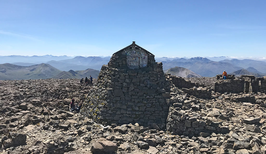
‘Mountain Path’, ‘Tourist Route’ or ‘Pony Track’: these are the names given to the standard route up Ben Nevis, the highest mountain in Scotland and the whole of Great Britain. However, the route to the majestic summit is not quite as straightforward as the name suggests. Whilst the standard route presents no technical difficulties, you will need to climb over 1,300 metres in altitude to reach the highest point. Furthermore, adverse conditions such as fog, storms and snow can turn what is supposedly an easy hike into a serious undertaking. After all, Ben Nevis is shrouded in clouds for 300 days a year, so there is a risk of losing your bearings on the vast summit plateau. In good conditions, however, the hike up Ben Nevis is a delight and the view from the former weather station at the summit seems boundless.
As with any country’s highest peak, you won’t find solitude on Ben Nevis. Every year, more than 200,000 visitors attempt the ascent, half of whom make it to the highest point. We start our hike at the Ben Nevis Visitor Centre in Glen Nevis. From there, a well-maintained path with steps leads us up to ‘Half Way Loch’, which is actually called Lochan Meall an t-Suidhe. From the mountain loch, the landscape becomes more rugged with every metre of altitude, and we reach the spacious summit plateau via scree-covered and boulder-strewn terrain. From Ben Nevis, we hike back down to Glen Nevis via the same route.
 From the car park in Glen Nevis (17 m), we follow the signposts towards the “Visitor Centre” and the “Ben Nevis Path” . We walk southwards to the visitor centre and, keeping to the left, cross the River Nevis. After the bridge, we come to a cross-path, turn right and follow the footpath southwards, running parallel to the river. After just two minutes, we reach a fork and turn left. We walk along a stone wall towards the grassy Meall an t-Suidhe and, after a few minutes, arrive at a gate. We climb over the gate via a step and reach the cross-path that leads up from the Ben Nevis Inn. We now turn right and follow the moderately ascending path south-eastwards into Glen Nevis.
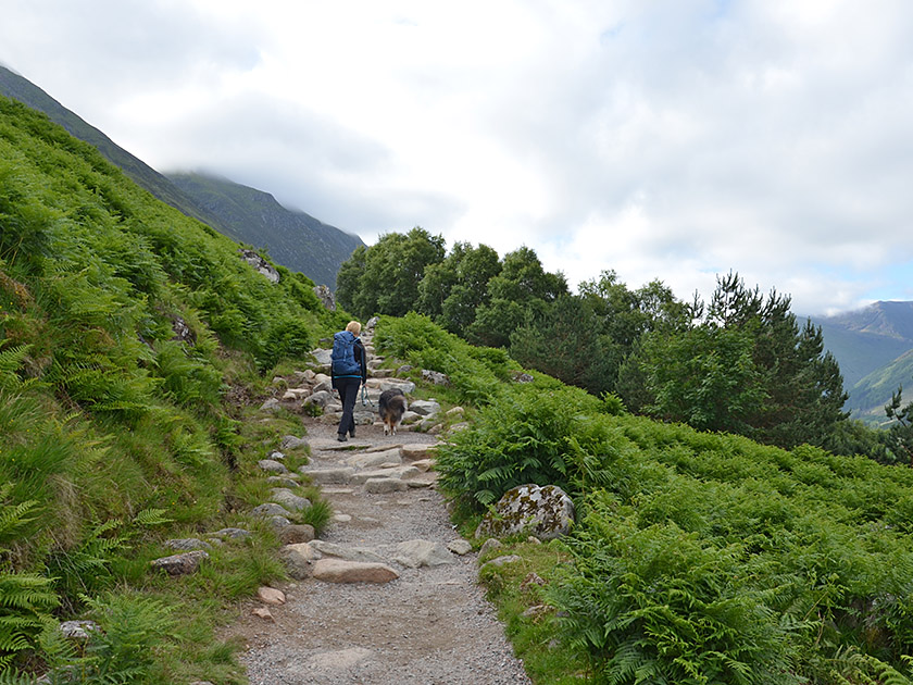
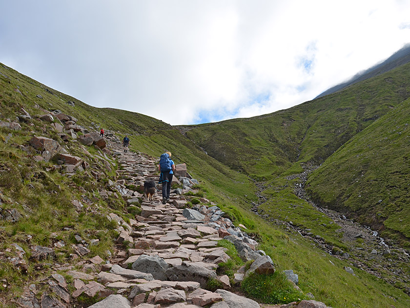 The path, which has been built up with many stony steps, crosses the south-western flank of Meall an t-Suidhe. After a walking time of just under 40 minutes, we meet the path leading up from the Youth Hostel to the Ben Nevis Path. We continue straight ahead, climbing somewhat more steeply in hairpin bends and passing a wooden bridge that takes us over a stream. After the bridge, the path leads us in a sweeping left-hand bend into the valley of the river Allt Na n-Urchaire, also known as Red Burn. We cross the grassy slopes of Meall an t-Suidhe heading north-east and then climb in two hairpin bends to a spacious saddle. On the saddle separating Meall an t-Suidhe from Ben Nevis lies the so-called Half Way Loch. Some distance from the loch, the gently ascending path leads us north-eastwards.
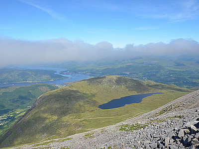
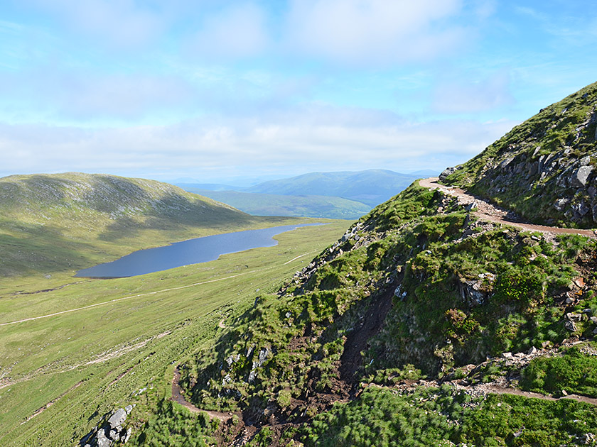 On the south-eastern side of the beautifully situated mountain lake, we come to a fork (630 m, 1¾ hours from the car park at the Visitor Centre). At the junction (no signpost), we turn sharply right and follow the path southwards. The path now becomes slightly steeper again and takes us to the Red Burn stream. We cross the stream and the path then leads us a little further south. Eventually, the path turns sharply to the left and leads us uphill in a general easterly direction via numerous hairpin bends. The higher we climb, the rockier the path becomes and the more barren the landscape grows. In places, the path is strewn with small boulders. Looking west, we can see down to Loch Linnhe, across Fort William and towards Loch Eil.
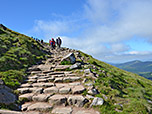
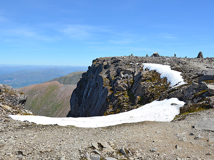 At an altitude of 1,200 metres, the path makes a final bend and then leads us straight eastwards through a scree field, climbing moderately towards the summit. One last time, the gradient increases and we climb over the broad mountain ridge to the spacious summit plateau. Close to the edge of the cliff, we pass a notch and then hike in a left-hand bend up to the buildings of the former weather station. After a walking time of 4 hours, we have reached the highest point in Scotland and the British Isles and enjoy the fantastic view of the countless peaks of the Highlands. The imposing mountain landscape of the Cairn Gorms to the east stands out particularly in the panorama. To the south-west, we look out over Loch Linnhe and the Firth of Lorn towards the Scottish Sea.
Same as ascent.
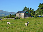
Ben Nevis Inn (35 m), Tel. +44 1397 701227.
| Elevation | Time | Total | Destination | ||
|---|---|---|---|---|---|
| 17 m | - 630 m | + 1:45 | 1:45 | Abzweig am Half Way Loch | |
| 630 m | - 1345 m | + 2:15 | 4:00 | Ben Nevis | |
| 1345 m | - 630 m | + 1:40 | 5:40 | Abzweig am Half Way Loch | |
| 630 m | - 17 m | + 1:20 | 7:00 | Ben Nevis Visitor Centre | |