
 Lofoten
E10/Brenna junction at Kleppstad (27 m) – Kleppstadheia (534 m)
Overall an easy mountain hike, leading over good paths – steep and stony in places – to a gentle hill with panoramic views. Caution is advised in the summit area in poor visibility, as the terrain drops steeply to the north and east.
Take the E10 from Svolvær towards Leknes. Immediately after Kleppstad and just before the Gimsøystraumen bridge, which leads from Austvågøy to Gimsøy, turn right towards Brenna and park your car immediately on the right-hand side at the turning area, slightly away from the bus stop.
Take bus route 18-741 from Svolvær towards Leknes to the Kleppstad stop (for timetable information).
68.25823995, 14.27587627
Anzeige
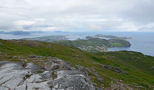
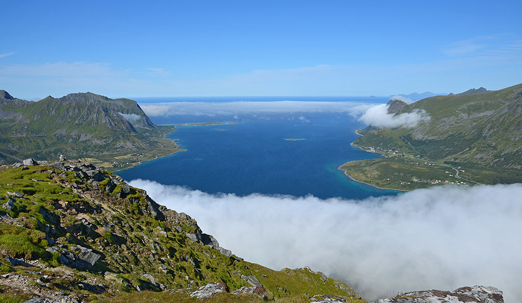
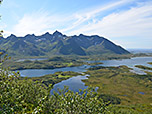
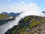
Kleppstadheia is a gentle, broad mountain ridge in the western part of the island of Austvågøy in the Lofoten. This beautiful mountain with its panoramic views is fairly easy to reach. The ascent begins north of Kleppstad, just before the Gimsøystraumen bridge, and leads up to the summit in just under two hours via a comfortable path through sparse scrub and across steep grassy slopes. The terrain is generally very gentle throughout the ascent; only on the broad summit ridge does the terrain drop steeply to the north and east. In foggy conditions, one should be very careful in the summit area. From the highest point, there is a wonderful view across the Gimsøystraumen strait to the mountain range around Svarttinden and over the many small islands, lakes and bays with the rugged peaks towering above them in the western Austvågøy.
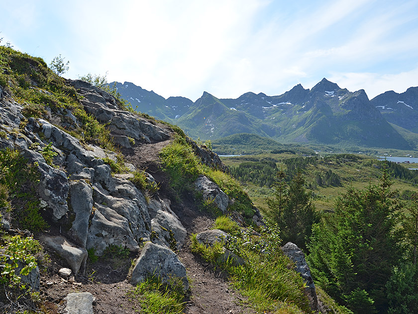 From the turning area, we follow the track a short distance northwards towards Brenna. After a cattle grid, we spot a path on the right-hand side leading eastwards away from the track. Here we turn right and hike up a slope. After the first steep ascent, we find ourselves on a ridge, which we follow south-eastwards to the next rise. We tackle another short climb and can now catch our first glimpse southwards of the mountains beyond the Olderfjorden. The path then leads us slightly to the left in an easterly direction towards a hill covered in sparse scrub. We climb uphill through the small wood and are now approaching the western flank of Kleppstadheia.
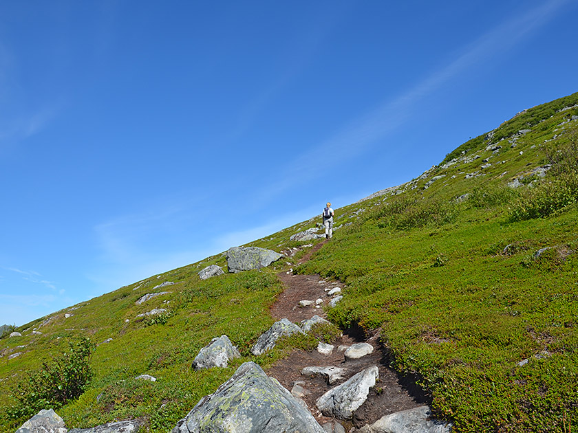 Shortly before reaching the summit slope, the path turns to the right (south-east) and leads us in a sweeping left-hand bend to the edge of the south-western slope. We follow this uphill, the path becoming significantly steeper and winding through sparse scrub. The bushes recede further and further, and the low trees give way to heather. The view back towards the Gimsøystraumen strait is magnificent, with the small offshore islands and the rugged peaks rising skywards on Vestvågøy. At an altitude of 480 metres, we turn left and head northwards into the flank of Kleppstadheia. As we do so, we pass several fields dotted with small boulders, without coming into contact with them.
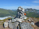
 After a good five minutes, the path turns right (east) again and leads us steeply up the broad ridge of Kleppstadheia. Once we reach the ridge, we catch sight of the neighbouring pointed pyramid of Kvasstinden (576 m) to the south-east. To our left and below us, we can see the head of Sydalspollen Bay. The view towards the east over the rugged mountain landscape of Austvågøy is magnificent. At the ridge, we turn left and follow the ridge line northwards to the highest point. The summit is marked by a large cairn, and there is also a summit book in a box there. Now the view to the north also opens up, stretching across the vast expanse of the sea as far as the Vesterålen islands. To the west, we look across the Gimsøy Strait towards the peaks of the neighbouring island of Gimsøy.
Same as ascent.
There are no places to stop for refreshments along the way.
| Elevation | Time | Total | Destination | ||
|---|---|---|---|---|---|
| 27 m | - 534 m | + 1:50 | 1:50 | Kleppstadheia | |
| 534 m | - 27 m | + 1:20 | 3:10 | Abzweig E10/Brenna bei Kleppstad | |